


Town Bahía de Banderas, Nayarit Municipality of Bahía de Banderas Banderas Bay Riviera Nayarit
Planned resort town just across the Ameca River from Puerto Vallarta: long beach, big hotels, canals, marinas and golf. Officially Nuevo Nayarit since 2022.
From Puerto Vallarta: 20 min by car (17 km by road) How to get there ↓
Near here



Plan your visit to Nuevo Vallarta
Where to stay near Nuevo Vallarta
Compare hotels, posadas and guest houses in Nuevo Vallarta.
Tours to Nuevo Vallarta
Day trips around Sayulita sometimes stop in Nuevo Vallarta; a tour is the easy way to see it without a car.
 Whale Watching Cruise In Puerto Vallarta & Nuevo Vallarta
★ 4.8 (413) · From US$99
How to get to Nuevo Vallarta
- From Puerto Vallarta: about 20 min by road (~17 km)
- Nearest airport: Puerto Vallarta (PVR), 41 min by car to Sayulita
Links open a partner site. We may earn a commission if you book, at no cost to you.
Popular tours to Nuevo Vallarta


Tours, prices and ratings from Viator, checked weekly. We may earn a commission if you book.
About Nuevo Vallarta
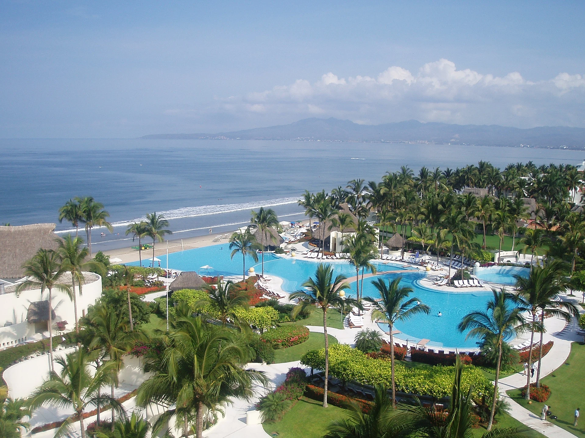
Nuevo Vallarta is the resort zone that begins right where Puerto Vallarta ends: across the Ameca River, which is the border between Jalisco and Nayarit, on the flat delta at the head of Banderas Bay, about fifteen minutes by car from the airport. It belongs to the municipality of Bahía de Banderas and is the southern gateway of the Riviera Nayarit coast. Unlike the old fishing towns around the bay, it was planned from scratch: the federal government began developing it in the 1980s on land drained and cut with canals, and laid out a marina, residential estates with private docks, golf courses and a hotel strip along the sand.
Today that strip, Paseo de los Cocoteros, runs north from the marina past one large all-inclusive resort after another to the Flamingos and RIU complexes, with a bike path down its median. In front of it is one of the longest beaches in the bay, wide, flat and pale, with gentle waves and views across the water to Puerto Vallarta and the Sierra. Behind the hotels are condos, the Paradise Plaza shopping centre, several golf courses (El Tigre, Flamingos, and the Nayar and Vallarta courses at the huge Vidanta complex), water parks along the highway and mangrove swamps where crocodiles live. Only about 1,300 people were counted as residents in the 2020 census, but tens of thousands of visitors stay here in high season.
The beach is also one of the main sea-turtle nesting sites of the Mexican Pacific: the Nuevo Vallarta turtle camp, the largest in Nayarit, protects thousands of olive ridley nests a year along about 14 km of shore and invites visitors to sunset hatchling releases. In July 2022 the Nayarit Congress officially renamed the town Nuevo Nayarit, to stress that it is in Nayarit and not in Jalisco; the change was controversial, and most signs and almost everyone still say Nuevo Vallarta.
How to get to Nuevo Vallarta
Drive from Puerto Vallarta: 20 min, 17 km
Nuevo Vallarta is just north of Puerto Vallarta's airport on Highway 200 (Carretera Tepic-Vallarta), across the Ameca River bridge; the two main entrances are Boulevard Nuevo Vallarta and Boulevard Nayarit, and the hotel strip runs about 3 km west of the highway. Allow 25 to 45 minutes from downtown Puerto Vallarta, as traffic bunches around the airport. ATM buses (grey or white with red and blue stripes) run two routes into Nuevo Vallarta every 20 to 60 minutes from Puerto Vallarta, stopping along Highway 200 at Las Glorias, the Walmart near the marina and the airport footbridge; the fare was 29 pesos in January 2026. Taxis and Uber also serve the area; at the airport buy a taxi voucher at the exit.
Directions to Nuevo Vallarta on Google Maps
Distances are in a straight line; the road is usually longer.
Links open a partner site. We may earn a commission if you book, at no cost to you.
From the nearest cities to Nuevo Vallarta
- Puerto Vallarta · 17 km by road, 20 min
- Tepic · 152 km by road, 2 h 15 min
- Autlán · about 185 km by road, ~2 h 45 min
Drive times by road from OpenStreetMap, without traffic or stops. Times marked ~ are estimated from the straight-line distance.
What to see in Nuevo Vallarta 4
Sights with their own page, closest to the centre first.
Landmarks and museums
-
Paradise Village Marina · Landmark · 1 km from the centre
A 200-berth marina in a sheltered estuary inside the Paradise Village resort in Nuevo Vallarta, base of the Vallarta Yacht Club. -
Aquaventuras Park · Landmark · 2 km from the centre
Water park on Highway 200 at the entrance to Nuevo Vallarta, ten minutes from the airport: slides, a lazy river, zip line and a dolphin and sea lion habitat. -
VidantaWorld · Landmark · 2 km from the centre
Vast resort complex at the south end of Nuevo Vallarta: golf, the PGA Tour Mexico Open, Cirque du Soleil's LUDŌ and the new BON theme park.
Beaches
-
Boca de Tomates · Beach · 4 km from the centre
A beach of seafood ramadas behind Puerto Vallarta's airport, by the Ameca river mouth: come for pescado sarandeado, not a swim, as crocodiles live here.

Map of Nuevo Vallarta
Neighbourhoods and villages of Nuevo Vallarta
Part of Nuevo Vallarta or just outside it, closest first.
-
Mezcalitos · Village · 1 km from the centre
A small community on Boulevard Nuevo Vallarta, between Valle Dorado and Mezcales, a couple of kilometers from the resorts of Nuevo Vallarta. -
Las Jarretaderas · Town · 2 km from the centre
The first town in Nayarit after the Ameca River bridge, an old ejido beside Nuevo Vallarta known for seafood joints and its surf-fishing tournament. -
Mezcales · Town · 3 km from the centre
Busy working town on Highway 200 between Nuevo Vallarta and Bucerías, one of the largest in Bahía de Banderas; taquerías, cenadurías and local life. -
San Clemente de Lima · Town · 4 km from the centre
Young valley town next to Mezcales that grew from a hamlet of under 200 people to nearly 10,000 in fifteen years; named for Saint Clement.
Day trips and tours from Nuevo Vallarta
The closest Pueblos Mágicos and places to visit, with the drive from Nuevo Vallarta and tours that leave from it.




Times marked ~ are estimated from the distance. Links open a partner site. We may earn a commission if you book, at no cost to you.
Before you go: getting to and around Nuevo Vallarta
- The nearest airport is Puerto Vallarta (PVR).
- The best months to go are March, April, May, and November.
- 2 of the places on this page are more than 3 km from the centre: take a taxi, a ride-hailing app or a local bus.
- For day trips a rental car gives the most freedom; the tours above leave from Nuevo Vallarta.
Before you go to Nuevo Vallarta: hours, prices and tips
- Best time of day
- Turtle hatchling releases at the camp take place at sunset, from about 7:45 pm, by reservation; call around midday to confirm there will be one. Zona Turística · checked Oct 2026
- Best season
- Olive ridley turtles nest on the beach from late June; hatchling releases for visitors run from August to February. Zona Turística · checked Oct 2026
Hours and prices change, especially around holidays. Each fact links to where we checked it.
Visiting Nuevo Vallarta: what to see and do
Walk or cycle the long, flat beach and the Paseo de los Cocoteros bike path.
Join a sunset release of turtle hatchlings at the Nuevo Vallarta turtle camp (August to February).
Play one of the golf courses: El Tigre, Flamingos, or the Nayar and Vallarta courses at Vidanta.
See the crocodiles of the mangrove swamps behind the hotel zone at one of the small sanctuaries.
Shop at the Tuesday Riviera Farmers Market or Paradise Plaza.
Walk the beach north to Bucerías.
Plan your trip
Places to stay in Nuevo Vallarta
Compare hotels, posadas, and rentals in and around Nuevo Vallarta.
Tours & activities
Day trips around Sayulita sometimes stop in Nuevo Vallarta; a tour is the easy way to see it without a car.
Rental cars
Pick up a car at PVR (Puerto Vallarta): about 41 min by road to Sayulita, then 24 km more to Nuevo Vallarta, on your own schedule.
Flights
The nearest airport with scheduled flights is Puerto Vallarta (PVR), about 41 min by road from Sayulita, the base for Nuevo Vallarta.
Mobile data
Signal can drop away from Sayulita: download a map of the way to Nuevo Vallarta before you set out, or carry an eSIM with data.
Links open a partner site. We may earn a commission if you book, at no cost to you.
Photos
When to go to Nuevo Vallarta warm
Nuevo Vallarta shares the climate of Sayulita, 24 km away. The best months to visit are March, April, May, and November.
See the month-by-month climate of Sayulita
Weather in Nuevo Vallarta now and the next 7 days
Live forecast from Open-Meteo. Chance of rain is the day's highest.
The closest Pueblo Mágico: Sayulita

Sayulita is the Pueblo Mágico closest to Nuevo Vallarta, with places to stay, food, and more to see.
Also close to
- Mascota · Jalisco · 56 km away
- Talpa de Allende · Jalisco · 60 km away
- Compostela · Nayarit · 72 km away
- San Sebastián del Oeste · Jalisco · 74 km away
Near Nuevo Vallarta






Drive times by road from OpenStreetMap, without traffic. Times marked ~ are estimated from the straight-line distance.
Location from OpenStreetMap. Written by Puebloteca.