Nature reserve Bahía de Banderas, Nayarit Municipality of Bahía de Banderas Banderas Bay Riviera Nayarit
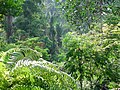
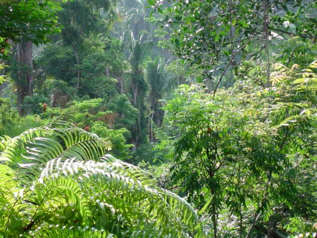
The jungle-covered coastal range behind Sayulita and the Bahía de Banderas valley, home to jaguars, 261 bird species and shade-grown coffee.
From Puerto Vallarta: 1 h 5 min by car (77 km by road) How to get there ↓
Near here
See everything nearby ↓


Plan your visit to Sierra de Vallejo
Where to stay near Sierra de Vallejo
Compare hotels, posadas and guest houses in Sierra de Vallejo.
Tours to Sierra de Vallejo
Day trips and guided outings from Sayulita often include Sierra de Vallejo; with a local guide you can get there without a car.
 El Mirador Jungle ATV Tour – Ride Single
★ 4.9 (64) · From US$88
How to get to Sierra de Vallejo
- From Puerto Vallarta: about 1 h 5 min by road (~77 km)
- Nearest airport: Puerto Vallarta (PVR), 41 min by car to Sayulita
Links open a partner site. We may earn a commission if you book, at no cost to you.
Popular tours to Sierra de Vallejo

Tours, prices and ratings from Viator, checked weekly. We may earn a commission if you book.
About Sierra de Vallejo
The Sierra de Vallejo is the steep, forested range that rises behind the Riviera Nayarit coast, filling the land between the valley of Bahía de Banderas to the south and Compostela to the north. Scientists put it at roughly 70,000 hectares in the municipalities of Bahía de Banderas and Compostela, stretching from about the latitude of Valle de Banderas north to beyond Rincón de Guayabitos. Geologically it continues the coastal mountains of Jalisco and forms part of the lower basin of the Ameca River. Its slopes are cut by deep ravines and a dense web of rivers and streams that water the farming valleys below.
Nayarit declared it a state biosphere reserve in 2004, and in January 2024 the federal government folded it into the much larger Sierra de Vallejo-Río Ameca Biosphere Reserve, about 225,000 hectares that also take in the Ameca valley and mountains in Puerto Vallarta, San Sebastián del Oeste, Mascota and Mixtlán in Jalisco. Conservationists, including the group Alianza Jaguar, campaigned for that protection for two decades, and researchers note that the decree still lacks a management plan.
Medium-height tropical forest covers most of the sierra, with dry forest on the southern slopes of Compostela, oak woods higher up and gallery forest along the rivers. It is one of the places in western Mexico where the jaguar still lives, along with the guacoyul palm, and a survey by the Universidad Autónoma de Nayarit counted 261 bird species, 31 of them found only in Mexico and 43 in some category of threat. Between about 200 and 1,200 meters, farmers grow coffee under the shade of the native trees, and these plantations turn out to be rich bird habitat. Farming, cattle and new tourist development are the main pressures on the forest.
There is no visitor center or park entrance. Most people see the sierra from the coast road or on a guided hike or ATV tour from Sayulita and the towns of the bay, such as the biologist-led walks in the private Natikari reserve near Sayulita.
How to get to Sierra de Vallejo
Drive from Puerto Vallarta: 1 h 5 min, 77 km
Highway 200 from Puerto Vallarta to Sayulita, Lo de Marcos and Rincón de Guayabitos runs along the coastal side of the sierra, and the farming towns of Valle de Banderas and San Juan de Abajo sit at its southern foot. There is no public entrance: the easiest way in is a guided tour. The Natikari hike meets in Sayulita at 9:00 and returns there.
Directions to Sierra de Vallejo on Google Maps
Distances are in a straight line; the road is usually longer.
Links open a partner site. We may earn a commission if you book, at no cost to you.
From the nearest cities to Sierra de Vallejo
- Puerto Vallarta · 77 km by road, 1 h 5 min
- Tepic · 111 km by road, 1 h 40 min
- Autlán · about 205 km by road, ~3 h
Drive times by road from OpenStreetMap, without traffic or stops. Times marked ~ are estimated from the straight-line distance.
Before you go to Sierra de Vallejo: hours, prices and tips
- Time needed
- The guided Natikari hike covers about 7 km with about 160 m of climbing and takes about four hours with breaks, starting at 9:00. Travel Buddies · checked Oct 2026
- Guide or tour
- There are no public trails or visitor facilities; guided tours such as the biologist-led walk in the Natikari reserve, limited to 10 people, are the usual way to hike in the sierra. Tours: Viator GetYourGuide Travel Buddies · checked Oct 2026
- What to bring
- Water and snacks (not provided), sturdy shoes for uneven trails, layers and insect repellent; a camera or binoculars for birds. Travel Buddies · checked Oct 2026
- Rules
- The Natikari hike is for ages 7 and up and needs reasonable fitness: the paths are narrow and steep in places. Travel Buddies · checked Oct 2026
Hours and prices change, especially around holidays. Each fact links to where we checked it.
Visiting Sierra de Vallejo: what to see and do
Join a biologist-led hike through the Natikari private reserve near Sayulita: about 7 km on forest trails and riverbeds.
Watch for some of the 261 bird species recorded in the sierra, including Mexican endemics, best early in the morning.
Ride into the jungle foothills on one of the ATV tours that leave from the Sayulita area.
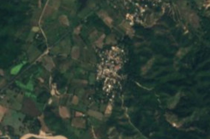
See the sierra rise behind the farm towns of Valle de Banderas and San Juan de Abajo, at its southern foot.
Plan your trip
Places to stay in Sierra de Vallejo
Compare hotels, posadas, and rentals in and around Sierra de Vallejo.
Tours & activities
Day trips and guided outings from Sayulita often include Sierra de Vallejo; with a local guide you can get there without a car.
Rental cars
Pick up a car at PVR (Puerto Vallarta): about 41 min by road to Sayulita, then 19 km more to Sierra de Vallejo, on your own schedule.
Flights
The nearest airport with scheduled flights is Puerto Vallarta (PVR), about 41 min by road from Sayulita, the base for Sierra de Vallejo.
Travel insurance
If you plan on hiking at Sierra de Vallejo, check that your policy covers it: some plans leave adventure activities out.
Mobile data
Signal can drop away from Sayulita: download a map of the way to Sierra de Vallejo before you set out, or carry an eSIM with data.
Links open a partner site. We may earn a commission if you book, at no cost to you.
When to go to Sierra de Vallejo warm
Sierra de Vallejo shares the climate of Sayulita, 19 km away. The best months to visit are March, April, May, and November.
See the month-by-month climate of Sayulita
Weather in Sierra de Vallejo now and the next 7 days
Live forecast from Open-Meteo. Chance of rain is the day's highest.
The closest Pueblo Mágico: Sayulita

Sayulita is the Pueblo Mágico closest to Sierra de Vallejo, with places to stay, food, and more to see.
Also close to
- Compostela · Nayarit · 51 km away
- Mascota · Jalisco · 66 km away
- San Blas · Nayarit · 69 km away
- Talpa de Allende · Jalisco · 75 km away
- San Sebastián del Oeste · Jalisco · 77 km away
Closest to Sierra de Vallejo
-
Chula Vista · Village · 7 km away
-
Villa Morelos · Village · 7 km away
-
El Monteón · Village · 9 km away
-
Úrsulo Galván · Village · 9 km away
-
Lo de Marcos · Town · 10 km away
-
El Colomo · Village · 12 km away
-
Los Ayala · Village · 12 km away
-
Playa Las Minitas · Beach · 12 km away


Near Sierra de Vallejo





Drive times by road from OpenStreetMap, without traffic. Times marked ~ are estimated from the straight-line distance.
Lists with Sierra de Vallejo
Nature Parks in Nayarit · 6 Nature Parks near Puerto Vallarta · 7 Nature Parks near Compostela · 4Location from OpenStreetMap. Written by Puebloteca.