Town Santiago Yolomécatl, Oaxaca Mixteca of Oaxaca
Mixteca municipal seat at 2,140 m, next to Teposcolula, with a 1678 church, an 1710 town hall and a 1928 tower.
From Huajuapan de León: 1 h 20 min by car (75 km by road) How to get there ↓
Near here
See everything nearby ↓


Plan your visit to Santiago Yolomécatl
Where to stay near Santiago Yolomécatl
Compare hotels, posadas and guest houses in Santiago Yolomécatl.
Tours to Santiago Yolomécatl
Day trips around Teposcolula sometimes stop in Santiago Yolomécatl; a tour is the easy way to see it without a car.
How to get to Santiago Yolomécatl
- From Huajuapan de León: about 1 h 20 min by road (~75 km)
- Nearest airport: Oaxaca (OAX), 1 h 45 min by car to Teposcolula
Links open a partner site. We may earn a commission if you book, at no cost to you.
About Santiago Yolomécatl
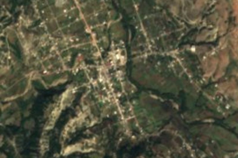
The name is Nahuatl for "heart of the rope": yolotl, heart, and mecatl, cord. The town sits at roughly 2,140 metres in the rolling, gullied hills of the Mixteca Alta, and its centre runs right up to the boundary with San Pedro y San Pablo Teposcolula, the main town of the area. Saint James the Apostle is the patron, hence the Santiago in the name. Before the Spanish arrived the land was known as Iniyoo.
The population has barely shifted in a century: 1,754 people in 1900, a low of 1,052 in 1980, then a slow climb to 1,879 in 2010 and 1,740 in 2020. The municipality has 13 localities and the seat holds most of its people. The climate is temperate and sub-humid, 14 to 18 degrees C on average with 700 to 900 mm of rain a year, nearly all of it in summer, so winter mornings are cold even under a clear sky. Much of the land is grass and woodland, with fields on the gentler slopes.
Three dated buildings are what the town keeps on show: the Catholic church of 1678, the town hall of 1710 and a monumental tower from 1928. Fiesta music is brass band, and the local table runs to barbacoa, mole, tamales and pozole, with mezcal and beer to go with them. One local oddity: only about 4% of residents speak an indigenous language, far fewer than in many neighbouring Mixtec towns.
This is a stop for people already in Teposcolula who want to see a Mixtec village with no tour groups and no tourist signs: you can walk it in a short while, ask for the church and carry on. We found no published hotels or restaurants in the village itself, so base yourself in Teposcolula.
How to get to Santiago Yolomécatl
Drive from Huajuapan de León: 1 h 20 min, 75 km
Yolomécatl is about 9 km from Teposcolula (roughly 10 minutes by car) and around 120 km by road from Oaxaca city, which is about 2 hours 15 minutes by bus.
By bus: Autobuses Fletes y Pasajes (Fypsa) runs Oaxaca to Teposcolula twice a day, in about 2 h 16 min. The alternative is ADO from Oaxaca to Asunción Nochixtlán (about 1 h 20 min, departures roughly every 10 minutes) and then Fypsa on to Teposcolula, another 40 minutes with two departures a day. Oaxaca's first-class terminal is on Calzada Niños Héroes de Chapultepec.
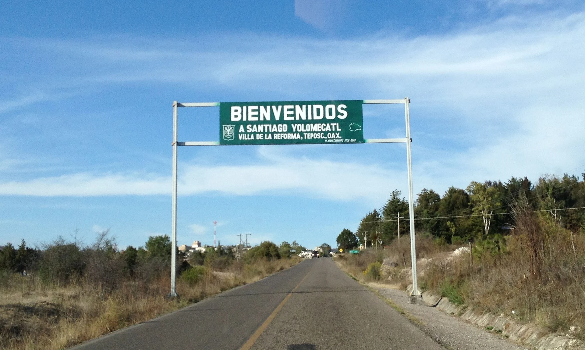
Last stretch: we found no published colectivo or combi between Teposcolula and Yolomécatl, nor a timetable. The practical choices are a taxi from Teposcolula or your own car; the welcome arch at the entrance stands on a paved two-lane road. Ask in Teposcolula about local transport before counting on it.
Directions to Santiago Yolomécatl on Google Maps
Distances are in a straight line; the road is usually longer.
Links open a partner site. We may earn a commission if you book, at no cost to you.
From the nearest cities to Santiago Yolomécatl
- Huajuapan de León · 75 km by road, 1 h 20 min
- Oaxaca · 131 km by road, 1 h 45 min
- Tlapa · about 140 km by road, ~2 h 5 min
Drive times by road from OpenStreetMap, without traffic or stops. Times marked ~ are estimated from the straight-line distance.
Before you go to Santiago Yolomécatl: hours, prices and tips
- Rules
- Quiet farming village with no tourist services listed; dress warm in winter. INEGI Compendio municipal 2010 · checked Oct 2026
Hours and prices change, especially around holidays. Each fact links to where we checked it.
Visiting Santiago Yolomécatl: what to see and do
Visit the Catholic church of 1678.
Look at the town hall, dated 1710.
Find the monumental tower of 1928.
Pass under the welcome arch on the highway, signed "Villa de la Reforma".
If there is a fiesta, listen to the brass band and try the barbacoa.
Head on to Teposcolula for its former convent and open chapel.
Plan your trip
Places to stay in Santiago Yolomécatl
Compare hotels, posadas, and rentals in and around Santiago Yolomécatl.
Tours & activities
Day trips around Teposcolula sometimes stop in Santiago Yolomécatl; a tour is the easy way to see it without a car.
Rental cars
Pick up a car at OAX (Oaxaca): about 1 h 45 min by road to Teposcolula, then 9 km more to Santiago Yolomécatl, on your own schedule.
Flights
The nearest airport with scheduled flights is Oaxaca (OAX), about 1 h 45 min by road from Teposcolula, the base for Santiago Yolomécatl.
Mobile data
Signal can drop away from Teposcolula: download a map of the way to Santiago Yolomécatl before you set out, or carry an eSIM with data.
Links open a partner site. We may earn a commission if you book, at no cost to you.
When to go to Santiago Yolomécatl cool
Santiago Yolomécatl shares the climate of Teposcolula, 9 km away. The best months to visit are January, February, March, and December.
See the month-by-month climate of Teposcolula
Weather in Santiago Yolomécatl now and the next 7 days
Live forecast from Open-Meteo. Chance of rain is the day's highest.
The closest Pueblo Mágico: Teposcolula

Teposcolula is the Pueblo Mágico closest to Santiago Yolomécatl, with places to stay, food, and more to see.
Closest to Santiago Yolomécatl
-
Huamelulpan · Archaeological site · 9 km away
-
San Martín Huamelulpan · Village · 9 km away
-
Santa Cruz Tayata · Town · 13 km away
-
Santa Catarina Tayata · Town · 14 km away
-
San Juan Achiutla · Village · 16 km away
-
San Juan Teposcolula · Town · 18 km away
-
San Miguel Achiutla · Landmark · 20 km away
-
Villa Tejúpam de la Unión · Town · 24 km away


Near Santiago Yolomécatl





Drive times by road from OpenStreetMap, without traffic. Times marked ~ are estimated from the straight-line distance.
Location from OpenStreetMap. Written by Puebloteca.