Town Santo Tomás Ocotepec, Oaxaca Mixteca of Oaxaca
Mixtec seat at 2,100 m near Tlaxiaco: Te kasiqui carnival, Santo Tomás fiesta 18-20 December, Friday market.
From Huajuapan de León: 2 h 25 min by car (135 km by road) How to get there ↓
Near here
See everything nearby ↓



Plan your visit to Santo Tomás Ocotepec
Where to stay near Santo Tomás Ocotepec
Compare hotels, posadas and guest houses in Santo Tomás Ocotepec.
Tours to Santo Tomás Ocotepec
Day trips around Teposcolula sometimes stop in Santo Tomás Ocotepec; a tour is the easy way to see it without a car.
How to get to Santo Tomás Ocotepec
- From Huajuapan de León: about 2 h 25 min by road (~135 km)
- Nearest airport: Oaxaca (OAX), 1 h 45 min by car to Teposcolula
Links open a partner site. We may earn a commission if you book, at no cost to you.
About Santo Tomás Ocotepec
Ocotepec is a Mixteca Alta seat whose size has swung widely: 2,893 residents in 1960, 375 in 2020. In Mixtec it is Ñuu yuku tuyuja, and the Nahuatl name points to the hill of the ocote pines. It sits at about 2,100 metres in a temperate climate with summer rain and an average near 14 °C; strong winds blow from January to March, especially in the higher communities. The Yute Suji river crosses the municipality, which groups 16 localities and where about 86% of people speak an Indigenous language. The largest locality is not the seat but Diecinueve de Abril, with 534 people.
It is known for its carnival. Men from the municipality's communities dress in masks, bright clothes, bells and charro hats and dance as Te kasiqui, "the one who dances", to wake the earth before maize, beans and squash are planted. The festival starts in January and peaks on Carnival Tuesday, when more than 3,000 costumed dancers fill the esplanade. The village's traditional dances (la aguja, el ceñidor, el gusto) and the municipal band join in.
The church dates from the sixteenth century and the patron is Saint Thomas the Apostle; his fiesta runs 18 to 20 December, with dawn mañanitas at 5 a.m., mass, a lunch for visitors at the mayordomo's house, basketball, folk dances and fireworks. On 1 and 2 November altars are set with marigolds. Festival tables bring black mole with turkey, pozole, yellow mole, barbacoa made with cracked nixtamal, pulque and tepache. Land titles were issued here in 1532.
How to get to Santo Tomás Ocotepec
Drive from Huajuapan de León: 2 h 25 min, 135 km
The municipality is about 30 km from Tlaxiaco by road, 40 minutes to an hour according to the municipal plan, and the paved road linking it with Nuyoo and Yucuhiti was a project the community itself pushed through. From Oaxaca city the way is to Tlaxiaco through the Mixteca (via Nochixtlán): Fypsa runs an Oaxaca-Tlaxiaco bus of about 3 hours, and the two-leg route Oaxaca-Nochixtlán (ADO, frequent departures) plus Nochixtlán-Tlaxiaco is another option; confirm times at Fypsa, since aggregators disagree on frequency. In Tlaxiaco the shared taxis of Sitio Ocotepec run to the village centre (in 2009 it was 18 pesos shared or 80 for a private run; more today), along with El Paraíso Mixteco cabs. The farther communities, such as Nunuma (10 km from the seat) or Lázaro Cárdenas (14 km), were still being paved when the municipal plan was written; ask about road conditions before going.
Directions to Santo Tomás Ocotepec on Google Maps
Distances are in a straight line; the road is usually longer.
Links open a partner site. We may earn a commission if you book, at no cost to you.
From the nearest cities to Santo Tomás Ocotepec
- Huajuapan de León · 135 km by road, 2 h 25 min
- Oaxaca · 192 km by road, 2 h 45 min
- Tehuacán · 216 km by road, 3 h 10 min
Drive times by road from OpenStreetMap, without traffic or stops. Times marked ~ are estimated from the straight-line distance.
Before you go to Santo Tomás Ocotepec: hours, prices and tips
- Best time of day
- Carnival Tuesday for the Te kasiqui gathering of more than 3,000 dancers. Wikipedia, Municipio de Santo Tomás Ocotepec · checked Oct 2026
- Best season
- Carnival from January, peaking on Carnival Tuesday; patron fiesta 18-20 December; Day of the Dead altars on 1-2 November. Plan Municipal de Desarrollo 2008-2010; Wikipedia · checked Oct 2026
- What to bring
- A warm layer: about 14 °C average and strong winds from January to March. Plan Municipal de Desarrollo 2008-2010 · checked Oct 2026
Hours and prices change, especially around holidays. Each fact links to where we checked it.
Visiting Santo Tomás Ocotepec: what to see and do
See the sixteenth-century church of Santo Tomás and its atrium.
Come for carnival: on Tuesday thousands of Te kasiqui dance on the esplanade.
Visit the Friday market and try barbacoa or black mole at fiesta time.
Walk toward the higher communities such as Nunuma, past maize fields and ocote pines.
Come 18 to 20 December for the fiesta of Santo Tomás.
Plan your trip
Places to stay in Santo Tomás Ocotepec
Compare hotels, posadas, and rentals in and around Santo Tomás Ocotepec.
Tours & activities
Day trips around Teposcolula sometimes stop in Santo Tomás Ocotepec; a tour is the easy way to see it without a car.
Rental cars
Pick up a car at OAX (Oaxaca): about 1 h 45 min by road to Teposcolula, then 50 km more to Santo Tomás Ocotepec, on your own schedule.
Flights
The nearest airport with scheduled flights is Oaxaca (OAX), about 1 h 45 min by road from Teposcolula, the base for Santo Tomás Ocotepec.
Mobile data
Signal can drop away from Teposcolula: download a map of the way to Santo Tomás Ocotepec before you set out, or carry an eSIM with data.
Links open a partner site. We may earn a commission if you book, at no cost to you.
When to go to Santo Tomás Ocotepec cool
Santo Tomás Ocotepec shares the climate of Teposcolula, 50 km away. The best months to visit are January, February, March, and December.
See the month-by-month climate of Teposcolula
Weather in Santo Tomás Ocotepec now and the next 7 days
Live forecast from Open-Meteo. Chance of rain is the day's highest.
The closest Pueblo Mágico: Teposcolula

Teposcolula is the Pueblo Mágico closest to Santo Tomás Ocotepec, with places to stay, food, and more to see.
Closest to Santo Tomás Ocotepec
-
San Esteban Atatlahuca · Town · 13 km away
-
San Martín Itunyoso · Town · 16 km away
-
Tlaxiaco · Town · 16 km away
-
San Juan Mixtepec Distrito 08 · Town · 19 km away
-
Putla Villa de Guerrero · Town · 22 km away
-
San Juan Copala · Village · 22 km away
-
Chalcatongo de Hidalgo · Town · 24 km away
-
Santa Catarina Ticuá · Town · 26 km away
Near Santo Tomás Ocotepec


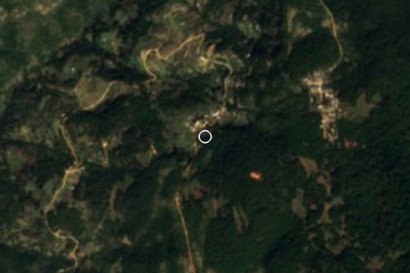


Drive times by road from OpenStreetMap, without traffic. Times marked ~ are estimated from the straight-line distance.
Location from OpenStreetMap. Written by Puebloteca.