


Town Putla Villa de Guerrero, Oaxaca Mixteca of Oaxaca
Sierra Sur town between the Mixteca and the coast at 744 m, known for the Carnaval Putleco and a mountain road from Oaxaca, Tlaxiaco and Pinotepa.
From Huajuapan de León: 2 h 50 min by car (158 km by road) How to get there ↓
Near here
See everything nearby ↓

Plan your visit to Putla Villa de Guerrero
Where to stay near Putla Villa de Guerrero
Compare hotels, posadas and guest houses in Putla Villa de Guerrero.
Tours to Putla Villa de Guerrero
Day trips around Teposcolula sometimes stop in Putla Villa de Guerrero; a tour is the easy way to see it without a car.
How to get to Putla Villa de Guerrero
- From Huajuapan de León: about 2 h 50 min by road (~158 km)
- Nearest airport: Oaxaca (OAX), 1 h 45 min by car to Teposcolula
Links open a partner site. We may earn a commission if you book, at no cost to you.
About Putla Villa de Guerrero
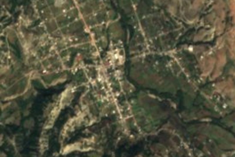
Putla lies in Oaxaca's Sierra Sur at about 744 metres, on the line between the Mixteca and the Coast, and is the seat of the municipality and district of the same name. In Nahuatl it was called Poctlan; the Mixtec name cited is Ñuu Ñuma, "place of smoke", now Ñuu Kaa, "place of mist". It received the title Villa de Guerrero by decree. According to the tradition on Wikipedia, the Mixtecs first lived in old Putla near San Juan Lagunas under the lordship of Tututepec, moved to the area of today's cemetery because of illness, and finally settled in the valley where the town stands now. In viceregal times it was a stopover and supply point between the coast and the interior, and José María Morelos is said to have passed and rested here, with a monument to him.
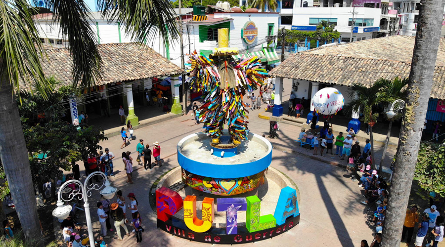
The Carnaval Putleco brings the most visitors. It is held the weekend before Ash Wednesday, with three comparsas: the Viejos or Tiliches, the Copalas and the Mascaritas (Danza del Macho). The "robo" is staged on Tuesday. The plaza has a carnival monument with the letters PUTLA. The patron feast of the Virgen de la Natividad runs 6 to 8 September, with flower offerings, traditional dress, fireworks and a calenda with mojigangas and marmotas.
The centre is small: the municipal park, the church half a block away and tile-roofed houses. Typical food includes tamal de mole, mole amarillo, masita de chivo with barbacoa, tetelas, pan de yema, chile atole and the "sándwich de nieve". Growers raise coffee, papaya, plantain, sugarcane, rice, mango, cacao and tobacco, and rivers nearby include the Copala and the Yucuhiti.
The town had 12,729 people in the 2020 INEGI census. Putla is mostly a place to spend a day or a night, catch the carnival, or break the journey toward the coast.
How to get to Putla Villa de Guerrero
Drive from Huajuapan de León: 2 h 50 min, 158 km
Putla is on the mountain road that links Oaxaca with Tlaxiaco and Pinotepa Nacional (highway 125). From the city of Oaxaca it is about 370 km and takes almost six hours according to Heraldo de México, though some comparison sites list less; do not trust the short times, because the road is all curves.
By public transport, Heraldo says units leave from Calzada Madero, almost opposite Soriana, in Oaxaca for about 200 pesos. Rome2Rio also lists Autobuses Fletes y Pasajes (Fypsa) with two runs a day from Oaxaca to Putla. From Tlaxiaco, Busbud lists about 3 h 10 min with OCC, and from Pinotepa Nacional about 2 hours. From Puerto Escondido the route goes through Pinotepa and takes close to 6 hours. Confirm times with the companies, because these pages are not recent.
The nearest pueblo in our guide is Teposcolula, about 71 km as the crow flies, roughly 2 hours or more by road, approximate.
Directions to Putla Villa de Guerrero on Google Maps
Distances are in a straight line; the road is usually longer.
Links open a partner site. We may earn a commission if you book, at no cost to you.
From the nearest cities to Putla Villa de Guerrero
- Huajuapan de León · 158 km by road, 2 h 50 min
- Tehuacán · about 220 km by road, ~3 h 15 min
- Chilpancingo · about 230 km by road, ~3 h 25 min
Drive times by road from OpenStreetMap, without traffic or stops. Times marked ~ are estimated from the straight-line distance.
Before you go to Putla Villa de Guerrero: hours, prices and tips
- Best season
- Carnaval Putleco the weekend before Ash Wednesday; patron feast of the Virgen de la Natividad on 6 to 8 September. Heraldo de México Oaxaca · checked Oct 2026
Hours and prices change, especially around holidays. Each fact links to where we checked it.
Visiting Putla Villa de Guerrero: what to see and do
Walk the municipal park and the carnival monument with the PUTLA letters.
Step into the church, half a block from the park.
Find the monument to Morelos.
Try tamal de mole, masita de chivo and the "sándwich de nieve".
Come the weekend before Ash Wednesday for the Carnaval Putleco.
Come on 6 to 8 September for the feast of the Virgen de la Natividad.
Plan your trip
Places to stay in Putla Villa de Guerrero
Compare hotels, posadas, and rentals in and around Putla Villa de Guerrero.
Tours & activities
Day trips around Teposcolula sometimes stop in Putla Villa de Guerrero; a tour is the easy way to see it without a car.
Rental cars
Pick up a car at OAX (Oaxaca): about 1 h 45 min by road to Teposcolula, then 71 km more to Putla Villa de Guerrero, on your own schedule.
Flights
The nearest airport with scheduled flights is Oaxaca (OAX), about 1 h 45 min by road from Teposcolula, the base for Putla Villa de Guerrero.
Mobile data
Signal can drop away from Teposcolula: download a map of the way to Putla Villa de Guerrero before you set out, or carry an eSIM with data.
Links open a partner site. We may earn a commission if you book, at no cost to you.
Photos
When to go to Putla Villa de Guerrero cool
Putla Villa de Guerrero shares the climate of Teposcolula, 71 km away. The best months to visit are January, February, March, and December.
See the month-by-month climate of Teposcolula
Weather in Putla Villa de Guerrero now and the next 7 days
Live forecast from Open-Meteo. Chance of rain is the day's highest.
The closest Pueblo Mágico: Teposcolula

Teposcolula is the Pueblo Mágico closest to Putla Villa de Guerrero, with places to stay, food, and more to see.
Closest to Putla Villa de Guerrero
-
Mesones Hidalgo · Town · 15 km away
-
San Juan Copala · Village · 18 km away
-
Santo Tomás Ocotepec · Town · 22 km away
-
San Martín Itunyoso · Town · 23 km away
-
San Esteban Atatlahuca · Town · 27 km away
-
San Juan Mixtepec Distrito 08 · Town · 33 km away
-
San Sebastián Tecomaxtlahuaca · Town · 37 km away
-
Chalcatongo de Hidalgo · Town · 38 km away

Near Putla Villa de Guerrero




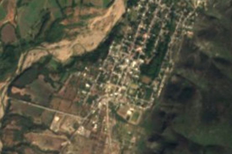


Drive times by road from OpenStreetMap, without traffic. Times marked ~ are estimated from the straight-line distance.
Location from OpenStreetMap. Written by Puebloteca.