Archaeological site Tamuín, San Luis Potosí Huasteca Potosina
The Huastec town of El Consuelo by the Tampaón River: earth-and-cobble platforms, an altar with mural painting, and free entry.
From Ciudad Valles: 40 min by car (42 km by road) How to get there ↓
Near here
See everything nearby ↓



Plan your visit to Zona Arqueológica Tamohi
Where to stay near Zona Arqueológica Tamohi
Compare hotels, posadas and guest houses in Zona Arqueológica Tamohi.
Tours to Zona Arqueológica Tamohi
A guide brings Zona Arqueológica Tamohi to life: look for tours from Aquismón that include the site and the ride there.
 Tours from Ciudad Valles
Rafting in Tampaon River from Ciudad Valles
★ 5.0 (845) · From US$115
How to get to Zona Arqueológica Tamohi
- From Ciudad Valles: about 40 min by road (~42 km)
- Nearest airport: Tampico (TAM), 2 h 49 min by car to Aquismón
Links open a partner site. We may earn a commission if you book, at no cost to you.
Tours from Ciudad Valles, near Zona Arqueológica Tamohi


Tours, prices and ratings from Viator, checked weekly. We may earn a commission if you book.
About Zona Arqueológica Tamohi
Tamohi, also known as El Consuelo after the ranch it stands on, or simply as Tamuín, was a town of the Huastec (Teenek) people on the right bank of the Tampaón River, one of the rivers that form the Pánuco, about 6 km south of the town of Tamuín. Its Teenek name has been translated as "place of effervescence" or "where the water swirls". It dates from the last centuries of the pre-Hispanic Huasteca, on the northern edge of Mesoamerica, and was abandoned early in the Spanish conquest. At its height it may have had around 10,000 inhabitants.
The town spread over more than 200 hectares. Because the river flooded often, the important buildings stood on natural rises and large platforms, while ordinary people lived on terraces on the neighbouring slopes, with their houses and gardens. River trade mattered: there were landing places and ramps up which traders and visitors climbed to the market and meeting spaces. The Huasteca paid tribute to the Aztec empire in painted cotton mantles, dried chilli, cacao, greenstone, copal, rubber, natural tar and feathers.
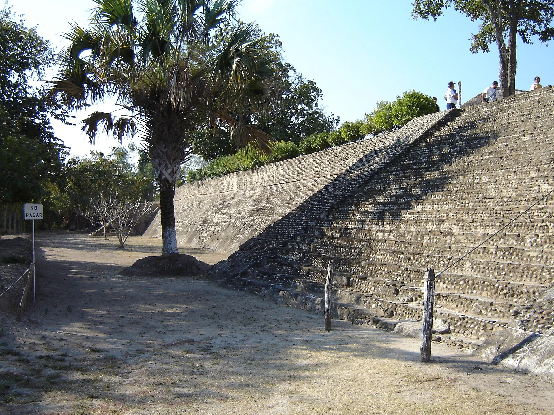
Only about 0.6 per cent of the site has been excavated. What you visit is a rectangular platform about 6 metres high facing east, carrying nine main buildings over more than 8,000 m²: five large bases frame a plaza open to the east, with three smaller structures in the middle. Everything is built of rammed earth faced with river cobbles and coated with lime stucco; some terraces had underground kilns for firing pottery. The main altar keeps its mural painting: a procession of richly dressed figures bearing the attributes of Quetzalcóatl beneath a stepped-fret band. Round structures are another hallmark of Tamuín's architecture.
The first explorations were by Wilfrido Du Solier in 1946, who uncovered the main plaza and the painted altar; in the late 1970s Leonor Merino Carrión and Ángel García Cook carried out conservation work. The Huastec Adolescent was found on El Consuelo ranch, a sandstone figure of a naked youth carrying a child on his back, regarded as a masterpiece of Huastec art; the original is in the National Museum of Anthropology and a replica in the Museo Regional Potosino. It is a small, lightly visited site; the same municipality also holds Tamtoc, the great Huastec city on the Tampaón.
How to get to Zona Arqueológica Tamohi
Drive from Ciudad Valles: 40 min, 42 km
From Tampico it is about 115 km, nearly 2 hours: head west on federal highway 70 toward Ciudad Valles as far as Tamuín, then take the Tamuín–San Vicente Tancuayalab road (SLP 14); the turn-off is at kilometre 5.8, signposted shortly after Antiguo Tamuín. From Ciudad Valles it is about 40 km, 40 minutes on the same highway 70. Buses run hourly from Ciudad Valles to Tamuín (about 45 minutes), but the site is a long way from town, so a taxi makes sense. The nearest Pueblo Mágico is Aquismón, about 65 km and an hour away.
Directions to Zona Arqueológica Tamohi on Google Maps
Distances are in a straight line; the road is usually longer.
Links open a partner site. We may earn a commission if you book, at no cost to you.
From the nearest cities to Zona Arqueológica Tamohi
- Ciudad Valles · 42 km by road, 40 min
- Tampico · 115 km by road, 2 h
- Ciudad Mante · 139 km by road, 2 h 15 min
Drive times by road from OpenStreetMap, without traffic or stops. Times marked ~ are estimated from the straight-line distance.
Before you go to Zona Arqueológica Tamohi: hours, prices and tips
- Hours
- Monday to Sunday 09:00–18:00; last entry 17:00. INAH · checked Oct 2026
- Entry
- Free entry; using a video camera costs 45 pesos. INAH · checked Oct 2026
- Rules
- No smoking, no food and no pets. INAH · checked Oct 2026
Hours and prices change, especially around holidays. Each fact links to where we checked it.
Visiting Zona Arqueológica Tamohi: what to see and do
Climb the main platform and look over the plaza framed by five bases.
Find the mural on the main altar, with its procession of figures under a stepped fret.
Notice the building technique: rammed earth, river cobbles and lime stucco.
Round off the day at Tamtoc, the municipality's other archaeological site.
If you pass through San Luis Potosí, see the replica of the Huastec Adolescent in the Museo Regional Potosino.
Plan your trip
Places to stay in Zona Arqueológica Tamohi
Compare hotels, posadas, and rentals in and around Zona Arqueológica Tamohi.
Tours & activities
A guide brings Zona Arqueológica Tamohi to life: look for tours from Aquismón that include the site and the ride there.
Rental cars
Pick up a car at TAM (Tampico): about 2 h 49 min by road to Aquismón, then 46 km more to Zona Arqueológica Tamohi, on your own schedule.
Flights
The nearest airport with scheduled flights is Tampico (TAM), about 2 h 49 min by road from Aquismón, the base for Zona Arqueológica Tamohi.
Mobile data
Signal can drop away from Aquismón: download a map of the way to Zona Arqueológica Tamohi before you set out, or carry an eSIM with data.
Links open a partner site. We may earn a commission if you book, at no cost to you.
When to go to Zona Arqueológica Tamohi warm
Zona Arqueológica Tamohi shares the climate of Aquismón, 46 km away. The best months to visit are January, February, March, and December.
See the month-by-month climate of Aquismón
Weather in Zona Arqueológica Tamohi now and the next 7 days
Live forecast from Open-Meteo. Chance of rain is the day's highest.
The closest Pueblo Mágico: Aquismón

Aquismón is the Pueblo Mágico closest to Zona Arqueológica Tamohi, with places to stay, food, and more to see.
Also close to
- Xilitla · San Luis Potosí · 68 km away
Closest to Zona Arqueológica Tamohi
-
Zona Arqueológica de Tamtoc · Archaeological site · 7 km away
-
Ciudad Valles · City · 28 km away
-
Cascadas de Tambaque · Waterfall · 43 km away
-
Cascadas de Micos · Waterfall · 45 km away
-
Tancanhuitz · Town · 45 km away
-
Cueva del Agua · Cave · 46 km away
-
Cascada de Tamul · Waterfall · 48 km away
-
Cuevas de Mantetzulel · Cave · 48 km away

Near Zona Arqueológica Tamohi

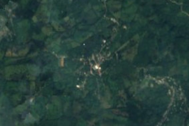





Drive times by road from OpenStreetMap, without traffic. Times marked ~ are estimated from the straight-line distance.
Location from OpenStreetMap. Written by Puebloteca.