

Viewpoint Ixtaczoquitlán, Veracruz Municipality of Ixtaczoquitlán Altas Montañas (Orizaba and Córdoba)
A deep, misty ravine with 19th-century railway tunnels, an old track you can walk, and some of Mexico's tallest bridges.
From Córdoba: 10 min by car (11 km by road) How to get there ↓
Near here
See everything nearby ↓




Plan your visit to Barranca de Metlac
Where to stay near Barranca de Metlac
La Casa Azul Hotel · 540 m from the center Prices Magnolias Hotel · 1.7 km from the center PricesTours to Barranca de Metlac
Day trips and guided outings from Córdoba often include Barranca de Metlac; with a local guide you can get there without a car.
 Tours from Veracruz
Private Sunrise Taj Mahal Tour from Delhi By Car -All inclusive
★ 5.0 (546) · From US$14
How to get to Barranca de Metlac
- From Córdoba: about 10 min by road (~11 km)
- 8 km west of Córdoba
- Nearest airport: Veracruz (VER), 1 h 25 min by car to Córdoba
Links open a partner site. We may earn a commission if you book, at no cost to you.
Tours from Veracruz, near Barranca de Metlac


Tours, prices and ratings from Viator, checked weekly. We may earn a commission if you book.
About Barranca de Metlac
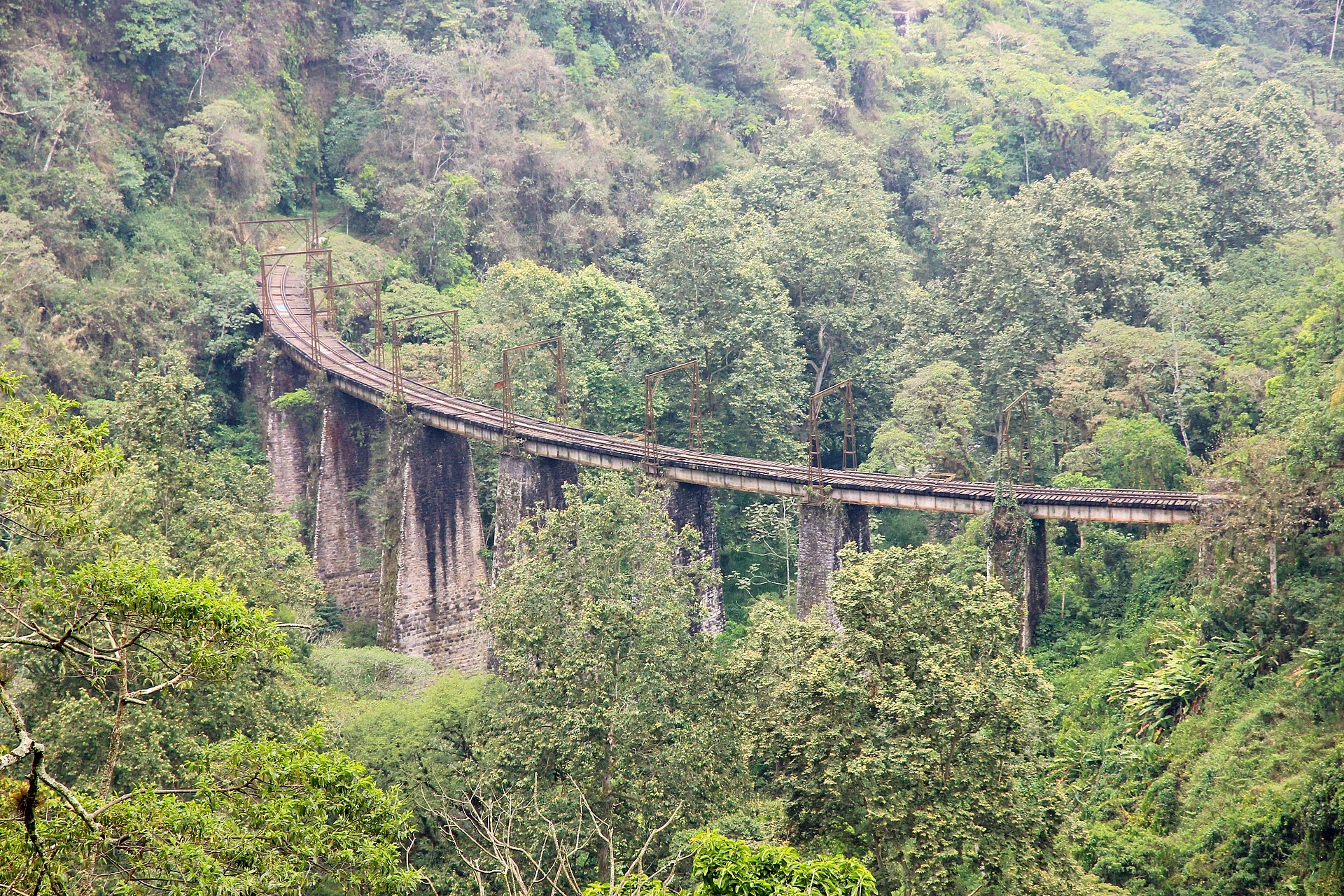
The Barranca de Metlac is the gorge the Metlac River has cut between Fortín de las Flores and Ixtaczoquitlán, on the way from Córdoba to Orizaba. Its walls are covered in humid mountain forest, and mist often fills it in the morning, which gives the place an eerie, half-hidden feel.
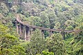
Getting the railway across it was one of the great engineering problems of the Ferrocarril Mexicano, the line between Veracruz and Mexico City that opened in 1873. Engineers dug a string of tunnels along the ravine wall and built a curved iron bridge high over the river; the painter José María Velasco made it famous in the 1880s. The old bridge was later replaced, and today modern railway and highway bridges span the ravine at dizzying heights.
In 2023 the federal government declared the stretch of railway between Sumidero and Fortín, with its seven tunnels and old stations, a zone of historic monuments. Part of the old track bed is now walked and biked by visitors, and a lookout on the Fortín side gives a view down into the forest.
How to get to Barranca de Metlac
Drive from Córdoba: 10 min, 11 km
The ravine is about 20 minutes from Córdoba: drive or take a bus to Fortín de las Flores and follow the road toward Ixtaczoquitlán to the lookout. Trails into the ravine are rough and the railway is still in use, so going with a local guide is strongly recommended; avoid walking on active tracks.
8 km west of Córdoba
Directions from Córdoba on Google Maps
Distances are in a straight line; the road is usually longer.
Links open a partner site. We may earn a commission if you book, at no cost to you.
From the nearest cities to Barranca de Metlac
- Córdoba · 11 km by road, 10 min
- Orizaba · 17 km by road, 15 min
- Tehuacán · 84 km by road, 1 h 15 min
Drive times by road from OpenStreetMap, without traffic or stops. Times marked ~ are estimated from the straight-line distance.
Before you go to Barranca de Metlac: hours, prices and tips
- Best season
- Fog rolls through the ravine often; expect misty views rather than clear ones. México Desconocido · checked Oct 2026
- Guide or tour
- The lookout beside the Fortín–Ixtaczoquitlán road is easy to reach on your own, but for the old railway track and its tunnels a local guide is strongly recommended. Tours: Viator GetYourGuide México Desconocido · checked Oct 2026
Hours and prices change, especially around holidays. Each fact links to where we checked it.
Visiting Barranca de Metlac: what to see and do
Look down into the ravine from the lookout on the Fortín side, best early before the mist rises or late in the afternoon.
Walk the old railway line through the tunnels with a local guide.
Mountain bike along the former track bed.
Spot the tall modern bridges of the railway and the Córdoba–Orizaba highway.
Plan your trip
Places to stay in Barranca de Metlac
La Casa Azul Hotel · 540 m from the center Find on Expedia Magnolias Hotel · 1.7 km from the center Find on Expedia Hotel "Las Vías" Hotel · 1.8 km from the center Find on Expedia Suites María Antonieta Hotel · 1.8 km from the center Find on Expedia Ruiz Galindo Hotel · 1.9 km from the center Find on Expedia Gran Hotel Hotel · 2.0 km from the center Find on ExpediaTours & activities
Day trips and guided outings from Córdoba often include Barranca de Metlac; with a local guide you can get there without a car.
Rental cars
Pick up a car at VER (Veracruz): about 1 h 25 min by road to Córdoba, then 8 km more to Barranca de Metlac, on your own schedule.
Flights
The nearest airport with scheduled flights is Veracruz (VER), about 1 h 25 min by road from Córdoba, the base for Barranca de Metlac.
Mobile data
Signal can drop away from Córdoba: download a map of the way to Barranca de Metlac before you set out, or carry an eSIM with data.
Links open a partner site. We may earn a commission if you book, at no cost to you. Hotel names from OpenStreetMap.
Photos
When to go to Barranca de Metlac mild
Barranca de Metlac shares the climate of Córdoba, 8 km away. The best months to visit are February, March, April, and December.
For the clearest views from Barranca de Metlac, go in the driest months (February, March, April, and December); in the rains, clouds tend to build up by midday.
See the month-by-month climate of Córdoba
Weather in Barranca de Metlac now and the next 7 days
Live forecast from Open-Meteo. Chance of rain is the day's highest.
Make Córdoba your base

Barranca de Metlac is an easy trip from Córdoba, a Pueblo Mágico with places to stay, food, and more to see.
Also close to
- Orizaba · Veracruz · 12 km away
- Coscomatepec · Veracruz · 19 km away
- Xico · Veracruz · 57 km away
- Coatepec · Veracruz · 61 km away
Closest to Barranca de Metlac
-
Sumidero · Village · 1 km away · Veracruz
-
Fortín de las Flores · Town · 2 km away
-
Cuautlapan · Village · 3 km away · Veracruz
-
Monte Salas · Village · 3 km away · Veracruz
-
Cuapichapan · Village · 4 km away · Veracruz
-
Moyoapan · Village · 4 km away · Veracruz
-
Escamela · Village · 7 km away · Veracruz
-
Monte Blanco · Village · 7 km away · Veracruz


Near Barranca de Metlac


Drive times by road from OpenStreetMap, without traffic. Times marked ~ are estimated from the straight-line distance.
Something wrong or missing on this page? Suggest a fix or addition
Location from OpenStreetMap. Written by Puebloteca.