
Village Ixtaczoquitlán, Veracruz Municipality of Ixtaczoquitlán Altas Montañas (Orizaba and Córdoba)
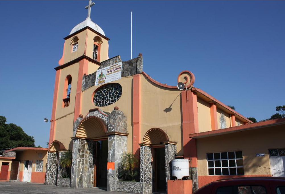
Ixtaczoquitlán village between Orizaba and Córdoba, with the parish of San Sebastián Mártir and the San Juan and Chicahuaxtla hills above it.
From Orizaba: 15 min by car (11 km by road) How to get there ↓
Near here
See everything nearby ↓


Plan your visit to Cuautlapan
Where to stay near Cuautlapan
Compare hotels, posadas and guest houses in Cuautlapan.
Tours to Cuautlapan
Day trips and guided outings from Córdoba often include Cuautlapan; with a local guide you can get there without a car.
How to get to Cuautlapan
- From Orizaba: about 15 min by road (~11 km)
- Nearest airport: Veracruz (VER), 1 h 25 min by car to Córdoba
Links open a partner site. We may earn a commission if you book, at no cost to you.
About Cuautlapan
Cuautlapan is one of the larger communities of Ixtaczoquitlán, the industrial municipality that fills the valley between Orizaba and Córdoba in Veracruz's Altas Montañas. Around 8,200 people live here, and the name is Nahuatl, built from cuauhtlalli, fertile land, and pan, on: "on fertile land".
The village centres on the parish church of San Sebastián Mártir on Calle Independencia, part of the Diocese of Orizaba and listed among the most visited churches in the municipality. Two hills rise behind the houses. Cerro San Juan, known locally as the Cerro de las Antenas, gives a view over the whole village, while the summit of Cerro Chicahuaxtla looks down on Cuautlapan and neighbouring Zapoapan, where guided walks along the Sendero Chicahuaxtla begin.
The damp hillsides matter to biologists as well. Cuautlapan and Cerro Chicahuaxtla are among the places where the salamander Pseudoeurycea nigromaculata, found only in Veracruz, has been recorded, at 1,240 to 1,670 metres, and a 1990s field study of the knob-scaled lizard Xenosaurus grandis was carried out here. For food, the local staple is chayote, which cooks across the municipality turn into sweets, jelly, purée and sauce.
How to get to Cuautlapan
Drive from Orizaba: 15 min, 11 km
Cuautlapan lies in the valley between Orizaba and Córdoba, just off Federal Highway 150. From Orizaba, the nearest Pueblo Mágico, leave along Oriente 6 and Bulevar Fernando Gutiérrez Barrios, which is the free Highway 150 towards Fortín, and turn off onto Avenida 27 de Septiembre into the village: about 10 km and 15 minutes. From Córdoba take the same free Highway 150 through Fortín towards Orizaba, cross the San Miguel bridge and follow 27 de Septiembre: about 14 km and 20 minutes. There is also a road from the municipal seat, the Ixtaczoquitlán–Cuautlapan road. Long-distance buses run to the Orizaba and Córdoba terminals; carry on from there by local bus or taxi.
Directions to Cuautlapan on Google Maps
Distances are in a straight line; the road is usually longer.
Links open a partner site. We may earn a commission if you book, at no cost to you.
From the nearest cities to Cuautlapan
- Orizaba · 11 km by road, 15 min
- Córdoba · 14 km by road, 20 min
- Tehuacán · 79 km by road, 1 h 10 min
Drive times by road from OpenStreetMap, without traffic or stops. Times marked ~ are estimated from the straight-line distance.
Visiting Cuautlapan: what to see and do
Visit the parish church of San Sebastián Mártir on Calle Independencia.
Climb Cerro San Juan (Cerro de las Antenas) for a view over the village.
Walk the Sendero Chicahuaxtla on a guided tour from Zapoapan.
Try the municipality's chayote dishes: sweets, jelly or sauce.
Plan your trip
Places to stay in Cuautlapan
Compare hotels, posadas, and rentals in and around Cuautlapan.
Tours & activities
Day trips and guided outings from Córdoba often include Cuautlapan; with a local guide you can get there without a car.
Rental cars
Pick up a car at VER (Veracruz): about 1 h 25 min by road to Córdoba, then 9 km more to Cuautlapan, on your own schedule.
Flights
The nearest airport with scheduled flights is Veracruz (VER), about 1 h 25 min by road from Córdoba, the base for Cuautlapan.
Mobile data
Signal can drop away from Córdoba: download a map of the way to Cuautlapan before you set out, or carry an eSIM with data.
Links open a partner site. We may earn a commission if you book, at no cost to you.
When to go to Cuautlapan mild
Cuautlapan shares the climate of Córdoba, 9 km away. The best months to visit are February, March, April, and December.
See the month-by-month climate of Córdoba
Weather in Cuautlapan now and the next 7 days
Live forecast from Open-Meteo. Chance of rain is the day's highest.
The closest Pueblo Mágico: Córdoba

Córdoba is the Pueblo Mágico closest to Cuautlapan, with places to stay, food, and more to see.
Also close to
- Orizaba · Veracruz · 9 km away
- Coscomatepec · Veracruz · 22 km away
- Xico · Veracruz · 60 km away
- Coatepec · Veracruz · 65 km away
Closest to Cuautlapan
-
Barranca de Metlac · Viewpoint · 3 km away
-
Cuapichapan · Village · 3 km away
-
Sumidero · Village · 3 km away
-
Escamela · Village · 4 km away
-
Fortín de las Flores · Town · 4 km away
-
Moyoapan · Village · 5 km away
-
Villa Unión · Village · 5 km away
-
Campo Grande · Village · 6 km away


Near Cuautlapan

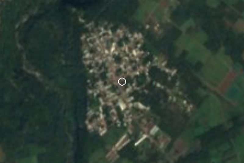


Drive times by road from OpenStreetMap, without traffic. Times marked ~ are estimated from the straight-line distance.
Location from OpenStreetMap. Written by Puebloteca.