

Village Acultzingo, Veracruz Altas Montañas (Orizaba and Córdoba)
Acultzingo village on Highway 150 below the Cumbres: a former hacienda, the 1862 Barranca Seca battle and a hikers' day in October.
From Orizaba: 20 min by car (18 km by road) How to get there ↓
Near here
See everything nearby ↓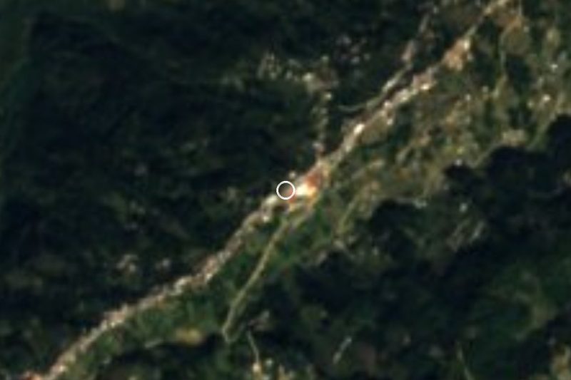



Plan your visit to Tecamalucan
Where to stay near Tecamalucan
Compare hotels, posadas and guest houses in Tecamalucan.
Tours to Tecamalucan
Day trips and guided outings from Orizaba often include Tecamalucan; with a local guide you can get there without a car.
How to get to Tecamalucan
- From Orizaba: about 20 min by road (~18 km)
- Nearest airport: Veracruz (VER), 1 h 42 min by car to Orizaba
Links open a partner site. We may earn a commission if you book, at no cost to you.
About Tecamalucan
Tecamalucan sits at the eastern foot of the Cumbres de Acultzingo, the most rugged stretch of the old road between Mexico City and the port of Veracruz. It lies at 1,380 metres beside the Río Blanco, on Federal Highway 150 between Orizaba and Tehuacán, and had 2,173 residents in 2020. Its Nahuatl name combines stone, house and captivity and is read as "prison".
History has passed right by its door. On 18 May 1862, two weeks after the French defeat at Puebla, a Republican brigade under General Santiago Tapia clashed with Leonardo Márquez's conservative forces near Barranca Seca and the Tecamalucan hacienda, trying to stop them joining the French army as it fell back towards Orizaba. The hacienda is listed among the municipality's historic monuments.
The 20th century gave the village two moments in the spotlight. In 1923, under Governor Adalberto Tejeda, a regional teacher-training school for rural teachers opened here, later closed like the rest of those schools. And from October 1924 to December 1926 Tecamalucan was the municipal seat, until another decree moved it back to Acultzingo.
Today the village has an alameda, schools up to upper secondary, a Banco del Bienestar branch and a petrol station on the highway. Up in the Cumbres there are pine, oak and fir forests, fog for much of the year and frosts from late November to January. On the third Sunday of October the village holds its Día del Excursionista, a day for hikers.
How to get to Tecamalucan
Drive from Orizaba: 20 min, 18 km
Tecamalucan is on the free (non-toll) Federal Highway 150 between Orizaba and Tehuacán. From central Orizaba it is about 18.5 km, some 20 minutes: head west on the 150, use a short stretch of the 150D toll road and rejoin the free 150 through Ciudad Mendoza, about 7 km from the village. From Acultzingo, the municipal seat, it is about 11 km on the same highway, around 11 minutes, coming down from the Cumbres. From Córdoba take the 150D toll road to Orizaba and continue the same way. Long-distance buses run on the free 150 between Puebla, Tehuacán and Orizaba; we found no published timetable with a stop at Tecamalucan, so the practical option is local transport towards Acultzingo from Orizaba or Ciudad Mendoza. The road is winding and often foggy: drive carefully, especially at night.
Directions to Tecamalucan on Google Maps
Distances are in a straight line; the road is usually longer.
Links open a partner site. We may earn a commission if you book, at no cost to you.
From the nearest cities to Tecamalucan
Drive times by road from OpenStreetMap, without traffic or stops. Times marked ~ are estimated from the straight-line distance.
Visiting Tecamalucan: what to see and do
The old Tecamalucan hacienda.
The site of the Barranca Seca battle of 18 May 1862.
The village alameda.
The Día del Excursionista, third Sunday of October.
The Cumbres de Acultzingo, with pine and fir forest.
The Río Blanco, flowing beside the village.
Plan your trip
Places to stay in Tecamalucan
Compare hotels, posadas, and rentals in and around Tecamalucan.
Tours & activities
Day trips and guided outings from Orizaba often include Tecamalucan; with a local guide you can get there without a car.
Rental cars
Pick up a car at VER (Veracruz): about 1 h 42 min by road to Orizaba, then 16 km more to Tecamalucan, on your own schedule.
Flights
The nearest airport with scheduled flights is Veracruz (VER), about 1 h 42 min by road from Orizaba, the base for Tecamalucan.
Mobile data
Signal can drop away from Orizaba: download a map of the way to Tecamalucan before you set out, or carry an eSIM with data.
Links open a partner site. We may earn a commission if you book, at no cost to you.
When to go to Tecamalucan mild
Tecamalucan shares the climate of Orizaba, 16 km away. The best months to visit are February, March, April, and December.
See the month-by-month climate of Orizaba
Weather in Tecamalucan now and the next 7 days
Live forecast from Open-Meteo. Chance of rain is the day's highest.
The closest Pueblo Mágico: Orizaba

Orizaba is the Pueblo Mágico closest to Tecamalucan, with places to stay, food, and more to see.
Also close to
- Córdoba · Veracruz · 34 km away
- Coscomatepec · Veracruz · 39 km away
- Xico · Veracruz · 77 km away
- Huautla · Oaxaca · 80 km away
Closest to Tecamalucan
-
Atzompa · Village · 6 km away
-
Ciudad Mendoza · Town · 7 km away
-
Huitzila · Village · 7 km away
-
Laguna de Nogales · Lake · 9 km away
-
Acultzingo · Town · 10 km away
-
Cañón del Río Blanco · Nature reserve · 12 km away
-
Boca del Monte · Village · 13 km away
-
San José Cuyachapa · Village · 14 km away

Near Tecamalucan


Drive times by road from OpenStreetMap, without traffic. Times marked ~ are estimated from the straight-line distance.
Location from OpenStreetMap. Written by Puebloteca.