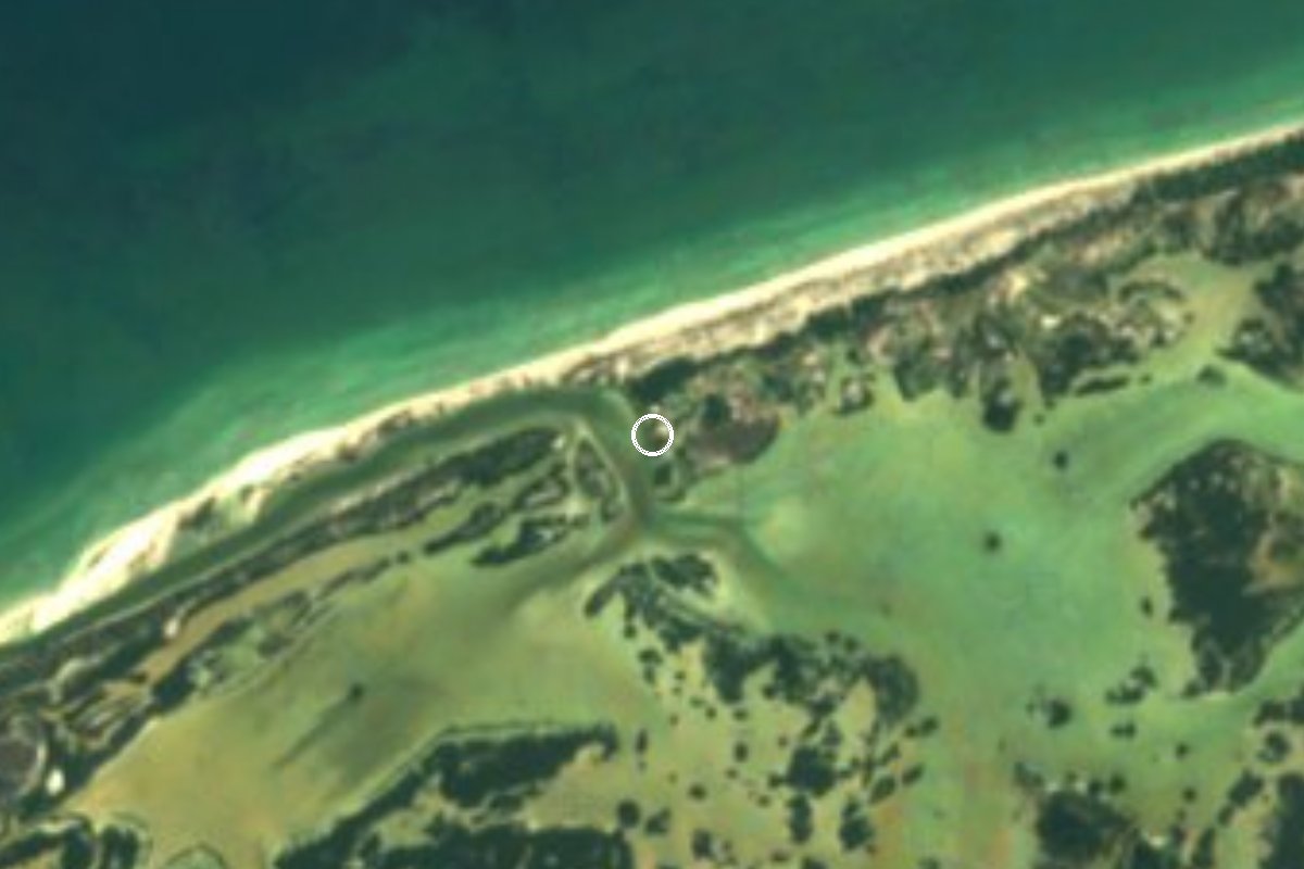
Nature reserve Hunucmá, Yucatán Yucatán's west coast
Mangrove lagoon west of Chuburná, opened to the sea by Hurricane Gilbert, with flamingos, pelicans and the Dzul-Ha freshwater spring.
From Mérida: 1 h 25 min by car (66 km by road) How to get there ↓
Near here
See everything nearby ↓


Plan your visit to La Carbonera
Where to stay near La Carbonera
Compare hotels, posadas and guest houses in La Carbonera.
Tours to La Carbonera
Day trips and guided outings from Sisal often include La Carbonera; with a local guide you can get there without a car.
 Tours from Progreso
Learn Paddle Board and Explore the Mangroves of Progreso
★ 5.0 (356) · From US$80
How to get to La Carbonera
- From Mérida: about 1 h 25 min by road (~66 km)
- Nearest airport: Mérida (MID), 1 h 7 min by car to Sisal
Links open a partner site. We may earn a commission if you book, at no cost to you.
Tours from Progreso, near La Carbonera


Tours, prices and ratings from Viator, checked weekly. We may earn a commission if you book.
About La Carbonera
La Carbonera is a stretch of mangrove, lagoon and nearly untouched beach on Yucatán's north coast, between the ports of Chuburná and Sisal. The mapped viewpoint lies in the municipality of Hunucmá, a few kilometers west of Chuburná Puerto, and the boats that take visitors there leave from Chuburná's fishermen's harbor. The area runs for about five kilometers.
It is a young landscape. When Hurricane Gilbert hit in 1988, the sea broke through and joined a coastal lagoon to the Gulf, creating a system of calm, clear water where fresh and salt water mix. Since then mangroves and petenes, the islands of forest that grow around springs in the marsh, have filled in, and the area has become a refuge for wildlife. Reddish egrets and other herons, white and brown pelicans and pink flamingos feed in the shallows, along with fish and reptiles.
Visits are by guided tour. A typical outing crosses the lagoon by boat, then continues by kayak, paddleboard or a poled flat-bottomed boat (chalana) through a channel in the mangroves to Dzul-Ha, a small freshwater spring where you can cool off; whether you can swim depends on the water level, which sometimes surges or overflows. Paddle tours last about two and a half hours, no motorboats are used inside, and guides keep about 5 to 6 meters from the birds so as not to disturb them. Many trips end with time on the beach facing the open sea.
How to get to La Carbonera
Drive from Mérida: 1 h 25 min, 66 km
Drive from Mérida to Chuburná Puerto, the beach town west of Progreso. There is no road into La Carbonera: tours leave by boat from Chuburná's fishermen's harbor (puerto de abrigo) and cross the lagoon before continuing by kayak or paddleboard. Tours are personalized and booked in advance.
Directions to La Carbonera on Google Maps
Distances are in a straight line; the road is usually longer.
Links open a partner site. We may earn a commission if you book, at no cost to you.
From the nearest cities to La Carbonera
- Mérida · 66 km by road, 1 h 25 min
- Campeche · 213 km by road, 3 h 15 min
- Tizimín · about 235 km by road, ~3 h 25 min
Drive times by road from OpenStreetMap, without traffic or stops. Times marked ~ are estimated from the straight-line distance.
Before you go to La Carbonera: hours, prices and tips
- Entry
- Tours cost about 400 pesos per person; the price varies with the service and time spent. Posta Yucatán (March 2026) · checked Oct 2026
- Time needed
- Kayak or chalana tours take about two and a half hours. Por Esto (2022) · checked Oct 2026
- Guide or tour
- Visits are by boat and paddle tour with local guides, booked ahead. Tours: Viator GetYourGuide Por Esto (2022) · checked Oct 2026
- What to bring
- Sunscreen, a cap, insect repellent, light clothes, comfortable shoes and a camera. Por Esto (June 2026) · checked Oct 2026
Hours and prices change, especially around holidays. Each fact links to where we checked it.
Visiting La Carbonera: what to see and do
Paddle a kayak or paddleboard through the mangrove channels.
Cool off in Dzul-Ha, the small freshwater spring at the end of the channel.
Watch flamingos, white and brown pelicans and reddish egrets feeding in the lagoon.
Finish on the nearly empty beach facing the Gulf.
Plan your trip
Places to stay in La Carbonera
Compare hotels, posadas, and rentals in and around La Carbonera.
Tours & activities
Day trips and guided outings from Sisal often include La Carbonera; with a local guide you can get there without a car.
Rental cars
Pick up a car at MID (Mérida): about 1 h 7 min by road to Sisal, then 16 km more to La Carbonera, on your own schedule.
Flights
The nearest airport with scheduled flights is Mérida (MID), about 1 h 7 min by road from Sisal, the base for La Carbonera.
Travel insurance
If you plan on hiking at La Carbonera, check that your policy covers it: some plans leave adventure activities out.
Mobile data
Signal can drop away from Sisal: download a map of the way to La Carbonera before you set out, or carry an eSIM with data.
Links open a partner site. We may earn a commission if you book, at no cost to you.
When to go to La Carbonera warm
La Carbonera shares the climate of Sisal, 16 km away. The best months to visit are January, February, November, and December.
See the month-by-month climate of Sisal
Weather in La Carbonera now and the next 7 days
Live forecast from Open-Meteo. Chance of rain is the day's highest.
The closest Pueblo Mágico: Sisal

Sisal is the Pueblo Mágico closest to La Carbonera, with places to stay, food, and more to see.
Also close to
- Motul · Yucatán · 65 km away
Closest to La Carbonera
-
Isla Columpios · Island · 5 km away
-
Chuburná Puerto · Village · 8 km away
-
Chelem · Village · 16 km away
-
Sierra Papacal · Village · 20 km away
-
Yucalpetén · Landmark · 20 km away
-
Dzidzilché · Village · 22 km away
-
Suytunchén · Village · 22 km away
-
Kikteil · Village · 23 km away


Near La Carbonera


Drive times by road from OpenStreetMap, without traffic. Times marked ~ are estimated from the straight-line distance.
Lists with La Carbonera
Nature Parks in Yucatán · 11 Nature Parks near Sisal · 5 Nature Parks near Mérida · 4Location from OpenStreetMap. Written by Puebloteca.