
Town Tulancingo de Bravo, Hidalgo Municipality of Tulancingo de Bravo
An urban locality hugging Tulancingo on the valley floor; its Nahuatl name means place of sandy ground and its church is dedicated to St Francis of Assisi.
From Tulancingo: 10 min by car (7 km by road) How to get there ↓
Near here
See everything nearby ↓




Plan your visit to Jaltepec
Where to stay near Jaltepec
Compare hotels, posadas and guest houses in Jaltepec.
Tours to Jaltepec
Day trips around Huasca de Ocampo sometimes stop in Jaltepec; a tour is the easy way to see it without a car.
How to get to Jaltepec
- From Tulancingo: about 10 min by road (~7 km)
- Nearest airport: Mexico City (Felipe Ángeles) (NLU), 1 h 21 min by car to Huasca de Ocampo
Links open a partner site. We may earn a commission if you book, at no cost to you.
About Jaltepec
Jaltepec comes from Nahuatl xalli, sand, and tepec, hill or town: "place of sandy ground" or "on the sandy hill". It lies in the Tulancingo Valley at 2,157 metres, on plain and valley terrain with a semi-dry temperate climate, and its waters drain to the Metztitlán river subbasin. Today it is an urban locality counted inside the Tulancingo metropolitan area, and INEGI classes it as a villa.
The clearest thing the numbers say is how fast it has grown. The 2000 census counted 3,266 inhabitants; in 2005 there were 5,177, in 2010 6,463 and in 2020 7,973, which is 4.74% of the population of the municipality of Tulancingo de Bravo. There are 2,315 occupied private homes. More than a quarter of the people are 14 or younger (2,061), only 503 are 65 or older, and 6,614 say they are Catholic against 577 Protestant.
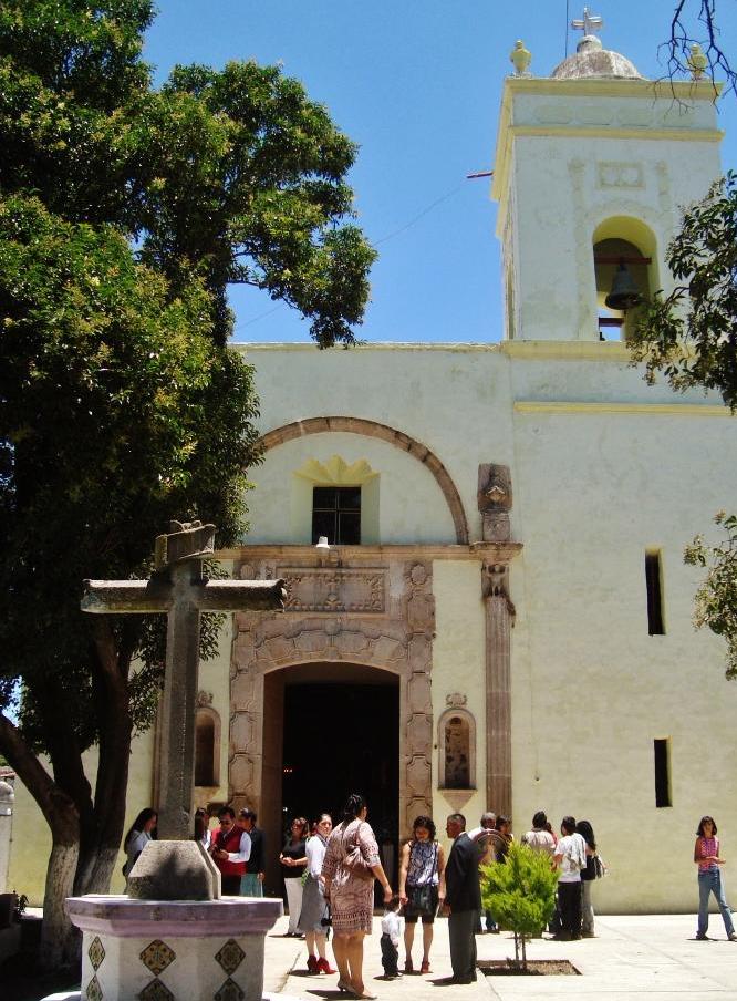
The building that organises the town is the church of San Francisco de Asís, with a whitewashed front and a tower holding a bell under a small dome, facing a churchyard with a stone cross. Tulancingo is only a few kilometres from Jaltepec, and the two make up a single metropolitan area.
How to get to Jaltepec
Drive from Tulancingo: 10 min, 7 km
Jaltepec is right against Tulancingo, about 6 km away in a straight line (roughly 5 minutes by car, an estimate). Federal highways 130 (Pachuca-Poza Rica-Tampico) and 132 (Mexico-Teotihuacán-Tulancingo) reach Tulancingo; by the 132 it is 119 km from Mexico City, and from Pachuca the city is 40 km, according to Wikipedia.
The same source lists the long-distance bus lines serving Tulancingo: Estrella Blanca, Futura, Blancos Coordinados, Autobuses de Oriente, Flecha Roja, Tepehuas and Conexión, among others. Huasca de Ocampo, a Pueblo Mágico, shows at about 21 km straight and 25 minutes by estimate; with the bends, more.
Directions to Jaltepec on Google Maps
Distances are in a straight line; the road is usually longer.
Links open a partner site. We may earn a commission if you book, at no cost to you.
From the nearest cities to Jaltepec
- Tulancingo · 7 km by road, 10 min
- Huauchinango · 46 km by road, 45 min
- Pachuca · 48 km by road, 50 min
Drive times by road from OpenStreetMap, without traffic or stops. Times marked ~ are estimated from the straight-line distance.
Visiting Jaltepec: what to see and do
Church of San Francisco de Asís, with its bell tower
Churchyard with a stone cross in front of the church
The city of Tulancingo and its neoclassical cathedral, a few kilometres away
Plan your trip
Places to stay in Jaltepec
Compare hotels, posadas, and rentals in and around Jaltepec.
Tours & activities
Day trips around Huasca de Ocampo sometimes stop in Jaltepec; a tour is the easy way to see it without a car.
Rental cars
Pick up a car at NLU (Mexico City (Felipe Ángeles)): about 1 h 21 min by road to Huasca de Ocampo, then 21 km more to Jaltepec, on your own schedule.
Flights
The nearest airport with scheduled flights is Mexico City (Felipe Ángeles) (NLU), about 1 h 21 min by road from Huasca de Ocampo, the base for Jaltepec.
Mobile data
Signal can drop away from Huasca de Ocampo: download a map of the way to Jaltepec before you set out, or carry an eSIM with data.
Links open a partner site. We may earn a commission if you book, at no cost to you.
When to go to Jaltepec cool
Jaltepec shares the climate of Huasca de Ocampo, 21 km away. The best months to visit are January, February, March, and December.
See the month-by-month climate of Huasca de Ocampo
Weather in Jaltepec now and the next 7 days
Live forecast from Open-Meteo. Chance of rain is the day's highest.
The closest Pueblo Mágico: Huasca de Ocampo

Huasca de Ocampo is the Pueblo Mágico closest to Jaltepec, with places to stay, food, and more to see.
Also close to
- Acaxochitlán · Hidalgo · 23 km away
- Real del Monte · Hidalgo · 27 km away
- Zempoala · Hidalgo · 34 km away
- Pahuatlán · Puebla · 34 km away
- Mineral del Chico · Hidalgo · 36 km away
Closest to Jaltepec
-
Acatlán · Town · 4 km away
-
Metepec Primero · Village · 4 km away
-
El Pedregal de San José · Village · 5 km away
-
San Dionisio · Village · 5 km away
-
Tulancingo · City · 6 km away
-
Zona Arqueológica de Huapalcalco · Archaeological site · 6 km away
-
Los Romeros · Village · 9 km away
-
Santiago Tulantepec · Town · 11 km away


Near Jaltepec




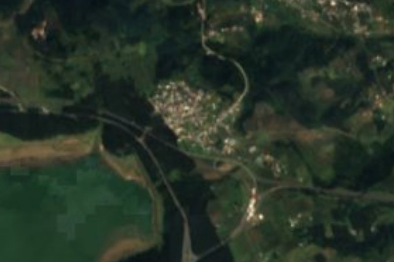
Drive times by road from OpenStreetMap, without traffic. Times marked ~ are estimated from the straight-line distance.
Location from OpenStreetMap. Written by Puebloteca.