


Nature reserve Mineral del Chico, Hidalgo Municipality of Mineral del Chico Hidalgo Mountain Corridor Comarca Minera Geopark
Fir forest and giant volcanic crags above Pachuca, protected since 1898; trails, climbing, dams and viewpoints. Closed for pest clean-up in 2026.
From Pachuca: 30 min by car (25 km by road) How to get there ↓
Near here
See everything nearby ↓


Plan your visit to Parque Nacional El Chico
Where to stay near Parque Nacional El Chico
Hotel Bello Amanecer Hotel · ★★ · 3.7 km from the center Prices Hospedaje el Chico Hotel · 870 m from the center PricesTours to Parque Nacional El Chico
Day trips and guided outings from Mineral del Chico often include Parque Nacional El Chico; with a local guide you can get there without a car.
 Tours from Zacatlan
Zacatlán Guided Tour walking through the Center
★ 5.0 (2) · From US$8
How to get to Parque Nacional El Chico
- From Pachuca: about 30 min by road (~25 km)
- 2 km east of Mineral del Chico
- Nearest airport: Mexico City (Felipe Ángeles) (NLU), 1 h 12 min by car to Mineral del Chico
Links open a partner site. We may earn a commission if you book, at no cost to you.
Tours from Zacatlan, near Parque Nacional El Chico
Tours, prices and ratings from Viator, checked weekly. We may earn a commission if you book.
About Parque Nacional El Chico
El Chico National Park protects 2,739 hectares of mountain forest in the Sierra de Pachuca, wrapped around the Pueblo Mágico of Mineral del Chico, with smaller parts in Pachuca and Mineral del Monte. It is one of the oldest protected areas in Latin America: in 1898 Porfirio Díaz declared it the "Monte Vedado del Mineral del Chico", pushed by the engineer and botanist Miguel Ángel de Quevedo, to save the woods that the mines were consuming, and it became a national park by decree on 6 July 1982. It is also part of the Comarca Minera UNESCO Global Geopark, designated in 2017.
The park ranges from about 2,320 metres in the north to 3,090 metres at Las Ventanas, its highest crags. Sacred fir (oyamel) forest covers more than 60 percent of it, mixed with oak, pine and white cedar, and above the trees rise eroded towers of volcanic rock such as Las Ventanas, Las Monjas, La Muela, Los Enamorados and the Peña del Cuervo, which have made El Chico one of central Mexico's classic climbing areas. Small dams and meadows such as El Cedral and Llano Grande, plus ejido-run parks such as El Cerezo with cabins, a zip line, boats and horses, round out a day of hiking, mountain biking, fishing or camping.
The forest has been hit hard by bark beetles. By the end of 2025 more than 23,700 infested trees had been felled, and the state is replanting thousands of oyamel firs. The Peña del Cuervo viewpoint closed in late January 2026, and on 20 February 2026 park authorities closed its access points, campgrounds, viewpoints and trails for sanitation work with no reopening date. A July 2026 camping guide in the Hidalgo press described the campgrounds without mentioning the closure, but we found no official reopening notice, so check the park's official social media before you go.
How to get to Parque Nacional El Chico
Drive from Pachuca: 30 min, 25 km
The park begins at the edge of Mineral del Chico, and the road from Pachuca to Mineral del Chico runs through it, with turnoffs to the dams, viewpoints and campgrounds. Pachuca is about 90 km north of Mexico City by toll highway. There is little public transport inside the park, so a car or taxi from Pachuca or Mineral del Chico is the easiest way to reach the trailheads.
2 km east of Mineral del Chico
Directions from Mineral del Chico on Google Maps
Distances are in a straight line; the road is usually longer.
Links open a partner site. We may earn a commission if you book, at no cost to you.
From the nearest cities to Parque Nacional El Chico
- Pachuca · 25 km by road, 30 min
- Tulancingo · 70 km by road, 1 h 15 min
- Huauchinango · 111 km by road, 1 h 50 min
Drive times by road from OpenStreetMap, without traffic or stops. Times marked ~ are estimated from the straight-line distance.
Before you go to Parque Nacional El Chico: hours, prices and tips
- Entry
- Entering the national park itself is free; ejido-run areas charge their own fees, for example 30 pesos per person at Presa El Cedral, camping there 40 to 150 pesos by season, and about 175 pesos per tent at Los Conejos (2026). Criterio Hidalgo (Jul 2026); México Desconocido · checked Oct 2026
- Best time of day
- Go in daylight, roughly 8 am to 6 pm, and stay out of the forest during electrical storms. México Desconocido; Criterio Hidalgo · checked Oct 2026
- Best season
- Closed since 20 February 2026 (access points, campgrounds, viewpoints and trails) for bark-beetle sanitation, with no reopening date announced as of our check; confirm on the park's official social media. In normal years October to April is drier and clearer with little rain, and winter brings fog and hard cold. Criterio Hidalgo (Feb 2026); México Desconocido · checked Oct 2026
- What to bring
- Hiking shoes, warm layers and a rain jacket, water and cash (many services take cash only). Phone signal is patchy, so download offline maps and tell someone your route; showers are rare at campgrounds. México Desconocido; Criterio Hidalgo · checked Oct 2026
- Rules
- Camp only in authorised areas, light fires only where permitted, don't feed wildlife and take all your rubbish out. Criterio Hidalgo (Jul 2026) · checked Oct 2026
Hours and prices change, especially around holidays. Each fact links to where we checked it.
Visiting Parque Nacional El Chico: what to see and do
Climb to the Peña del Cuervo viewpoint (2,770 m) for a view over the forest and Mineral del Chico, when it is open.
Hike or climb at Las Ventanas, the park's highest crags at 3,090 m.
Fish or camp at the El Cedral dam.
Rent a cabin, ride a horse or take a boat at the El Cerezo ejido park near Llano Grande.
Walk through the oyamel fir forest, one of the best preserved north of the Valley of Mexico.
Plan your trip
Tours & activities
Day trips and guided outings from Mineral del Chico often include Parque Nacional El Chico; with a local guide you can get there without a car.
Rental cars
Pick up a car at NLU (Mexico City (Felipe Ángeles)): about 1 h 12 min by road to Mineral del Chico, then 2 km more to Parque Nacional El Chico, on your own schedule.
Flights
The nearest airport with scheduled flights is Mexico City (Felipe Ángeles) (NLU), about 1 h 12 min by road from Mineral del Chico, the base for Parque Nacional El Chico.
Travel insurance
If you plan on hiking at Parque Nacional El Chico, check that your policy covers it: some plans leave adventure activities out.
Mobile data
Signal can drop away from Mineral del Chico: download a map of the way to Parque Nacional El Chico before you set out, or carry an eSIM with data.
Links open a partner site. We may earn a commission if you book, at no cost to you. Hotel names from OpenStreetMap.
Photos
When to go to Parque Nacional El Chico cool
Parque Nacional El Chico shares the climate of Mineral del Chico, 2 km away. The best months to visit are February, March, April, and May.
See the month-by-month climate of Mineral del Chico
Weather in Parque Nacional El Chico now and the next 7 days
Live forecast from Open-Meteo. Chance of rain is the day's highest.
Make Mineral del Chico your base

Parque Nacional El Chico is an easy trip from Mineral del Chico, a Pueblo Mágico with places to stay, food, and more to see.
Also close to
- Real del Monte · Hidalgo · 10 km away
- Huasca de Ocampo · Hidalgo · 14 km away
- Zempoala · Hidalgo · 33 km away
- Metztitlán · Hidalgo · 42 km away
- Acaxochitlán · Hidalgo · 55 km away
Closest to Parque Nacional El Chico
-
Mirador Peña del Cuervo · Viewpoint · 1 km away
-
Las Ventanas · Mountain · 2 km away
-
Presa El Cedral · Lake · 3 km away
-
Presa El Jaramillo · Lake · 4 km away
-
El Arbolito · Landmark · 8 km away · Hidalgo
-
Cristo Rey · Viewpoint · 9 km away · Hidalgo
-
Jardín de los Niños Héroes · Nature reserve · 9 km away · Hidalgo
-
Plaza Juárez · Landmark · 9 km away · Hidalgo


Near Parque Nacional El Chico
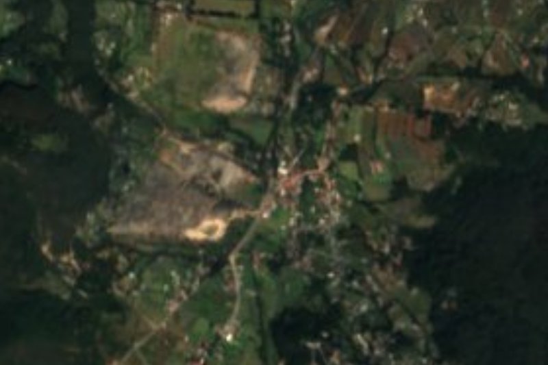


Drive times by road from OpenStreetMap, without traffic. Times marked ~ are estimated from the straight-line distance.
Lists with Parque Nacional El Chico
Nature Parks in Hidalgo · 12 Nature Parks near Pachuca · 11 Nature Parks near Zempoala · 12 Nature Parks near Tulancingo · 12 Nature Parks near Otumba · 13 Nature Parks near Teotihuacán · 15Something wrong or missing on this page? Suggest a fix or addition
Location from OpenStreetMap. Written by Puebloteca.