
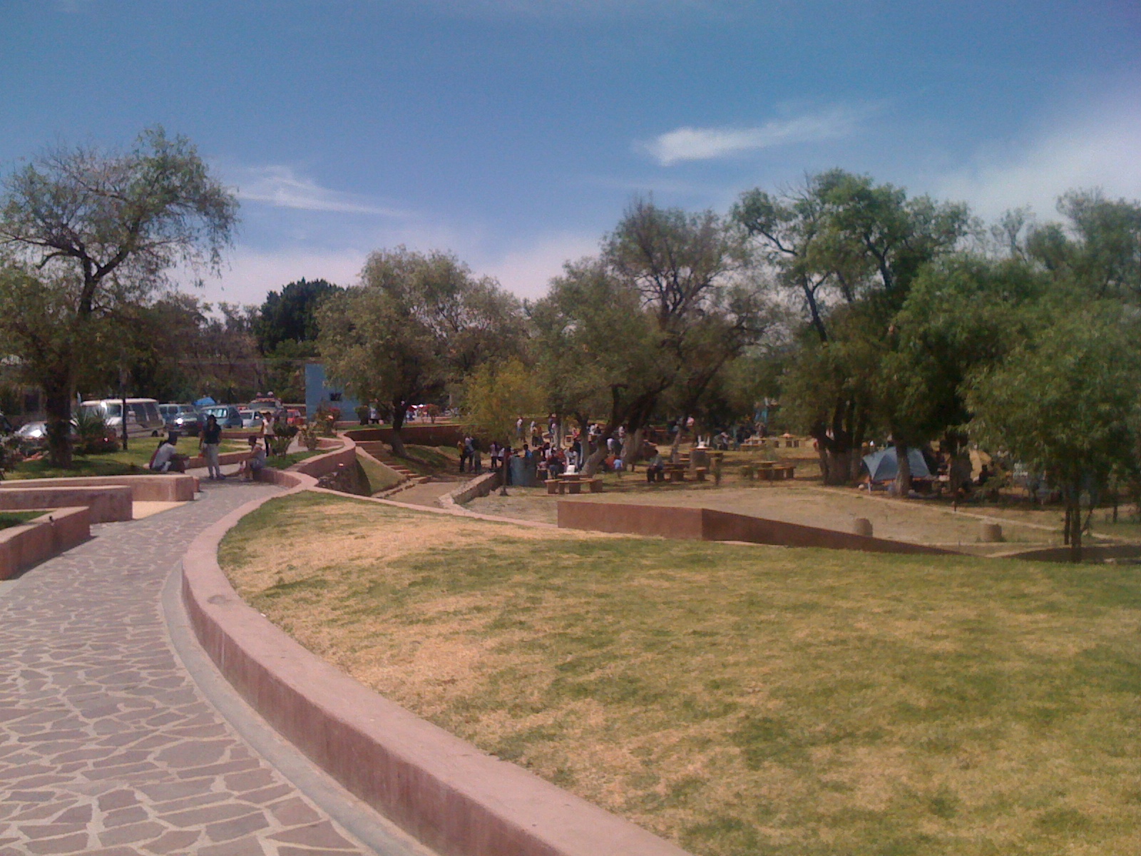
Village Tuxcueca, Jalisco
Fishing town on the south shore of Lake Chapala, right on Highway 15, with a lakeside park and pier and a patron-saint fiesta every August.
From Sahuayo: 1 h 10 min by car (74 km by road) How to get there ↓
Near here
See everything nearby ↓




Plan your visit to San Luis Soyatlán
Where to stay near San Luis Soyatlán
Compare hotels, posadas and guest houses in San Luis Soyatlán.
Tours to San Luis Soyatlán
Day trips and guided outings from Ajijic often include San Luis Soyatlán; with a local guide you can get there without a car.
 Tours from Guadalajara
Full Day Tour to Tequila and Amatitán with Fun and Culture
★ 4.9 (751) · From US$44
How to get to San Luis Soyatlán
- From Sahuayo: about 1 h 10 min by road (~74 km)
- Nearest airport: Guadalajara (GDL), 39 min by car to Ajijic
Links open a partner site. We may earn a commission if you book, at no cost to you.
Tours from Guadalajara, near San Luis Soyatlán


Tours, prices and ratings from Viator, checked weekly. We may earn a commission if you book.
About San Luis Soyatlán
San Luis Soyatlán, usually just called San Luis, is the largest town in the municipality of Tuxcueca and sits on the south shore of Lake Chapala, looking across the water to Ajijic and the rest of the north shore. More than half the municipality's people live here, and it generates most of its income. Federal Highway 15, known in town as Avenida Álvaro Obregón, runs right through it, lined with small eateries, ice-cream shops, fruit stands, pharmacies and stores. The town is long and narrow, squeezed between the lake and the hills.
The name combines the patron saint, Saint Louis of Toulouse, with a Nahuatl word meaning "place of the soyate", the palm fibre used to weave mats and hats. The area was inhabited before the Spanish arrived, and shortly before the Conquest the Purépecha took it over to control the salt flats of Zacoalco and Sayula, which led to what is known as the Saltpetre War. San Luis belonged to Jocotepec until 1 October 1888, when it was transferred to Tuxcueca, which had become a municipality two years earlier.
The church of San Luis Obispo began as an adobe chapel built by Franciscans in 1564 and was completed on 22 December 1885, still without the bell tower that is now the town's landmark. Across the highway from it is the main plaza, with the arcaded municipal delegation building and the market beside it. Along the lake runs the Edén park and malecón, more than 40,000 m² of piers, grills, picnic tables, sports courts and palms; at weekends it fills with families, music and food stalls.
In the hills behind town there is a lookout with a large metal cross, and a waterfall of more than 30 metres that flows in the rainy season. Cerro García, nearly 2,600 metres high, is the tallest peak on the lakeshore, and its summit takes in the whole lake. The patron-saint fiesta runs from 11 to 19 August, with guilds, processions, fireworks towers and evening serenades in the plaza; one day belongs to the townspeople who come back from the United States, and it includes a football match between the visiting "hamburgers" and the local "tilapias".
How to get to San Luis Soyatlán
Drive from Sahuayo: 1 h 10 min, 74 km
San Luis sits on Federal Highway 15 (Guadalajara–Morelia), which runs straight through town. From Guadalajara, head south on Highway 15 to the lakeshore, pass Jocotepec and continue along the south shore for about 21 km more; in total it is about 79 km and roughly 1 h 15 min from central Guadalajara. From Ajijic you have to go round the western end of the lake via Jocotepec: about 40 km, roughly 40 min. Mazamitla is about 56 km away, roughly 55 min.
By bus, several companies run from Guadalajara's Antigua Central Camionera (the old bus station) towards Sahuayo, Michoacán, about every 20 minutes, and they pass through San Luis; ask for a ticket to San Luis or, if boarding on the road, check the bus is going to Sahuayo. Autotransportes Mazamitla also runs Guadalajara–San Luis Soyatlán hourly from the stop at Lázaro Cárdenas and 8 de Julio, taking about 1 h 40 min.
Directions to San Luis Soyatlán on Google Maps
Distances are in a straight line; the road is usually longer.
Links open a partner site. We may earn a commission if you book, at no cost to you.
From the nearest cities to San Luis Soyatlán
- Sahuayo · 74 km by road, 1 h 10 min
- Guadalajara · 79 km by road, 1 h 10 min
- Ciudad Guzmán · 95 km by road, 1 h 35 min
Drive times by road from OpenStreetMap, without traffic or stops. Times marked ~ are estimated from the straight-line distance.
Before you go to San Luis Soyatlán: hours, prices and tips
- Best season
- Saint Louis patron-saint fiesta 11–19 August; Señor de la Salud novena 12–21 May; enramadas (food and drink huts) on the malecón during Lent. Wikipedia (es) · checked Oct 2026
Hours and prices change, especially around holidays. Each fact links to where we checked it.
Visiting San Luis Soyatlán: what to see and do
The church of San Luis Obispo, with its single tower, and its atrium facing the main plaza.
The Edén park and malecón on the lakeshore, with piers, grills and views of the north shore.
The chapel of the Señor de la Salud, a few blocks from the church, with its novena from 12 to 21 May.
The Mirador de la Cruz, on the hill behind town, about half an hour's walk uphill.
El Salto waterfall, more than 30 m in three drops, flowing in the rainy season.
Vampiros (a red cocktail of sangrita, citrus soda, juices and tequila) and seafood along Avenida Álvaro Obregón.
Plan your trip
Places to stay in San Luis Soyatlán
Compare hotels, posadas, and rentals in and around San Luis Soyatlán.
Tours & activities
Day trips and guided outings from Ajijic often include San Luis Soyatlán; with a local guide you can get there without a car.
Rental cars
Pick up a car at GDL (Guadalajara): about 39 min by road to Ajijic, then 12 km more to San Luis Soyatlán, on your own schedule.
Flights
The nearest airport with scheduled flights is Guadalajara (GDL), about 39 min by road from Ajijic, the base for San Luis Soyatlán.
Mobile data
Signal can drop away from Ajijic: download a map of the way to San Luis Soyatlán before you set out, or carry an eSIM with data.
Links open a partner site. We may earn a commission if you book, at no cost to you.
When to go to San Luis Soyatlán mild
San Luis Soyatlán shares the climate of Ajijic, 12 km away. The best months to visit are January, March, April, and November.
See the month-by-month climate of Ajijic
Weather in San Luis Soyatlán now and the next 7 days
Live forecast from Open-Meteo. Chance of rain is the day's highest.
The closest Pueblo Mágico: Ajijic

Ajijic is the Pueblo Mágico closest to San Luis Soyatlán, with places to stay, food, and more to see.
Also close to
- Mazamitla · Jalisco · 43 km away
- Sayula · Jalisco · 46 km away
- Tlaquepaque · Jalisco · 49 km away
- Tapalpa · Jalisco · 55 km away
- Cocula · Jalisco · 57 km away
Closest to San Luis Soyatlán
-
San Juan Cosalá · Hot springs · 11 km away
-
Teocuitatlán de Corona · Village · 14 km away
-
Tuxcueca · Village · 14 km away
-
Isla de los Alacranes · Nature reserve · 15 km away
-
Chapala · Town · 16 km away
-
Jocotepec · Town · 16 km away
-
Santa Cruz de la Soledad · Village · 20 km away
-
Ixtlahuacán de los Membrillos · Town · 21 km away


Near San Luis Soyatlán




Drive times by road from OpenStreetMap, without traffic. Times marked ~ are estimated from the straight-line distance.
Location from OpenStreetMap. Written by Puebloteca.