


Nature reserve Tututepec, Oaxaca Municipality of Tututepec Oaxaca Coast
A 1937 national park of lagoons, mangroves and beach west of Puerto Escondido, with the fishing village of Chacahua on its sandbar.
Reached by boat from El Zapotalito: 45 min each way. How to get there ↓
Near here
See everything nearby ↓
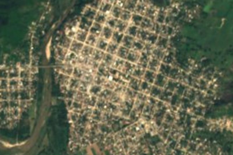


Plan your visit to Parque Nacional Lagunas de Chacahua
Where to stay near Parque Nacional Lagunas de Chacahua
Compare hotels, posadas and guest houses in Parque Nacional Lagunas de Chacahua.
Tours to Parque Nacional Lagunas de Chacahua
Day trips and guided outings from Juquila often include Parque Nacional Lagunas de Chacahua; with a local guide you can get there without a car.
 Tours from Puerto Escondido
Dolphin & Whale Watching in Puerto Escondido
★ 4.8 (362) · From US$61
How to get to Parque Nacional Lagunas de Chacahua
- Reached by boat from El Zapotalito: 45 min each way.
- From Oaxaca: about 3 h 35 min by road (~252 km)
- Nearest airport: Puerto Escondido (PXM), 1 h 22 min by car to Juquila
Links open a partner site. We may earn a commission if you book, at no cost to you.
Tours from Puerto Escondido, near Parque Nacional Lagunas de Chacahua


Tours, prices and ratings from Viator, checked weekly. We may earn a commission if you book.
About Parque Nacional Lagunas de Chacahua
Lagunas de Chacahua National Park protects about 133 square kilometres of the Oaxacan coast in the municipality of Tututepec, roughly 54 km west of Puerto Escondido. President Lázaro Cárdenas decreed it on 9 July 1937, making it the first protected area with tropical ecosystems in Mexico, and in 2008 it was added to the Ramsar list of wetlands of international importance. Around 30 square kilometres of the park are water: the Chacahua and La Pastoría lagoons and several smaller ones, linked by narrow channels through the mangroves, with a long barrier of sand and dunes between them and the Pacific.
The park holds ten types of vegetation, from mangrove swamp and thorn forest to palm groves and coastal dunes, and studies have recorded hundreds of species of plants and animals. Herons, storks, pelicans, roseate spoonbills and ducks feed in the shallows, sea turtles come ashore to nest on the beaches, and American crocodiles live in the lagoons, which were hunted heavily in the 1970s; a crocodile breeding station on the far side of the Chacahua lagoon mouth raises them for the park. Fishing still supports the lagoon villages, and Chacahua itself is an Afro-Mexican fishing community.
The village of Chacahua sits on the sandbar where Laguna de Chacahua meets the sea. It is a small fishing settlement of sandy lanes, palm-roofed restaurants and simple cabins along the beach, with no bank machine, and is reached only by water. Visitors take boats from El Zapotalito, either straight across the lagoons through the mangroves or on a short crossing followed by a pickup truck along a dirt road. People come to surf the long right-hand waves by the jetty, eat fresh fish, go out on the lagoon at night when the water glows with bioluminescence, and cross the channel to the lighthouse hill for the sunset.
How to get to Parque Nacional Lagunas de Chacahua
Drive from Oaxaca to El Zapotalito: 3 h 35 min, 252 km
From Puerto Escondido, follow Highway 200 west past Río Grande and turn off for El Zapotalito, on the shore of the lagoons; colectivos toward Río Grande and Santa Rosa de Lima drop you at the Zapotalito junction (about an hour), and shared taxis cover the last few minutes to the landing. No road reaches the village. From El Zapotalito, a direct boat crosses the lagoons to Chacahua in roughly 30 to 45 minutes, or a cheaper shared boat makes a short crossing and a pickup truck continues along a dirt track to the village. Plan to arrive in daylight.
Reached by boat from El Zapotalito: 45 min each way.
Directions to Parque Nacional Lagunas de Chacahua on Google Maps
Distances are in a straight line; the road is usually longer.
Links open a partner site. We may earn a commission if you book, at no cost to you.
From the nearest cities to Parque Nacional Lagunas de Chacahua
- Oaxaca · 252 km by road, 3 h 35 min to El Zapotalito, then 45 min by boat
- Tlapa · about 265 km by road, ~3 h 55 min to El Zapotalito, then 45 min by boat
- Huajuapan de León · about 265 km by road, ~3 h 55 min to El Zapotalito, then 45 min by boat
Drive times by road from OpenStreetMap, without traffic or stops. Times marked ~ are estimated from the straight-line distance.
Before you go to Parque Nacional Lagunas de Chacahua: hours, prices and tips
- Entry
- No park entrance fee; boats from El Zapotalito are paid separately (about 50 pesos for the short crossing plus 50 for the truck, or about 300 per person on a direct boat). Wikivoyage · checked Oct 2026
- Best time of day
- Bioluminescence shows best on dark nights around the new moon. Indie Traveller · checked Oct 2026
- Best season
- Hot all year; the rainy season runs from June to October or November, and summer brings the biggest surf. Wikivoyage · checked Oct 2026
- What to bring
- Cash, since Chacahua has no ATM, and insect repellent. Wikivoyage · checked Oct 2026
Hours and prices change, especially around holidays. Each fact links to where we checked it.
Visiting Parque Nacional Lagunas de Chacahua: what to see and do
Ride a boat from El Zapotalito through the mangrove channels to Chacahua.
Watch for herons, spoonbills and pelicans on the lagoons.
Visit the crocodile breeding station across the lagoon mouth.
Surf the right-hand waves beside the jetty or take a lesson.
Take a night boat on the lagoon to see the bioluminescence.
Climb the lighthouse hill across the channel for the sunset.
Plan your trip
Places to stay in Parque Nacional Lagunas de Chacahua
Compare hotels, posadas, and rentals in and around Parque Nacional Lagunas de Chacahua.
Tours & activities
Day trips and guided outings from Juquila often include Parque Nacional Lagunas de Chacahua; with a local guide you can get there without a car.
Rental cars
Pick up a car at PXM (Puerto Escondido): about 1 h 22 min by road to Juquila, then 51 km more to Parque Nacional Lagunas de Chacahua, on your own schedule.
Flights
The nearest airport with scheduled flights is Puerto Escondido (PXM), about 1 h 22 min by road from Juquila, the base for Parque Nacional Lagunas de Chacahua.
Travel insurance
If you plan on hiking at Parque Nacional Lagunas de Chacahua, check that your policy covers it: some plans leave adventure activities out.
Mobile data
Signal can drop away from Juquila: download a map of the way to Parque Nacional Lagunas de Chacahua before you set out, or carry an eSIM with data.
Links open a partner site. We may earn a commission if you book, at no cost to you.
Photos
When to go to Parque Nacional Lagunas de Chacahua mild
Parque Nacional Lagunas de Chacahua shares the climate of Juquila, 51 km away. The best months to visit are January, February, March, and December.
See the month-by-month climate of Juquila
Weather in Parque Nacional Lagunas de Chacahua now and the next 7 days
Live forecast from Open-Meteo. Chance of rain is the day's highest.
The closest Pueblo Mágico: Juquila

Juquila is the Pueblo Mágico closest to Parque Nacional Lagunas de Chacahua, with places to stay, food, and more to see.
Closest to Parque Nacional Lagunas de Chacahua
-
Laguna de Pastoría · Lagoon · 10 km away
-
Río Grande · Town · 27 km away
-
Playa Roca Blanca · Beach · 35 km away
-
Santiago Jamiltepec · Town · 38 km away
-
San Miguel Panixtlahuaca · Town · 46 km away
-
San Andrés Huaxpaltepec · Town · 47 km away
Near Parque Nacional Lagunas de Chacahua
-
Laguna de Manialtepec · Lagoon · Oaxaca
1 h 20 min: 45 min by boat back to El Zapotalito, then drive -
La Punta (Playa Zicatela) · Beach · Oaxaca
1 h 50 min: 45 min by boat back to El Zapotalito, then drive




Drive times by road from OpenStreetMap, without traffic. Times marked ~ are estimated from the straight-line distance.
Lists with Parque Nacional Lagunas de Chacahua
Nature Parks in Oaxaca · 8Location from OpenStreetMap. Written by Puebloteca.