Town San Juan Quiahije, Oaxaca Oaxaca Coast
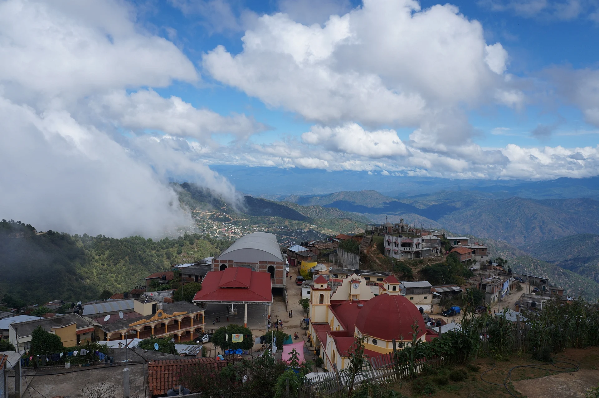
Chatino town at nearly 2,000 m in the Juquila sierra, ringed by sacred hills such as Cerro Espina.
From Oaxaca: 3 h 20 min by car (204 km by road) How to get there ↓
Near here
See everything nearby ↓


Plan your visit to San Juan Quiahije
Where to stay near San Juan Quiahije
Compare hotels, posadas and guest houses in San Juan Quiahije.
Tours to San Juan Quiahije
Day trips around Juquila sometimes stop in San Juan Quiahije; a tour is the easy way to see it without a car.
How to get to San Juan Quiahije
- From Oaxaca: about 3 h 20 min by road (~204 km)
- Nearest airport: Puerto Escondido (PXM), 1 h 22 min by car to Juquila
Links open a partner site. We may earn a commission if you book, at no cost to you.
About San Juan Quiahije
Quiahije is one of the centres of the Chatino people. The seat sits at about 1,957 m in the Sierra Madre del Sur and had 2,342 residents in 2020. Its census series has nearly tripled since 1900, when it counted 672, with the biggest jump between 1990 (1,076) and 2000 (2,095). The whole municipality has 4,203 people in eight localities; the second largest, Cieneguilla, has 1,421.
The name comes from Zapotec: quia, "stone", and guixe, "mountain", roughly "mountain stone". By local oral tradition, the church and park stand on a former reed swamp, and the first settlers, who lived 1.5 km to the east, built a small shrine after San Juan Bautista appeared to them on the way to Juquila.
Nearly 3,700 of the 4,203 residents speak an indigenous language, and 3,691 speak Chatino, the eastern variety, a language of many tones. Rituals for births, weddings and community posts, offerings at sacred places and the work of healers remain part of daily life: about half of residents still turn to healers and about 40% still wear traditional dress.
The landscape holds pine and oak forest and hills regarded as sacred: Cerro Espina, the highest, Cerro Piedra del Rey, Cerro Manteca, Piedra Santo and Piedra Traviesa. Visitors should go with respect, ask the authorities for permission and ask which places are open to outsiders. The local economy rests on farming, livestock and trade.
How to get to San Juan Quiahije
Drive from Oaxaca: 3 h 20 min, 204 km
Quiahije is only 8 km straight-line northwest of Santa Catarina Juquila (about 10 minutes on a map; the sierra road is winding and longer, so allow 30 minutes to an hour, approx.). A road links Juquila, Cieneguilla and San Juan, documented in University of Texas language recordings, along with a footpath across Cerro Espina between the town and Juquila.
To reach Juquila from Oaxaca, a route portal says to leave on Highway 175 toward San Bartolo Coyotepec and take Highway 131 toward Sola de Vega: about 105 km straight-line, 3 to 5 hours by road depending on the source (approx.). We found no sourced bus operators or schedules; ask in Juquila for pickups to San Juan Quiahije.
Directions to San Juan Quiahije on Google Maps
Distances are in a straight line; the road is usually longer.
Links open a partner site. We may earn a commission if you book, at no cost to you.
From the nearest cities to San Juan Quiahije
- Oaxaca · 204 km by road, 3 h 20 min
- Tlapa · about 250 km by road, ~3 h 40 min
- Tuxtepec · about 305 km by road, ~4 h 30 min
Drive times by road from OpenStreetMap, without traffic or stops. Times marked ~ are estimated from the straight-line distance.
Visiting San Juan Quiahije: what to see and do
See the town on its hillside, with sierra and valleys behind.
Ask about the church of San Juan Bautista, the shrine of the local story.
Listen for Chatino in the streets.
Ask the authorities about sacred hills such as Cerro Espina before approaching them.
Walk over to neighbouring Cieneguilla.
Pair the visit with the sanctuary at Santa Catarina Juquila.
Plan your trip
Places to stay in San Juan Quiahije
Compare hotels, posadas, and rentals in and around San Juan Quiahije.
Tours & activities
Day trips around Juquila sometimes stop in San Juan Quiahije; a tour is the easy way to see it without a car.
Rental cars
Pick up a car at PXM (Puerto Escondido): about 1 h 22 min by road to Juquila, then 8 km more to San Juan Quiahije, on your own schedule.
Flights
The nearest airport with scheduled flights is Puerto Escondido (PXM), about 1 h 22 min by road from Juquila, the base for San Juan Quiahije.
Mobile data
Signal can drop away from Juquila: download a map of the way to San Juan Quiahije before you set out, or carry an eSIM with data.
Links open a partner site. We may earn a commission if you book, at no cost to you.
When to go to San Juan Quiahije mild
San Juan Quiahije shares the climate of Juquila, 8 km away. The best months to visit are January, February, March, and December.
See the month-by-month climate of Juquila
Weather in San Juan Quiahije now and the next 7 days
Live forecast from Open-Meteo. Chance of rain is the day's highest.
The closest Pueblo Mágico: Juquila

Juquila is the Pueblo Mágico closest to San Juan Quiahije, with places to stay, food, and more to see.
Closest to San Juan Quiahije
-
San Miguel Panixtlahuaca · Town · 8 km away
-
Santa María Amialtepec · Town · 11 km away
-
San Pedro Juchatengo · Town · 25 km away
-
San Juan Lachao · Town · 26 km away
-
San Gabriel Mixtepec · Town · 34 km away
-
Río Grande · Town · 35 km away
-
Playa Roca Blanca · Beach · 40 km away
-
Laguna de Manialtepec · Lagoon · 42 km away


Near San Juan Quiahije
-
Parque Nacional Lagunas de Chacahua · Nature reserve · Oaxaca
1 h 55 min: drive to El Zapotalito, then 45 min by boat


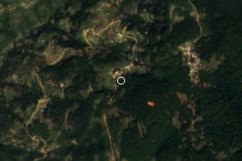


Drive times by road from OpenStreetMap, without traffic. Times marked ~ are estimated from the straight-line distance.
Location from OpenStreetMap. Written by Puebloteca.