Village Tlapanalá, Puebla Mixteca Poblana
Hot-country town near Atlixco, "in the broken ground", with a 16th-century church, the Ojo del Carbón spring pool and the Tepapayeca pyramid.
From Atlixco: 35 min by car (31 km by road) How to get there ↓
Near here
See everything nearby ↓


Plan your visit to Tlapanalá
Where to stay near Tlapanalá
Compare hotels, posadas and guest houses in Tlapanalá.
Tours to Tlapanalá
Day trips and guided outings from Atlixco often include Tlapanalá; with a local guide you can get there without a car.
 Tours from Atlixco
Atlixco Volcano Views Popocatépetl Tour Forest Route
From US$108
How to get to Tlapanalá
- From Atlixco: about 35 min by road (~31 km)
- Nearest airport: Puebla (PBC), 41 min by car to Atlixco
Links open a partner site. We may earn a commission if you book, at no cost to you.
Tours from Atlixco, near Tlapanalá
Tours, prices and ratings from Viator, checked weekly. We may earn a commission if you book.
About Tlapanalá
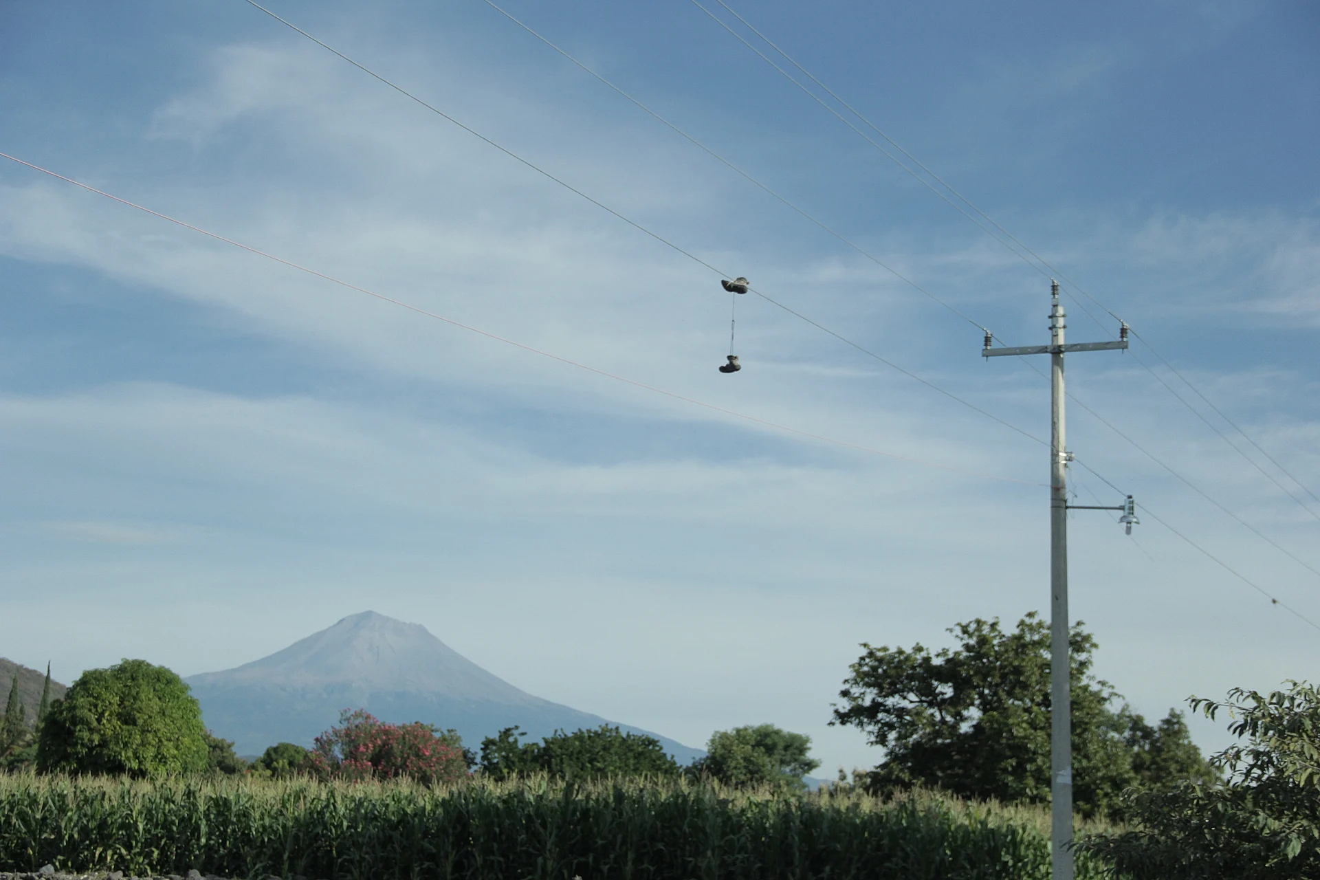
From Tlapanalá you look straight at Popocatépetl, as in the photo. The town, with 3,163 people in 2020, lies at about 1,400 m in south-western Puebla, between Atlixco, 27 km away, and Izúcar de Matamoros. Its name, from tlapana, to break, and tlan, place, translates as "place of breaks" or "in the broken ground".
The area was inhabited before the Conquest, as the Codex of San Luis Chalma and the Lienzo de Huaquechula show. In colonial times Dominicans evangelised it, it became a self-governing Indian town, and the Spanish brought sugar cane and haciendas that later became sugar mills. During the Revolution Zapatista bands took refuge here and even kept a barracks in town. The church of Santo Tomás de Aquino, the patron, dates from the 16th century, and the municipality keeps the former hacienda of San Luis Chalma and, at Tepapayeca, a pyramid and the 16th-century convent of the Purificación de Santa María, both protected by INAH. In 2013 the municipality and INAH published the book "Tlapanalá: cauce histórico e identidad".
The climate is warm and sub-humid, averaging 20 to 24 °C. Three quarters of the municipality's 84 km² are planted with cane, peanuts, beans and sorghum. The Ojo del Carbón pool is fed by a spring. Local cooking includes green pipián, tlanipa and fresh-corn tamales, pozole and squash sweets with brown sugar, and the municipality has two brass bands.
How to get to Tlapanalá
Drive from Atlixco: 35 min, 31 km
Tlapanalá lies in south-western Puebla between Atlixco (27 km) and Izúcar de Matamoros, about 52 km in a straight line from the capital. Take the Atlixco–Izúcar road and a short turn-off; buses from Puebla and Atlixco to Izúcar connect with local transport.
Directions to Tlapanalá on Google Maps
Distances are in a straight line; the road is usually longer.
Links open a partner site. We may earn a commission if you book, at no cost to you.
From the nearest cities to Tlapanalá
Drive times by road from OpenStreetMap, without traffic or stops. Times marked ~ are estimated from the straight-line distance.
Visiting Tlapanalá: what to see and do
The view of Popocatépetl.
The 16th-century church of Santo Tomás de Aquino.
The pyramid and convent at Tepapayeca.
The Ojo del Carbón spring pool.
Plan your trip
Places to stay in Tlapanalá
Compare hotels, posadas, and rentals in and around Tlapanalá.
Tours & activities
Day trips and guided outings from Atlixco often include Tlapanalá; with a local guide you can get there without a car.
Rental cars
Pick up a car at PBC (Puebla): about 41 min by road to Atlixco, then 27 km more to Tlapanalá, on your own schedule.
Flights
The nearest airport with scheduled flights is Puebla (PBC), about 41 min by road from Atlixco, the base for Tlapanalá.
Mobile data
Signal can drop away from Atlixco: download a map of the way to Tlapanalá before you set out, or carry an eSIM with data.
Links open a partner site. We may earn a commission if you book, at no cost to you.
When to go to Tlapanalá mild
Tlapanalá shares the climate of Atlixco, 27 km away. The best months to visit are January, February, March, and December.
See the month-by-month climate of Atlixco
Weather in Tlapanalá now and the next 7 days
Live forecast from Open-Meteo. Chance of rain is the day's highest.
The closest Pueblo Mágico: Atlixco

Atlixco is the Pueblo Mágico closest to Tlapanalá, with places to stay, food, and more to see.
Also close to
- Cholula · Puebla · 47 km away
- Huejotzingo · Puebla · 53 km away
- Tlayacapan · Morelos · 55 km away
- Tlaltizapán · Morelos · 64 km away
- Tepoztlán · Morelos · 67 km away
Closest to Tlapanalá
-
Tepapayeca · Village · 3 km away
-
Huaquechula · Town · 8 km away
-
La Galarza · Village · 9 km away
-
Tepeojuma · Village · 10 km away
-
Cacaloxúchitl · Village · 12 km away
-
Casa Blanca (Cuyotliapa) · Village · 13 km away
-
Izúcar de Matamoros · City · 13 km away
-
Atzitzihuacán · Village · 15 km away

Near Tlapanalá





Drive times by road from OpenStreetMap, without traffic. Times marked ~ are estimated from the straight-line distance.
Location from OpenStreetMap. Written by Puebloteca.