
City Valle de Chalco Solidaridad, Estado de México Valley of Mexico
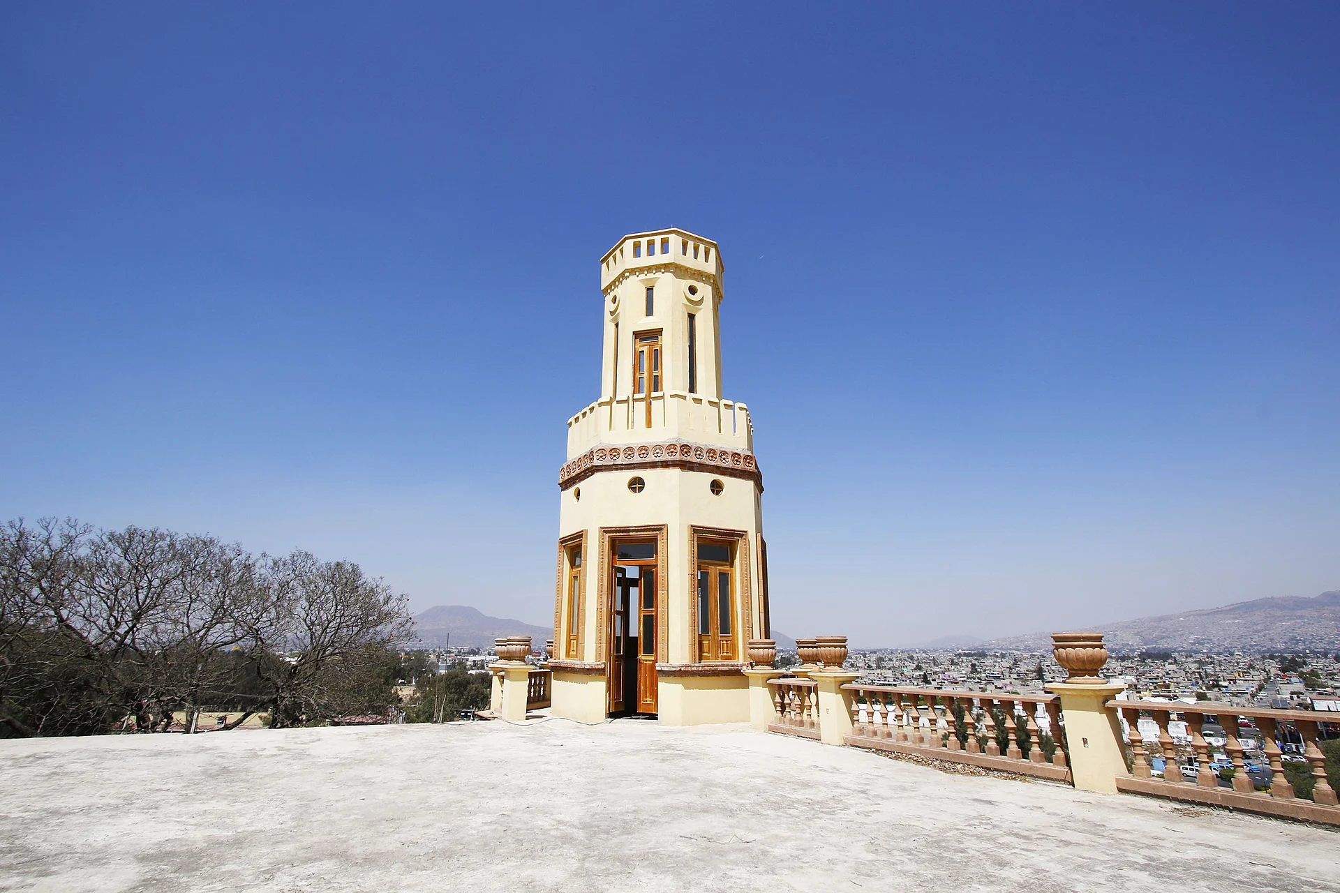
The city of Valle de Chalco, settled from the 1970s on the dry bed of Lake Chalco: a Porfirian hacienda, a community museum and an elevated trolleybus.
From Mexico City: 35 min by car (32 km by road) How to get there ↓
Near here
See everything nearby ↓


Plan your visit to Xico
Where to stay near Xico
Compare hotels, posadas and guest houses in Xico.
Tours to Xico
Day trips and guided outings from Tepoztlán often include Xico; with a local guide you can get there without a car.
 Xalapa with the Magic Towns of Coatepec and Xico
★ 5.0 (7) · From US$119
How to get to Xico
- From Mexico City: about 35 min by road (~32 km)
- Nearest airport: Mexico City (MEX), 1 h 25 min by car to Tepoztlán
Links open a partner site. We may earn a commission if you book, at no cost to you.
Popular tours to Xico

Tours, prices and ratings from Viator, checked weekly. We may earn a commission if you book.
About Xico
Xico is the city that fills nearly all of Valle de Chalco Solidaridad municipality, on the eastern edge of the Valley of Mexico next to Mexico City's Iztapalapa and Tláhuac boroughs. It had 384,327 people in 2020, almost the whole municipality. The name comes from Cerro Xico, the extinct volcano that was once an island, and means "navel" in Nahuatl. The hill has its own Puebloteca page. Almost the whole city around it is built on what used to be the bottom of Lake Chalco.
That history is in the ground. The shoreline had fishing villages from the 9th century BC, a Teotihuacan village between 550 and 650, Otomi terraces on Cerro del Marqués, and from 1328 the Acxotecas and their chinampa fields; Tezozómoc conquered Xico in 1381. Under Porfirio Díaz, the Asturian businessman Íñigo Noriega won the concession to drain the lake and kept the land. After the Revolution it was handed out as ejidos, Estación Xico and San Miguel Xico, which stayed mostly empty until the late 1970s.
Then hundreds of families arrived from Oaxaca, Guerrero, Puebla, Michoacán and Mexico City itself looking for cheap plots, and built homes with no water, drains or power. By 1990 about 252,000 people lived here. President Carlos Salinas launched his National Solidarity Programme here, and on 7 May 1990 Pope John Paul II said Mass at what is now the cathedral of San Juan Diego, planting an ash tree that still stands. The municipality was created in November 1994. Dozens of Indigenous groups live here today, which shows in the food, with street snacks from central and southern Mexico, and in more than 40 neighbourhood patron-saint feasts.
The building with the most history is the Ex-Hacienda de Xico, built when the lake was drained. Zapatista and then Carrancista troops took it during the Revolution, after which it was left to decay; restoration began in 2015, and since 2018 INAH has worked on it and on the Cerro del Marqués remains. The Museo Comunitario del Valle de Xico opened in 1996 in a 19th-century hacienda under INAH supervision, with trilobite fossils, mammoth bones, Ticomán and Coyotlatelco pottery, Tláloc-style offerings and a relief of Quetzalcóatl. The Chalchiuhtlicue culture centre, founded the same year, runs workshops in music, theatre, painting and traditional medicine.
How to get to Xico
Drive from Mexico City: 35 min, 32 km
The most direct option is elevated trolleybus Line 11, which opened on 18 May 2025. It starts at Santa Marta in Iztapalapa, where it connects with Metro Line A and Cablebús Line 2, and runs along the México–Puebla highway to Chalco. Its Valle de Chalco stations are Xico, Parque de la Mujer, Cuauhtémoc, Puente Rojo, Puente Blanco and Parque Tejones (Xico station was still under construction at opening). The fare is 13 pesos, and it runs Monday to Saturday 4:30 am to 12:30 am, Sundays and holidays 5 am to midnight; the full route takes about 45 minutes, or 33 on the express service.
By car there are three ways in: the México–Puebla highway on the north side, Eje 10 Sur in the northwest and the Chalco–Tláhuac road in the south, with Avenida Cuauhtémoc linking the highway to the latter. La Paz station on Metro Line A also has buses to the area. Central Mexico City is about 26 km away in a straight line, and traffic decides the rest. Tepoztlán, the nearest Pueblo Mágico, is about 35 km away in a straight line, in Morelos.
Directions to Xico on Google Maps
Distances are in a straight line; the road is usually longer.
Links open a partner site. We may earn a commission if you book, at no cost to you.
From the nearest cities to Xico
- Mexico City · 32 km by road, 35 min
- San Martín Texmelucan · 68 km by road, 1 h 5 min
- Cuautla · 73 km by road, 1 h 10 min
Drive times by road from OpenStreetMap, without traffic or stops. Times marked ~ are estimated from the straight-line distance.
Before you go to Xico: hours, prices and tips
- Best season
- Valle de Chalco's neighbourhoods hold more than 40 patron-saint feasts; one of the biggest is Juan Diego's, on 12 December. Wikipedia · checked Oct 2026
Hours and prices change, especially around holidays. Each fact links to where we checked it.
Visiting Xico: what to see and do
The Porfirian-era Ex-Hacienda de Xico, under restoration.
The Museo Comunitario del Valle de Xico, with finds from prehistory to Aztec times.
The cathedral of San Juan Diego, where John Paul II said Mass in 1990, and the ash tree he planted.
Cerro Xico, the old island volcano and its crater, which has its own page.
The feast of Juan Diego on 12 December.
Street markets and food stalls with dishes from the states its residents came from.
Plan your trip
Places to stay in Xico
Compare hotels, posadas, and rentals in and around Xico.
Tours & activities
Day trips and guided outings from Tepoztlán often include Xico; with a local guide you can get there without a car.
Rental cars
Pick up a car at MEX (Mexico City): about 1 h 25 min by road to Tepoztlán, then 35 km more to Xico, on your own schedule.
Flights
The nearest airport with scheduled flights is Mexico City (MEX), about 1 h 25 min by road from Tepoztlán, the base for Xico.
Mobile data
Signal can drop away from Tepoztlán: download a map of the way to Xico before you set out, or carry an eSIM with data.
Links open a partner site. We may earn a commission if you book, at no cost to you.
When to go to Xico mild
Xico shares the climate of Tepoztlán, 35 km away. The best months to visit are January, February, March, and December.
See the month-by-month climate of Tepoztlán
Weather in Xico now and the next 7 days
Live forecast from Open-Meteo. Chance of rain is the day's highest.
The closest Pueblo Mágico: Tepoztlán

Tepoztlán is the Pueblo Mágico closest to Xico, with places to stay, food, and more to see.
Also close to
- Tlayacapan · Morelos · 35 km away
- Teotihuacán · Estado de México · 48 km away
- Otumba · Estado de México · 52 km away
- Tepotzotlán · Estado de México · 57 km away
- Huejotzingo · Puebla · 58 km away
Closest to Xico
-
Cerro Xico · Mountain · 2 km away
-
Lago de Chalco · Lake · 3 km away
-
Chalco de Díaz Covarrubias · City · 6 km away
-
Lago de los Reyes Aztecas · Lake · 6 km away
-
San Antonio Tecómitl · Village · 7 km away
-
San Pablo Atlazalpan · Town · 8 km away
-
Volcán Guadalupe · Mountain · 8 km away
-
Volcán Teuhtli · Mountain · 8 km away


Near Xico


Drive times by road from OpenStreetMap, without traffic. Times marked ~ are estimated from the straight-line distance.
Location from OpenStreetMap. Written by Puebloteca.