Mountain Valle de Chalco Solidaridad, Estado de México Valley of Mexico
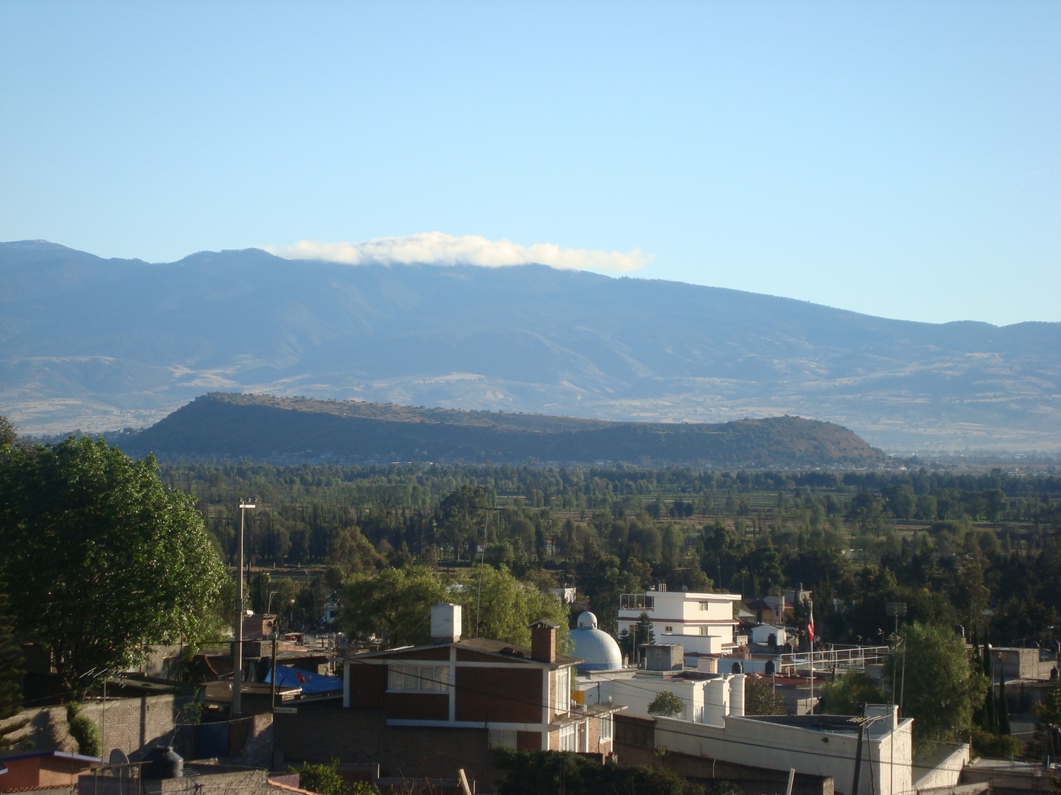
A near-perfect tuff ring in the old Lake Chalco bed, the so-called navel of the world, with fields in the crater and a community museum at its foot.
From Mexico City: 40 min by car (37 km by road) How to get there ↓
Near here
See everything nearby ↓


Plan your visit to Cerro Xico
Where to stay near Cerro Xico
Compare hotels, posadas and guest houses in Cerro Xico.
Tours to Cerro Xico
Day trips and guided outings from Tlayacapan often include Cerro Xico; with a local guide you can get there without a car.
 Tours from Mexico City
Teotihuacan pyramids morning or afternoon without tourist traps
★ 4.9 (10,269) · From US$59
How to get to Cerro Xico
- From Mexico City: about 40 min by road (~37 km)
- Nearest airport: Mexico City (MEX), 1 h 33 min by car to Tlayacapan
Links open a partner site. We may earn a commission if you book, at no cost to you.
Tours from Mexico City, near Cerro Xico


Tours, prices and ratings from Viator, checked weekly. We may earn a commission if you book.
About Cerro Xico
Cerro Xico, or the Xico volcano, is a nearly perfect circular crater that rises about 100 metres above the floor of the former Lake Chalco, at 2,240 m above sea level, in the southeast of Valle de Chalco Solidaridad. The crater is roughly 1,400 metres across. It is not a cone but a tuff ring: it formed when rising magma met lake water and blew apart, an eruption Wikipedia dates to over 100,000 years ago (another passage in the same article says 550 to 640 CE, so the figures do not agree). It belongs to the Chichinautzin volcanic field.
The name comes from Nahuatl and is tied to the word for navel, and the place was long seen as the centre of the world. Digs in 1990 turned up ceremonial structures with sea shells, green stones and shell ornaments, offerings linked to water worship. After the conquest the crater dried out. Today families live on the slopes and farm inside the crater, where volcanic soil holds moisture, and people use it for walking, running and cycling.
On the ground it is hard to make out the ring's shape; it reads far better from aerial images. To round out a visit, the Museo Comunitario del Valle de Xico, in an old hacienda and open since 1996, keeps archaeological and fossil pieces from the area.
How to get to Cerro Xico
Drive from Mexico City: 40 min, 37 km
The crater is about 40 km southeast of central Mexico City (approx.), in Valle de Chalco Solidaridad. The México-Puebla highway crosses the north of the municipality and links to Metro San Lázaro (Line B). Without a car, the most practical way out is Metro Line A to La Paz or Santa Martha; buses from Santa Martha leave for Chalco, Ixtapaluca and other points in the eastern State of Mexico. From there you need local transport toward San Miguel Xico and Calle Pirul, the address Chilango gives for the crater. We found no published timetable or minibus route, so ask along the way or use a transit map. A line of the Trolebús (Line 11) also runs through the municipality.
Directions to Cerro Xico on Google Maps
Distances are in a straight line; the road is usually longer.
Links open a partner site. We may earn a commission if you book, at no cost to you.
From the nearest cities to Cerro Xico
- Mexico City · 37 km by road, 40 min
- San Martín Texmelucan · 70 km by road, 1 h 5 min
- Cuautla · 70 km by road, 1 h 10 min
Drive times by road from OpenStreetMap, without traffic or stops. Times marked ~ are estimated from the straight-line distance.
Visiting Cerro Xico: what to see and do
Walk or cycle the trails on the slopes and across the crater floor, among cornfields.
Look at the tuff ring from above, or in aerial images, to see its near-perfect shape.
Visit the Museo Comunitario del Valle de Xico, in an old hacienda, for archaeological and fossil pieces.
Picture the Lake Chalco that once surrounded it: Xico was an island before the lake was drained.
Plan your trip
Places to stay in Cerro Xico
Compare hotels, posadas, and rentals in and around Cerro Xico.
Tours & activities
Day trips and guided outings from Tlayacapan often include Cerro Xico; with a local guide you can get there without a car.
Rental cars
Pick up a car at MEX (Mexico City): about 1 h 33 min by road to Tlayacapan, then 34 km more to Cerro Xico, on your own schedule.
Flights
The nearest airport with scheduled flights is Mexico City (MEX), about 1 h 33 min by road from Tlayacapan, the base for Cerro Xico.
Travel insurance
If you plan on hiking at altitude at Cerro Xico, check that your policy covers it: some plans leave adventure activities out.
Mobile data
Signal can drop away from Tlayacapan: download a map of the way to Cerro Xico before you set out, or carry an eSIM with data.
Links open a partner site. We may earn a commission if you book, at no cost to you.
When to go to Cerro Xico mild
Cerro Xico shares the climate of Tlayacapan, 34 km away. The best months to visit are January, February, March, and December.
For the clearest views from Cerro Xico, go in the driest months (January, February, March, and December); in the rains, clouds tend to build up by midday.
See the month-by-month climate of Tlayacapan
Weather in Cerro Xico now and the next 7 days
Live forecast from Open-Meteo. Chance of rain is the day's highest.
The closest Pueblo Mágico: Tlayacapan

Tlayacapan is the Pueblo Mágico closest to Cerro Xico, with places to stay, food, and more to see.
Also close to
- Tepoztlán · Morelos · 35 km away
- Teotihuacán · Estado de México · 49 km away
- Otumba · Estado de México · 53 km away
- Huejotzingo · Puebla · 57 km away
- Tepotzotlán · Estado de México · 59 km away
Closest to Cerro Xico
-
Xico · City · 2 km away
-
Chalco de Díaz Covarrubias · City · 4 km away
-
Lago de Chalco · Lake · 5 km away
-
San Pablo Atlazalpan · Town · 6 km away
-
Lago de los Reyes Aztecas · Lake · 7 km away
-
San Antonio Tecómitl · Village · 7 km away
-
Cocotitlán · Town · 8 km away
-
San Gregorio Cuautzingo · Village · 8 km away


Near Cerro Xico


Drive times by road from OpenStreetMap, without traffic. Times marked ~ are estimated from the straight-line distance.
Lists with Cerro Xico
Mountains in Estado de México · 8 Mountains near Mexico City · 14 Mountains near Tlayacapan · 12 Mountains near Tepoztlán · 13 Mountains near Cuautla · 9 Mountains near Cuernavaca · 10 Mountains near Teotihuacán · 12 Mountains near San Martín Texmelucan · 16Location from OpenStreetMap. Written by Puebloteca.