

Town Milpa Alta, Ciudad de México Municipality of Milpa Alta Valley of Mexico
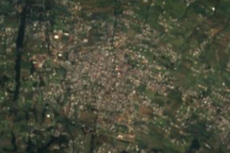
Mexico City's rural, Nahuatl-speaking south: nopal fields, a 16th-century Franciscan church, Zapata's barracks and the October mole fair.
From Mexico City: 45 min by car (35 km by road) How to get there ↓
Near here


Plan your visit to Milpa Alta
Where to stay near Milpa Alta
Compare hotels, posadas and guest houses in Milpa Alta.
Tours to Milpa Alta
Day trips around Tepoztlán sometimes stop in Milpa Alta; a tour is the easy way to see it without a car.
 Tours from Mexico City
Teotihuacan pyramids morning or afternoon without tourist traps
★ 4.9 (10,269) · From US$59
How to get to Milpa Alta
- From Mexico City: about 45 min by road (~35 km)
- Nearest airport: Mexico City (MEX), 1 h 25 min by car to Tepoztlán
Links open a partner site. We may earn a commission if you book, at no cost to you.
Tours from Mexico City, near Milpa Alta


Tours, prices and ratings from Viator, checked weekly. We may earn a commission if you book.
About Milpa Alta
Milpa Alta is the most rural corner of Mexico City: a borough of hills, forest and farmland in the far south whose seat, Villa Milpa Alta, still feels like a country town. Twelve original villages share its 228 square kilometres, the second-largest territory in the city and the least populated, and it has the city's largest community of Nahuatl speakers; signs at the entrance greet visitors in both languages. Before the Spanish arrived the place was called Malacachtepec Momoxco, usually translated as "place surrounded by hills". The Franciscans renamed it La Asunción de Milpa Alta and began their mission here in 1529; the parish church of the Asunción, built between 1585 and 1630, still anchors the town centre and its big festivals.
Milpa Alta's fields feed the country's kitchens. Nopal growing took off in the 20th century, and around 2000 the borough was producing roughly three quarters of the nopal eaten in Mexico, from some 7,500 hectares of cactus. Paddles are sold at the nopal collection centre, and Villa Milpa Alta holds a nopal fair each June. A few kilometres west, San Pedro Atocpan calls itself the capital of mole: nearly the whole village lives from grinding and selling mole paste, and since 1978 it has hosted the Feria Nacional del Mole every October, with more than 20 kinds to taste; the 2026 edition runs from 3 to 25 October.
History runs deep in the hills too. Zapata's southern army held this area during the Revolution, and in 1914 Zapata ratified the Plan de Ayala at the barracks in San Pablo Oztotepec, now a small museum of documents, photographs and weapons. The slopes of the Teuhtli volcano are covered in pine forest, and environmental education centres in the uplands offer hiking, mountain biking and camping. The borough runs a free tour bus, the Milpabús, with themed routes through the mole village, nopal and maguey fields and the Zapatista sites.
How to get to Milpa Alta
Drive from Mexico City: 45 min, 35 km
From Metro Tláhuac, the end of Line 12, RTP buses (4 pesos) and concession buses (about 8 pesos) run to Villa Milpa Alta; the ride takes roughly an hour to an hour and a half depending on traffic through San Juan Ixtayopan and Tulyehualco, and waits for a bus can be long. Buses also run to Milpa Alta from Metro Taxqueña (Line 2) by way of Xochimilco, a slower ride of up to two hours. The RTP terminal in Villa Milpa Alta is on Calle Michoacán Oriente, about five minutes' walk from the borough hall, and buses and combis fan out from the centre to the other villages. The Feria Nacional del Mole is held at km 17.5 of the Xochimilco–Oaxtepec road in San Pedro Atocpan.
Directions to Milpa Alta on Google Maps
Distances are in a straight line; the road is usually longer.
Links open a partner site. We may earn a commission if you book, at no cost to you.
From the nearest cities to Milpa Alta
- Mexico City · 35 km by road, 45 min
- Cuautla · 59 km by road, 1 h 10 min
- Cuernavaca · 59 km by road, 1 h 20 min
Drive times by road from OpenStreetMap, without traffic or stops. Times marked ~ are estimated from the straight-line distance.
What to see in Milpa Alta 1
Sights with their own page, closest to the centre first.
-
Volcán Teuhtli · Mountain · 4 km from the centre
Extinct 2,710 m volcano where Milpa Alta, Tláhuac and Xochimilco meet: a 30-minute climb to the crater, lava-tube caves and a Mass on 3 May.
Map of Milpa Alta
Neighbourhoods and villages of Milpa Alta
Part of Milpa Alta or just outside it, closest first.
-
San Agustín Ohtenco · Village · 1 km from the centre
A Milpa Alta founding village, the youngest of the twelve, home to the paper balloon and lantern contest every Day of the Dead. -
San Pedro Atocpan · Village · 3 km from the centre
Milpa Alta's mole village: nearly everyone here grinds or sells mole almendrado, and each October it hosts the Feria Nacional del Mole. -
Santa Ana Tlacotenco · Village · 3 km from the centre
A Milpa Alta pueblo among cornfields and nopal, with a 17th-century church, living Nahuatl and the feast of Santa Ana on 26 July.
Day trips and tours from Milpa Alta
The closest Pueblos Mágicos and places to visit, with the drive from Milpa Alta and tours that leave from it.


Times marked ~ are estimated from the distance. Links open a partner site. We may earn a commission if you book, at no cost to you.
Before you go: getting to and around Milpa Alta
- The nearest airport is Mexico City (MEX).
- The best months to go are January, February, March, and December.
- 1 of the places on this page is more than 3 km from the centre: take a taxi, a ride-hailing app or a local bus.
- For day trips a rental car gives the most freedom; the tours above leave from Milpa Alta.
Before you go to Milpa Alta: hours, prices and tips
- Entry
- Villa Milpa Alta itself is free to explore. At the 2025 mole fair, entry was free Monday to Thursday and 20 pesos Friday to Sunday; gates opened at 10 am. El Financiero · checked Oct 2026
- Best season
- The Feria Nacional del Mole fills San Pedro Atocpan every October (3 to 25 October in 2026); Villa Milpa Alta's nopal fair is in June. La Crónica de Hoy · checked Oct 2026
- Guide or tour
- You can explore alone, or ride the free Milpabús, which runs themed routes Wednesday to Sunday from 10 am from the car park of the borough's administrative building (29 seats; book on 55 5862 3150 ext. 1809). Activities along the way are paid separately. TV Azteca · checked Oct 2026
Hours and prices change, especially around holidays. Each fact links to where we checked it.
Visiting Milpa Alta: what to see and do
Visit the parish church of the Asunción, the 16th-century Franciscan church at the heart of Villa Milpa Alta.
Eat your way through San Pedro Atocpan's mole mills and restaurants, or come for the Feria Nacional del Mole in October.
See nopal being sorted and sold at the nopal collection centre, or join the nopal fair in June.
Visit the Museo Cuartel Zapatista in San Pablo Oztotepec, where Zapata ratified the Plan de Ayala in 1914.
Hike or bike in the pine forests on the slopes of the Teuhtli volcano.
Ride one of the free Milpabús routes through mole country, nopal fields and maguey plantations.
Plan your trip
Places to stay in Milpa Alta
Compare hotels, posadas, and rentals in and around Milpa Alta.
Tours & activities
Day trips around Tepoztlán sometimes stop in Milpa Alta; a tour is the easy way to see it without a car.
Rental cars
Pick up a car at MEX (Mexico City): about 1 h 25 min by road to Tepoztlán, then 24 km more to Milpa Alta, on your own schedule.
Flights
The nearest airport with scheduled flights is Mexico City (MEX), about 1 h 25 min by road from Tepoztlán, the base for Milpa Alta.
Mobile data
Signal can drop away from Tepoztlán: download a map of the way to Milpa Alta before you set out, or carry an eSIM with data.
Links open a partner site. We may earn a commission if you book, at no cost to you.
When to go to Milpa Alta mild
Milpa Alta shares the climate of Tepoztlán, 24 km away. The best months to visit are January, February, March, and December.
See the month-by-month climate of Tepoztlán
Weather in Milpa Alta now and the next 7 days
Live forecast from Open-Meteo. Chance of rain is the day's highest.
The closest Pueblo Mágico: Tepoztlán

Tepoztlán is the Pueblo Mágico closest to Milpa Alta, with places to stay, food, and more to see.
Also close to
- Tlayacapan · Morelos · 27 km away
- Xochitepec · Morelos · 53 km away
- Tlaltizapán · Morelos · 57 km away
- Malinalco · Estado de México · 57 km away
- Teotihuacán · Estado de México · 59 km away
Near Milpa Alta


Drive times by road from OpenStreetMap, without traffic. Times marked ~ are estimated from the straight-line distance.
Location from OpenStreetMap. Written by Puebloteca.