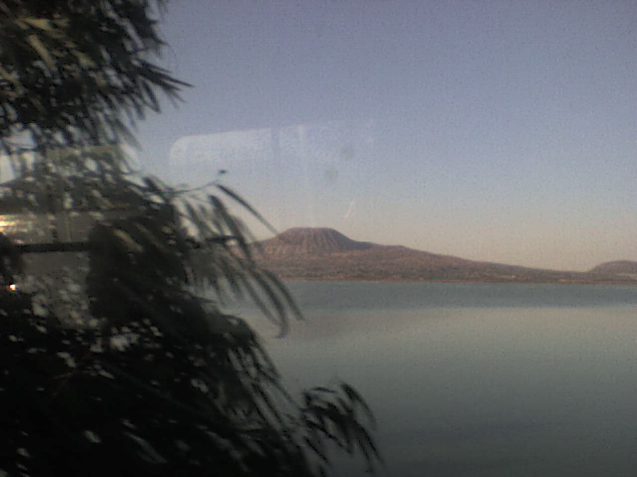
Lake Tláhuac, Ciudad de México Municipality of Tláhuac Valley of Mexico
The lake that was drained and came back: a wetland between Tláhuac and Valle de Chalco, protected since 2024, with pelicans in winter.
From Mexico City: 40 min by car (32 km by road) How to get there ↓
Near here
See everything nearby ↓


Plan your visit to Lago de Chalco
Where to stay near Lago de Chalco
Compare hotels, posadas and guest houses in Lago de Chalco.
Tours to Lago de Chalco
Day trips and guided outings from Tepoztlán often include Lago de Chalco; with a local guide you can get there without a car.
 Tours from Mexico City
Teotihuacan pyramids morning or afternoon without tourist traps
★ 4.9 (10,269) · From US$59
How to get to Lago de Chalco
- From Mexico City: about 40 min by road (~32 km)
- Nearest airport: Mexico City (MEX), 1 h 25 min by car to Tepoztlán
Links open a partner site. We may earn a commission if you book, at no cost to you.
Tours from Mexico City, near Lago de Chalco


Tours, prices and ratings from Viator, checked weekly. We may earn a commission if you book.
About Lago de Chalco
Lake Chalco was the southeastern end of the chain of lakes that filled the Basin of Mexico, alongside Texcoco, Zumpango, Xaltocan and Xochimilco. Springs along its southern shore kept the water fresh, unlike the brackish lakes to the north, and that made it chinampa country for centuries. Its western edge was the island of Cuitláhuac, today's Tláhuac, with Lake Xochimilco beyond. Around 500 BC the Chalco area was one of the most densely settled parts of the valley, and the lake was one of the axolotl's two original homes. Drainage began under Spanish rule; a land speculator's draining scheme in the late 1860s sparked the peasant revolt led by Julio López Chávez, and by the Porfirio Díaz years the lake was essentially gone. In the 1980s the city of Valle de Chalco spread across the dry bed.
Then the water came back. Fourteen wells drilled in the early 1980s, the Mixquic-Santa Catarina system, pumped the aquifer so hard that the plain sank by up to 40 cm a year. Rain and wastewater pooled in the hollow, and by 2007 this New Lake Chalco covered about 1,000 hectares, its surface 12 m below where the ground used to be. On the State of Mexico side it became the Xico lagoons, a state water sanctuary park since 2004; on the Mexico City side are the Tláhuac marsh and the Lago de los Reyes Aztecas.
A federal decree of 8 January 2024 made Lago Tláhuac-Xico a 3,545-hectare natural resources protection area, two thirds of it in Mexico City, including 376 hectares of chinampas, seven archaeological sites and more than a thousand recorded species. In winter it fills with American white pelicans, northern shovelers, herons and coots. The water is badly polluted and not for swimming. The classic view is from the Tláhuac-Chalco road, with the volcanic cones of the Sierra de Santa Catarina behind.
How to get to Lago de Chalco
Drive from Mexico City: 40 min, 32 km
By Metro: Line 12 (Mixcoac–Tláhuac) to its Tláhuac terminal; the whole line has been running again since 30 January 2024. Next to the station is the CETRAM transfer hub with local buses and microbuses, and microbuses, including route 51, run along the Tláhuac-Chalco road. From the station to the lakeside stretch is about 4.5 km by road, some 6 minutes by car without traffic. For the Lago de los Reyes Aztecas in San Pedro Tláhuac, walk about half an hour from the Metro or take a taxi.
From the east: Line 11 of the elevated Trolebús (Santa Marta–Chalco, 13 pesos) runs along the México-Puebla highway north of the Xico lagoons and connects with Metro Line A at Santa Marta.
By car: from the Zócalo it is about 32 km, roughly 40 minutes without traffic, out along Avenida Tláhuac to the Tláhuac-Chalco road. The road is busy with frequent crashes, and in the rainy season water can spill over it, so drive carefully. From Tepoztlán it is about 77 km, roughly 1 h 20 min.
Directions to Lago de Chalco on Google Maps
Distances are in a straight line; the road is usually longer.
Links open a partner site. We may earn a commission if you book, at no cost to you.
From the nearest cities to Lago de Chalco
- Mexico City · 32 km by road, 40 min
- San Martín Texmelucan · 72 km by road, 1 h 10 min
- Cuautla · 74 km by road, 1 h 15 min
Drive times by road from OpenStreetMap, without traffic or stops. Times marked ~ are estimated from the straight-line distance.
Before you go to Lago de Chalco: hours, prices and tips
- Entry
- Trajinera on the Lago de los Reyes Aztecas: 400 pesos an hour (2022 price); a speaker costs 50 pesos. You can bring your own food and drinks. Chilango · checked Oct 2026
- Best time of day
- Winter, when the American white pelicans and other migratory birds arrive. Chilango · checked Oct 2026
- Rules
- The wetlands are not for swimming or camping; the water is polluted. México Desconocido · checked Oct 2026
Hours and prices change, especially around holidays. Each fact links to where we checked it.
Visiting Lago de Chalco: what to see and do
Look out over the New Lake from the Tláhuac-Chalco road, with the Guadalupe (El Borrego) and La Caldera volcanoes behind.
Watch for American white pelicans in winter around the Lago de los Reyes Aztecas and along the road to Chalco.
Hire a trajinera on the Lago de los Reyes Aztecas in San Pedro Tláhuac and drift past chinampas, tule and reed beds.
Walk the chinampas around Mixquic, part of the protected area.
Cross into Valle de Chalco for the Xico lagoons and Cerro Xico, the crater that rises from the old lake bed.
Plan your trip
Places to stay in Lago de Chalco
Compare hotels, posadas, and rentals in and around Lago de Chalco.
Tours & activities
Day trips and guided outings from Tepoztlán often include Lago de Chalco; with a local guide you can get there without a car.
Rental cars
Pick up a car at MEX (Mexico City): about 1 h 25 min by road to Tepoztlán, then 34 km more to Lago de Chalco, on your own schedule.
Flights
The nearest airport with scheduled flights is Mexico City (MEX), about 1 h 25 min by road from Tepoztlán, the base for Lago de Chalco.
Travel insurance
If you plan on swimming or kayaking at Lago de Chalco, check that your policy covers it: some plans leave adventure activities out.
Mobile data
Signal can drop away from Tepoztlán: download a map of the way to Lago de Chalco before you set out, or carry an eSIM with data.
Links open a partner site. We may earn a commission if you book, at no cost to you.
When to go to Lago de Chalco mild
Lago de Chalco shares the climate of Tepoztlán, 34 km away. The best months to visit are January, February, March, and December.
Lago de Chalco is best for swimming and time on the water in the warmest months (March, April, and May); in the rainiest ones (June, August, and September) expect storms in the afternoon.
See the month-by-month climate of Tepoztlán
Weather in Lago de Chalco now and the next 7 days
Live forecast from Open-Meteo. Chance of rain is the day's highest.
The closest Pueblo Mágico: Tepoztlán

Tepoztlán is the Pueblo Mágico closest to Lago de Chalco, with places to stay, food, and more to see.
Also close to
- Tlayacapan · Morelos · 35 km away
- Teotihuacán · Estado de México · 50 km away
- Otumba · Estado de México · 53 km away
- Tepotzotlán · Estado de México · 56 km away
- Huejotzingo · Puebla · 62 km away
Closest to Lago de Chalco
-
Lago de los Reyes Aztecas · Lake · 3 km away
-
Xico · City · 3 km away
-
Cerro Xico · Mountain · 5 km away
-
San Antonio Tecómitl · Village · 5 km away
-
Volcán Teuhtli · Mountain · 5 km away
-
Volcán Guadalupe · Mountain · 7 km away
-
Chalco de Díaz Covarrubias · City · 9 km away
-
Milpa Alta · Town · 9 km away


Near Lago de Chalco


Drive times by road from OpenStreetMap, without traffic. Times marked ~ are estimated from the straight-line distance.
Lists with Lago de Chalco
Lakes and Lagoons near Mexico City · 9 Lakes and Lagoons near Cuernavaca · 6 Lakes and Lagoons near Teotihuacán · 11 Lakes and Lagoons near Otumba · 9 Lakes and Lagoons near Tepotzotlán · 9 Lakes and Lagoons near San Martín Texmelucan · 6Location from OpenStreetMap. Written by Puebloteca.