
City Ixtapaluca, Estado de México Municipality of Ixtapaluca Valley of Mexico
A State of Mexico seat on the México–Puebla highway with a 1531 parish, a spring national fair and the Acozac and Tlapacoya sites close by.
From Mexico City: 35 min by car (35 km by road) How to get there ↓
Near here


Plan your visit to Ixtapaluca
Where to stay near Ixtapaluca
Compare hotels, posadas and guest houses in Ixtapaluca.
Tours to Ixtapaluca
Day trips and guided outings from Teotihuacán often include Ixtapaluca; with a local guide you can get there without a car.
 Tours from Mexico City
Teotihuacan pyramids morning or afternoon without tourist traps
★ 4.9 (10,269) · From US$59
How to get to Ixtapaluca
- From Mexico City: about 35 min by road (~35 km)
- Nearest airport: Mexico City (Felipe Ángeles) (NLU), 35 min by car to Teotihuacán
Links open a partner site. We may earn a commission if you book, at no cost to you.
Tours from Mexico City, near Ixtapaluca


Tours, prices and ratings from Viator, checked weekly. We may earn a commission if you book.
About Ixtapaluca
The name Ixtapaluca comes from Nahuatl and is usually explained as “on the wet salt”. In pre-Hispanic times it paid tribute to the lordship of Texcoco, and the Acozac archaeological site nearby was occupied between AD 900 and 1521. The parish of San Jacinto was founded in 1531 and the municipality created on 5 December 1820. As late as 1980 the seat had only 16,776 people; large housing developments since the 1990s took it to 368,585 in 2020 (542,211 across the municipality).
The centre revolves around the Jardín Municipal, which faces the San Jacinto parish. The big event is the Feria Nacional de Ixtapaluca, announced for May and June in 2026; the 2025 edition ran 29 May to 8 June as the patron-saint feast of the Señor de los Milagros y del Buen Camino, with stages at the Jardín Municipal, the Explanada Municipal and the Teatro del Pueblo. The municipality also has the Rosario church at Coatepec (1775), the Tejalpa dams at San Francisco Acuautla and, in the mountains, the hills of Tláloc, Telapón and Cabeza de Toro and Zoquiapan National Park for long walks. Tlapacoya hill (El Elefante) holds an archaeological site and museum.
Everyday life runs through its 20 public markets and the shopping centres along the highway.
How to get to Ixtapaluca
Drive from Mexico City: 35 min, 35 km
Ixtapaluca sits on the eastern side of the metropolitan area, about 29 km in a straight line from the capital's centre. By car, the México–Puebla highway (150D) crosses the municipality, with about 29 km of its length inside the limits, and the Circuito Exterior Mexiquense also runs through (about 13 km); time depends on traffic (about 35 minutes to over an hour). By public transport, buses run to the Zaragoza and Balbuena Metro stations and microbuses go to La Paz (Line A), Santa Marta and the airport. For long-distance buses toward Puebla from the TAPO, check at the ticket window whether they stop in Ixtapaluca. Trolleybus Line 11 runs from Santa Marta to Chalco along the highway and has no stop in Ixtapaluca. The nearest pueblo on our list, Teotihuacán, is about 42 km in a straight line, around the north of the metro area; allow an hour or more.
Directions to Ixtapaluca on Google Maps
Distances are in a straight line; the road is usually longer.
Links open a partner site. We may earn a commission if you book, at no cost to you.
From the nearest cities to Ixtapaluca
- Mexico City · 35 km by road, 35 min
- San Martín Texmelucan · 60 km by road, 55 min
- Cuautla · 70 km by road, 1 h 10 min
Drive times by road from OpenStreetMap, without traffic or stops. Times marked ~ are estimated from the straight-line distance.
What to see in Ixtapaluca 2
Sights with their own page, closest to the centre first.
Mountains
-
Papayo · Mountain · 19 km from the centre
A lava dome of about 3,600 m, the youngest and southernmost peak of the Sierra de Río Frío, between Telapón and Iztaccíhuatl.

Archaeological sites
-
Acozac · Archaeological site · 2 km from the centre
Acolhua ruins in Ixtapaluca with a round temple to Ehécatl and a great platform facing the volcanoes; free entry.
Map of Ixtapaluca
Neighbourhoods and villages of Ixtapaluca
Part of Ixtapaluca or just outside it, closest first.
-
San Francisco Acuautla · Village · 4 km from the centre
A pueblo originario in Ixtapaluca, "forest among the water", now home to nearly 33,000; Franciscan parish and a 4 October procession.
Day trips and tours from Ixtapaluca
The closest Pueblos Mágicos and places to visit, with the drive from Ixtapaluca and tours that leave from it.


Times marked ~ are estimated from the distance. Links open a partner site. We may earn a commission if you book, at no cost to you.
Before you go: getting to and around Ixtapaluca
- The nearest airport is Mexico City (Felipe Ángeles) (NLU).
- The best months to go are January, February, March, and December.
- 2 of the places on this page are more than 3 km from the centre: take a taxi, a ride-hailing app or a local bus.
- For day trips a rental car gives the most freedom; the tours above leave from Ixtapaluca.
Before you go to Ixtapaluca: hours, prices and tips
- Best season
- The Feria Nacional de Ixtapaluca ran from 29 May to 8 June in 2025 (patron-saint feast of the Señor de los Milagros y del Buen Camino); the 2026 edition was announced for May and June. N+; Posta · checked Oct 2026
Hours and prices change, especially around holidays. Each fact links to where we checked it.
Visiting Ixtapaluca: what to see and do
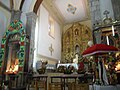
Visit the Parroquia de San Jacinto, founded in 1531, and the Jardín Municipal in front of it.
Go to the Feria Nacional de Ixtapaluca, which runs in May and June.
See the Acozac archaeological site beside the federal México–Puebla road.
Visit the Tlapacoya archaeological site and museum on El Elefante hill.
Step into the Rosario church at Coatepec, from 1775.
Hike the Tláloc, Telapón and Cabeza de Toro hills or Zoquiapan National Park.
Plan your trip
Places to stay in Ixtapaluca
Compare hotels, posadas, and rentals in and around Ixtapaluca.
Tours & activities
Day trips and guided outings from Teotihuacán often include Ixtapaluca; with a local guide you can get there without a car.
Rental cars
Pick up a car at NLU (Mexico City (Felipe Ángeles)): about 35 min by road to Teotihuacán, then 42 km more to Ixtapaluca, on your own schedule.
Flights
The nearest airport with scheduled flights is Mexico City (Felipe Ángeles) (NLU), about 35 min by road from Teotihuacán, the base for Ixtapaluca.
Mobile data
Signal can drop away from Teotihuacán: download a map of the way to Ixtapaluca before you set out, or carry an eSIM with data.
Links open a partner site. We may earn a commission if you book, at no cost to you.
When to go to Ixtapaluca mild
Ixtapaluca shares the climate of Teotihuacán, 42 km away. The best months to visit are January, February, March, and December.
See the month-by-month climate of Teotihuacán
Weather in Ixtapaluca now and the next 7 days
Live forecast from Open-Meteo. Chance of rain is the day's highest.
The closest Pueblo Mágico: Teotihuacán

Teotihuacán is the Pueblo Mágico closest to Ixtapaluca, with places to stay, food, and more to see.
Also close to
- Tlayacapan · Morelos · 42 km away
- Otumba · Estado de México · 44 km away
- Tepoztlán · Morelos · 44 km away
- Huejotzingo · Puebla · 53 km away
- Tepotzotlán · Estado de México · 57 km away
Near Ixtapaluca


Drive times by road from OpenStreetMap, without traffic. Times marked ~ are estimated from the straight-line distance.
Location from OpenStreetMap. Written by Puebloteca.