Town Tlalmanalco, Estado de México Valley of Mexico Volcano Route
A Franciscan-founded town below Iztaccíhuatl, with a 16th-century open chapel carved by Indigenous craftsmen and a small archaeology museum.
From Mexico City: 50 min by car (51 km by road) How to get there ↓
Near here
See everything nearby ↓


Plan your visit to Tlalmanalco de Velázquez
Where to stay near Tlalmanalco de Velázquez
Compare hotels, posadas and guest houses in Tlalmanalco de Velázquez.
Tours to Tlalmanalco de Velázquez
Day trips around Tlayacapan sometimes stop in Tlalmanalco de Velázquez; a tour is the easy way to see it without a car.
 Tours from Mexico City
Teotihuacan pyramids morning or afternoon without tourist traps
★ 4.9 (10,269) · From US$59
How to get to Tlalmanalco de Velázquez
- From Mexico City: about 50 min by road (~51 km)
- Nearest airport: Mexico City (MEX), 1 h 33 min by car to Tlayacapan
Links open a partner site. We may earn a commission if you book, at no cost to you.
Tours from Mexico City, near Tlalmanalco de Velázquez


Tours, prices and ratings from Viator, checked weekly. We may earn a commission if you book.
About Tlalmanalco de Velázquez
Tlalmanalco de Velázquez is the seat of Tlalmanalco municipality in the southeastern corner of the State of Mexico, where the Chalco valley starts climbing toward Iztaccíhuatl. The volcano fills the view here, and the municipality reaches all the way up to its western ridge. The town had 14,518 people in 2020. Its Nahuatl name is usually translated as "place of flattened land", and the state named it a Pueblo con Encanto in November 2018.
The Nonohualcas founded a city-state here in 1336, one of the Chalca confederation along with Amaquemecan, Chimalhuacán and Tenango Tepopollan, and the Aztecs only brought it under their rule in 1465. The Franciscans arrived in 1525: Friar Juan de Rivas laid out the Spanish town and built its first church, opened in 1532, and Friar Martín de Valencia, leader of the first twelve Franciscans in Mexico, was buried there in 1534.
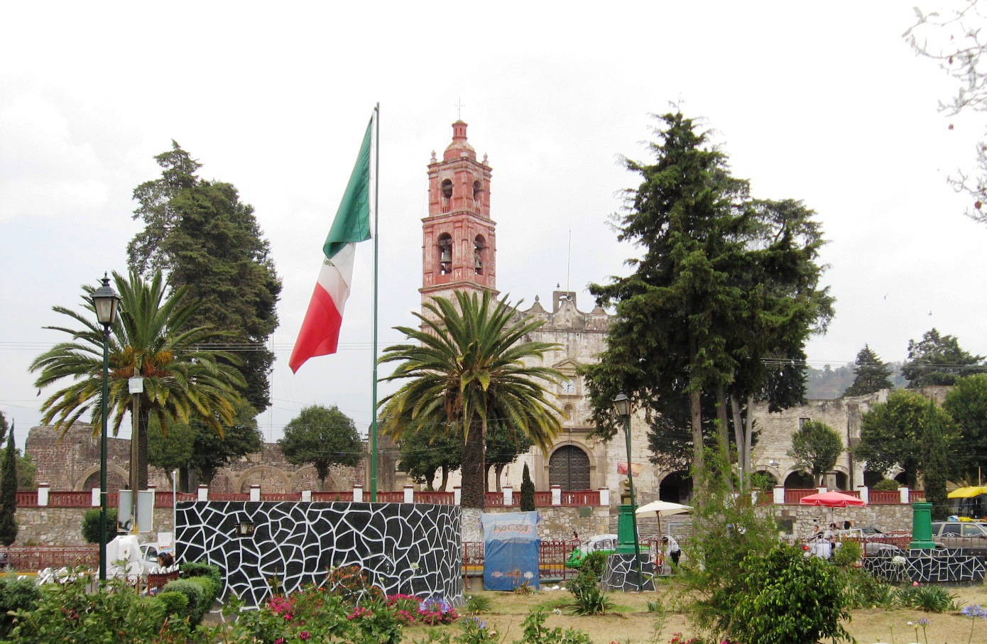
That convent of San Luis Obispo is still the reason to come. Its open chapel, where Mass was said outdoors for Indigenous congregations, was never finished, but its five arches keep carvings of angels, skulls, monkeys and flowers cut by local stonemasons, a textbook case of what art historians call tequitqui art. Historian Gustavo Curiel reads the hand-holding figures as a kind of dance of death. Inside the church is a Baroque cedar altarpiece with paintings by Baltasar de Echave, and the cloister has murals including portraits of Martín de Valencia and Saint Clare.
The old Bethlemite hospital now houses the town hall and the culture centre, and the town hall also holds the Nonohualca community museum: about 500 local archaeological pieces, mostly Preclassic, plus a mammoth molar and a mural of the god Tezcatlipoca. Some 5 km east is San Rafael, the former paper-mill village on the way to the Iztaccíhuatl waterfalls.
Local cooking leans on roast rabbit, mixiotes, green mole and tamales made with capulín cherries.
How to get to Tlalmanalco de Velázquez
Drive from Mexico City: 50 min, 51 km
By car from Mexico City, leave on Calzada Ignacio Zaragoza for the México–Puebla toll road (150D) and take the Chalco exit; from there Federal Highway 115 (México–Cuautla) heads south and skirts the town on the Tlalmanalco bypass. From the TAPO terminal it is about 43 km, roughly 45 minutes in light traffic and easily double that at rush hour. The Circuito Exterior Mexiquense is an alternative.
By bus, Volcanes buses to Amecameca leave the TAPO terminal (Metro San Lázaro, lines 1 and B) about every 30 minutes and run down Highway 115; the ride takes about an hour. Ask the driver for Tlalmanalco. Amecameca is about 10 km further south, and Tlayacapan, the nearest of our pueblos, is about 34 km away in a straight line, across the border in Morelos.
Directions to Tlalmanalco de Velázquez on Google Maps
Distances are in a straight line; the road is usually longer.
Links open a partner site. We may earn a commission if you book, at no cost to you.
From the nearest cities to Tlalmanalco de Velázquez
- Mexico City · 51 km by road, 50 min
- Cuautla · 53 km by road, 50 min
- San Martín Texmelucan · 74 km by road, 1 h 10 min
Drive times by road from OpenStreetMap, without traffic or stops. Times marked ~ are estimated from the straight-line distance.
Before you go to Tlalmanalco de Velázquez: hours, prices and tips
- Best season
- The feast of San Luis Obispo, the town's patron, is on 19 August (some sources say the 20th), with processions, fireworks and dances such as Los Doce Pares de Francia and chinelos. The Tlalmanalco fair runs every May, with a rodeo, dances and fairground rides. Wikipedia · checked Oct 2026
Hours and prices change, especially around holidays. Each fact links to where we checked it.
Visiting Tlalmanalco de Velázquez: what to see and do
The 16th-century open chapel and its five carved tequitqui arches.
The church of San Luis Obispo, with its Baroque cedar altarpiece and the grave of Friar Martín de Valencia.
The cloister murals, with portraits of Martín de Valencia and Saint Clare.
The Nonohualca community museum in the town hall, with Preclassic pieces and mammoth remains.
The former Bethlemite hospital, now the town hall and culture centre.
Views of Iztaccíhuatl from the town centre.
Plan your trip
Places to stay in Tlalmanalco de Velázquez
Compare hotels, posadas, and rentals in and around Tlalmanalco de Velázquez.
Tours & activities
Day trips around Tlayacapan sometimes stop in Tlalmanalco de Velázquez; a tour is the easy way to see it without a car.
Rental cars
Pick up a car at MEX (Mexico City): about 1 h 33 min by road to Tlayacapan, then 34 km more to Tlalmanalco de Velázquez, on your own schedule.
Flights
The nearest airport with scheduled flights is Mexico City (MEX), about 1 h 33 min by road from Tlayacapan, the base for Tlalmanalco de Velázquez.
Mobile data
Signal can drop away from Tlayacapan: download a map of the way to Tlalmanalco de Velázquez before you set out, or carry an eSIM with data.
Links open a partner site. We may earn a commission if you book, at no cost to you.
When to go to Tlalmanalco de Velázquez mild
Tlalmanalco de Velázquez shares the climate of Tlayacapan, 34 km away. The best months to visit are January, February, March, and December.
See the month-by-month climate of Tlayacapan
Weather in Tlalmanalco de Velázquez now and the next 7 days
Live forecast from Open-Meteo. Chance of rain is the day's highest.
The closest Pueblo Mágico: Tlayacapan

Tlayacapan is the Pueblo Mágico closest to Tlalmanalco de Velázquez, with places to stay, food, and more to see.
Also close to
- Tepoztlán · Morelos · 40 km away
- Huejotzingo · Puebla · 42 km away
- Atlixco · Puebla · 51 km away
- Cholula · Puebla · 54 km away
- Teotihuacán · Estado de México · 54 km away
Closest to Tlalmanalco de Velázquez
-
San Andrés Metla · Village · 4 km away
-
San Rafael · Town · 5 km away
-
Cocotitlán · Town · 7 km away
-
San Francisco Zentlalpan · Village · 7 km away
-
San Gregorio Cuautzingo · Village · 8 km away
-
Tenango del Aire · Town · 8 km away
-
Ayapango de Gabriel Ramos Millán · Town · 9 km away
-
Parque Nacional Sacromonte · Nature reserve · 9 km away


Near Tlalmanalco de Velázquez


Drive times by road from OpenStreetMap, without traffic. Times marked ~ are estimated from the straight-line distance.
Location from OpenStreetMap. Written by Puebloteca.