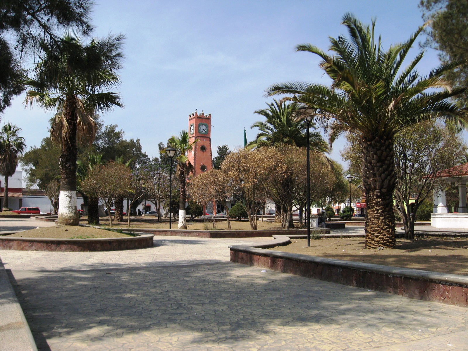
Town Tenango del Aire, Estado de México Valley of Mexico Volcano Route
Small seat below the volcanoes, with a 16th-century parish, a Divine Mercy shrine and the Casa de Madera museum.
From Cuautla: 50 min by car (53 km by road) How to get there ↓
Near here
See everything nearby ↓


Plan your visit to Tenango del Aire
Where to stay near Tenango del Aire
Compare hotels, posadas and guest houses in Tenango del Aire.
Tours to Tenango del Aire
Day trips around Tlayacapan sometimes stop in Tenango del Aire; a tour is the easy way to see it without a car.
How to get to Tenango del Aire
- From Cuautla: about 50 min by road (~53 km)
- Nearest airport: Mexico City (MEX), 1 h 33 min by car to Tlayacapan
Links open a partner site. We may earn a commission if you book, at no cost to you.
About Tenango del Aire
Tenango del Aire takes its name from the dust devils that whirl across these fields, mostly in the dry season; the "of the Air" tag stuck in the late 1800s. It is the seat of a small municipality of 38 km² and 11,359 people (INEGI 2020 census) in the southeast of the State of Mexico, at roughly 2,285 m, bordered by Temamatla, Tlalmanalco, Ayapango and Juchitepec.
Before the Spanish arrived it belonged to one of the four city-states of the Chalco region, settled from the 12th century by the Teotenanca. Bishop Juan de Zumárraga ordered the parish of San Juan Bautista built in 1532, and it was finished in 1671; the baptistery keeps a font dated 1710. In 1998 the former convent was made the National Shrine of Divine Mercy, so the Sunday after Easter now brings pilgrims.
The other draw is the Casa de Madera museum, a private collection recognised as a museum in 1992, full of everyday objects, applied arts and pre-Hispanic pieces. Out in the countryside stand the ruins of 17th-century haciendas such as Atempilla, and north of town lies the Chucóatl ceremonial site, with petroglyphs and a carved stone serpent head. Rabbit, mixiote and quesadillas are what people eat here.
How to get to Tenango del Aire
Drive from Cuautla: 50 min, 53 km
Tenango del Aire lies about 42 km southeast of Mexico City. By car, Rome2Rio estimates about 45 km and 45 minutes from the TAPO bus station (approx.), heading out east towards Chalco; the town sits in the Amecameca and volcanoes area.
Without a car, Volcanes buses leave the eastern bus terminal (TAPO, Metro San Lázaro) every half hour for the region; Rome2Rio suggests getting off at Cedral, for a total trip of just over an hour. It also lists an Estrella Roja Super Rápidos bus to San Marcos Huixtoco and a taxi from there (about 30 minutes). These are aggregator estimates, so check times with the bus lines.
Santiago Tepopula is 2 km south. Tlayacapan, the nearest Pueblo Mágico, is about 26 km away in a straight line, over in Morelos, and Cuautla about 38 km.
Directions to Tenango del Aire on Google Maps
Distances are in a straight line; the road is usually longer.
Links open a partner site. We may earn a commission if you book, at no cost to you.
From the nearest cities to Tenango del Aire
- Cuautla · 53 km by road, 50 min
- Mexico City · 53 km by road, 55 min
- San Martín Texmelucan · 77 km by road, 1 h 15 min
Drive times by road from OpenStreetMap, without traffic or stops. Times marked ~ are estimated from the straight-line distance.
Before you go to Tenango del Aire: hours, prices and tips
- Best season
- Feast of San Juan Bautista on 24 June; Lord of Mercy on the Sunday after Easter; Our Lady of Guadalupe in December, with chinelo dancers the weekend after the 12th. Wikipedia (es): Tenango del Aire · checked Oct 2026
Hours and prices change, especially around holidays. Each fact links to where we checked it.
Visiting Tenango del Aire: what to see and do
Parish of San Juan Bautista (1532–1671), now the National Shrine of Divine Mercy, with a 1710 baptismal font.
Casa de Madera museum, a private collection of everyday objects and pre-Hispanic pieces.
Chucóatl ceremonial site, with petroglyphs and a carved serpent head, about 6 km north of town.
Ruins of the 17th-century Atempilla hacienda.
The plain 16th-century church of San Juan Coxtocán.
Crafts corridor: embroidery, carved wood, basketry and traditional liqueurs.
Plan your trip
Places to stay in Tenango del Aire
Compare hotels, posadas, and rentals in and around Tenango del Aire.
Tours & activities
Day trips around Tlayacapan sometimes stop in Tenango del Aire; a tour is the easy way to see it without a car.
Rental cars
Pick up a car at MEX (Mexico City): about 1 h 33 min by road to Tlayacapan, then 26 km more to Tenango del Aire, on your own schedule.
Flights
The nearest airport with scheduled flights is Mexico City (MEX), about 1 h 33 min by road from Tlayacapan, the base for Tenango del Aire.
Mobile data
Signal can drop away from Tlayacapan: download a map of the way to Tenango del Aire before you set out, or carry an eSIM with data.
Links open a partner site. We may earn a commission if you book, at no cost to you.
When to go to Tenango del Aire mild
Tenango del Aire shares the climate of Tlayacapan, 26 km away. The best months to visit are January, February, March, and December.
See the month-by-month climate of Tlayacapan
Weather in Tenango del Aire now and the next 7 days
Live forecast from Open-Meteo. Chance of rain is the day's highest.
The closest Pueblo Mágico: Tlayacapan

Tlayacapan is the Pueblo Mágico closest to Tenango del Aire, with places to stay, food, and more to see.
Also close to
- Tepoztlán · Morelos · 32 km away
- Huejotzingo · Puebla · 47 km away
- Atlixco · Puebla · 53 km away
- Cholula · Puebla · 58 km away
- Teotihuacán · Estado de México · 59 km away
Closest to Tenango del Aire
-
Santiago Tepopula · Village · 2 km away
-
Ayapango de Gabriel Ramos Millán · Town · 7 km away
-
Juchitepec de Mariano Riva Palacio · Town · 7 km away
-
San Andrés Metla · Village · 7 km away
-
Cocotitlán · Town · 8 km away
-
San Francisco Zentlalpan · Village · 8 km away
-
San Matías Cuijingo · Village · 8 km away
-
San Pablo Atlazalpan · Town · 8 km away


Near Tenango del Aire


Drive times by road from OpenStreetMap, without traffic. Times marked ~ are estimated from the straight-line distance.
Location from OpenStreetMap. Written by Puebloteca.