
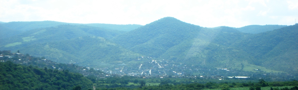
Town Eduardo Neri, Guerrero Central Guerrero
Seat of Eduardo Neri, 15 minutes from Chilpancingo: an old mining town with an 1847 parish church, the Candelaria fair and glazed encalado bread.
From Chilpancingo: about 15 min by road (~15 km) How to get there ↓
Near here
See everything nearby ↓


Plan your visit to Zumpango del Río
Where to stay near Zumpango del Río
Compare hotels, posadas and guest houses in Zumpango del Río.
Tours to Zumpango del Río
Day trips around Ixcateopan sometimes stop in Zumpango del Río; a tour is the easy way to see it without a car.
 Tours from Acapulco
Paddle Boarding At Acapulco´s Bay
★ 5.0 (247) · From US$24
How to get to Zumpango del Río
- From Chilpancingo: about 15 min by road (~15 km)
- Nearest airport: Toluca (TLC), 2 h 40 min by car to Ixcateopan
Links open a partner site. We may earn a commission if you book, at no cost to you.
Tours from Acapulco, near Zumpango del Río


Tours, prices and ratings from Viator, checked weekly. We may earn a commission if you book.
About Zumpango del Río
Zumpango del Río, usually just Zumpango, is the seat of Eduardo Neri municipality, about 13 km northeast of Chilpancingo on federal highway 95, the old Mexico City-Acapulco road. Home to 27,944 people in 2020, it sits a little over 1,000 m up, among low hills of dry tropical forest and savanna at the foot of the Sierra Madre del Sur. Its Nahuatl name points to the tzompantli, the Aztec skull rack, while "del Río" refers to the Tetelzin stream the town grew up beside.
Before the conquest it was a Coixca settlement that the Aztecs took over and made the head of a province covering Tixtla, Mochitlán and Huitziltepec. Spaniards struck silver here in 1531, Hernán Cortés owned some of the mines and the place became Zumpango de las Minas, though most workings were abandoned by 1582. Guava orchards are common today, and some mezcal is made.
An earthquake in the 1830s brought down the colonial church; all that is left is a wall and part of a window among houses on the north side of the alameda. Its replacement, the Herrerian-style parish church of Santiago Apóstol, was finished in 1847 and opened during the Candelaria fiesta. Locals say it was built with earth and a mortar of lime and egg white. It houses the Señor de las Misericordias, a Christ figure that draws pilgrims every 25 July.
That opening gave the town its signature bread. Encalados are hard ring loaves of flour, sugar and cinnamon under a crunchy white glaze dotted with four spots of red sugar, first baked as an offering for the 1847 ceremony. The municipal market sells them all year, and bakers step up output in early February. The Candelaria fair, starting on 2 February, is the big event of the year; the 2025 edition ran from 1 to 16 February with dances, charreadas and free concerts in the Alameda Coronel José María Bernal. The Jacobo Harootian cultural centre fills the old town hall, known as the Casa de Altos, and honours a benefactor who arrived around 1889.
How to get to Zumpango del Río
Zumpango sits on free federal highway 95, the stretch between Iguala and Chilpancingo, with the Autopista del Sol (95D) running up the same valley. From Chilpancingo it is 15 minutes and 13 km by road, heading north; from Taxco, 1 h 55 min and 125 km by way of Iguala. Without a car, first get to Chilpancingo: Futura, Estrella de Oro, Costa Line, ETN and Costeños leave Mexico City's Taxqueña station (Terminal del Sur), taking four to five hours. We could not confirm an urvan or combi route between Chilpancingo and Zumpango or its fare; ask at the Chilpancingo bus station or take a taxi for the last leg. The US government keeps Guerrero at its highest warning level, Do Not Travel; move only in daylight and check the local situation before setting out.
Directions to Zumpango del Río on Google Maps
Distances are in a straight line; the road is usually longer.
Links open a partner site. We may earn a commission if you book, at no cost to you.
From the nearest cities to Zumpango del Río
- Chilpancingo · about 15 km by road, ~15 min
- Iguala · about 100 km by road, ~1 h 30 min
- Acapulco · about 125 km by road, ~1 h 50 min
Drive times by road from OpenStreetMap, without traffic or stops. Times marked ~ are estimated from the straight-line distance.
Before you go to Zumpango del Río: hours, prices and tips
- Best time of day
- The dry season, October to May; rain falls mostly from June to September. Wikipedia · checked Oct 2026
- Best season
- Candelaria fair from 2 February (1 to 16 February in 2025), with dances, charreadas and free concerts; Señor de las Misericordias fiesta on 25 July. Tus Buenas Noticias · checked Oct 2026
Hours and prices change, especially around holidays. Each fact links to where we checked it.
Visiting Zumpango del Río: what to see and do
The parish church of Santiago Apóstol, finished in 1847, with its Señor de las Misericordias.
The remains of the colonial church: a wall and part of a window north of the alameda.
Fresh encalados at the municipal market in the centre.
The Jacobo Harootian cultural centre in the old town hall, the Casa de Altos.
The Alameda Coronel José María Bernal, where the fair's concerts are held.
The Candelaria fair, around 2 February.
The Señor de las Misericordias fiesta on 25 July.
Plan your trip
Places to stay in Zumpango del Río
Compare hotels, posadas, and rentals in and around Zumpango del Río.
Tours & activities
Day trips around Ixcateopan sometimes stop in Zumpango del Río; a tour is the easy way to see it without a car.
Rental cars
Pick up a car at TLC (Toluca): about 2 h 40 min by road to Ixcateopan, then 99 km more to Zumpango del Río, on your own schedule.
Flights
The nearest airport with scheduled flights is Toluca (TLC), about 2 h 40 min by road from Ixcateopan, the base for Zumpango del Río.
Mobile data
Signal can drop away from Ixcateopan: download a map of the way to Zumpango del Río before you set out, or carry an eSIM with data.
Links open a partner site. We may earn a commission if you book, at no cost to you.
When to go to Zumpango del Río mild
Zumpango del Río shares the climate of Ixcateopan, 99 km away. The best months to visit are January, February, March, and December.
See the month-by-month climate of Ixcateopan
Weather in Zumpango del Río now and the next 7 days
Live forecast from Open-Meteo. Chance of rain is the day's highest.
The closest Pueblo Mágico: Ixcateopan

Ixcateopan is the Pueblo Mágico closest to Zumpango del Río, with places to stay, food, and more to see.
Closest to Zumpango del Río
-
Chilpancingo · City · 11 km away
-
Museo Regional de Guerrero · Landmark · 11 km away
-
Zona arqueológica "Pezuapan" · Archaeological site · 12 km away
-
Tixtla de Guerrero · Town · 16 km away
-
El Santuario · Landmark · 17 km away
-
La Organera-Xochipala · Archaeological site · 21 km away
-
Chilapa de Álvarez · City · 37 km away
-
Concatedral de Chilapa · Landmark · 37 km away

Near Zumpango del Río




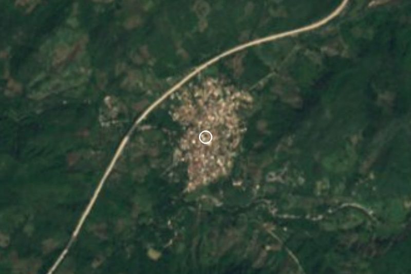


Drive times by road from OpenStreetMap, without traffic. Times marked ~ are estimated from the straight-line distance.
Location from OpenStreetMap. Written by Puebloteca.