


City Iguala de la Independencia, Guerrero Northern Guerrero
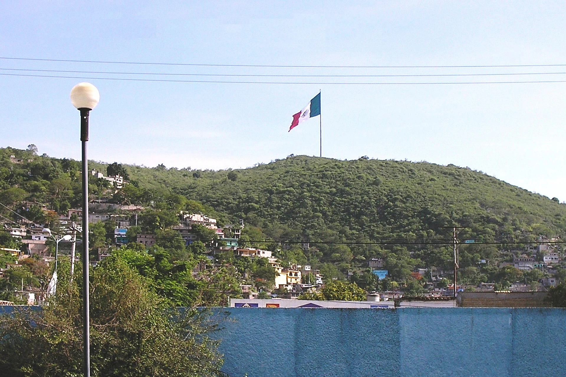
The 'tamarind city' where the Plan de Iguala was proclaimed and Mexico's first flag was sewn in 1821, with a flag museum and a 113 m flagpole on a hill.
From Taxco: 35 min by car (36 km by road) How to get there ↓
Near here
See everything nearby ↓


Plan your visit to Iguala
Where to stay near Iguala
Compare hotels, posadas and guest houses in Iguala.
Tours to Iguala
Day trips and guided outings from Taxco often include Iguala; with a local guide you can get there without a car.
 Tours from Taxco
Taxco and Cuernavaca Tour from CDMX
★ 4.5 (11) · From US$61
How to get to Iguala
- From Taxco: about 35 min by road (~36 km)
- Nearest airport: Toluca (TLC), 2 h by car to Taxco
Links open a partner site. We may earn a commission if you book, at no cost to you.
Tours from Taxco, near Iguala


Tours, prices and ratings from Viator, checked weekly. We may earn a commission if you book.
About Iguala
Iguala de la Independencia is a hot lowland city in northern Guerrero, about 190 km from Mexico City on Highway 95, and the third-largest city in the state; the municipality had 154,173 people in 2020. Its place in Mexican history comes from 1821. On 24 February Agustín de Iturbide, with the insurgent leader Vicente Guerrero, proclaimed here the Plan de Iguala, which ended the long War of Independence, and the local tailor José Magdaleno Ocampo made the first national flag, the green, white and red banner of the Three Guarantees. On 2 March the Ejército Trigarante formed up on the old Plaza de Armas, today's zócalo, to swear allegiance to the plan and the flag, and Iguala calls itself the birthplace of the flag. When Guerrero state was created in 1849, Iguala was designated its first capital.
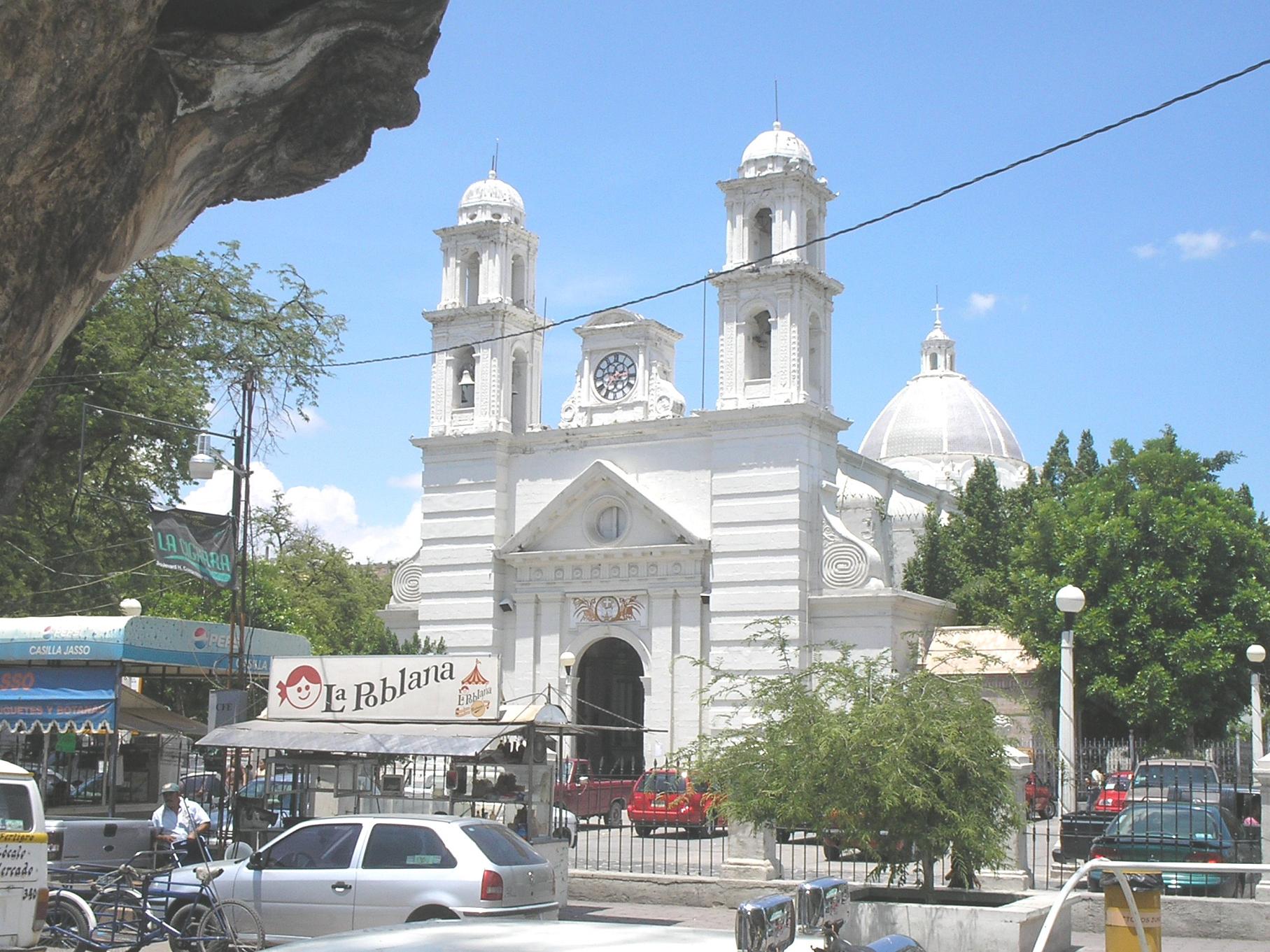
The centre is shaded by tamarind trees, 32 of them planted around the main square in 1812, which earned Iguala the nickname 'la ciudad tamarindera'. Local legend says one of them is a female 'tamarinda', and couples who kiss beneath it are bound to marry. Beside the square stands the neoclassical Parroquia de San Francisco de Asís, vaulted from 1850 with help from a wealthy resident of the Juanacate barrio, and the Museo de la Bandera y Santuario de la Patria, opened in 1982, displays replicas of every historic Mexican flag, Trigarante uniforms and copies of the Plan de Iguala and Morelos's Sentimientos de la Nación. A pink-stone flag monument dates from 1942, and the Franciscan church of Santa María de la Asunción from around 1539. On Cerro Tehuehe above the city, the monumental flagpole, raised in 1998, is 113.10 m tall and flies a flag of 55 by 31.43 m. Iguala is also a centre of gold jewellery, a craft that began here in the 1920s.
The Feria de la Bandera runs from the second week of February into early March, opening with a parade through the historic centre and fireworks, and offering a livestock show, a cockfighting palenque and concerts. On 4 October, the feast of St Francis is marked by the 'día de los locos' parade of costumed characters. The city is hot all year, above 30 °C every month and up to 37–39 °C in April and May, with rain from June to October. Iguala is also known for the disappearance of 43 students from the Ayotzinapa teachers' college here in September 2014, which led to years of protests.
How to get to Iguala
Drive from Taxco: 35 min, 36 km
Iguala is on the toll Autopista del Sol (95D) and the free Highway 95 between Mexico City, Cuernavaca and Acapulco, about 190 km from Mexico City and 102 km from Chilpancingo; Highway 51 heads west to Teloloapan and Ciudad Altamirano. There are two bus stations, the Terminal Central near the market and the Estrella de Oro terminal on Calle Bandera Nacional. In town, combis and two urban bus routes cover the city and nearby villages such as Tuxpan. The US government currently advises against all travel to Guerrero state.
Directions to Iguala on Google Maps
Distances are in a straight line; the road is usually longer.
Links open a partner site. We may earn a commission if you book, at no cost to you.
From the nearest cities to Iguala
- Taxco · 36 km by road, 35 min
- Cuernavaca · 99 km by road, 1 h 25 min
- Chilpancingo · 106 km by road, 1 h 35 min
Drive times by road from OpenStreetMap, without traffic or stops. Times marked ~ are estimated from the straight-line distance.
Before you go to Iguala: hours, prices and tips
- Hours
- Museo de la Bandera y Santuario de la Patria: Tuesday to Sunday, 9am to 6pm. Radio y Televisión de Guerrero · checked Oct 2026
- Entry
- The Museo de la Bandera is free. El Sol de Acapulco · checked Oct 2026
- Best time of day
- Hot all year; April and May reach 37–39 °C. The rainy season is June to October, and winter days are warm with mild nights. Wikivoyage · checked Oct 2026
- Best season
- The Feria de la Bandera runs from the second week of February to early March, around 24 February, the anniversary of the first flag. Market days: a general tianguis on Thursdays and a farm and craft tianguis on Sundays. Wikipedia · checked Oct 2026
Hours and prices change, especially around holidays. Each fact links to where we checked it.
Visiting Iguala: what to see and do
Walk the zócalo under the tamarind trees, where the Trigarante army swore the Plan de Iguala in 1821.
Visit the Museo de la Bandera y Santuario de la Patria and its replicas of Mexico's historic flags.
Go up Cerro Tehuehe to the 113 m monumental flagpole and its views over the city.
See the Parroquia de San Francisco de Asís and the 1942 flag monument.
Shop for gold jewellery made by Iguala's goldsmiths.
Eat fish by the Laguna de Tuxpan, 5 km east of the city.
Plan your trip
Places to stay in Iguala
Compare hotels, posadas, and rentals in and around Iguala.
Tours & activities
Day trips and guided outings from Taxco often include Iguala; with a local guide you can get there without a car.
Rental cars
Pick up a car at TLC (Toluca): about 2 h by road to Taxco, then 25 km more to Iguala, on your own schedule.
Flights
The nearest airport with scheduled flights is Toluca (TLC), about 2 h by road from Taxco, the base for Iguala.
Mobile data
Signal can drop away from Taxco: download a map of the way to Iguala before you set out, or carry an eSIM with data.
Links open a partner site. We may earn a commission if you book, at no cost to you.
Photos
When to go to Iguala mild
Iguala shares the climate of Taxco, 25 km away. The best months to visit are January, February, March, and December.
See the month-by-month climate of Taxco
Weather in Iguala now and the next 7 days
Live forecast from Open-Meteo. Chance of rain is the day's highest.
The closest Pueblo Mágico: Taxco

Taxco is the Pueblo Mágico closest to Iguala, with places to stay, food, and more to see.
Also close to
- Ixcateopan · Guerrero · 32 km away
- Tonatico · Estado de México · 53 km away
- Xochitepec · Morelos · 56 km away
- Tlaltizapán · Morelos · 57 km away
- Ixtapan de la Sal · Estado de México · 57 km away
Closest to Iguala
-
Laguna de Tuxpan · Lake · 5 km away
-
Taxco el Viejo · Town · 16 km away
-
Tlamacazapa · Town · 17 km away
-
Pozas Azules de Atzala · Waterfall · 23 km away
-
Mil Cascadas · Waterfall · 26 km away
-
Cascada de Cacalotenango · Waterfall · 27 km away
-
Cerro del Huixteco · Mountain · 29 km away
-
Casahuatlán · Village · 30 km away
Near Iguala



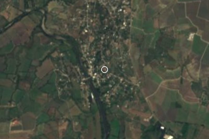


Drive times by road from OpenStreetMap, without traffic. Times marked ~ are estimated from the straight-line distance.
Location from OpenStreetMap. Written by Puebloteca.