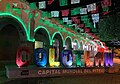

Town Colotlán, Jalisco
Northern Jalisco town on the Zacatecas border, known for piteado: leather belts and saddles embroidered with pita fibre.
From Zacatecas: 2 h by car (129 km by road) How to get there ↓
Near here
See everything nearby ↓


Plan your visit to Colotlán
Where to stay near Colotlán
Compare hotels, posadas and guest houses in Colotlán.
Tours to Colotlán
Day trips around Villanueva sometimes stop in Colotlán; a tour is the easy way to see it without a car.
How to get to Colotlán
- From Zacatecas: about 2 h by road (~129 km)
- Nearest airport: Zacatecas (ZCL), 1 h 6 min by car to Villanueva
Links open a partner site. We may earn a commission if you book, at no cost to you.
About Colotlán
Colotlán is the main town of northern Jalisco, set in a valley at about 1,550 metres and wedged between parts of Zacatecas, which surround it to the south, east and west. The 2020 census counted 15,129 people. The name is translated as "place where scorpions abound", which is why the municipal coat of arms has a scorpion at its centre. It is home to the University of Guadalajara's northern campus (CUNORTE), opened in 2000, which draws students from across the region.
What sets Colotlán apart is piteado, embroidery on leather with thread made from pita fibre, used for belts, saddles, hats, bags and boots. The big letters on the plaza call it the "world capital of piteado", and around 190 workshops in town divide the work: some artisans twist the thread (traditionally with saliva, which is said to make it stronger), others cut and design the leather, and others do the embroidery. A fine piteado belt can take two or three months and cost up to 5,000 pesos, and a saddle runs to around 50,000. The craft boomed in the 1990s with the fashion for banda and mariachi music, and charros from other states still come to Colotlán to buy; the biggest market is now the United States. Local potters also make ollas, jugs, comales and casseroles.
The valley's recorded history begins with resistance. Pedro Almíndez Chirinos arrived in 1530 and found no large settlement; ten years later a leader called Zacatecas rallied the local peoples against the conquest and died in the Mixtón War. In 1589 Captain Miguel Caldera granted land to found the Villa Nueva Tlaxcala, settled with Tlaxcalan families brought in to pacify the Chichimecas, and the town was laid out in three barrios: Tlaxcala, Soyatitlán and Tochopa. After independence it became a villa and the seat of a canton, and it was made a city on 19 February 1833. President Victoriano Huerta was born here.
In the centre are the 19th-century Parroquia de San Luis, with a three-tier neoclassical front, Ionic columns, a statue of the saint in the top niche, an unfinished tower and an oil mural in the sanctuary, and the Templo de San Nicolás, with a Baroque doorway, a three-tier tower and a two-level stone altar canopy inside. The climate is semi-dry, with rain in June and July and around 22 frost days a year. Local food includes pipián with poultry and squash seeds, milk sweets, candied biznaga, sweet potato and squash, pulque and aguamiel.
How to get to Colotlán
Drive from Zacatecas: 2 h, 129 km
Colotlán lies on federal Highway 23, which becomes Avenida Reforma in town. From Guadalajara it is about 206 km by road, roughly 3 hours by car north on Highway 23. Zacatecas, the nearest large city, is about 128 km away, 1 h 45 min to 2 hours. The nearest Pueblo Mágico is Villanueva, in Zacatecas, about 61 km by road, roughly 1 h 30 min.
By bus, Rojo de los Altos (Estrella Blanca group) has one direct departure a day from Guadalajara's Nueva Central Camionera, module 7, taking about 6 h 30 min. There are no published timetables for a direct bus from Zacatecas; the options are to go via Guadalajara or drive. Confirm the schedule with the bus line before travelling.
Directions to Colotlán on Google Maps
Distances are in a straight line; the road is usually longer.
Links open a partner site. We may earn a commission if you book, at no cost to you.
From the nearest cities to Colotlán
- Zacatecas · 129 km by road, 2 h
- Fresnillo · 141 km by road, 2 h 15 min
- San Juan de los Lagos · about 175 km by road, ~2 h 35 min
Drive times by road from OpenStreetMap, without traffic or stops. Times marked ~ are estimated from the straight-line distance.
Before you go to Colotlán: hours, prices and tips
- Best season
- Regional Fair 3–11 May (queen's coronation, livestock and craft show, charreadas, horse races) with cockfights 1–8 May; San Lorenzo 1–10 August; San Luis Obispo 10–19 August; San Nicolás 1–10 September. Enciclopedia de los Municipios de México (INAFED) · checked Oct 2026
Hours and prices change, especially around holidays. Each fact links to where we checked it.
Visiting Colotlán: what to see and do
Piteado workshops and shops: belts, saddles, hats and bags in leather embroidered with pita.
The "world capital of piteado" letters in front of the arcades on the plaza.
The 19th-century Parroquia de San Luis, with its neoclassical front and oil mural in the sanctuary.
The Templo de San Nicolás, with its Baroque doorway and stone altar canopy.
Local pottery: ollas, jugs, comales and casseroles.
Pipián, milk sweets, candied biznaga and squash, pulque and aguamiel.
Plan your trip
Places to stay in Colotlán
Compare hotels, posadas, and rentals in and around Colotlán.
Tours & activities
Day trips around Villanueva sometimes stop in Colotlán; a tour is the easy way to see it without a car.
Rental cars
Pick up a car at ZCL (Zacatecas): about 1 h 6 min by road to Villanueva, then 48 km more to Colotlán, on your own schedule.
Flights
The nearest airport with scheduled flights is Zacatecas (ZCL), about 1 h 6 min by road from Villanueva, the base for Colotlán.
Mobile data
Signal can drop away from Villanueva: download a map of the way to Colotlán before you set out, or carry an eSIM with data.
Links open a partner site. We may earn a commission if you book, at no cost to you.
When to go to Colotlán mild
Colotlán shares the climate of Villanueva, 48 km away. The best months to visit are March, April, May, and December.
See the month-by-month climate of Villanueva
Weather in Colotlán now and the next 7 days
Live forecast from Open-Meteo. Chance of rain is the day's highest.
The closest Pueblo Mágico: Villanueva

Villanueva is the Pueblo Mágico closest to Colotlán, with places to stay, food, and more to see.
Also close to
- Calvillo · Aguascalientes · 64 km away
- Jerez · Zacatecas · 66 km away
- Teúl de González Ortega · Zacatecas · 75 km away
Closest to Colotlán
-
Santa María de los Ángeles · Town · 8 km away
-
Huacasco · Village · 21 km away
-
Huejúcar · Village · 28 km away
-
Totatiche · Village · 28 km away
-
Temastián · Village · 31 km away
-
Hacienda La Encarnación · Hot springs · 38 km away
-
Tepetongo · Town · 40 km away
-
El Salto · Landmark · 41 km away

Near Colotlán



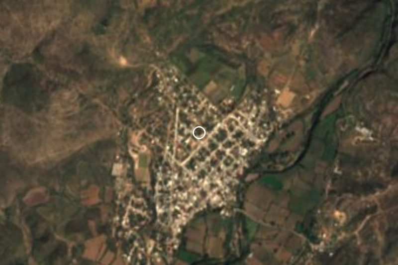



Drive times by road from OpenStreetMap, without traffic. Times marked ~ are estimated from the straight-line distance.
Location from OpenStreetMap. Written by Puebloteca.