Town Ejutla, Jalisco
Seat of a Sierra de Amula municipality with the San Miguel parish, a 16th-century convent, the Cristo Rey and the Basilio Vadillo reservoir.
From Autlán: 45 min by car (37 km by road) How to get there ↓
Near here
See everything nearby ↓


Plan your visit to Ejutla
Where to stay near Ejutla
Compare hotels, posadas and guest houses in Ejutla.
Tours to Ejutla
Day trips around Tapalpa sometimes stop in Ejutla; a tour is the easy way to see it without a car.
 Tours from Manzanillo
Private Chichen Itza & Yaxunah Ruins with Cenote
★ 4.8 (111) · From US$518
How to get to Ejutla
- From Autlán: about 45 min by road (~37 km)
- Nearest airport: Colima (CLQ), 2 h by car to Tapalpa
Links open a partner site. We may earn a commission if you book, at no cost to you.
Tours from Manzanillo, near Ejutla


Tours, prices and ratings from Viator, checked weekly. We may earn a commission if you book.
About Ejutla
Ejutla is the seat of the municipality of the same name, in the Sierra de Amula region, at about 1,140 metres above sea level. The 2020 census counted 1,367 people in the town. The name comes from the Nahuatl axutla, usually rendered as "where the water springs." According to the Enciclopedia de los Municipios, survivors of a 1544 plague founded the settlement of San Miguel; in 1694 the Franciscan Diego de Muñoz listed it as an important town on one of the routes between Valladolid (today Morelia) and Nueva Galicia, and a deed of 5 August 1727 calls it San Miguel de Ejutla. The municipality was created by decree on 2 August 1875.
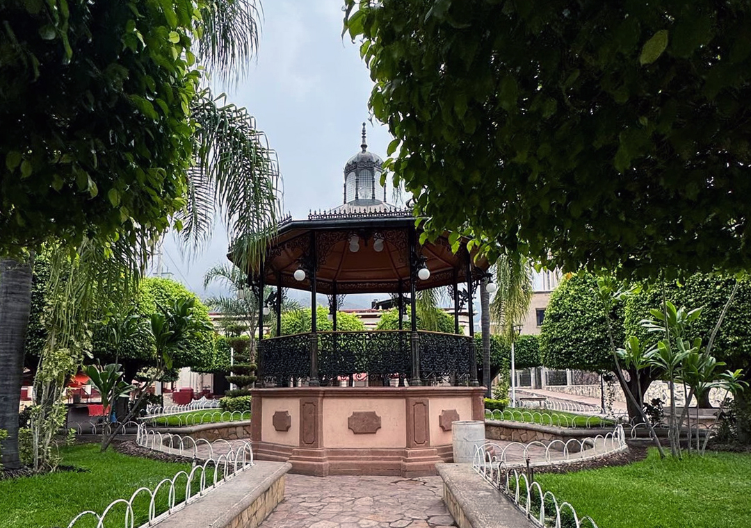
The centre is built around the plaza with its kiosk and the parish church of San Miguel, which has two towers and a large dome. Nearby are the Sanctuary of the Sacred Heart, the Templo de la Tercera Orden and the Templo de la Soledad. The Convent of the Madres Adoratrices dates from the mid-16th century and is considered one of the earliest convents in the state; sweets such as rompope, obleas and honey candy are sold near it. On the hill stands the Cristo Rey, by Guadalajara sculptor Luis Larios, from 1975: a statue about seven metres tall on a nine-metre octagonal chapel.
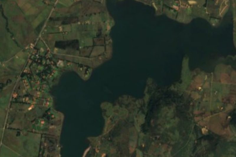
Outside town is the Basilio Vadillo reservoir, known as Las Piedras, with boat rides, sport fishing and kayaking, as well as La Compuerta, a swimming spot with shaded grills, and the Las Tres Peñas trail. The patron-saint festival of St Michael the Archangel runs ten days around the last week of October. Bullfights have been held since 1986 during Easter Week, and on 6 January the Fiesta del Mono starts with the sharing of the Three Kings bread.
How to get to Ejutla
Drive from Autlán: 45 min, 37 km
Ejutla is in the Sierra de Amula, in southwest Jalisco, between Unión de Tula, El Grullo and El Limón. By road it is about 21 km (roughly 32 minutes by car) from Ejutla to Unión de Tula; El Grullo is about 12 km and El Limón about 23 km as the crow flies. From Guadalajara, plan on about three hours by car. There are no published schedules for a direct bus; buses to Guadalajara leave from Autlán about every two hours, and Unión de Tula and El Grullo are the nearest places to connect. Tapalpa, the nearest Pueblo Mágico, is about 42 km away in a straight line.
Directions to Ejutla on Google Maps
Distances are in a straight line; the road is usually longer.
Links open a partner site. We may earn a commission if you book, at no cost to you.
From the nearest cities to Ejutla
- Autlán · 37 km by road, 45 min
- Ciudad Guzmán · 109 km by road, 2 h 5 min
- Tecomán · about 150 km by road, ~2 h 10 min
Drive times by road from OpenStreetMap, without traffic or stops. Times marked ~ are estimated from the straight-line distance.
Before you go to Ejutla: hours, prices and tips
- Best season
- Patron-saint festival of San Miguel Arcángel, ten days around the last week of October; bullfights during Easter Week; Fiesta del Mono on 6 January; posadas in December. EcuRed · checked Oct 2026
Hours and prices change, especially around holidays. Each fact links to where we checked it.
Visiting Ejutla: what to see and do
Parish church of San Miguel, with two towers and a large dome, on the main plaza
Convent of the Madres Adoratrices, from the 16th century
Cristo Rey (1975), a statue by Luis Larios on an octagonal chapel
Basilio Vadillo reservoir (Las Piedras): boats, fishing and kayaking
La Compuerta and the Las Tres Peñas trail
Plan your trip
Places to stay in Ejutla
Compare hotels, posadas, and rentals in and around Ejutla.
Tours & activities
Day trips around Tapalpa sometimes stop in Ejutla; a tour is the easy way to see it without a car.
Rental cars
Pick up a car at CLQ (Colima): about 2 h by road to Tapalpa, then 42 km more to Ejutla, on your own schedule.
Flights
The nearest airport with scheduled flights is Colima (CLQ), about 2 h by road from Tapalpa, the base for Ejutla.
Mobile data
Signal can drop away from Tapalpa: download a map of the way to Ejutla before you set out, or carry an eSIM with data.
Links open a partner site. We may earn a commission if you book, at no cost to you.
When to go to Ejutla mild
Ejutla shares the climate of Tapalpa, 42 km away. The best months to visit are January, March, April, and November.
See the month-by-month climate of Tapalpa
Weather in Ejutla now and the next 7 days
Live forecast from Open-Meteo. Chance of rain is the day's highest.
The closest Pueblo Mágico: Tapalpa

Tapalpa is the Pueblo Mágico closest to Ejutla, with places to stay, food, and more to see.
Also close to
Closest to Ejutla
-
El Limón · Town · 9 km away
-
El Grullo · Town · 12 km away
-
Autlán de Navarro · City · 26 km away
-
Tuxcacuesco · Village · 30 km away
-
Ayutla · Town · 31 km away
-
Tenamaxtlán · Town · 35 km away
-
Chiquilistlán · Town · 37 km away
-
Tamazulita · Village · 39 km away


Near Ejutla



Drive times by road from OpenStreetMap, without traffic. Times marked ~ are estimated from the straight-line distance.
Location from OpenStreetMap. Written by Puebloteca.