
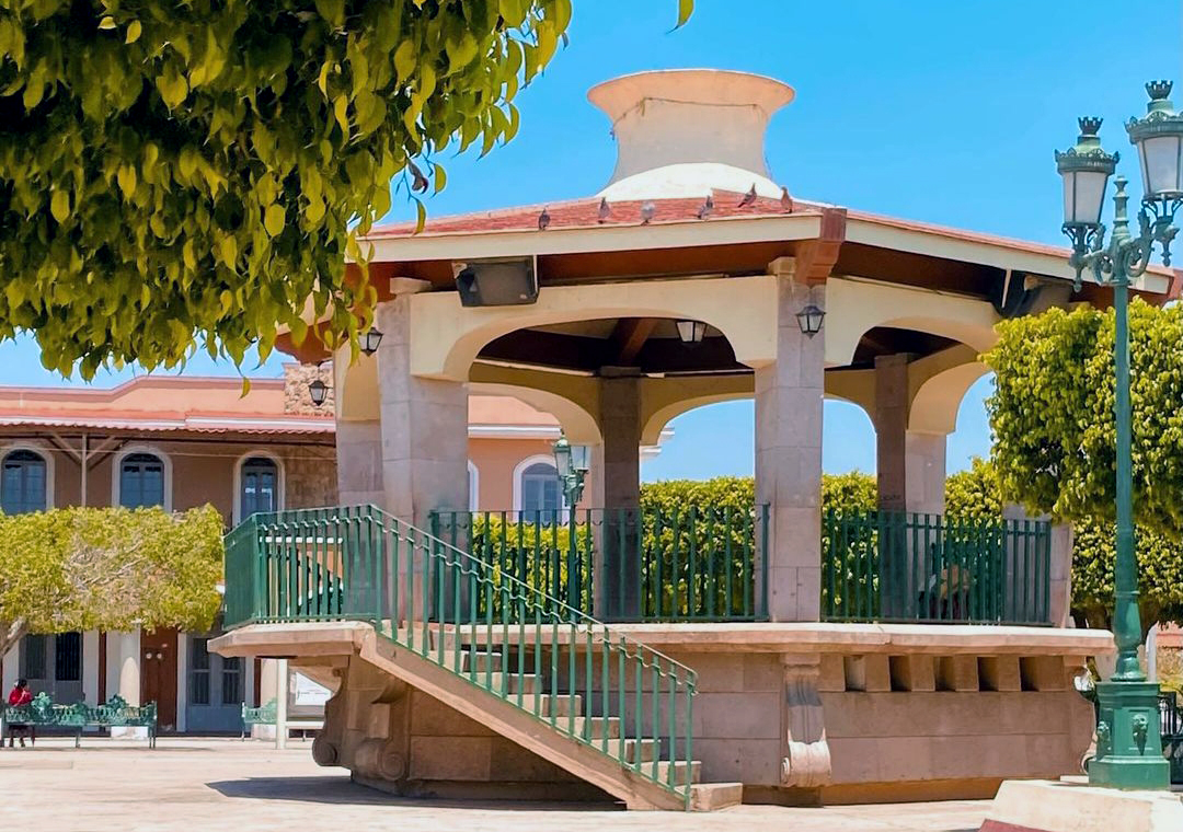
Town Zapotiltic, Jalisco
Southern Jalisco town whose name means "place of black zapotes", with haciendas, hot-spring spas, Presa del Calaque and thirteen-day May fiestas.
From Ciudad Guzmán: 15 min by car (14 km by road) How to get there ↓
Near here
See everything nearby ↓


Plan your visit to Zapotiltic
Where to stay near Zapotiltic
Compare hotels, posadas and guest houses in Zapotiltic.
Tours to Zapotiltic
Day trips around Sayula sometimes stop in Zapotiltic; a tour is the easy way to see it without a car.
How to get to Zapotiltic
- From Ciudad Guzmán: about 15 min by road (~14 km)
- Nearest airport: Colima (CLQ), 1 h 14 min by car to Sayula
Links open a partner site. We may earn a commission if you book, at no cost to you.
About Zapotiltic
Zapotiltic is the seat of the municipality of the same name in southern Jalisco, at about 1,300 metres above sea level. At the 2020 census the town had 27,260 people and the municipality 33,713. The name comes from Nahuatl and is interpreted as "place of black zapotes". Before the conquest it was ruled by the cacique Tlamazollan and its people took part in the so-called Guerra del Salitre; in colonial times it belonged to the Provincia de Ávalos and was a crossroads for goods moving between Colima and the coast. The local church was built in 1629. In 1936 the Municipal Palace was seized on state orders in a violent episode in which mayor Cayetano Vega and his brother were killed.
The economy combines maize, sorghum, jícama and sugar cane with lime, cement and marmolina; there is a Cementos Tolteca plant, now part of Cemex. Sights include the parish of the Señor del Perdón, the main garden, the Acueducto, the Torreón, the former Huescalapa hacienda with its arcades and the Hacienda del Rincón, a former sugar mill. There are hot-spring spas at Agua Caliente and El Cortijo, El Salvial park, known as Parque de las Piedras, and the Calaque dam in the Sierra del Tigre for ecotourism. Mountain biking is very popular.
The May fiestas are the most important: they begin 28 days after Easter Sunday, last thirteen days and bring pilgrimages to the temple of the Señor del Perdón; they include charrería, cockfights and a parade of floats. On 15 September the Bajada de los Arbolitos comes down from El Lindero and El Pueblito. People eat birria de chivo, with garapiñado peanuts and walnut palanqueta for sweets; pomegranate punch is the typical drink.
How to get to Zapotiltic
Drive from Ciudad Guzmán: 15 min, 14 km
Zapotiltic is about 135 km from Guadalajara (roughly 1 h 40 min by car) on the Guadalajara-Ciudad Guzmán-Jiquilpan highway, a few kilometres from Ciudad Guzmán. By bus you go through Ciudad Guzmán: Primera Plus leaves the Nueva Central Camionera in Guadalajara (module 1) hourly, about 2 hours, to the Central de Autobuses Zapotlán (Avenida Miguel de la Madrid). From there, Sur de Jalisco runs to Zapotiltic in about 35 minutes, with departures roughly every 4 hours; timetables are at surdejalisco.com.mx. From Colima, Elite, Futura and other lines reach Ciudad Guzmán in about 1 h 10 min, with the same transfer. Aggregator timetables may be out of date, so confirm with the line.
Directions to Zapotiltic on Google Maps
Distances are in a straight line; the road is usually longer.
Links open a partner site. We may earn a commission if you book, at no cost to you.
From the nearest cities to Zapotiltic
- Ciudad Guzmán · 14 km by road, 15 min
- Colima · 68 km by road, 1 h
- Tecomán · 114 km by road, 1 h 40 min
Drive times by road from OpenStreetMap, without traffic or stops. Times marked ~ are estimated from the straight-line distance.
Before you go to Zapotiltic: hours, prices and tips
- Best season
- May fiestas (13 days, starting 28 days after Easter Sunday); Bajada de los Arbolitos on 15 September; Guadalupe pilgrimages on 12 December; Cristo Rey at El Rincón in November; pilgrimage to Huescalapa for the Santo Niño de Atocha every Monday. Wikipedia (Municipio de Zapotiltic) · checked Oct 2026
Hours and prices change, especially around holidays. Each fact links to where we checked it.
Visiting Zapotiltic: what to see and do
Visit the parish of the Señor del Perdón and the main garden.
See the former Huescalapa hacienda and the Hacienda del Rincón, a former sugar mill.
Soak at the Agua Caliente or El Cortijo spas.
Head to the Calaque dam in the Sierra del Tigre or to El Salvial park (Parque de las Piedras).
Eat birria de chivo and try pomegranate punch and walnut palanqueta.
Come for the May fiestas or the Bajada de los Arbolitos on 15 September.
Plan your trip
Places to stay in Zapotiltic
Compare hotels, posadas, and rentals in and around Zapotiltic.
Tours & activities
Day trips around Sayula sometimes stop in Zapotiltic; a tour is the easy way to see it without a car.
Rental cars
Pick up a car at CLQ (Colima): about 1 h 14 min by road to Sayula, then 35 km more to Zapotiltic, on your own schedule.
Flights
The nearest airport with scheduled flights is Colima (CLQ), about 1 h 14 min by road from Sayula, the base for Zapotiltic.
Mobile data
Signal can drop away from Sayula: download a map of the way to Zapotiltic before you set out, or carry an eSIM with data.
Links open a partner site. We may earn a commission if you book, at no cost to you.
When to go to Zapotiltic mild
Zapotiltic shares the climate of Sayula, 35 km away. The best months to visit are January, March, November, and December.
See the month-by-month climate of Sayula
Weather in Zapotiltic now and the next 7 days
Live forecast from Open-Meteo. Chance of rain is the day's highest.
The closest Pueblo Mágico: Sayula

Sayula is the Pueblo Mágico closest to Zapotiltic, with places to stay, food, and more to see.
Also close to
Closest to Zapotiltic
-
Tuxpan · Town · 9 km away
-
Tamazula de Gordiano · Town · 18 km away
-
Nevado de Colima · Mountain · 21 km away
-
Tecalitlán · Town · 21 km away
-
Volcán de Colima · Mountain · 25 km away
-
Tonila · Town · 28 km away
-
Quesería · Town · 31 km away
-
La Garita · Village · 35 km away


Near Zapotiltic





Drive times by road from OpenStreetMap, without traffic. Times marked ~ are estimated from the straight-line distance.
Location from OpenStreetMap. Written by Puebloteca.