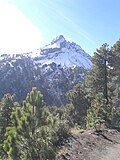

Mountain Tuxpan, Jalisco Colima and its volcanoes
The higher, long-extinct twin of the Volcán de Fuego, about 4,260 m and sometimes snow-capped; its summit lies in Tuxpan, Jalisco, reached from Ciudad Guzmán.
From Ciudad Guzmán: 1 h 10 min by car (36 km by road) How to get there ↓
Near here
See everything nearby ↓


Plan your visit to Nevado de Colima
Where to stay near Nevado de Colima
Compare hotels, posadas and guest houses in Nevado de Colima.
Tours to Nevado de Colima
Day trips and guided outings from Comala often include Nevado de Colima; with a local guide you can get there without a car.
 Nevado de Colima Day Trip
From US$402
How to get to Nevado de Colima
- From Ciudad Guzmán: about 1 h 10 min by road (~36 km)
- Nearest airport: Colima (CLQ), 32 min by car to Comala
Links open a partner site. We may earn a commission if you book, at no cost to you.
Popular tours to Nevado de Colima


Tours, prices and ratings from Viator, checked weekly. We may earn a commission if you book.
About Nevado de Colima
The Nevado de Colima, also known by its Nahuatl name Tzapotépetl, is the older and higher of the two volcanoes that close off the north of the Colima valley. Its highest point, El Picacho, is usually given as about 4,260 m above sea level (some sources give a few metres more), which makes it Mexico's sixth-highest mountain. Despite its name, almost all of it lies in the state of Jalisco; it stands a few kilometres north of the very active Volcán de Colima, or Volcán de Fuego, and unlike its neighbour it shows no volcanic activity. Its eroded summit hides much of its history, but pyroclastic deposits from an enormous ancient eruption and debris avalanche have been found more than 80 km from the crater.
Both peaks are protected by the Parque Nacional Volcán Nevado de Colima, decreed by President Lázaro Cárdenas on 5 September 1936 and redrawn in 1940; since 1997 it has been managed by the governments of Jalisco and Colima, and about 89 percent of it lies in Jalisco, in the municipalities of Zapotitlán de Vadillo, Tuxpan and Tonila, with the rest in Comala and Cuauhtémoc in Colima. The slopes are covered in forests of pine, fir and oak, which give way above about 4,000 m to high-mountain grassland (zacatonal) and mosses. Pumas, white-tailed deer, coyotes and collared peccaries live here, and more than a hundred bird species have been recorded; the red warbler, a bird found only in Mexico, is the park's symbol.
The mountain is the usual high-altitude outing of western Mexico. A dirt road climbs from the Ciudad Guzmán side through the forest to the La Joya area, with cabins, picnic tables and official campsites, and on to antennas near 4,000 m, the highest point cars can reach. From the La Joya base camp the walk to the summit takes about three and a half hours and needs good fitness; it is not technical in good weather, but conditions change fast, with snowstorms, strong wind and very cold nights. Snow is irregular and most likely in January and February, and the first snowfall draws big crowds: on 18 January 2026 Jalisco's civil protection closed the park to more cars after 200 vehicles had entered by 6:15 in the morning.
How to get to Nevado de Colima
Drive from Ciudad Guzmán: 1 h 10 min, 36 km
The summit is reached from Jalisco, not from the city of Colima. From Ciudad Guzmán take the Ciudad Guzmán–El Grullo road and turn off at km 11 onto the Camino al Milanés, which climbs as a dirt and forest road through the park to La Joya, the only parking area inside the park; one account gives the drive from Guadalajara to the highest parking as about 3.5 hours, including about 1.5 hours from the park entrance. Only four-wheel-drive vehicles are allowed up, and there is no public transport.
Directions to Nevado de Colima on Google Maps
Distances are in a straight line; the road is usually longer.
Links open a partner site. We may earn a commission if you book, at no cost to you.
From the nearest cities to Nevado de Colima
- Ciudad Guzmán · 36 km by road, 1 h 10 min
- Colima · 103 km by road, 2 h
- Autlán · 131 km by road, 2 h 40 min
Drive times by road from OpenStreetMap, without traffic or stops. Times marked ~ are estimated from the straight-line distance.
Before you go to Nevado de Colima: hours, prices and tips
- Entry
- A recovery fee of about 60 pesos per person, paid at the entrance booth. México Desconocido · checked Oct 2026
- Best time of day
- Snow is rare and irregular; January and February are the most likely months to see it. Nights are very cold. Mexico News Daily · checked Oct 2026
- What to bring
- Nothing is sold in the park: bring water, food, thermal clothing, non-slip footwear and a bag for your rubbish, and check the forecast and official channels before leaving. Azteca Jalisco · checked Oct 2026
- Rules
- Only 4x4 or all-wheel-drive vehicles; no sedans, side-by-sides or quad bikes. La Joya parking takes about 200 vehicles a day; during snow operations entry is 7 am to noon, with exit from 1 pm, and the park may close when full or in bad weather. Semadet Jalisco · checked Oct 2026
Hours and prices change, especially around holidays. Each fact links to where we checked it.
Visiting Nevado de Colima: what to see and do
Hike from the La Joya base camp to the summit, about three and a half hours up.
Look across to the smoking cone of the Volcán de Fuego, the most active volcano in Mexico.
Camp at the official sites of La Joya, La Caperuza, Curva del Leñador or La Calle.
Walk among the very tall firs and pines of the Valle de los Gigantes trail.
Watch for the red warbler, the park's symbol, in the high forest.
Plan your trip
Places to stay in Nevado de Colima
Compare hotels, posadas, and rentals in and around Nevado de Colima.
Tours & activities
Day trips and guided outings from Comala often include Nevado de Colima; with a local guide you can get there without a car.
Rental cars
Pick up a car at CLQ (Colima): about 32 min by road to Comala, then 31 km more to Nevado de Colima, on your own schedule.
Flights
The nearest airport with scheduled flights is Colima (CLQ), about 32 min by road from Comala, the base for Nevado de Colima.
Travel insurance
If you plan on hiking at altitude at Nevado de Colima, check that your policy covers it: some plans leave adventure activities out.
Mobile data
Signal can drop away from Comala: download a map of the way to Nevado de Colima before you set out, or carry an eSIM with data.
Links open a partner site. We may earn a commission if you book, at no cost to you.
When to go to Nevado de Colima warm
Nevado de Colima shares the climate of Comala, 31 km away. The best months to visit are January, February, November, and December.
For the clearest views from Nevado de Colima, go in the driest months (March, April, May, and December); in the rains, clouds tend to build up by midday.
See the month-by-month climate of Comala
Weather in Nevado de Colima now and the next 7 days
Live forecast from Open-Meteo. Chance of rain is the day's highest.
The closest Pueblo Mágico: Comala

Comala is the Pueblo Mágico closest to Nevado de Colima, with places to stay, food, and more to see.
Also close to
Closest to Nevado de Colima
-
Volcán de Colima · Mountain · 6 km away
-
Laguna La María · Lake · 16 km away
-
Copala · Village · 18 km away
-
Laguna Carrizalillos · Lake · 18 km away
-
Tonila · Town · 18 km away
-
Zapotiltic · Town · 21 km away
-
Zapotitlán de Vadillo · Village · 22 km away
-
Suchitlán · Town · 24 km away


Near Nevado de Colima


Drive times by road from OpenStreetMap, without traffic. Times marked ~ are estimated from the straight-line distance.
Lists with Nevado de Colima
Mountains in Jalisco · 6Location from OpenStreetMap. Written by Puebloteca.