Town Tomatlán, Jalisco
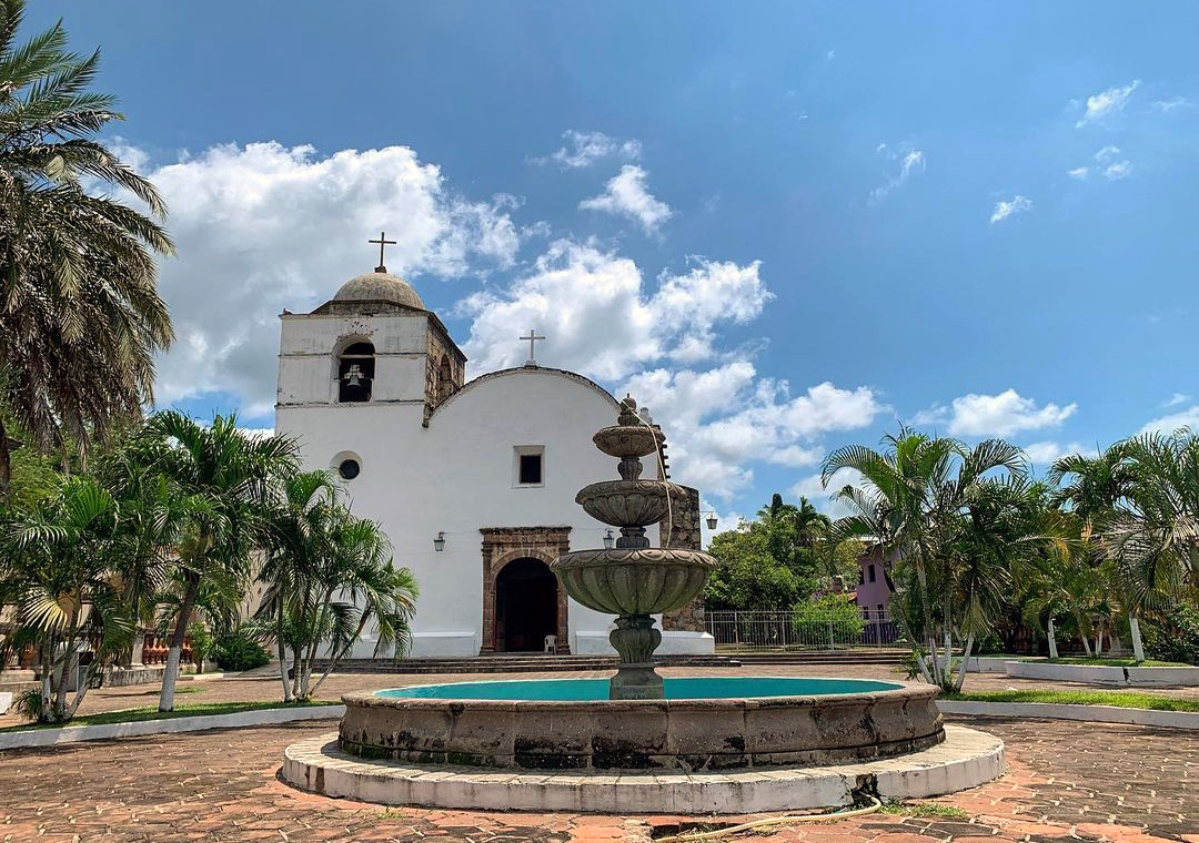
Costalegre farm town with a Franciscan church of 1.5 m walls; a base for Cajón de Peña lake and undeveloped beaches.
From Puerto Vallarta: about 1 h 30 min by road (~100 km) How to get there ↓
Near here
See everything nearby ↓



Plan your visit to Tomatlán
Where to stay near Tomatlán
Compare hotels, posadas and guest houses in Tomatlán.
Tours to Tomatlán
Day trips around Talpa de Allende sometimes stop in Tomatlán; a tour is the easy way to see it without a car.
 Los Arcos Half-Day Snorkeling & 6 Hidden Beaches Tour
★ 5.0 (253) · From US$55
How to get to Tomatlán
- From Puerto Vallarta: about 1 h 30 min by road (~100 km)
- Nearest airport: Puerto Vallarta (PVR), 2 h 23 min by car to Talpa de Allende
Links open a partner site. We may earn a commission if you book, at no cost to you.
Popular tours to Tomatlán


Tours, prices and ratings from Viator, checked weekly. We may earn a commission if you book.
About Tomatlán
Tomatlán is the seat of a municipality covering some 3,015 km² of the Jalisco coast, and sits in a valley about 42 metres above sea level, inland from the Costalegre beaches. It had 9,842 people in 2020. The name means place of tomatoes, after a small wild tomatillo with sweet-sour clusters that grew all over the area. Tradition says a Nahua group came down from the Sierra del Nayar and settled the valley around 1324.
Spanish conquerors rode in from El Tuito on Holy Monday 1525, spent Easter here and raised a first church on the site of the native shrine. The region rebelled in 1541, and Pedro de Alvarado had to march from Manzanillo twice to put it down. Tomatlán was granted the title of pueblo on January 15, 1752, and had a town council by 1825. In October 1811 the insurgent Miguel Gallaga, a nephew of Hidalgo, was shot in front of the church of Santo Santiago.
That church, the parish of Santiago Apóstol, is the town's main sight: Franciscan in origin, with stone walls up to 1.5 m thick and bell towers you can climb, about 50 steps up. The municipality lives from cattle, mangoes, papaya, plantains and sesame, and holds Jalisco's main salt flats. Inland is the Cajón de Peña dam, built in 1976 and the largest reservoir in the state, with bass fishing and cabins; towards the sea lie barely developed beaches such as Chalacatepec, with a turtle camp, Majahuas and Peñitas. Tomatlán is also where Pi's lifeboat comes ashore at the end of Life of Pi.
How to get to Tomatlán
Tomatlán is on Federal Highway 200, the coast road between Puerto Vallarta and Manzanillo. From Puerto Vallarta it is 1 h 30 min south by car (101 km by road), through El Tuito; Sayulita, the nearest Pueblo Mágico, is 2 h 15 min away (157 km). By bus, Primera Plus and Autocamiones del Pacífico run from Puerto Vallarta to Tomatlán several times a day, roughly every 4 hours; the trip takes about 2 h 30 min and cost around 200 pesos in August 2023. The Central de Autobuses in Tomatlán is open 5 am to 11 pm, with four buses a day to Puerto Vallarta and to Manzanillo and two to Guadalajara (3 pm and 10 pm). The nearest airports with commercial flights are Puerto Vallarta and Manzanillo.
Directions to Tomatlán on Google Maps
Distances are in a straight line; the road is usually longer.
Links open a partner site. We may earn a commission if you book, at no cost to you.
From the nearest cities to Tomatlán
- Puerto Vallarta · about 100 km by road, ~1 h 30 min
- Autlán · about 120 km by road, ~1 h 50 min
- Manzanillo · about 180 km by road, ~2 h 40 min
Drive times by road from OpenStreetMap, without traffic or stops. Times marked ~ are estimated from the straight-line distance.
Visiting Tomatlán: what to see and do
Climb the bell towers of the Santiago Apóstol parish church, with stone walls 1.5 m thick.
Eat seafood on Calle Galeana or birria with handmade tortillas on Calle Constitución.
Head to Cajón de Peña lake for bass fishing or a night in a cabin.
Visit the sea turtle camp at Chalacatepec beach.
Camp at Majahuas beach, packed with local families over Easter week.
Swim in the calm water at Peñitas de Acosta or look for the petroglyphs at Playa Peñitas.
Plan your trip
Places to stay in Tomatlán
Compare hotels, posadas, and rentals in and around Tomatlán.
Tours & activities
Day trips around Talpa de Allende sometimes stop in Tomatlán; a tour is the easy way to see it without a car.
Rental cars
Pick up a car at PVR (Puerto Vallarta): about 2 h 23 min by road to Talpa de Allende, then 66 km more to Tomatlán, on your own schedule.
Flights
The nearest airport with scheduled flights is Puerto Vallarta (PVR), about 2 h 23 min by road from Talpa de Allende, the base for Tomatlán.
Mobile data
Signal can drop away from Talpa de Allende: download a map of the way to Tomatlán before you set out, or carry an eSIM with data.
Links open a partner site. We may earn a commission if you book, at no cost to you.
When to go to Tomatlán mild
Tomatlán shares the climate of Talpa de Allende, 66 km away. The best months to visit are January, March, November, and December.
See the month-by-month climate of Talpa de Allende
Weather in Tomatlán now and the next 7 days
Live forecast from Open-Meteo. Chance of rain is the day's highest.
The closest Pueblo Mágico: Talpa de Allende

Talpa de Allende is the Pueblo Mágico closest to Tomatlán, with places to stay, food, and more to see.
Also close to
- Mascota · Jalisco · 80 km away
Closest to Tomatlán
-
El Tuito · Town · 43 km away
-
Ipala · Village · 44 km away
-
Villa del Mar · Village · 45 km away
-
Rancho Primavera · Nature reserve · 46 km away
-
Tehuamixtle · Village · 47 km away
-
Xametla · Beach · 48 km away
-
El Negrito · Beach · 49 km away
-
Mayto · Beach · 49 km away


Near Tomatlán

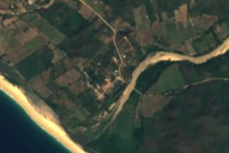




Drive times by road from OpenStreetMap, without traffic. Times marked ~ are estimated from the straight-line distance.
Location from OpenStreetMap. Written by Puebloteca.