Mountain San Jerónimo Tecuanipan, Puebla Municipality of San Jerónimo Tecuanipan Volcano Route Puebla Valley
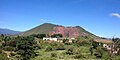
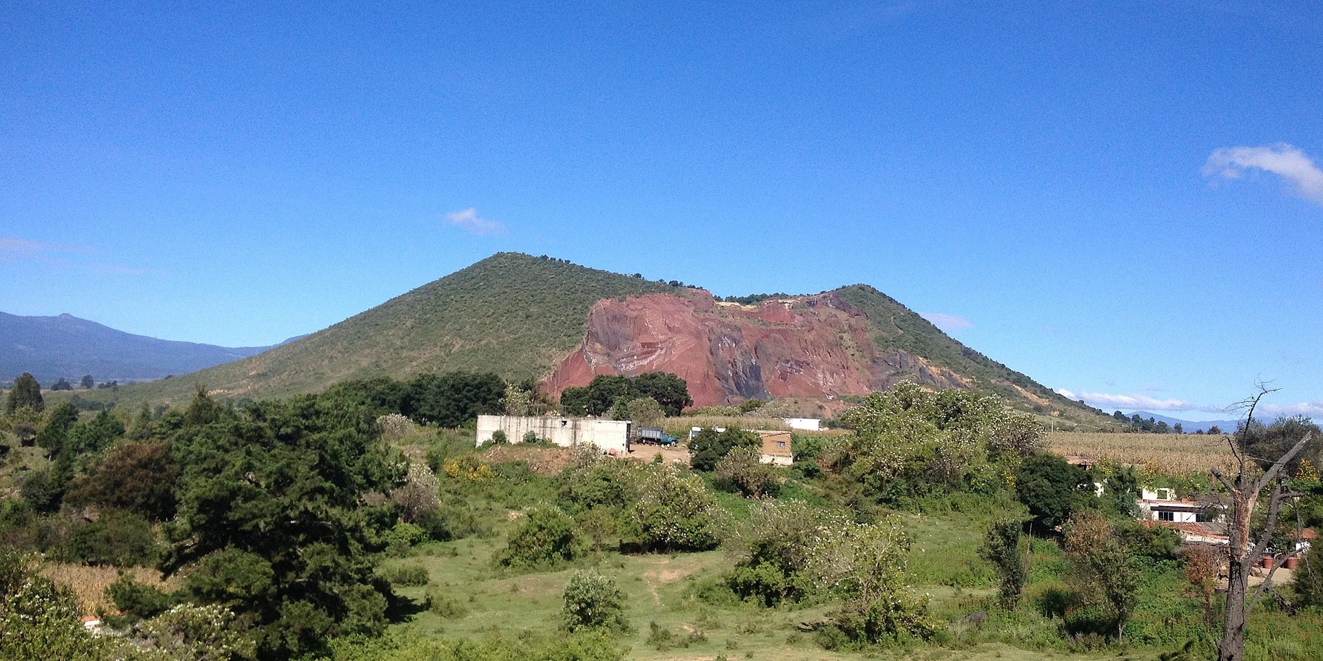
A 2,460 m cinder cone by San Miguel Papaxtla in the Puebla valley; a short, steep path climbs to its crater and two peaks.
From Atlixco: 35 min by car (25 km by road) How to get there ↓
Near here
See everything nearby ↓



Plan your visit to Tecajete
Where to stay near Tecajete
Compare hotels, posadas and guest houses in Tecajete.
Tours to Tecajete
Day trips and guided outings from Cholula often include Tecajete; with a local guide you can get there without a car.
 Tours from Atlixco
Atlixco Volcano Views Popocatépetl Tour Forest Route
From US$108
How to get to Tecajete
- From Atlixco: about 35 min by road (~25 km)
- Nearest airport: Puebla (PBC), 16 min by car to Cholula
Links open a partner site. We may earn a commission if you book, at no cost to you.
Tours from Atlixco, near Tecajete
Tours, prices and ratings from Viator, checked weekly. We may earn a commission if you book.
About Tecajete
Tecajete is a 2,460 m volcanic hill in the north of the municipality of San Jerónimo Tecuanipan, close to the borders with Calpan and San Pedro Cholula. The village of San Miguel Papaxtla wraps around its south-east side. The name comes from the Nahuatl tecaxic, "in the stone bowl", after its bowl-shaped crater. It is modest next to the volcanoes ringing the Puebla-Tlaxcala valley, but because it rises from the flattest part of the valley it can be seen from far around.
It is a textbook cinder cone, a steep volcano of loose fragments with a wide crater, unlike Cerro Zapotecas, which is a shield volcano, or the hills of the Nealtican lava field. Around the 1940s or 1950s people from Papaxtla bought it and began digging out its tezontle, the red volcanic stone. Today there are three quarries, on the north-west, north and east slopes, which give it a broken look, especially from the Puebla city side. The quarrying is loosely controlled, since the local council largely follows traditional self-government, and has caused environmental damage and at least one death.
Even so, it holds the municipality's only woodland, with Chihuahua pine, yellow trumpetbush, hopbush, morning-glory trees and madrone. Although it is private land, villagers use it for walks and grazing. A short but steep path climbs to the old crater and its two peaks, the southern one the higher, where a small altar to the Sacred Heart remembers a Puebla family who went missing while climbing the hill.
How to get to Tecajete
Drive from Atlixco: 35 min, 25 km
Tecajete stands beside San Miguel Papaxtla in San Jerónimo Tecuanipan, west of Cholula. Cholula is about 9 km away in a straight line, roughly 10 to 15 minutes by car, and central Puebla about 20 km, roughly 25 minutes. The path starts from the village side; it is short but steep, with loose stone. The hill is private land with working tezontle quarries on three slopes: keep well away from the quarry faces.
Directions to Tecajete on Google Maps
Distances are in a straight line; the road is usually longer.
Links open a partner site. We may earn a commission if you book, at no cost to you.
From the nearest cities to Tecajete
- Atlixco · 25 km by road, 35 min
- Puebla · 26 km by road, 35 min
- San Martín Texmelucan · 28 km by road, 35 min
Drive times by road from OpenStreetMap, without traffic or stops. Times marked ~ are estimated from the straight-line distance.
Before you go to Tecajete: hours, prices and tips
- Rules
- It is private land with working tezontle quarries; stay away from the quarry edges. Wikipedia · checked Oct 2026
Hours and prices change, especially around holidays. Each fact links to where we checked it.
Visiting Tecajete: what to see and do
The old bowl-shaped crater.
The two peaks; the southern one is the higher.
The altar to the Sacred Heart on top.
The view over the Puebla valley and the volcanoes around it.
The pine and madrone woodland, the only one in the municipality.
Plan your trip
Places to stay in Tecajete
Compare hotels, posadas, and rentals in and around Tecajete.
Tours & activities
Day trips and guided outings from Cholula often include Tecajete; with a local guide you can get there without a car.
Rental cars
Pick up a car at PBC (Puebla): about 16 min by road to Cholula, then 9 km more to Tecajete, on your own schedule.
Flights
The nearest airport with scheduled flights is Puebla (PBC), about 16 min by road from Cholula, the base for Tecajete.
Travel insurance
If you plan on hiking at altitude at Tecajete, check that your policy covers it: some plans leave adventure activities out.
Mobile data
Signal can drop away from Cholula: download a map of the way to Tecajete before you set out, or carry an eSIM with data.
Links open a partner site. We may earn a commission if you book, at no cost to you.
When to go to Tecajete mild
Tecajete shares the climate of Cholula, 9 km away. The best months to visit are January, February, March, and December.
For the clearest views from Tecajete, go in the driest months (January, February, March, and December); in the rains, clouds tend to build up by midday.
See the month-by-month climate of Cholula
Weather in Tecajete now and the next 7 days
Live forecast from Open-Meteo. Chance of rain is the day's highest.
The closest Pueblo Mágico: Cholula

Cholula is the Pueblo Mágico closest to Tecajete, with places to stay, food, and more to see.
Also close to
- Huejotzingo · Puebla · 10 km away
- Atlixco · Puebla · 18 km away
- Ixtenco · Tlaxcala · 53 km away
- Huamantla · Tlaxcala · 57 km away
- Tlayacapan · Morelos · 63 km away
Closest to Tecajete
-
San Miguel Papaxtla · Village · 1 km away
-
San Francisco Cuapan · Village · 3 km away
-
San Buenaventura Nealtican · Village · 4 km away
-
Santa María Acuexcomac · Village · 4 km away
-
Cerro Zapotecas · Nature reserve · 5 km away
-
San Gregorio Zacapechpan · Village · 5 km away
-
Cháhuac · Village · 6 km away
-
Los Reyes Tlanechicolpan · Village · 6 km away


Near Tecajete





Drive times by road from OpenStreetMap, without traffic. Times marked ~ are estimated from the straight-line distance.
Lists with Tecajete
Mountains in Puebla · 8 Mountains near Cholula · 11 Mountains near Huejotzingo · 12 Mountains near Atlixco · 9 Mountains near Puebla · 10 Mountains near San Martín Texmelucan · 16 Mountains near Chiautempan · 13 Mountains near Huamantla · 11Location from OpenStreetMap. Written by Puebloteca.