Village Mariano Escobedo, Veracruz Altas Montañas (Orizaba and Córdoba)
Mountain village at 2,600 m on the slopes of Pico de Orizaba, Mariano Escobedo municipality; church of San Isidro Labrador. 35 min from Orizaba.
From Orizaba: 35 min by car (26 km by road) How to get there ↓
Near here
See everything nearby ↓


Plan your visit to San Isidro el Berro
Where to stay near San Isidro el Berro
Compare hotels, posadas and guest houses in San Isidro el Berro.
Tours to San Isidro el Berro
Day trips and guided outings from Orizaba often include San Isidro el Berro; with a local guide you can get there without a car.
How to get to San Isidro el Berro
- From Orizaba: about 35 min by road (~26 km)
- Nearest airport: Veracruz (VER), 1 h 42 min by car to Orizaba
Links open a partner site. We may earn a commission if you book, at no cost to you.
About San Isidro el Berro
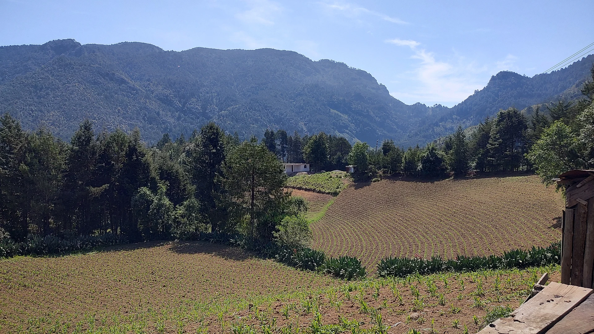
Driving up to El Berro, as it is known locally, you leave the Orizaba valley behind and enter another climate. The village sits about 2,600 metres above sea level on the southern foothills of Citlaltépetl, the Pico de Orizaba volcano, and the yearly average temperature is barely above 12 °C. Snow is still rare: the heaviest fall on record since 1970 was a single centimetre on 5 March 1987. Around it are forests of ayacahuite (Mexican white pine) and ocozote (sweetgum), and fields worked into the slopes.
The full name honours its patron, Saint Isidore the Farmer, protector of country people, and the village church is dedicated to him. It has grown fast, from 876 people in 2005 to 1,219 in 2010 and 1,645 in 2020, and is now the sixth largest of the municipality's 50 localities. It is also one of the most isolated: in 2020 only one house in three had a mobile phone and almost none had internet, so do not count on a signal.
Mariano Escobedo, called Jesús María until 1932, covers the mountainous country between Orizaba and the Puebla state line. The high fields grow maize, beans, wheat, peas, potatoes and broad beans, and the streams coming down from the volcano feed the Río Blanco. In the municipal seat, the feast of Saint Joseph from 19 to 21 March brings processions, a fair and the dance of the Twelve Peers of France.
How to get to San Isidro el Berro
Drive from Orizaba: 35 min, 26 km
From central Orizaba, the nearest Pueblo Mágico, it is about 26 km and roughly 35 minutes of climbing: leave north along Calle Norte 8 and take the Camino Viejo a Mariano Escobedo; past the Ocoxotla area, mountain roads continue through Las Camelias and El Tuzal up to El Berro. It is a winding, steep drive, best done in daylight. Long-distance buses arrive in Orizaba; we found no published public transport routes or timetables to the village, so the practical options are to ask about colectivos in Orizaba or in the municipal seat, Mariano Escobedo, or to go up by car or taxi.
Directions to San Isidro el Berro on Google Maps
Distances are in a straight line; the road is usually longer.
Links open a partner site. We may earn a commission if you book, at no cost to you.
From the nearest cities to San Isidro el Berro
- Orizaba · 26 km by road, 35 min
- Córdoba · 48 km by road, 55 min
- Tehuacán · 94 km by road, 1 h 15 min
Drive times by road from OpenStreetMap, without traffic or stops. Times marked ~ are estimated from the straight-line distance.
Visiting San Isidro el Berro: what to see and do
The church of San Isidro Labrador.
Views of the slopes of Pico de Orizaba.
Mexican white pine forest and hillside plots of potatoes, broad beans and maize.
The feast of Saint Joseph in Mariano Escobedo, 19 to 21 March, with the dance of the Twelve Peers of France.
Plan your trip
Places to stay in San Isidro el Berro
Compare hotels, posadas, and rentals in and around San Isidro el Berro.
Tours & activities
Day trips and guided outings from Orizaba often include San Isidro el Berro; with a local guide you can get there without a car.
Rental cars
Pick up a car at VER (Veracruz): about 1 h 42 min by road to Orizaba, then 14 km more to San Isidro el Berro, on your own schedule.
Flights
The nearest airport with scheduled flights is Veracruz (VER), about 1 h 42 min by road from Orizaba, the base for San Isidro el Berro.
Mobile data
Signal can drop away from Orizaba: download a map of the way to San Isidro el Berro before you set out, or carry an eSIM with data.
Links open a partner site. We may earn a commission if you book, at no cost to you.
When to go to San Isidro el Berro mild
San Isidro el Berro shares the climate of Orizaba, 14 km away. The best months to visit are February, March, April, and December.
See the month-by-month climate of Orizaba
Weather in San Isidro el Berro now and the next 7 days
Live forecast from Open-Meteo. Chance of rain is the day's highest.
The closest Pueblo Mágico: Orizaba

Orizaba is the Pueblo Mágico closest to San Isidro el Berro, with places to stay, food, and more to see.
Also close to
- Coscomatepec · Veracruz · 23 km away
- Córdoba · Veracruz · 29 km away
- Xico · Veracruz · 59 km away
- Coatepec · Veracruz · 64 km away
Closest to San Isidro el Berro
-
Toluca · Village · 6 km away
-
Chilapa · Village · 9 km away
-
Atzitzintla · Town · 13 km away
-
Laguna de Nogales · Lake · 13 km away
-
Pico de Orizaba · Mountain · 13 km away
-
Ciudad Mendoza · Town · 14 km away
-
San José Cuyachapa · Village · 14 km away
-
Cañón del Río Blanco · Nature reserve · 15 km away

Near San Isidro el Berro


Drive times by road from OpenStreetMap, without traffic. Times marked ~ are estimated from the straight-line distance.
Location from OpenStreetMap. Written by Puebloteca.