
Town Zumpango, Estado de México Municipality of Zumpango Valley of Mexico
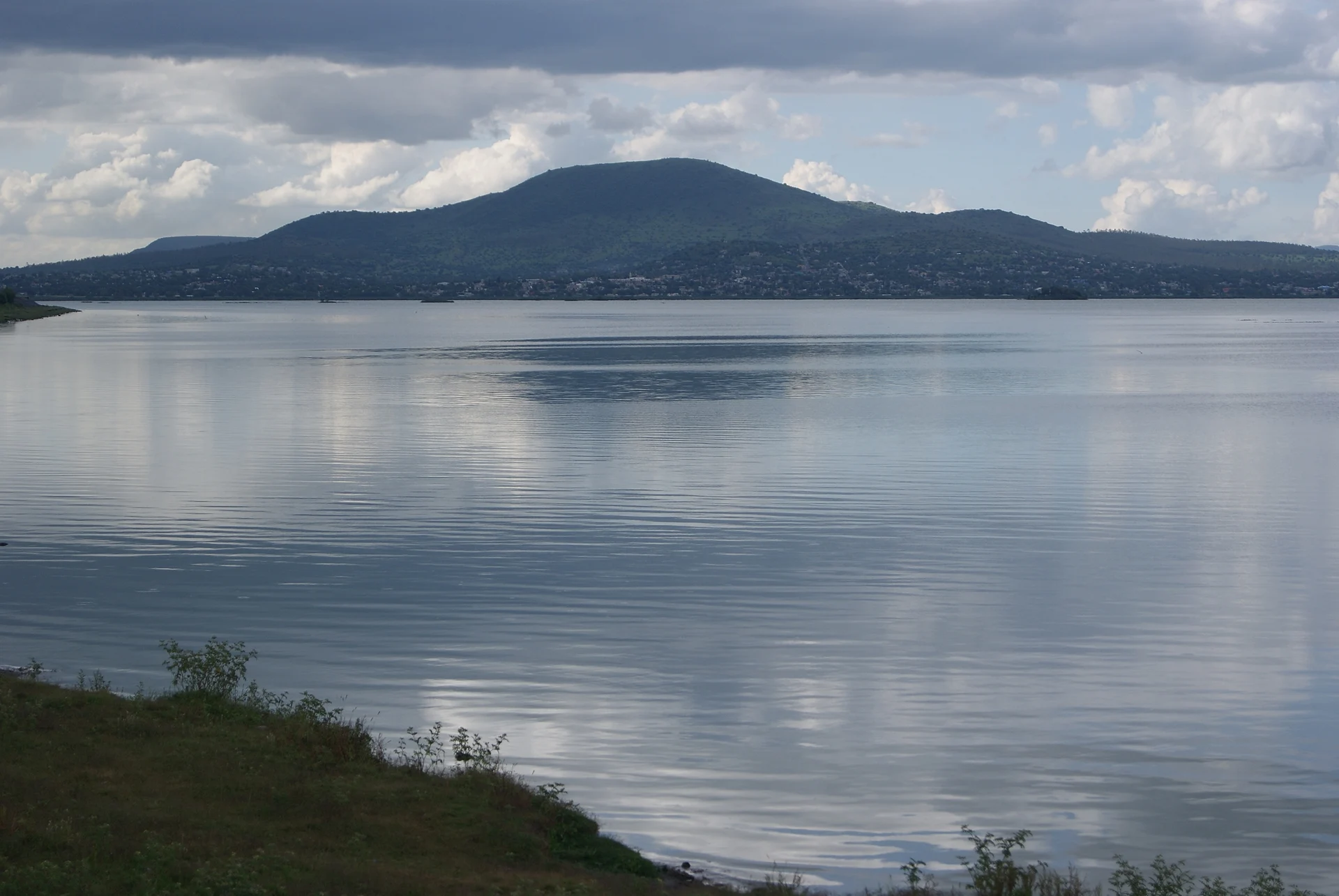
A Zumpango pueblo of 20,500 on the shore of the lagoon, with the parish of San Juan and the Cerro de la Estrella, the municipality's high point.
From Pachuca: 55 min by car (61 km by road) How to get there ↓
Near here
See everything nearby ↓


Plan your visit to San Juan Zitlaltepec
Where to stay near San Juan Zitlaltepec
Compare hotels, posadas and guest houses in San Juan Zitlaltepec.
Tours to San Juan Zitlaltepec
Day trips around Tepotzotlán sometimes stop in San Juan Zitlaltepec; a tour is the easy way to see it without a car.
 Tours from Zacatlan
Zacatlán Guided Tour walking through the Center
★ 5.0 (2) · From US$8
How to get to San Juan Zitlaltepec
- From Pachuca: about 55 min by road (~61 km)
- Nearest airport: Mexico City (Felipe Ángeles) (NLU), 48 min by car to Tepotzotlán
Links open a partner site. We may earn a commission if you book, at no cost to you.
Tours from Zacatlan, near San Juan Zitlaltepec
Tours, prices and ratings from Viator, checked weekly. We may earn a commission if you book.
About San Juan Zitlaltepec
San Juan Zitlaltepec is the second-largest locality in the municipality of Zumpango: 20,537 people in 2020, up from 19,600 in 2010. It lies about 5 km west of Zumpango de Ocampo, at 2,280 m, in the north of the Valley of Mexico. The name is Nahuatl and means "hill of the star", and the hill exists: the Cerro de la Estrella (or Guaytepeque), around 2,650 m, is the municipality's high point and stands some 4 km north of the village. It has a parish church of San Juan and is also an ejido.
Zitlaltepec is one of the shoreline villages of the Zumpango lagoon, a remnant of the valley's old lake system. From the 17th century its water was drained towards the Tula river; in 1989 Conagua refilled it as a regulating reservoir, and after pressure from the shore villages, this one among them, better-quality water went in during 1990-1991. Today there are boat rides to an island with an image of the Virgin of Guadalupe, and every 12 December a procession of decorated boats. The lagoon is unreliable: in September 2023 it almost dried out and was covered by water hyacinth, and the rains brought back part of the water.
In the municipality, fireworks castles are a craft and drive the patron-saint feasts. The climate is semi-arid and cool: 15 °C on average, about 680 mm of rain a year, July the wettest month.
How to get to San Juan Zitlaltepec
Drive from Pachuca: 55 min, 61 km
Zitlaltepec is about 5 km west of Zumpango de Ocampo and about 42 km in a straight line from central Mexico City, roughly 50 minutes to a little over an hour by car depending on traffic. The municipality is reached by the Circuito Exterior Mexiquense and by state roads; the AIFA airport is about 8 km from the city of Zumpango. Tepotzotlán, the nearest pueblo, is about 13 km as the crow flies.
By public transport: Zumpango has intercity combis, colectivos to the Mexibús, the Tren Suburbano and the Metro, and buses with terminals in Mexico City and Pachuca. There is no published published direct route to Zitlaltepec; the simplest way is to reach Zumpango de Ocampo and continue by taxi or combi.
Directions to San Juan Zitlaltepec on Google Maps
Distances are in a straight line; the road is usually longer.
Links open a partner site. We may earn a commission if you book, at no cost to you.
From the nearest cities to San Juan Zitlaltepec
- Pachuca · 61 km by road, 55 min
- Mexico City · 53 km by road, 1 h
- Tulancingo · 106 km by road, 1 h 30 min
Drive times by road from OpenStreetMap, without traffic or stops. Times marked ~ are estimated from the straight-line distance.
Before you go to San Juan Zitlaltepec: hours, prices and tips
- Best season
- The lagoon's level swings widely: it almost dried out in September 2023 and partly refilled with the rains. Ask beforehand whether boats are running. Wikipedia (es): Laguna de Zumpango · checked Oct 2026
Hours and prices change, especially around holidays. Each fact links to where we checked it.
Visiting San Juan Zitlaltepec: what to see and do
The parish church of San Juan in the middle of the village.
The Zumpango lagoon and the boat rides to the island of the Virgin of Guadalupe.
The procession of decorated boats on 12 December.
The lagoon's birds, with over 90 species recorded in recent studies.
The Cerro de la Estrella, about 4 km to the north.
Plan your trip
Places to stay in San Juan Zitlaltepec
Compare hotels, posadas, and rentals in and around San Juan Zitlaltepec.
Tours & activities
Day trips around Tepotzotlán sometimes stop in San Juan Zitlaltepec; a tour is the easy way to see it without a car.
Rental cars
Pick up a car at NLU (Mexico City (Felipe Ángeles)): about 48 min by road to Tepotzotlán, then 13 km more to San Juan Zitlaltepec, on your own schedule.
Flights
The nearest airport with scheduled flights is Mexico City (Felipe Ángeles) (NLU), about 48 min by road from Tepotzotlán, the base for San Juan Zitlaltepec.
Mobile data
Signal can drop away from Tepotzotlán: download a map of the way to San Juan Zitlaltepec before you set out, or carry an eSIM with data.
Links open a partner site. We may earn a commission if you book, at no cost to you.
When to go to San Juan Zitlaltepec cool
San Juan Zitlaltepec shares the climate of Tepotzotlán, 13 km away. The best months to visit are January, February, March, and December.
See the month-by-month climate of Tepotzotlán
Weather in San Juan Zitlaltepec now and the next 7 days
Live forecast from Open-Meteo. Chance of rain is the day's highest.
The closest Pueblo Mágico: Tepotzotlán

Tepotzotlán is the Pueblo Mágico closest to San Juan Zitlaltepec, with places to stay, food, and more to see.
Also close to
- Villa del Carbón · Estado de México · 34 km away
- Teotihuacán · Estado de México · 34 km away
- Otumba · Estado de México · 43 km away
- Jilotepec · Estado de México · 43 km away
- Zempoala · Hidalgo · 51 km away
Closest to San Juan Zitlaltepec
-
Santa María de Guadalupe · Village · 2 km away
-
Laguna de Zumpango · Lake · 5 km away
-
Zumpango de Ocampo · Town · 5 km away
-
Huehuetoca · Town · 6 km away
-
Santa Ana Nextlalpan · Town · 10 km away
-
El Dorado Huehuetoca · Town · 11 km away
-
Jorobas · Village · 11 km away
-
San Marcos Jilotzingo · Town · 11 km away


Near San Juan Zitlaltepec


Drive times by road from OpenStreetMap, without traffic. Times marked ~ are estimated from the straight-line distance.
Location from OpenStreetMap. Written by Puebloteca.