Landmark Tulancingo de Bravo, Hidalgo Municipality of Tulancingo de Bravo
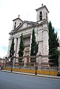
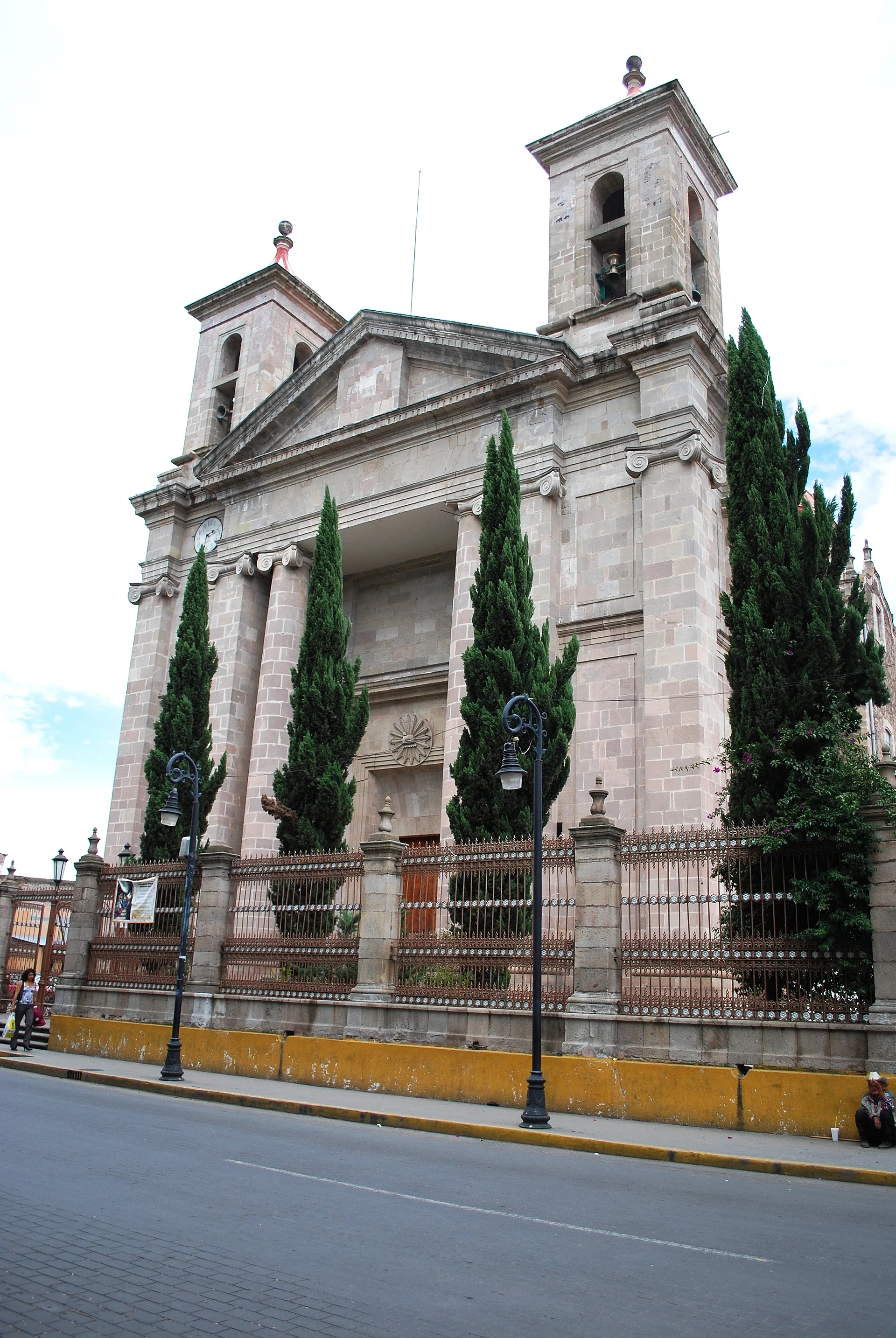
The grey-stone Cathedral of St John the Baptist: founded by Franciscans in 1528, remade in neoclassical style by Ortiz de Castro in 1788-89.
From Huauchinango: about 40 min by road (~45 km) How to get there ↓
Near here
See everything nearby ↓


Plan your visit to Catedral de Tulancingo
Where to stay near Catedral de Tulancingo
Compare hotels, posadas and guest houses in Catedral de Tulancingo.
Tours to Catedral de Tulancingo
Look for tours of the area around Acaxochitlán that stop at Catedral de Tulancingo.
 Tours from Zacatlan
Zacatlán Guided Tour walking through the Center
★ 5.0 (2) · From US$8
How to get to Catedral de Tulancingo
- From Huauchinango: about 40 min by road (~45 km)
- Nearest airport: Poza Rica (PAZ), 1 h 41 min by car to Acaxochitlán
Links open a partner site. We may earn a commission if you book, at no cost to you.
Tours from Zacatlan, near Catedral de Tulancingo
Tours, prices and ratings from Viator, checked weekly. We may earn a commission if you book.
About Catedral de Tulancingo
Tulancingo's cathedral, dedicated to St John the Baptist, anchors the historic centre opposite La Floresta, the city's main square. It began as a convent the Franciscans started in 1528 to evangelise the valley, and over time the complex gained a chapel, an orchard and an atrium. It became the parish of San Juan Bautista in 1754, and in 1788-1789 it was enlarged under José Damián Ortiz de Castro, the architect who also helped complete Mexico City's Metropolitan Cathedral. He steered it away from the baroque towards the plain neoclassicism it shows today. It was raised to cathedral rank in 1863, when Pope Pius IX created the diocese of Tulancingo, and it is now the seat of an archdiocese.
The whole building is of grey cantera stone. The front is a triangular pediment carried on Ionic columns and pilasters about 17 metres tall, between two small single-stage towers capped with lanterns. Inside the Latin-cross plan rises an octagonal dome with its own lantern; from the ground to the cross on the dome it measures about 54 metres, and its walls of massive stones are almost a metre thick.
The interior was remodelled in the same neoclassical spirit. Look for the high altar, the carved stone baptismal font and the wooden pulpit with relief work, and out in the patios for an atrial cross and a sundial. The church also has a pipe organ, so ask whether it is ever played. Afterwards, the Benito Juárez market close by is the place for a guajolote, the city's stuffed bread roll.
How to get to Catedral de Tulancingo
The cathedral sits right in the middle of Tulancingo, facing the La Floresta garden. By car it is about 120 km and two hours from Mexico City on the México–Tuxpan toll road; Pachuca is 45 minutes (50 km) away on federal highway 130, Huauchinango 40 minutes (42 km) and the Pueblo Mágico of Acaxochitlán 25 minutes (23 km). By bus, Autobuses Conexión leaves Mexico City's Terminal Norte every hour, and ADO, Futura and Estrella Blanca also run to Tulancingo from the capital, Pachuca and Poza Rica. From the bus station take a taxi or local transport into the centre, where the cathedral, the square and the museums are all within walking distance.
Directions to Catedral de Tulancingo on Google Maps
Distances are in a straight line; the road is usually longer.
Links open a partner site. We may earn a commission if you book, at no cost to you.
From the nearest cities to Catedral de Tulancingo
- Huauchinango · about 45 km by road, ~40 min
- Pachuca · about 50 km by road, ~45 min
- Chiautempan · about 115 km by road, ~1 h 40 min
Drive times by road from OpenStreetMap, without traffic or stops. Times marked ~ are estimated from the straight-line distance.
Before you go to Catedral de Tulancingo: hours, prices and tips
- Best time of day
- March, June, September and November; come early, when the morning sun lights up the façade. Guía turística del municipio de Tulancingo · checked Oct 2026
- What to bring
- A sweater in winter, when it runs about 8 to 15 °C, and comfortable shoes for walking the centre. Guía turística del municipio de Tulancingo · checked Oct 2026
- Rules
- It is a working church: keep quiet and avoid loud noise during your visit. Guía turística del municipio de Tulancingo · checked Oct 2026
Hours and prices change, especially around holidays. Each fact links to where we checked it.
Visiting Catedral de Tulancingo: what to see and do
The neoclassical front with its pediment and Ionic columns, seen from La Floresta.
The octagonal dome, about 54 metres up to its cross.
The high altar and the carved wooden pulpit.
The stone baptismal font.
The atrial cross and the sundial in the patios.
A guajolote at the Benito Juárez market near the cathedral.
Plan your trip
Places to stay in Catedral de Tulancingo
Compare hotels, posadas, and rentals in and around Catedral de Tulancingo.
Tours & activities
Look for tours of the area around Acaxochitlán that stop at Catedral de Tulancingo.
Rental cars
Pick up a car at PAZ (Poza Rica): about 1 h 41 min by road to Acaxochitlán, then 19 km more to Catedral de Tulancingo, on your own schedule.
Flights
The nearest airport with scheduled flights is Poza Rica (PAZ), about 1 h 41 min by road from Acaxochitlán, the base for Catedral de Tulancingo.
Mobile data
Signal can drop away from Acaxochitlán: download a map of the way to Catedral de Tulancingo before you set out, or carry an eSIM with data.
Links open a partner site. We may earn a commission if you book, at no cost to you.
When to go to Catedral de Tulancingo cool
Catedral de Tulancingo shares the climate of Acaxochitlán, 19 km away. The best months to visit are February, March, April, and May.
See the month-by-month climate of Acaxochitlán
Weather in Catedral de Tulancingo now and the next 7 days
Live forecast from Open-Meteo. Chance of rain is the day's highest.
The closest Pueblo Mágico: Acaxochitlán

Acaxochitlán is the Pueblo Mágico closest to Catedral de Tulancingo, with places to stay, food, and more to see.
Also close to
- Huasca de Ocampo · Hidalgo · 27 km away
- Pahuatlán · Puebla · 32 km away
- Real del Monte · Hidalgo · 32 km away
- Huauchinango · Puebla · 35 km away
- Zempoala · Hidalgo · 37 km away
Closest to Catedral de Tulancingo
-
Antigua hacienda de Exquitlán · Landmark · 1 km away
-
Museo del Santo · Landmark · 1 km away
-
Tulancingo · City · 1 km away
-
Zona Arqueológica de Huapalcalco · Archaeological site · 4 km away
-
El Pedregal de San José · Village · 5 km away
-
Santiago Tulantepec · Town · 5 km away
-
Jaltepec · Town · 6 km away
-
Tezoquipa · Village · 6 km away


Near Catedral de Tulancingo




Drive times by road from OpenStreetMap, without traffic. Times marked ~ are estimated from the straight-line distance.
Location from OpenStreetMap. Written by Puebloteca.