

Village Zacualpan de Amilpas, Morelos Municipality of Zacualpan de Amilpas
Village at 1,750 m on the slopes of Popocatépetl, with a church dated 1639, adobe-oven bread and the Jesuit ruins of Chicomocelo 1 km away.
From Cuautla: 40 min by car (31 km by road) How to get there ↓
Near here
See everything nearby ↓


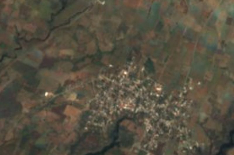

Plan your visit to Tlacotepec
Where to stay near Tlacotepec
Compare hotels, posadas and guest houses in Tlacotepec.
Tours to Tlacotepec
Day trips and guided outings from Tlayacapan often include Tlacotepec; with a local guide you can get there without a car.
How to get to Tlacotepec
- From Cuautla: about 40 min by road (~31 km)
- Nearest airport: Mexico City (MEX), 1 h 33 min by car to Tlayacapan
Links open a partner site. We may earn a commission if you book, at no cost to you.
About Tlacotepec
The usual reading of Tlacotepec's Nahuatl name is "place between hills", which suits a village at about 1,750 m on the foothills of Popocatépetl, some 4.5 km north of Zacualpan de Amilpas, its municipal seat. It is the larger of the two: 5,388 people in 2010, nearly 60 percent of the municipality. Under a deal struck in 2000, the mayor's office alternates between people from Tlacotepec and from Zacualpan.
A cross in the atrium of the church of Nuestra Señora de la Asunción is dated 1639, probably the year the building was finished; inside are colonial paintings and an altarpiece called El Paraíso. One kilometre from the centre stand the ruins of the Chicomocelo hacienda, "place of the seven jaguars", built by the Jesuits in the 17th century to turn cane into sugar in its trapiches. It declined after the order was expelled in 1767 and was abandoned shortly before Independence. Walls, vaults, canals, aqueducts and a roofless church remain, with a small dam in front. The big millstones once used for wheat were moved to the village centre for display. The Xoloxuchitl community museum keeps pre-Hispanic and colonial pieces.
The main festival honours the Assumption from 1 to 15 August, with midnight mañanitas, a noon Mass and fireworks on the 15th; Candlemas, on 2 February, comes second. Expect chinelo and huehuenchis dancers and jaripeos (rodeos) through the year. Pan de Tlacotepec is baked in hand-built adobe ovens fired with local wood, and coffee grows in the old orchards. Cerro Gordo gives views of Popocatépetl, whose crater is about 25 km away.
How to get to Tlacotepec
Drive from Cuautla: 40 min, 31 km
From Cuautla follow Federal Highway 160 towards Izúcar de Matamoros (Puebla) as far as Amayuca, about 30 minutes, then take the turn north through Temoac to Zacualpan de Amilpas, about 20 minutes more. Cuautla to Zacualpan is about 29.5 km, roughly 40 minutes. Tlacotepec lies 4.5 km north of Zacualpan, uphill towards the volcano. From Mexico City, reach Cuautla on the Mexico-Cuernavaca toll road and its branch to Cuautla (toll booths at Tlalpan, Tepoztlán and Oacalco), or by bus from the Central del Sur (Taxqueña). By public transport: in Cuautla, combis to Amayuca leave near the bus station, in front of the Niño Artillero statue (40 to 50 minutes), and colectivo taxis run from Amayuca to Zacualpan; from there take a taxi or local colectivo up to Tlacotepec. Tlayacapan is about 29 km away in a straight line.
Directions to Tlacotepec on Google Maps
Distances are in a straight line; the road is usually longer.
Links open a partner site. We may earn a commission if you book, at no cost to you.
From the nearest cities to Tlacotepec
Drive times by road from OpenStreetMap, without traffic or stops. Times marked ~ are estimated from the straight-line distance.
Before you go to Tlacotepec: hours, prices and tips
- Best season
- The patronal fair of the Assumption runs from 1 to 15 August; the main day is the 15th, with midnight mañanitas, a noon Mass and fireworks at night. Wikipedia · checked Oct 2026
Hours and prices change, especially around holidays. Each fact links to where we checked it.
Visiting Tlacotepec: what to see and do
Find the cross dated 1639 in the atrium of the Assumption church.
Go inside to see the El Paraíso altarpiece.
Walk 1 km to the ruins of the Jesuit hacienda of Chicomocelo and its dam.
Look at the old millstones on display in the centre.
Visit the Xoloxuchitl community museum.
Buy pan de Tlacotepec, baked in adobe ovens.
Climb Cerro Gordo for views of Popocatépetl.
Plan your trip
Places to stay in Tlacotepec
Compare hotels, posadas, and rentals in and around Tlacotepec.
Tours & activities
Day trips and guided outings from Tlayacapan often include Tlacotepec; with a local guide you can get there without a car.
Rental cars
Pick up a car at MEX (Mexico City): about 1 h 33 min by road to Tlayacapan, then 29 km more to Tlacotepec, on your own schedule.
Flights
The nearest airport with scheduled flights is Mexico City (MEX), about 1 h 33 min by road from Tlayacapan, the base for Tlacotepec.
Mobile data
Signal can drop away from Tlayacapan: download a map of the way to Tlacotepec before you set out, or carry an eSIM with data.
Links open a partner site. We may earn a commission if you book, at no cost to you.
When to go to Tlacotepec mild
Tlacotepec shares the climate of Tlayacapan, 29 km away. The best months to visit are January, February, March, and December.
See the month-by-month climate of Tlayacapan
Weather in Tlacotepec now and the next 7 days
Live forecast from Open-Meteo. Chance of rain is the day's highest.
The closest Pueblo Mágico: Tlayacapan

Tlayacapan is the Pueblo Mágico closest to Tlacotepec, with places to stay, food, and more to see.
Also close to
- Atlixco · Puebla · 36 km away
- Tepoztlán · Morelos · 41 km away
- Tlaltizapán · Morelos · 43 km away
- Huejotzingo · Puebla · 53 km away
- Cholula · Puebla · 54 km away
Closest to Tlacotepec
-
Zacualpan de Amilpas · Town · 3 km away
-
Cohuecan · Village · 4 km away
-
Templo y exconvento de la Inmaculada Concepción · Landmark · 4 km away
-
Temoac · Village · 5 km away
-
Acteopan · Village · 6 km away
-
Huazulco · Village · 7 km away
-
Metepec · Village · 7 km away
-
Tecajec · Village · 7 km away


Near Tlacotepec







Drive times by road from OpenStreetMap, without traffic. Times marked ~ are estimated from the straight-line distance.
Location from OpenStreetMap. Written by Puebloteca.