
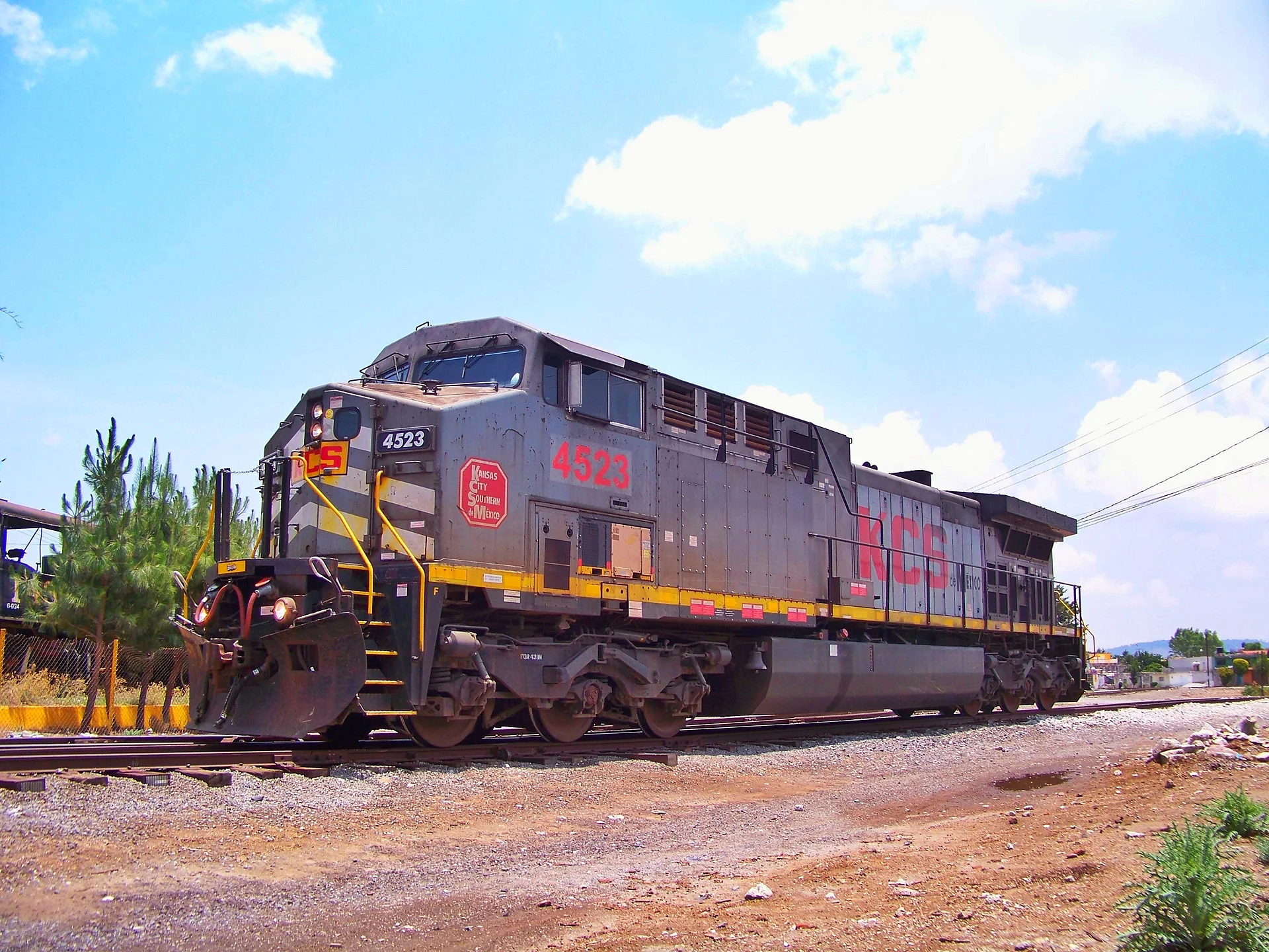
Village Oriental, Puebla
Railway town at 2,338 m on the Llanos de San Juan, beside Totolcingo lake and a short drive from the road to Cantona.
From Huamantla: 35 min by car (37 km by road) How to get there ↓
Near here
See everything nearby ↓


Plan your visit to Oriental
Where to stay near Oriental
Compare hotels, posadas and guest houses in Oriental.
Tours to Oriental
Day trips and guided outings from Huamantla often include Oriental; with a local guide you can get there without a car.
 Tours from Puebla City
Africam Safari Zoo Admission with Transportation
★ 4.8 (87) · From US$35
How to get to Oriental
- From Huamantla: about 35 min by road (~37 km)
- Nearest airport: Puebla (PBC), 1 h 5 min by car to Huamantla
Links open a partner site. We may earn a commission if you book, at no cost to you.
Tours from Puebla City, near Oriental


Tours, prices and ratings from Viator, checked weekly. We may earn a commission if you book.
About Oriental
Oriental began as a station: the town takes its name from the old Ferrocarril Oriental, which linked Mexico City with Veracruz and had a stop here. Until shortly before 1917 it was only a station within the San Juan de los Llanos district; on 29 October 1917 it was raised to town status and on 2 July 1942 it became a free municipality. The 2020 census counted 11,276 residents in the seat, at about 2,338 metres.
The landscape is the Llanos de San Juan, a lake plain north of the Malintzin volcano. To the south the ground is almost flat; to the north small hills rise, among them Cerro Pinto (3,000 m) and Tres Cerros (2,800 m), with pines, agave and cacti. The whole basin is closed and drains into Totolcingo lake, a brackish body of water that shrinks in the dry season and exposes a bed of tequesquite salt. The climate is temperate and semi-dry with summer rain.
The region once had wheat haciendas such as San Antonio Virreyes, Zacatepec and Santiago Texmelucan; the last, an eighteenth-century estate about 10 minutes along the Oriental-Zacatepec road, now runs as a hotel and organises horseback rides and trips to Cantona. At the table you find mixiote barbecue, goat cheese, salsa macha, pulque and home-made ice cream. The local calendar marks 29 October (the town's anniversary), 7 November (railway workers' day), the last Sunday of November (Cristo Rey) and 12 December (Virgen de Guadalupe).
How to get to Oriental
Drive from Huamantla: 35 min, 37 km
From the city of Puebla, take highway 150 México-Veracruz and at Amozoc join federal 129 toward Teziutlán; Oriental sits on that road, about 80 km from Puebla according to the municipal monograph (approx. 1 h 15). From Huamantla, the nearest neighbouring pueblo, it is about 32 km in a straight line and 35 minutes by car. For Cantona, take the road to Tepeyahualco in Oriental, which connects with the site's road (km 7.5 of the Tepeyahualco-Xonacatlán highway), per INAH. By bus, start at CAPU in Puebla; no fixed timetable to Oriental is published, so ask at the terminal about departures toward Teziutlán or Oriental, which run along the 129.
Directions to Oriental on Google Maps
Distances are in a straight line; the road is usually longer.
Links open a partner site. We may earn a commission if you book, at no cost to you.
From the nearest cities to Oriental
- Huamantla · 37 km by road, 35 min
- Teziutlán · 72 km by road, 50 min
- Chiautempan · 77 km by road, 1 h 5 min
Drive times by road from OpenStreetMap, without traffic or stops. Times marked ~ are estimated from the straight-line distance.
Before you go to Oriental: hours, prices and tips
- Best season
- Local dates: 29 October (town anniversary), 7 November (railway workers' day), last Sunday of November (Cristo Rey) and 12 December (Virgen de Guadalupe). Totolcingo lake shrinks in the dry season. Wikipedia (es), Municipio de Oriental · checked Oct 2026
Hours and prices change, especially around holidays. Each fact links to where we checked it.
Visiting Oriental: what to see and do
The tracks and the railway wye, source of the town's name and origin.
Totolcingo lake, with its tequesquite salt bed in the dry season.
The Santiago Texmelucan ex-hacienda, at km 5.5 of the Oriental-Zacatepec road.
The Cantona archaeological zone, a few kilometres along the road to Tepeyahualco: about 4 km on foot and 24 ball courts.
Cerro Pinto and Tres Cerros, north of the basin.
Mixiote barbecue and goat cheese from the area.
Plan your trip
Places to stay in Oriental
Compare hotels, posadas, and rentals in and around Oriental.
Tours & activities
Day trips and guided outings from Huamantla often include Oriental; with a local guide you can get there without a car.
Rental cars
Pick up a car at PBC (Puebla): about 1 h 5 min by road to Huamantla, then 32 km more to Oriental, on your own schedule.
Flights
The nearest airport with scheduled flights is Puebla (PBC), about 1 h 5 min by road from Huamantla, the base for Oriental.
Mobile data
Signal can drop away from Huamantla: download a map of the way to Oriental before you set out, or carry an eSIM with data.
Links open a partner site. We may earn a commission if you book, at no cost to you.
When to go to Oriental cool
Oriental shares the climate of Huamantla, 32 km away. The best months to visit are January, February, November, and December.
See the month-by-month climate of Huamantla
Weather in Oriental now and the next 7 days
Live forecast from Open-Meteo. Chance of rain is the day's highest.
The closest Pueblo Mágico: Huamantla

Huamantla is the Pueblo Mágico closest to Oriental, with places to stay, food, and more to see.
Also close to
- Ixtenco · Tlaxcala · 36 km away
- Tetela de Ocampo · Puebla · 53 km away
- Tlatlauquitepec · Puebla · 54 km away
- Tlaxco · Tlaxcala · 59 km away
- Teziutlán · Puebla · 60 km away
Closest to Oriental
-
Villa de El Carmen Tequexquitla · Town · 7 km away
-
Miravalles · Village · 9 km away
-
San Carlos · Village · 10 km away
-
Libres · Town · 12 km away
-
San Juan · Village · 12 km away
-
San Miguel · Village · 12 km away
-
Cuapiaxtla · Town · 18 km away
-
Laguna de Atexcac · Lake · 18 km away


Near Oriental





Drive times by road from OpenStreetMap, without traffic. Times marked ~ are estimated from the straight-line distance.
Location from OpenStreetMap. Written by Puebloteca.