Town Atltzayanca, Tlaxcala La Malinche
Municipal seat in eastern Tlaxcala, with the Santiago Apóstol parish, pulque haciendas and moors-and-Christians dances at the July fiesta.
From Huamantla: 25 min by car (24 km by road) How to get there ↓
Near here
See everything nearby ↓
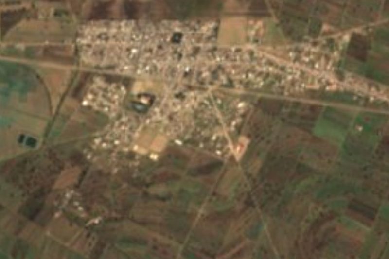


Plan your visit to Atltzayanca
Where to stay near Atltzayanca
Compare hotels, posadas and guest houses in Atltzayanca.
Tours to Atltzayanca
Day trips around Huamantla sometimes stop in Atltzayanca; a tour is the easy way to see it without a car.
 Tours from Puebla City
Africam Safari Zoo Admission with Transportation
★ 4.8 (87) · From US$35
How to get to Atltzayanca
- From Huamantla: about 25 min by road (~24 km)
- Nearest airport: Puebla (PBC), 1 h 5 min by car to Huamantla
Links open a partner site. We may earn a commission if you book, at no cost to you.
Tours from Puebla City, near Atltzayanca


Tours, prices and ratings from Viator, checked weekly. We may earn a commission if you book.
About Atltzayanca
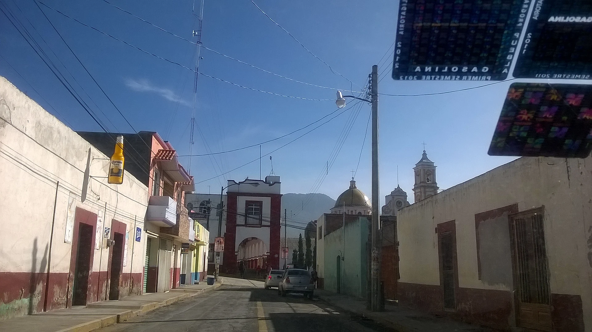
Atltzayanca, also spelled Altzayanca or Atlzayanca, is the seat of the municipality of the same name in eastern Tlaxcala, at about 2,600 metres on the slopes of the Sierra de La Caldera. The Nahuatl name is read as "place where the waters break". The 2020 census counted 4,387 people. Its colonial origin is a pulque hacienda: Spanish estates based in Puebla pushed into the Huamantla plains up to the sierra, and the Altzayanca hacienda gathered the few inhabitants from which the town later grew. In 1915 there was fighting here between Carrancistas and Zapatistas.
The parish of Santiago Apóstol, on Avenida Juárez, was built in the 18th century on a Latin-cross plan and redecorated in the 19th in neoclassical style. The Guadalupe chapel stands in the main park. Around town are 19th-century haciendas: San Antonio Zoapila, with a chapel of San Antonio de Padua; Vista Hermosa, 1 km east by dirt track, with the San Miguel chapel; and San José Xalasco.
The fiesta of Santiago Apóstol begins on 16 July, nine days before the 25th, with processions from nearby ranches arriving at the church with banners, the crowning of the fair and pulque queens, a cockfighting tournament and a running of bulls through the streets called the "altzayancada". The moors-and-Christians dance, with a wind band, is an essential part of the festivities. Locals do wood carving and make tinacas for pulque, and the food includes white pinole, mole prieto, chilacayote, mixiote lamb barbacoa and maguey worms.
How to get to Atltzayanca
Drive from Huamantla: 25 min, 24 km
Atltzayanca is in eastern Tlaxcala, near the Puebla border; the municipality borders Huamantla and Cuapiaxtla to the south and west. From Huamantla, the nearest Pueblo Mágico, it is about 19 km (approx. 20 minutes by car) along the Huamantla-Altzayanca highway. The road linking Puebla and Tlaxcala through this area was opened in 1929. From Puebla it is about 60 km (approx. 70 minutes). There are no published schedules for direct buses: the usual route goes through Huamantla, where the ADO terminal (Zaragoza Ote. 202) runs buses to Puebla and to Mexico City TAPO (about 2 h 15 min), and then a taxi or local transport toward Atltzayanca. From Tlaxcala city it is about 48 km east, according to Wikipedia.
Directions to Atltzayanca on Google Maps
Distances are in a straight line; the road is usually longer.
Links open a partner site. We may earn a commission if you book, at no cost to you.
From the nearest cities to Atltzayanca
- Huamantla · 24 km by road, 25 min
- Chiautempan · 64 km by road, 55 min
- Puebla · 75 km by road, 1 h 10 min
Drive times by road from OpenStreetMap, without traffic or stops. Times marked ~ are estimated from the straight-line distance.
Before you go to Atltzayanca: hours, prices and tips
- Best season
- Fiesta of Santiago Apóstol from 16 to 25 July (fixed date); carnival in February and March; Holy Cross on 3 May and Guadalupe on 12 December. INAFED, Enciclopedia de los Municipios; Wikipedia · checked Oct 2026
Hours and prices change, especially around holidays. Each fact links to where we checked it.
Visiting Atltzayanca: what to see and do
Parish of Santiago Apóstol, on Avenida Juárez, from the 18th century and redecorated in neoclassical style.
Guadalupe chapel, in the main park of the seat.
Hacienda Vista Hermosa, 1 km east by dirt track, with the San Miguel chapel.
Hacienda San Antonio Zoapila and its chapel of San Antonio de Padua.
Fiesta of Santiago Apóstol from 16 July, with moors and Christians and the altzayancada.
Plan your trip
Places to stay in Atltzayanca
Compare hotels, posadas, and rentals in and around Atltzayanca.
Tours & activities
Day trips around Huamantla sometimes stop in Atltzayanca; a tour is the easy way to see it without a car.
Rental cars
Pick up a car at PBC (Puebla): about 1 h 5 min by road to Huamantla, then 19 km more to Atltzayanca, on your own schedule.
Flights
The nearest airport with scheduled flights is Puebla (PBC), about 1 h 5 min by road from Huamantla, the base for Atltzayanca.
Mobile data
Signal can drop away from Huamantla: download a map of the way to Atltzayanca before you set out, or carry an eSIM with data.
Links open a partner site. We may earn a commission if you book, at no cost to you.
When to go to Atltzayanca cool
Atltzayanca shares the climate of Huamantla, 19 km away. The best months to visit are January, February, November, and December.
See the month-by-month climate of Huamantla
Weather in Atltzayanca now and the next 7 days
Live forecast from Open-Meteo. Chance of rain is the day's highest.
The closest Pueblo Mágico: Huamantla

Huamantla is the Pueblo Mágico closest to Atltzayanca, with places to stay, food, and more to see.
Also close to
- Ixtenco · Tlaxcala · 25 km away
- Tlaxco · Tlaxcala · 40 km away
- Tetela de Ocampo · Puebla · 43 km away
- Chignahuapan · Puebla · 51 km away
- Tlatlauquitepec · Puebla · 56 km away
Closest to Atltzayanca
-
Concepción Hidalgo · Town · 4 km away
-
Chipilo (Ixtacamaxtitlán) · Village · 9 km away
-
San José Xicohténcatl · Town · 10 km away
-
San Carlos · Village · 11 km away
-
San Juan · Village · 11 km away
-
Libres · Town · 12 km away
-
San Miguel · Village · 12 km away
-
Benito Juárez · Town · 14 km away
Near Atltzayanca




Drive times by road from OpenStreetMap, without traffic. Times marked ~ are estimated from the straight-line distance.
Location from OpenStreetMap. Written by Puebloteca.