
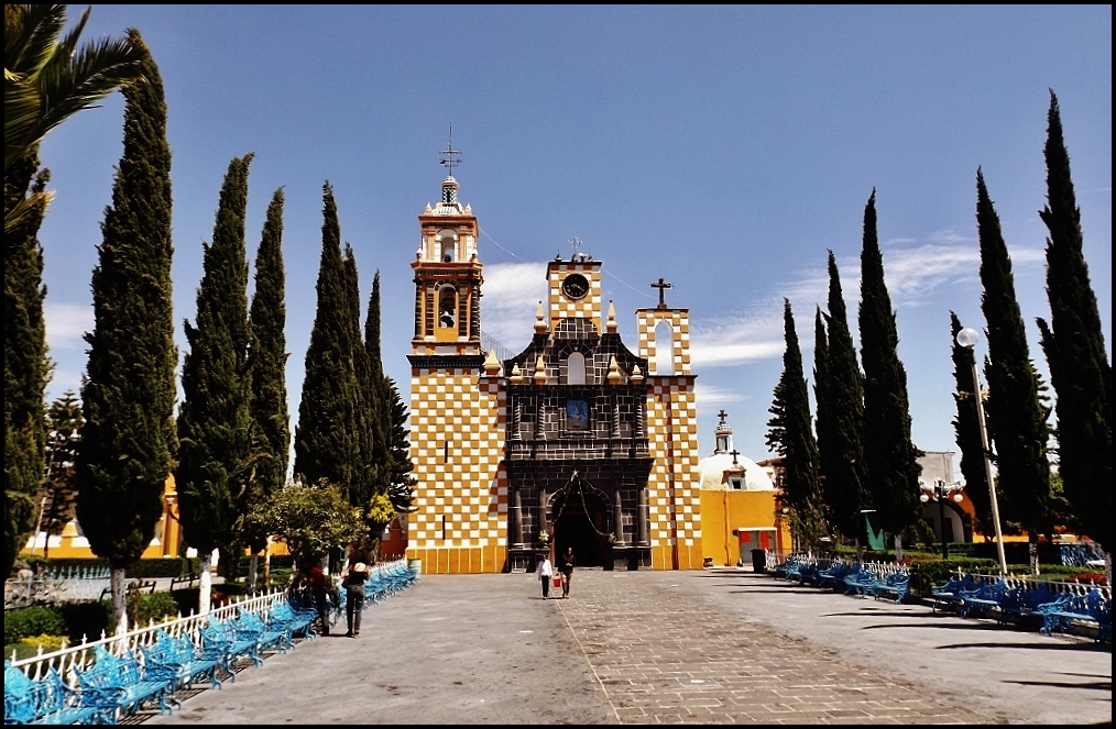
Village San Nicolás de los Ranchos, Puebla Municipality of San Nicolás de los Ranchos Volcano Route Monasteries on the slopes of Popocatépetl Puebla Valley
The closest inhabited village to Popocatépetl's crater, 12 km away, whose people revere the volcano as Don Goyo.
From Atlixco: 40 min by car (32 km by road) How to get there ↓
Near here
See everything nearby ↓


Plan your visit to Santiago Xalitzintla
Where to stay near Santiago Xalitzintla
Compare hotels, posadas and guest houses in Santiago Xalitzintla.
Tours to Santiago Xalitzintla
Day trips and guided outings from Huejotzingo often include Santiago Xalitzintla; with a local guide you can get there without a car.
How to get to Santiago Xalitzintla
- From Atlixco: about 40 min by road (~32 km)
- Nearest airport: Puebla (PBC), 7 min by car to Huejotzingo
Links open a partner site. We may earn a commission if you book, at no cost to you.
About Santiago Xalitzintla
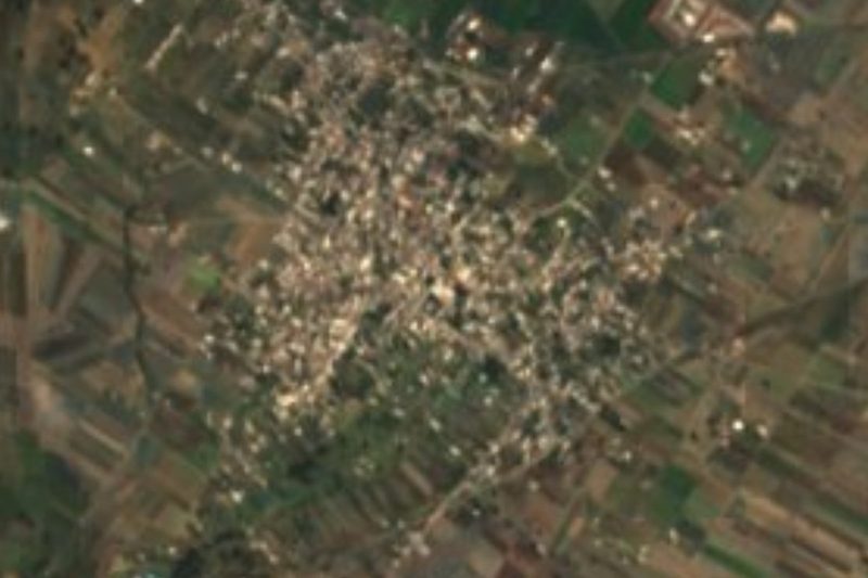
Santiago Xalitzintla (pronounced "Shalitzintla") is a village in the municipality of San Nicolás de los Ranchos in western Puebla, 2 km from the municipal seat. It stands at about 2,560 m and had 2,030 people in 2020. It is known as the closest permanent settlement to the crater of Popocatépetl, about 12 km away.
That closeness makes it the most exposed community in an eruption, from pyroclastic flows or from lahars caused by melting glaciers. At peaks of activity, as in December 2000, it has had to be evacuated. Yet its people have always been very reluctant to leave, out of a long tradition of revering the volcano, which they call Don Goyo and credit with bringing the rain their fields need.
The village fiesta is on 25 July, for Saint James the Apostle; it begins on the 24th with dawn songs in the church, after which the stewards change the image's robes. On the Day of the Dead, 2 November, every home sets up an offering. The municipality of San Nicolás de los Ranchos, about 195 km², climbs to the summit of Popocatépetl, about 5,400 m, which it shares with Tochimilco and Atlautla, and also holds Cerro Teotón, at 2,600 m, an archaeological site on the way up to Paso de Cortés.
How to get to Santiago Xalitzintla
Drive from Atlixco: 40 min, 32 km
Santiago Xalitzintla is 2 km from San Nicolás de los Ranchos, on the slopes of Popocatépetl. The Pueblo Mágico of Huejotzingo is about 14 km away in a straight line and Puebla city about 33 km, roughly 50 minutes by car. Before you go, check CENAPRED's volcanic alert level for Popocatépetl, because the village lies in the highest-risk zone.
Directions to Santiago Xalitzintla on Google Maps
Distances are in a straight line; the road is usually longer.
Links open a partner site. We may earn a commission if you book, at no cost to you.
From the nearest cities to Santiago Xalitzintla
- Atlixco · 32 km by road, 40 min
- San Martín Texmelucan · 37 km by road, 40 min
- Puebla · 39 km by road, 50 min
Drive times by road from OpenStreetMap, without traffic or stops. Times marked ~ are estimated from the straight-line distance.
Before you go to Santiago Xalitzintla: hours, prices and tips
- Best season
- The Saint James festival is on 25 July, starting with dawn songs on the 24th. Wikipedia · checked Oct 2026
Hours and prices change, especially around holidays. Each fact links to where we checked it.
Visiting Santiago Xalitzintla: what to see and do
Views of Popocatépetl, about 12 km from the village.
The church of Santiago Apóstol and its fiesta on 25 July.
Cerro Teotón, an archaeological site on the road up to Paso de Cortés.
The Day of the Dead offerings in people's homes.
Plan your trip
Places to stay in Santiago Xalitzintla
Compare hotels, posadas, and rentals in and around Santiago Xalitzintla.
Tours & activities
Day trips and guided outings from Huejotzingo often include Santiago Xalitzintla; with a local guide you can get there without a car.
Rental cars
Pick up a car at PBC (Puebla): about 7 min by road to Huejotzingo, then 14 km more to Santiago Xalitzintla, on your own schedule.
Flights
The nearest airport with scheduled flights is Puebla (PBC), about 7 min by road from Huejotzingo, the base for Santiago Xalitzintla.
Mobile data
Signal can drop away from Huejotzingo: download a map of the way to Santiago Xalitzintla before you set out, or carry an eSIM with data.
Links open a partner site. We may earn a commission if you book, at no cost to you.
When to go to Santiago Xalitzintla mild
Santiago Xalitzintla shares the climate of Huejotzingo, 14 km away. The best months to visit are January, February, March, and November.
See the month-by-month climate of Huejotzingo
Weather in Santiago Xalitzintla now and the next 7 days
Live forecast from Open-Meteo. Chance of rain is the day's highest.
The closest Pueblo Mágico: Huejotzingo

Huejotzingo is the Pueblo Mágico closest to Santiago Xalitzintla, with places to stay, food, and more to see.
Also close to
- Atlixco · Puebla · 21 km away
- Cholula · Puebla · 22 km away
- Tlayacapan · Morelos · 51 km away
- Tepoztlán · Morelos · 62 km away
- Ixtenco · Tlaxcala · 64 km away
Closest to Santiago Xalitzintla
-
San Mateo Ozolco · Village · 2 km away
-
San Nicolás de los Ranchos · Town · 4 km away
-
San Andrés Calpan · Landmark · 6 km away
-
Santa María Atexcac · Village · 6 km away
-
Cháhuac · Village · 10 km away
-
San Buenaventura Nealtican · Village · 10 km away
-
San Baltazar Atlimeyaya · Village · 11 km away
-
Cascada de Apatlaco · Waterfall · 12 km away

Near Santiago Xalitzintla



Drive times by road from OpenStreetMap, without traffic. Times marked ~ are estimated from the straight-line distance.
Location from OpenStreetMap. Written by Puebloteca.