Village Calpan, Puebla Volcano Route Monasteries on the slopes of Popocatépetl Puebla Valley
"On the old road": a Calpan village at 2,674 m, stretched along a ridge between wooded ravines coming down from the Sierra Nevada.
From Atlixco: 45 min by car (33 km by road) How to get there ↓
Near here
See everything nearby ↓


Plan your visit to San Mateo Ozolco
Where to stay near San Mateo Ozolco
Compare hotels, posadas and guest houses in San Mateo Ozolco.
Tours to San Mateo Ozolco
Day trips and guided outings from Huejotzingo often include San Mateo Ozolco; with a local guide you can get there without a car.
 Tours from Atlixco
Atlixco Volcano Views Popocatépetl Tour Forest Route
From US$108
How to get to San Mateo Ozolco
- From Atlixco: about 45 min by road (~33 km)
- Nearest airport: Puebla (PBC), 7 min by car to Huejotzingo
Links open a partner site. We may earn a commission if you book, at no cost to you.
Tours from Atlixco, near San Mateo Ozolco
Tours, prices and ratings from Viator, checked weekly. We may earn a commission if you book.
About San Mateo Ozolco
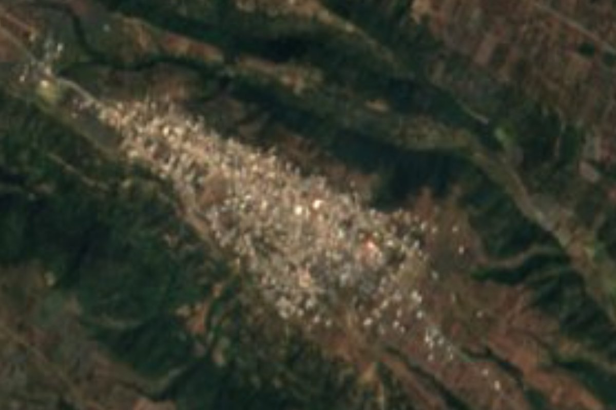
Its Nahuatl name combines otli, road, zoltic, old or worn, and the locative co, so Ozolco means "on the old road"; the San Mateo in the name is Matthew the Evangelist, its patron saint. It is the highest, most mountainous village in the municipality of Calpan: it sits at 2,674 metres, in the western part of the municipality that already belongs to the Sierra Nevada, the range of Iztaccíhuatl and Popocatépetl. The 2020 census counted 2,890 residents. Seen from a satellite, the houses stretch northwest to southeast along a ridge, flanked by dark tree-filled ravines, with crop plots in the clearings.
The municipality covers about 67 km², with elevations from 2,240 to 2,840 metres, and borders Huejotzingo, Domingo Arenas, Nealtican, San Pedro Cholula, San Jerónimo Tecuanipan and San Nicolás de los Ranchos. Before the Spanish arrived, Calpan was a small independent lordship of Olmeca-Xicalanca roots, closely tied to Huejotzingo; during the Conquest it sided with Tlaxcala, and Hernán Cortés crossed its land in 1519 on his way to Tenochtitlan. In the municipal seat, San Andrés Calpan, the Franciscans built around 1548 the convent with posa chapels that is now a UNESCO World Heritage Site.
Up in Ozolco, meltwater rules. Streams born high on Iztaccíhuatl form rivers such as the Alseseca, Acteopan, Actipitzi and Atlanepantla, all tributaries of the Atoyac. Around 16% of the municipality is still pine and oak forest, mostly on the mountain flanks and down in the ravines; the rest is maize and other rain-fed crops on sandy volcanic soil. It is cool up here: averages run from 8 to 16 °C, with 900 to 1,100 mm of rain, and part of the territory is already semi-cold. The area's fruit-growing tradition shows in the kitchen: candied figs, preserves of peach, pear and tejocote, cider, and liqueurs of capulín cherry, plum and tejocote.
How to get to San Mateo Ozolco
Drive from Atlixco: 45 min, 33 km
Ozolco lies about 34 km in a straight line west of Puebla city and 13 km from Huejotzingo. The usual route runs through Cholula or Huejotzingo to San Andrés Calpan, then uphill toward the volcanoes; the last kilometres climb between ravines, so drive slowly.
Directions to San Mateo Ozolco on Google Maps
Distances are in a straight line; the road is usually longer.
Links open a partner site. We may earn a commission if you book, at no cost to you.
From the nearest cities to San Mateo Ozolco
- Atlixco · 33 km by road, 45 min
- San Martín Texmelucan · 37 km by road, 45 min
- Puebla · 41 km by road, 55 min
Drive times by road from OpenStreetMap, without traffic or stops. Times marked ~ are estimated from the straight-line distance.
Visiting San Mateo Ozolco: what to see and do
Ozolco's ridge and its ravines of pine and oak forest.
Walks to the Acteopan ravine and its springs.
The Franciscan former convent of San Andrés Calpan and its posa chapels, in the municipal seat.
Plan your trip
Places to stay in San Mateo Ozolco
Compare hotels, posadas, and rentals in and around San Mateo Ozolco.
Tours & activities
Day trips and guided outings from Huejotzingo often include San Mateo Ozolco; with a local guide you can get there without a car.
Rental cars
Pick up a car at PBC (Puebla): about 7 min by road to Huejotzingo, then 13 km more to San Mateo Ozolco, on your own schedule.
Flights
The nearest airport with scheduled flights is Puebla (PBC), about 7 min by road from Huejotzingo, the base for San Mateo Ozolco.
Mobile data
Signal can drop away from Huejotzingo: download a map of the way to San Mateo Ozolco before you set out, or carry an eSIM with data.
Links open a partner site. We may earn a commission if you book, at no cost to you.
When to go to San Mateo Ozolco mild
San Mateo Ozolco shares the climate of Huejotzingo, 13 km away. The best months to visit are January, February, March, and November.
See the month-by-month climate of Huejotzingo
Weather in San Mateo Ozolco now and the next 7 days
Live forecast from Open-Meteo. Chance of rain is the day's highest.
The closest Pueblo Mágico: Huejotzingo

Huejotzingo is the Pueblo Mágico closest to San Mateo Ozolco, with places to stay, food, and more to see.
Also close to
- Cholula · Puebla · 22 km away
- Atlixco · Puebla · 23 km away
- Tlayacapan · Morelos · 52 km away
- Tepoztlán · Morelos · 63 km away
- Ixtenco · Tlaxcala · 63 km away
Closest to San Mateo Ozolco
-
Santiago Xalitzintla · Village · 2 km away
-
San Nicolás de los Ranchos · Town · 4 km away
-
San Andrés Calpan · Landmark · 5 km away
-
Santa María Atexcac · Village · 5 km away
-
Cháhuac · Village · 10 km away
-
San Buenaventura Nealtican · Village · 11 km away
-
Cascada de Apatlaco · Waterfall · 12 km away
-
San Baltazar Atlimeyaya · Village · 13 km away

Near San Mateo Ozolco



Drive times by road from OpenStreetMap, without traffic. Times marked ~ are estimated from the straight-line distance.
Location from OpenStreetMap. Written by Puebloteca.