Town Tepeyanco, Tlaxcala Municipality of Tepeyanco
Locality in Tepeyanco, 9 km from Tlaxcala city, with 3,019 residents in 2020, next to the Calvario hill and under 1 km from the municipal seat.
From Chiautempan: 15 min by car (12 km by road) How to get there ↓
Near here


Plan your visit to San Cosme Atlamaxac
Where to stay near San Cosme Atlamaxac
Compare hotels, posadas and guest houses in San Cosme Atlamaxac.
Tours to San Cosme Atlamaxac
Day trips around Huejotzingo sometimes stop in San Cosme Atlamaxac; a tour is the easy way to see it without a car.
 Tours from Puebla City
Africam Safari Zoo Admission with Transportation
★ 4.8 (87) · From US$35
How to get to San Cosme Atlamaxac
- From Chiautempan: about 15 min by road (~12 km)
- Nearest airport: Puebla (PBC), 7 min by car to Huejotzingo
Links open a partner site. We may earn a commission if you book, at no cost to you.
Tours from Puebla City, near San Cosme Atlamaxac


Tours, prices and ratings from Viator, checked weekly. We may earn a commission if you book.
About San Cosme Atlamaxac
San Cosme Atlamaxac is a locality in the municipality of Tepeyanco, in southern Tlaxcala, at about 2,240 metres above sea level and about 9 km from the state capital. It sits almost against the municipal seat: Wikipedia puts it 900 m from Tepeyanco, and population maps give 1.2 km in a straight line to the southeast. Its postal code is 90180 and its telephone code 246; the name is of Nahuatl origin and carries that of Saint Cosmas, a patron he shares with Saint Damian.
Its population has grown steadily: it had 471 residents in 1940, 1,032 in 1980, 1,854 in 2000 and 2,364 in 2010, and at the 2020 census 3,019 (1,572 women and 1,447 men) in 710 occupied dwellings. Almost every home has electricity and piped water, and homes with internet rose from about 10% in 2010 to nearly 75% in 2020.
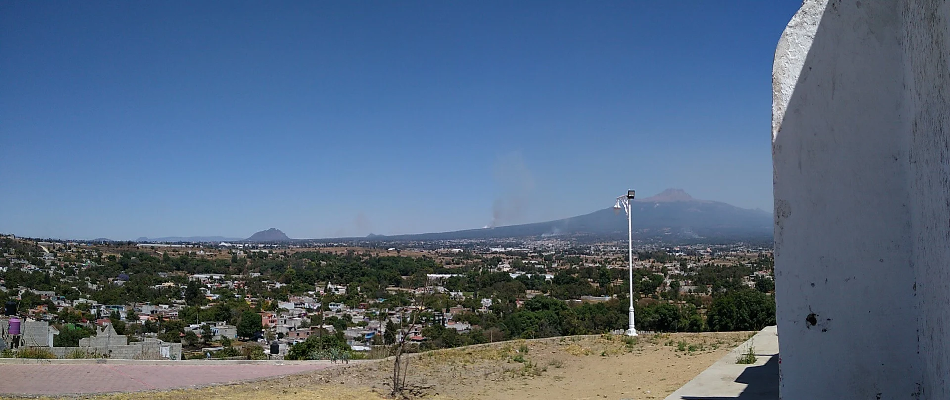
Its immediate neighbours are El Carmen Aztama (1.2 km), San Pedro Xalcaltzinco (1.5 km) and Colonia Las Águilas. The El Calvario hill (2,276 m) and Cerro Santa Bárbara (2,364 m) rise 1.4 to 2.3 km away. From the Calvario chapel on the hill above Tepeyanco the valley opens out toward La Malinche and Cerro Cuatlapanga. In the seat, a few minutes away, stands the parish of San Francisco de Asís, with the Franciscan former convent begun in October 1554.
How to get to San Cosme Atlamaxac
Drive from Chiautempan: 15 min, 12 km
San Cosme Atlamaxac is about 9 km from Tlaxcala city and less than 1.3 km from Tepeyanco, so the way in is to reach Tepeyanco, the municipal seat, and continue southeast to the locality, on foot or by taxi. From Tepeyanco, Cholula is about 36 km (roughly 30 minutes by car), Huejotzingo about 41 km (roughly 32 minutes) and Huamantla about 68 km (roughly 56 minutes). There are no published schedules for local colectivos; Zacatelco, 1.6–2 km from Tepeyanco, is the nearest larger town.
Directions to San Cosme Atlamaxac on Google Maps
Distances are in a straight line; the road is usually longer.
Links open a partner site. We may earn a commission if you book, at no cost to you.
From the nearest cities to San Cosme Atlamaxac
- Chiautempan · 12 km by road, 15 min
- Puebla · 25 km by road, 30 min
- San Martín Texmelucan · 33 km by road, 30 min
Drive times by road from OpenStreetMap, without traffic or stops. Times marked ~ are estimated from the straight-line distance.
Map of San Cosme Atlamaxac
Neighbourhoods and villages of San Cosme Atlamaxac
Part of San Cosme Atlamaxac or just outside it, closest first.
-
El Carmen Aztama · Village · 1 km from the centre
Teolocholco village whose Nahuatl name means 'place where herons are hunted', with a Virgen del Carmen church and a fair that starts on 14 July. -
Tepeyanco · Town · 1 km from the centre
Old lordship south of Tlaxcala city with the ruins of a 1554 Franciscan convent, a brick-and-tile parish church and a name for avocados. -
La Aurora · Village · 2 km from the centre
Tepeyanco locality close to the Franciscan former convent, among avocado orchards with La Malinche in the background. -
Acuamanala · Village · 3 km from the centre
A Baroque village on La Malinche's slopes with an 18th-century church, fireworks, mole prieto and a feast on 13 June. -
San Juan Huactzinco · Town · 3 km from the centre
Bread-baking town in southern Tlaxcala with a Franciscan church from 1670, carnival costumes and a San Juan Apóstol fiesta on 27 December. -
San Lorenzo Axocomanitla · Town · 3 km from the centre
One of Mexico's smallest municipalities: a 17th-century church, San Lorenzo's fiesta on 10 August and fibre basketry. -
Santa Cruz Quilehtla · Town · 3 km from the centre
Seat of a young municipality in southern Tlaxcala: carnival chivarrudos, rockets and paper flowers, and the Holy Cross fiesta on 3 May. -
Santiago Tlacochcalco · Village · 3 km from the centre
Village in Tepeyanco on the Acuitlapilco lagoon, with a church of Santiago Apóstol and a patron-saint fiesta on 25 July. -
Zacatelco · Town · 3 km from the centre
South Tlaxcala town between Puebla and the state capital: the Baroque Santa Inés parish, frothy cacao drink and the chivarrudos carnival dance. -
Concepción Chimalpa · Village · 4 km from the centre
Village in Acuamanala on the slopes of La Malinche, with a plain Immaculate Conception chapel on the Camino Real . -
San Jerónimo Zacualpan · Town · 4 km from the centre
Southern Tlaxcala town with a clock-tower church, tule weaving, carnival charros and a San Jerónimo fiesta on 30 September. -
Santa Isabel Xiloxoxtla · Town · 4 km from the centre
Seat of one of Tlaxcala's smallest municipalities, with an industrial park, a charros carnival and the chapel of Juan Diego. -
Santa María Acuitlapilco · Town · 4 km from the centre
Large locality south of the state capital, beside the lagoon that bears its name and known for its huehues and the dance of El Palomo. -
Teolocholco · Town · 4 km from the centre
Municipal seat on the lower slopes of La Malinche, with a Baroque San Luis Obispo parish, a finely carved atrium cross and a walnut fair in August.


Day trips and tours from San Cosme Atlamaxac
The closest Pueblos Mágicos and places to visit, with the drive from San Cosme Atlamaxac and tours that leave from it.


Times marked ~ are estimated from the distance. Links open a partner site. We may earn a commission if you book, at no cost to you.
Before you go: getting to and around San Cosme Atlamaxac
- The nearest airport is Puebla (PBC).
- The best months to go are January, February, March, and November.
- 5 of the places on this page are more than 3 km from the centre: take a taxi, a ride-hailing app or a local bus.
- For day trips a rental car gives the most freedom; the tours above leave from San Cosme Atlamaxac.
Visiting San Cosme Atlamaxac: what to see and do
The parish of San Francisco de Asís and the Franciscan former convent of Tepeyanco, begun in 1554, less than 1.3 km away.
The Calvario chapel and its lookout over the valley, with views of La Malinche and Cuatlapanga.
Cerro Santa Bárbara (2,364 m) and El Calvario hill (2,276 m), a short walk away.
The Feria de las Cazuelas of Tepeyanco, in honour of San Sebastián Mártir.
The old bridge and the Templo del Señor Santiago in Tepeyanco.
Plan your trip
Places to stay in San Cosme Atlamaxac
Compare hotels, posadas, and rentals in and around San Cosme Atlamaxac.
Tours & activities
Day trips around Huejotzingo sometimes stop in San Cosme Atlamaxac; a tour is the easy way to see it without a car.
Rental cars
Pick up a car at PBC (Puebla): about 7 min by road to Huejotzingo, then 21 km more to San Cosme Atlamaxac, on your own schedule.
Flights
The nearest airport with scheduled flights is Puebla (PBC), about 7 min by road from Huejotzingo, the base for San Cosme Atlamaxac.
Mobile data
Signal can drop away from Huejotzingo: download a map of the way to San Cosme Atlamaxac before you set out, or carry an eSIM with data.
Links open a partner site. We may earn a commission if you book, at no cost to you.
When to go to San Cosme Atlamaxac mild
San Cosme Atlamaxac shares the climate of Huejotzingo, 21 km away. The best months to visit are January, February, March, and November.
See the month-by-month climate of Huejotzingo
Weather in San Cosme Atlamaxac now and the next 7 days
Live forecast from Open-Meteo. Chance of rain is the day's highest.
The closest Pueblo Mágico: Huejotzingo

Huejotzingo is the Pueblo Mágico closest to San Cosme Atlamaxac, with places to stay, food, and more to see.
Also close to
Near San Cosme Atlamaxac


Drive times by road from OpenStreetMap, without traffic. Times marked ~ are estimated from the straight-line distance.
Location from OpenStreetMap. Written by Puebloteca.