
Town Tlaxcala Municipality of Tlaxcala La Malinche
Large locality south of the state capital, beside the lagoon that bears its name and known for its huehues and the dance of El Palomo.
From Chiautempan: 10 min by car (8 km by road) How to get there ↓
Near here


Plan your visit to Santa María Acuitlapilco
Where to stay near Santa María Acuitlapilco
Compare hotels, posadas and guest houses in Santa María Acuitlapilco.
Tours to Santa María Acuitlapilco
Day trips around Huejotzingo sometimes stop in Santa María Acuitlapilco; a tour is the easy way to see it without a car.
 Tours from Puebla City
Africam Safari Zoo Admission with Transportation
★ 4.8 (87) · From US$35
How to get to Santa María Acuitlapilco
- From Chiautempan: about 10 min by road (~8 km)
- Nearest airport: Puebla (PBC), 7 min by car to Huejotzingo
Links open a partner site. We may earn a commission if you book, at no cost to you.
Tours from Puebla City, near Santa María Acuitlapilco


Tours, prices and ratings from Viator, checked weekly. We may earn a commission if you book.
About Santa María Acuitlapilco
Santa María Acuitlapilco is one of the most populous localities of the municipality of Tlaxcala, in the south of the state at about 2,300 m above sea level, with 17,197 inhabitants at the 2020 census according to PueblosAmérica. Its name is also that of the Acuitlapilco lagoon, a freshwater wetland shared among the municipalities of Tlaxcala, Tepeyanco and Santa Isabel Xiloxoxtla. The Enciclopedia de los Municipios calls it one of the region's most notable bodies of water, now reduced to remnants, and also mentions a spring in the locality.
According to Wikipedia, the lagoon's surface ranges from 30 to 70 hectares with the season and can dry out in drought years; a 2011-2012 study recorded 36 species of waterbirds, mostly ducks, peaking in December. In the 16th century Diego Muñoz Camargo already described it as divided among indigenous nobles, whose tributaries harvested sedge and fish. Acuitlapilco then depended on the head town of Ocotelulco.
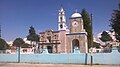
The village is famous in the Tlaxcala carnival for its huehues dance, with showy costumes and whips that crack in time. In Acuitlapilco the culebra dance, in which dancers lash at each other with maguey-fibre whips, is called El Palomo, and the dancers read their costume as a plea for good rains: the feather plume is clouds, the cuarta thunder and the cloth with roses water. The dances can last up to twelve hours. The parish, under the title of Nuestra Señora de la Natividad, has a bell tower and clock beside an atrium with a fountain.
How to get to Santa María Acuitlapilco
Drive from Chiautempan: 10 min, 8 km
Acuitlapilco is in the south of the municipality of Tlaxcala, about 2.6 km in a straight line northwest of Santa Isabel Xiloxoxtla. From Tlaxcala city it is a few minutes by taxi or by combi from the bus terminal; there are no published schedules for the local routes. From Puebla, buses from CAPU to Tlaxcala (Autobuses Valles, roughly every 15 minutes, about 40 minutes) and the 30-minute, 31 km drive bring you to the capital, and you continue south from there. The lagoon lies right beside the village, so it can be reached on foot from the parish. Huejotzingo is about 22 km as the crow flies (about 25 minutes) and Puebla about 26 km (about 30 minutes).
Directions to Santa María Acuitlapilco on Google Maps
Distances are in a straight line; the road is usually longer.
Links open a partner site. We may earn a commission if you book, at no cost to you.
From the nearest cities to Santa María Acuitlapilco
- Chiautempan · 8 km by road, 10 min
- San Martín Texmelucan · 28 km by road, 25 min
- Puebla · 30 km by road, 30 min
Drive times by road from OpenStreetMap, without traffic or stops. Times marked ~ are estimated from the straight-line distance.
What to see in Santa María Acuitlapilco 5
Sights with their own page, closest to the centre first.
Landmarks and museums
-
Catedral de Nuestra Señora de la Asunción · Landmark · 4 km from the centre
The 16th-century Franciscan church of the Asunción, with a Mudéjar cedar ceiling; Tlaxcala's cathedral and a World Heritage Site since 2021. -
Museo Regional de Tlaxcala · Landmark · 4 km from the centre
INAH museum in the cloister of Tlaxcala's Franciscan convent of the Assumption: 13 rooms running from the Paleolithic to the 20th century. -
Palacio de Gobierno de Tlaxcala · Landmark · 4 km from the centre
Seat of Tlaxcala's government since colonial times, on the Plaza de la Constitución; its arcades hold Desiderio Hernández Xochitiotzin's history murals.


Nature reserves
-
Parque nacional Xicoténcatl · Nature reserve · 4 km from the centre
A 1937 national park covering Tlaxcala's historic centre, the Zahuapan River and the hills of three of the old Tlaxcalan lordships.

Viewpoints
-
Escalinatas de los Héroes · Viewpoint · 4 km from the centre
A 1960s flight of 250 steps with a central fountain and statues of national heroes, climbing to a lookout over Tlaxcala city.

Map of Santa María Acuitlapilco
Neighbourhoods and villages of Santa María Acuitlapilco
Part of Santa María Acuitlapilco or just outside it, closest first.
-
San Diego Metepec · Town · 2 km from the centre
Town in Tlaxcala municipality, 'hill of the maguey', with a red-and-white church tower and the La Ocotera ecological park. -
San Sebastián Atlahapa · Town · 2 km from the centre
Locality of 6,503 people in Tlaxcala municipality beside the bypass, with a church with a painted dome dedicated to Saint Sebastian. -
Santa Isabel Xiloxoxtla · Town · 2 km from the centre
Seat of one of Tlaxcala's smallest municipalities, with an industrial park, a charros carnival and the chapel of Juan Diego. -
Santiago Tlacochcalco · Village · 2 km from the centre
Village in Tepeyanco on the Acuitlapilco lagoon, with a church of Santiago Apóstol and a patron-saint fiesta on 25 July. -
La Aurora · Village · 3 km from the centre
Tepeyanco locality close to the Franciscan former convent, among avocado orchards with La Malinche in the background. -
San Lucas Cuauhtelulpan · Town · 3 km from the centre
Locality in Tlaxcala municipality with 5,185 people in 2020, patron Saint Luke the Evangelist and a Nahuatl name meaning "on the wooded mound". -
Santa Cruz Tetela · Village · 3 km from the centre
A Chiautempan village at 2,295 m, with prickly-pear groves and farm plots; its Nahuatl name means stony place. -
La Magdalena Tlaltelulco · Town · 4 km from the centre
A town on the lower slopes of La Malinche, 8 km from Tlaxcala on the Chiautempan-Puebla road, its own municipality since 1995, with a barrio carnival. -
La Trinidad Tepehitec · Town · 4 km from the centre
Tlaxcala's "Heroic Town" by the city bus terminal: a hub of the 1910 anti-reelection movement, with one of the state's liveliest Day of the Dead nights. -
Ocotlán · Town · 4 km from the centre
The hill town above central Tlaxcala, the municipality's most populous locality, with the Pocito holy-water chapel and the basilica on top. -
San Andrés Cuamilpa · Village · 4 km from the centre
Tetlatlahuca village whose Nahuatl name means "in the wooded milpa"; church of Saint Andrew the Apostle. -
San Cosme Atlamaxac · Town · 4 km from the centre
Locality in Tepeyanco, 9 km from Tlaxcala city, with 3,019 residents in 2020, next to the Calvario hill and under 1 km from the municipal seat. -
San Gabriel Cuauhtla · Town · 4 km from the centre
Locality south of Tlaxcala city next to Ocotlán: once brick and tile makers, now housing estates, with a chapel of San Gabriel. -
Tepeyanco · Town · 4 km from the centre
Old lordship south of Tlaxcala city with the ruins of a 1554 Franciscan convent, a brick-and-tile parish church and a name for avocados.


Day trips and tours from Santa María Acuitlapilco
The closest Pueblos Mágicos and places to visit, with the drive from Santa María Acuitlapilco and tours that leave from it.


Times marked ~ are estimated from the distance. Links open a partner site. We may earn a commission if you book, at no cost to you.
Before you go: getting to and around Santa María Acuitlapilco
- The nearest airport is Puebla (PBC).
- The best months to go are January, February, March, and November.
- 12 of the places on this page are more than 3 km from the centre: take a taxi, a ride-hailing app or a local bus.
- For day trips a rental car gives the most freedom; the tours above leave from Santa María Acuitlapilco.
Before you go to Santa María Acuitlapilco: hours, prices and tips
- Best season
- Carnival: the huehues dances are held from the Friday to the Monday before Ash Wednesday. INAFED, Enciclopedia de los Municipios (Tlaxcala) · checked Oct 2026
- What to bring
- Water and sun protection: carnival dances run from morning into the night. Intolerancia Diario · checked Oct 2026
Hours and prices change, especially around holidays. Each fact links to where we checked it.
Visiting Santa María Acuitlapilco: what to see and do
Step into the parish of Santa María, with its bell tower, clock and atrium fountain.
Look over the Acuitlapilco lagoon, a wetland with ducks and other waterbirds in winter.
Come at carnival to see the huehues and the El Palomo dance.
Walk the village streets and their open-air murals.
Compare Acuitlapilco's carnival with Tepeyanco's and Xiloxoxtla's.
Plan your trip
Places to stay in Santa María Acuitlapilco
Compare hotels, posadas, and rentals in and around Santa María Acuitlapilco.
Tours & activities
Day trips around Huejotzingo sometimes stop in Santa María Acuitlapilco; a tour is the easy way to see it without a car.
Rental cars
Pick up a car at PBC (Puebla): about 7 min by road to Huejotzingo, then 22 km more to Santa María Acuitlapilco, on your own schedule.
Flights
The nearest airport with scheduled flights is Puebla (PBC), about 7 min by road from Huejotzingo, the base for Santa María Acuitlapilco.
Mobile data
Signal can drop away from Huejotzingo: download a map of the way to Santa María Acuitlapilco before you set out, or carry an eSIM with data.
Links open a partner site. We may earn a commission if you book, at no cost to you.
When to go to Santa María Acuitlapilco mild
Santa María Acuitlapilco shares the climate of Huejotzingo, 22 km away. The best months to visit are January, February, March, and November.
See the month-by-month climate of Huejotzingo
Weather in Santa María Acuitlapilco now and the next 7 days
Live forecast from Open-Meteo. Chance of rain is the day's highest.
The closest Pueblo Mágico: Huejotzingo

Huejotzingo is the Pueblo Mágico closest to Santa María Acuitlapilco, with places to stay, food, and more to see.
Also close to
Near Santa María Acuitlapilco


Drive times by road from OpenStreetMap, without traffic. Times marked ~ are estimated from the straight-line distance.
Location from OpenStreetMap. Written by Puebloteca.