Village Lerma, Estado de México Municipality of Lerma Toluca Valley
An Otomí community in Lerma at 2,789 m: October feast of San Francisco with arrieros dancers and a sacred forest contested by the Toluca-Naucalpan highway.
From Toluca: 35 min by car (27 km by road) How to get there ↓
Near here
See everything nearby ↓


Plan your visit to San Francisco Xochicuautla
Where to stay near San Francisco Xochicuautla
Compare hotels, posadas and guest houses in San Francisco Xochicuautla.
Tours to San Francisco Xochicuautla
Day trips and guided outings from Metepec often include San Francisco Xochicuautla; with a local guide you can get there without a car.
 Tours from Mexico City
Teotihuacan pyramids morning or afternoon without tourist traps
★ 4.9 (10,269) · From US$59
How to get to San Francisco Xochicuautla
- From Toluca: about 35 min by road (~27 km)
- Nearest airport: Toluca (TLC), 17 min by car to Metepec
Links open a partner site. We may earn a commission if you book, at no cost to you.
Tours from Mexico City, near San Francisco Xochicuautla


Tours, prices and ratings from Viator, checked weekly. We may earn a commission if you book.
About San Francisco Xochicuautla
San Francisco Xochicuautla, "Xochi" to locals, is an Otomí (Hñañú) community in Lerma municipality, at 2,789 m, with 3,980 residents in 2020. The Nahuatl name is read as "place of trees and flowers". Wikipedia says indigenous people founded it in pre-Hispanic times, and in 1863 it received part of the woods of the Hacienda de San Nicolás Peralta from a donation by Gregorio de Mier. Its main church marked 100 years since its reconstruction in 2019.
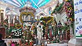
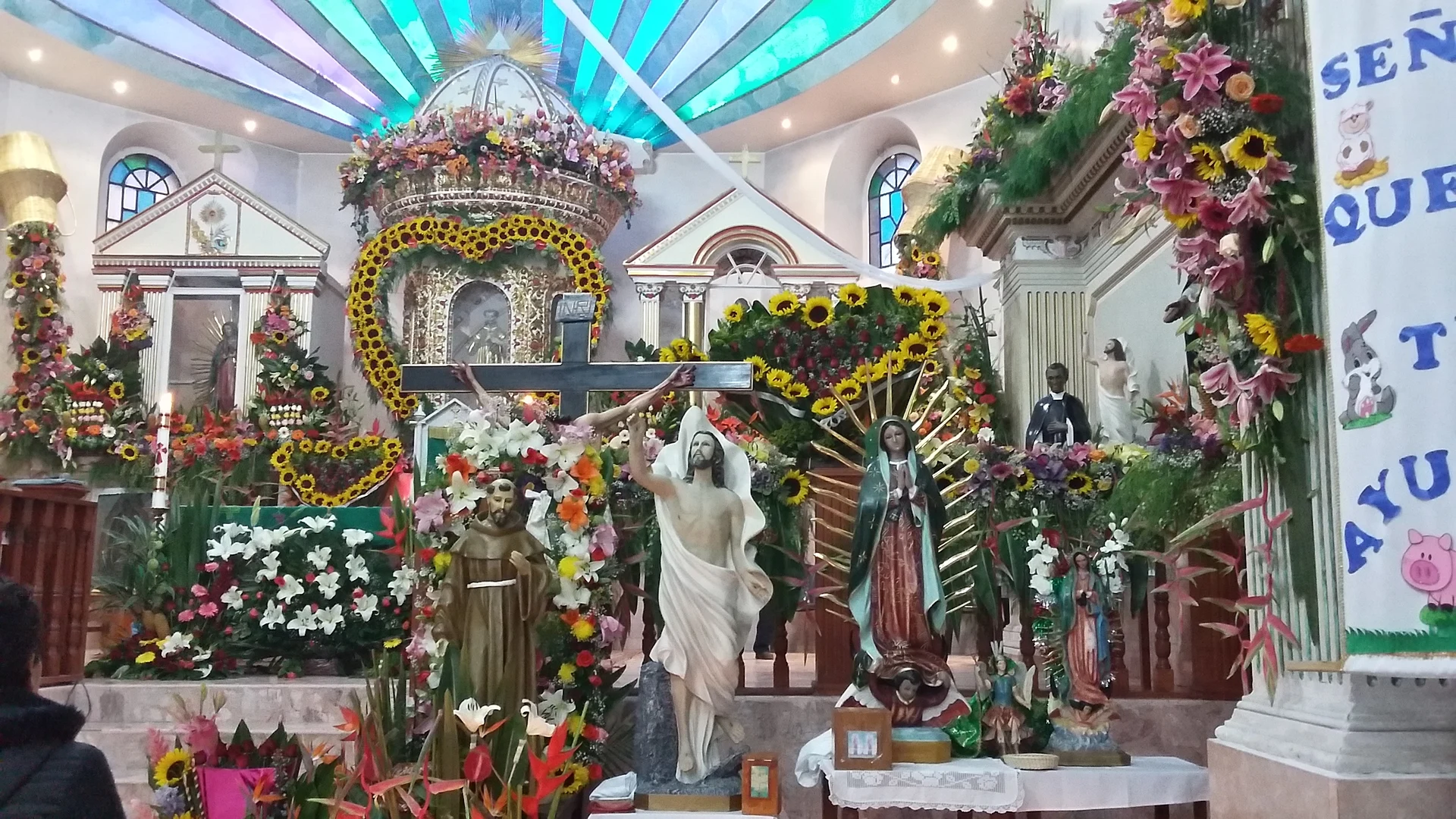
The best moment to visit is 4 October and the days around it, the feast of St Francis of Assisi. On the first day the images are carried down from the chapels to the main church, there is mass and, on weekdays, fireworks castles; the following Sunday the church is dressed in flowers and lights and the streets in cut-paper banners. Arrieros dance in their hats with clay pieces. The next Monday they throw kitchenware, sweets, fruit and toys to the crowd and stage a playful fight with the "rateros", costumed people who steal their banners; it ends with firework toritos. On Tuesday they say goodbye and the church stewards climb Cerro de la Verónica to fire rockets. On 13 September the chapel of the Señor de la Exaltación holds another eve with arrieros dancing and a shared meal.
The community is also known for defending its forest, which the Hñañú people regard as sacred: since 2007 the Supreme Indigenous Council has opposed the route of the Toluca-Naucalpan highway through those woods. If you come to walk or for the fiesta, do so with that context in mind.
How to get to San Francisco Xochicuautla
Drive from Toluca: 35 min, 27 km
San Francisco Xochicuautla is in Lerma municipality, about 12 km in a straight line northeast of Lerma de Villada, about 24 km straight-line from Toluca and about 21 km from Metepec, the nearest pueblo; by car allow roughly 30 minutes from Toluca (an estimate). A chapel (the Señor de la Exaltación) stands on the village's main road. There is no published published public transport timetables: ask about colectivos to Xochicuautla in Lerma or at the Toluca terminal. During the October feast stalls and rides fill the sports field, so allow extra time.
Directions to San Francisco Xochicuautla on Google Maps
Distances are in a straight line; the road is usually longer.
Links open a partner site. We may earn a commission if you book, at no cost to you.
From the nearest cities to San Francisco Xochicuautla
- Toluca · 27 km by road, 35 min
- Mexico City · 55 km by road, 1 h
- Cuautla · about 105 km by road, ~1 h 30 min
Drive times by road from OpenStreetMap, without traffic or stops. Times marked ~ are estimated from the straight-line distance.
Before you go to San Francisco Xochicuautla: hours, prices and tips
- Best time of day
- Early October, during the patron feast. Wikipedia (es) · checked Oct 2026
- Best season
- The feast of St Francis of Assisi is 4 October and the nearest weekend, with arrieros dancing; the eve of the Señor de la Exaltación is 13 September. Wikipedia (es) · checked Oct 2026
Hours and prices change, especially around holidays. Each fact links to where we checked it.
Visiting San Francisco Xochicuautla: what to see and do
Come for the feast of St Francis of Assisi (4 October and the nearest weekend), with arrieros dancing.
Go into the main church, rebuilt more than a century ago.
Attend the 13 September eve of the Señor de la Exaltación at the roadside chapel.
Climb Cerro de la Verónica, where the church stewards fire rockets.
Walk the Otomí forest respectfully; the community is defending it.
Plan your trip
Places to stay in San Francisco Xochicuautla
Compare hotels, posadas, and rentals in and around San Francisco Xochicuautla.
Tours & activities
Day trips and guided outings from Metepec often include San Francisco Xochicuautla; with a local guide you can get there without a car.
Rental cars
Pick up a car at TLC (Toluca): about 17 min by road to Metepec, then 21 km more to San Francisco Xochicuautla, on your own schedule.
Flights
The nearest airport with scheduled flights is Toluca (TLC), about 17 min by road from Metepec, the base for San Francisco Xochicuautla.
Mobile data
Signal can drop away from Metepec: download a map of the way to San Francisco Xochicuautla before you set out, or carry an eSIM with data.
Links open a partner site. We may earn a commission if you book, at no cost to you.
When to go to San Francisco Xochicuautla cool
San Francisco Xochicuautla shares the climate of Metepec, 21 km away. The best months to visit are January, February, March, and December.
See the month-by-month climate of Metepec
Weather in San Francisco Xochicuautla now and the next 7 days
Live forecast from Open-Meteo. Chance of rain is the day's highest.
The closest Pueblo Mágico: Metepec

Metepec is the Pueblo Mágico closest to San Francisco Xochicuautla, with places to stay, food, and more to see.
Also close to
- Villa del Carbón · Estado de México · 40 km away
- Tepotzotlán · Estado de México · 45 km away
- Malinalco · Estado de México · 47 km away
- Tepoztlán · Morelos · 56 km away
- Ixtapan de la Sal · Estado de México · 64 km away
Closest to San Francisco Xochicuautla
-
San Miguel Ameyalco · Village · 8 km away
-
Salazar · Village · 9 km away
-
Xonacatlán de Vicencio · Town · 9 km away
-
Huixquilucan de Degollado · Town · 10 km away
-
Amomolulco · Village · 11 km away
-
El Hielo · Village · 11 km away
-
Isidro Fabela · Village · 11 km away
-
Ocoyoacac · Town · 11 km away


Near San Francisco Xochicuautla


Drive times by road from OpenStreetMap, without traffic. Times marked ~ are estimated from the straight-line distance.
Location from OpenStreetMap. Written by Puebloteca.