Landmark Pachuca de Soto, Hidalgo Municipality of Pachuca de Soto Hidalgo Mountain Corridor Comarca Minera Geopark
Pachuca's former zoo, now a rescue centre for wild animals, with an aviary, primate area, splash zone and cycle path.
From Tulancingo: about 45 min by road (~50 km) How to get there ↓
Near here
See everything nearby ↓


Plan your visit to Bioparque de Convivencia Pachuca
Where to stay near Bioparque de Convivencia Pachuca
Compare hotels, posadas and guest houses in Bioparque de Convivencia Pachuca.
Tours to Bioparque de Convivencia Pachuca
Look for tours of the area around Real del Monte that stop at Bioparque de Convivencia Pachuca.
 Tours from Zacatlan
Zacatlán Guided Tour walking through the Center
★ 5.0 (2) · From US$8
How to get to Bioparque de Convivencia Pachuca
- From Tulancingo: about 45 min by road (~50 km)
- Nearest airport: Mexico City (Felipe Ángeles) (NLU), 1 h 6 min by car to Real del Monte
Links open a partner site. We may earn a commission if you book, at no cost to you.
Tours from Zacatlan, near Bioparque de Convivencia Pachuca
Tours, prices and ratings from Viator, checked weekly. We may earn a commission if you book.
About Bioparque de Convivencia Pachuca
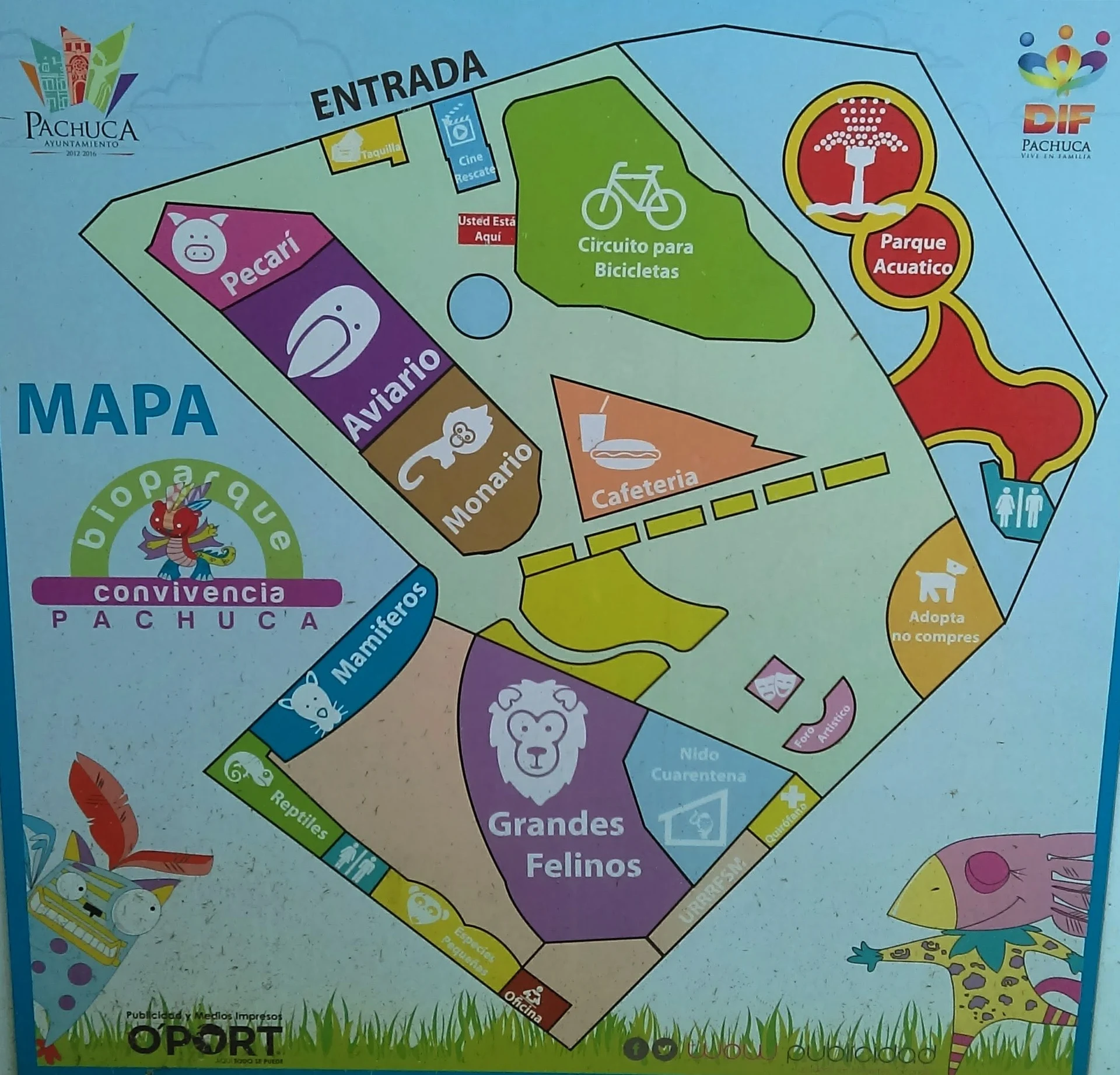
The Bioparque de Convivencia sits on Avenida Benito Juárez in the city of Pachuca de Soto, a little over a kilometre from the bus station. It began in 1978 as the Parque de Convivencia Infantil, little more than a children's playground opened under a scheme to reclaim public spaces. Over the years it turned into the city zoo, and in 1998 it was registered with the federal environment ministry as a wildlife management unit. In 2012 the city adopted an animal-welfare policy and rebuilt the grounds with a water play area, food court, open-air theatre and playground. In May 2013 it signed an agreement with The Wild Animal Sanctuary in Colorado to act as a temporary shelter for confiscated animals, and on 29 April 2014 it opened Mexico's first rescue, relocation and rehabilitation unit for wild, exotic and endemic fauna. That meant giving up its status as a zoo: animals taken from circuses, poor zoos and private homes are treated here and then released into protected areas or sent on to the Colorado sanctuary. The first patient was Invictus, a black bear from a travelling show whose jaw had been removed; surgeons fitted him with two titanium bars in July 2014, but he died of a heart condition that October. A Museum of Animal Rescue and a primate house with its own operating room opened in 2016. Today the grounds hold an aviary, the primate area, enclosures for big cats, reptiles and other mammals, a playground and splash zone, a café and a cycle path, plus workshops and guided visits. The three mascots carry Otomí names: Mädi, Mbon'i and Tzónigo. Some visitors find it run-down, so keep expectations modest.
How to get to Bioparque de Convivencia Pachuca
From Mexico City, Pachuca buses leave from Terminal Norte (Autobuses del Norte); there are also departures every 30 minutes from Terminal 1 of Benito Juárez airport, and Futura and ADO run from AIFA airport (about 90 minutes). Pachuca's bus station, at Ex Hacienda de Coscotitlán, is just over 1 km from the bioparque: take a taxi, a combi or the Tuzobús, which costs M$10 with a prepaid Tuzocard. By car from Tulancingo it is about 48 km and 50 minutes; from Real del Monte, 13 km and about 15 minutes.
Directions to Bioparque de Convivencia Pachuca on Google Maps
Distances are in a straight line; the road is usually longer.
Links open a partner site. We may earn a commission if you book, at no cost to you.
From the nearest cities to Bioparque de Convivencia Pachuca
- Tulancingo · about 50 km by road, ~45 min
- Huauchinango · about 95 km by road, ~1 h 25 min
- Mexico City · about 110 km by road, ~1 h 40 min
Drive times by road from OpenStreetMap, without traffic or stops. Times marked ~ are estimated from the straight-line distance.
Before you go to Bioparque de Convivencia Pachuca: hours, prices and tips
- Hours
- Tuesday to Sunday 10:00-17:00; closed Mondays. Wikivoyage · checked Oct 2026
- Guide or tour
- Guided visits and workshops are offered but not required. Tours: Viator GetYourGuide Wikipedia · checked Oct 2026
Hours and prices change, especially around holidays. Each fact links to where we checked it.
Visiting Bioparque de Convivencia Pachuca: what to see and do
The aviary.
The primate house, with its own operating room.
The enclosures for rescued big cats, reptiles and mammals.
The splash zone and children's playground.
The park's cycle path.
Workshops and guided visits.
Plan your trip
Places to stay in Bioparque de Convivencia Pachuca
Compare hotels, posadas, and rentals in and around Bioparque de Convivencia Pachuca.
Tours & activities
Look for tours of the area around Real del Monte that stop at Bioparque de Convivencia Pachuca.
Rental cars
Pick up a car at NLU (Mexico City (Felipe Ángeles)): about 1 h 6 min by road to Real del Monte, then 8 km more to Bioparque de Convivencia Pachuca, on your own schedule.
Flights
The nearest airport with scheduled flights is Mexico City (Felipe Ángeles) (NLU), about 1 h 6 min by road from Real del Monte, the base for Bioparque de Convivencia Pachuca.
Mobile data
Signal can drop away from Real del Monte: download a map of the way to Bioparque de Convivencia Pachuca before you set out, or carry an eSIM with data.
Links open a partner site. We may earn a commission if you book, at no cost to you.
When to go to Bioparque de Convivencia Pachuca cool
Bioparque de Convivencia Pachuca shares the climate of Real del Monte, 8 km away. The best months to visit are February, March, April, and May.
See the month-by-month climate of Real del Monte
Weather in Bioparque de Convivencia Pachuca now and the next 7 days
Live forecast from Open-Meteo. Chance of rain is the day's highest.
The closest Pueblo Mágico: Real del Monte

Real del Monte is the Pueblo Mágico closest to Bioparque de Convivencia Pachuca, with places to stay, food, and more to see.
Also close to
- Mineral del Chico · Hidalgo · 10 km away
- Huasca de Ocampo · Hidalgo · 19 km away
- Zempoala · Hidalgo · 24 km away
- Otumba · Estado de México · 47 km away
- Teotihuacán · Estado de México · 48 km away
Closest to Bioparque de Convivencia Pachuca
-
Basílica Menor de Nuestra Señora de Guadalupe · Landmark · 1 km away
-
Jardín del Maestro · Nature reserve · 1 km away
-
Pachuca · City · 1 km away
-
Parque Hidalgo · Nature reserve · 1 km away
-
Parque de la Familia · Nature reserve · 1 km away
-
Plaza Juárez · Landmark · 1 km away
-
Archivo Histórico y Museo de Minería de Pachuca · Landmark · 2 km away
-
El Arbolito · Landmark · 2 km away


Near Bioparque de Convivencia Pachuca


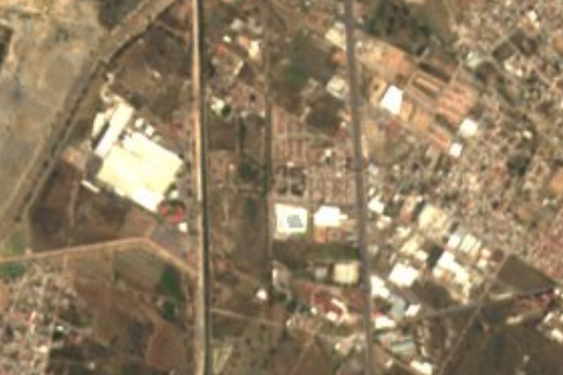

Drive times by road from OpenStreetMap, without traffic. Times marked ~ are estimated from the straight-line distance.
Location from OpenStreetMap. Written by Puebloteca.