Town Tepalcatepec, Michoacán Tierra Caliente
"Tepeque", a Tierra Caliente seat on the Jalisco line: arcades, the San Francisco parish and some of Mexico's hottest weather.
From Apatzingán: about 1 h by road (~70 km) How to get there ↓
Near here
See everything nearby ↓


Plan your visit to Tepalcatepec
Where to stay near Tepalcatepec
Compare hotels, posadas and guest houses in Tepalcatepec.
Tours to Tepalcatepec
Day trips around Cotija sometimes stop in Tepalcatepec; a tour is the easy way to see it without a car.
How to get to Tepalcatepec
- From Apatzingán: about 1 h by road (~70 km)
- Nearest airport: Uruapan (UPN), 2 h 5 min by car to Cotija
Links open a partner site. We may earn a commission if you book, at no cost to you.
About Tepalcatepec
Tepalcatepec, known to everyone as Tepeque, is the seat of the municipality of the same name, at the far western end of Michoacán's Tierra Caliente, right against the Jalisco line. It sits at about 370 metres in the valley of the Tepalcatepec River, 267 km from Morelia, and had 17,293 people in 2020. The name is Nahuatl for "hill of the potsherds".
The settlement is pre-Hispanic and paid tribute in cotton and salt to the Purépecha. In 1528 it was granted in encomienda to Alonso de Ávalos, Franciscans from Tancítaro converted its people, and by 1580 forty Spaniards lived here off cacao orchards and cattle ranches. It became a tenencia of Apatzingán in 1831 and a municipality of its own in June 1877. During the Cristero War, in 1927 and 1928, it was besieged three times by federal troops. In 2013 it was the birthplace of the self-defence movement led by the doctor José Manuel Mireles.
The yearly average is close to 29 °C, 50.3 °C has been recorded in May, and the air stays very dry most of the year. The land around is dry tropical scrub with mesquite, huizache, cactus and parota trees, and the rocky hillsides are home to the Michoacán spiny-tailed iguana, found only in this area.
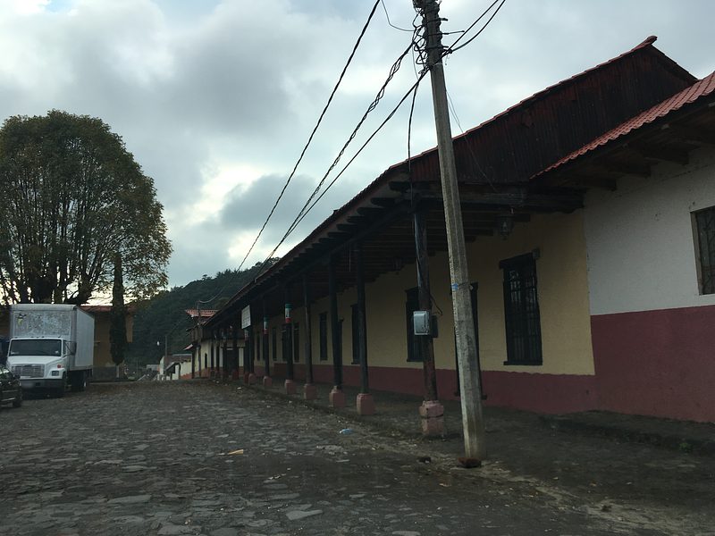
The centre keeps the parish church of San Francisco, the town hall, the arcades around the plaza, laid out under the building ordinances of Philip II, and Avenida Melchor Ocampo. The food is pure Tierra Caliente: cecina, morisqueta, fire-roasted goat, lard tamales, atoles and capirotada. Local workshops make wooden furniture and leather goods, and the music is harp and brass band.
How to get to Tepalcatepec
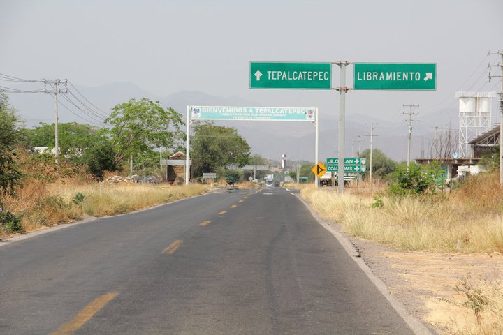
Tepalcatepec lies west of Apatzingán, 1 h 5 min away by car (66 km by road) on federal highway 120 (Quiroga–Tepalcatepec), which crosses the valley westward past Buenavista and ends in town. At the entrance, the welcome arch also signs the roads on to Jilotlán, in Jalisco, and to Coalcomán. The nearest Pueblo Mágico by road is Cotija, 2 h 15 min away (136 km). Parhikuni buses run between Apatzingán and Tepalcatepec with departures every few hours; the ride takes about an hour and a half. The US State Department rates Michoacán "Do not travel" because of crime, the area has seen fighting between criminal groups since 2020, and the town's mayor was murdered in June 2025. Check the current advisory and local news before going.
Directions to Tepalcatepec on Google Maps
Distances are in a straight line; the road is usually longer.
Links open a partner site. We may earn a commission if you book, at no cost to you.
From the nearest cities to Tepalcatepec
- Apatzingán · about 70 km by road, ~1 h
- Ciudad Guzmán · about 110 km by road, ~1 h 40 min
- Uruapan · about 115 km by road, ~1 h 40 min
Drive times by road from OpenStreetMap, without traffic or stops. Times marked ~ are estimated from the straight-line distance.
Visiting Tepalcatepec: what to see and do
Walk the arcades around the main plaza.
Step into the parish church of San Francisco.
See the town hall and stroll Avenida Melchor Ocampo.
Eat cecina, morisqueta, fire-roasted goat or lard tamales.
Look for wooden furniture and leatherwork made in town.
Listen for harp music or a brass band.
Plan your trip
Places to stay in Tepalcatepec
Compare hotels, posadas, and rentals in and around Tepalcatepec.
Tours & activities
Day trips around Cotija sometimes stop in Tepalcatepec; a tour is the easy way to see it without a car.
Rental cars
Pick up a car at UPN (Uruapan): about 2 h 5 min by road to Cotija, then 71 km more to Tepalcatepec, on your own schedule.
Flights
The nearest airport with scheduled flights is Uruapan (UPN), about 2 h 5 min by road from Cotija, the base for Tepalcatepec.
Mobile data
Signal can drop away from Cotija: download a map of the way to Tepalcatepec before you set out, or carry an eSIM with data.
Links open a partner site. We may earn a commission if you book, at no cost to you.
When to go to Tepalcatepec mild
Tepalcatepec shares the climate of Cotija, 71 km away. The best months to visit are January, March, April, and November.
See the month-by-month climate of Cotija
Weather in Tepalcatepec now and the next 7 days
Live forecast from Open-Meteo. Chance of rain is the day's highest.
The closest Pueblo Mágico: Cotija

Cotija is the Pueblo Mágico closest to Tepalcatepec, with places to stay, food, and more to see.
Closest to Tepalcatepec
-
Buenavista Tomatlán · Village · 27 km away
-
Jilotlán de los Dolores · Village · 27 km away
-
Santa María del Oro · Town · 45 km away
-
Chorros del Varal · Waterfall · 47 km away
Near Tepalcatepec




Drive times by road from OpenStreetMap, without traffic. Times marked ~ are estimated from the straight-line distance.
Location from OpenStreetMap. Written by Puebloteca.