
Archaeological site Tlayacapan, Morelos Municipality of Tlayacapan Monasteries on the slopes of Popocatépetl Northern Morelos
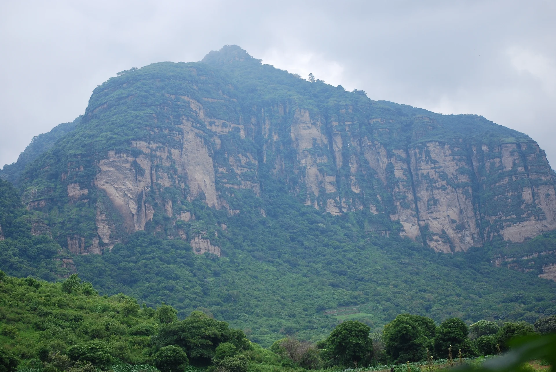
Toltec-era terraces, burials and a pyramid platform (AD 900-1200) atop a Tlayacapan rock hill, excavated by INAH since 2012.
Reached on foot from Tlayacapan: 1 h 30 min each way. How to get there ↓
Near here
See everything nearby ↓


Plan your visit to Zona Arqueológica El Tlatoani
Where to stay near Zona Arqueológica El Tlatoani
Compare hotels, posadas and guest houses in Zona Arqueológica El Tlatoani.
Tours to Zona Arqueológica El Tlatoani
A guide brings Zona Arqueológica El Tlatoani to life: look for tours from Tlayacapan that include the site and the ride there.
How to get to Zona Arqueológica El Tlatoani
- Reached on foot from Tlayacapan: 1 h 30 min each way.
- From Cuautla: about 25 min by road (~19 km)
- Nearest airport: Mexico City (MEX), 1 h 33 min by car to Tlayacapan
Links open a partner site. We may earn a commission if you book, at no cost to you.
About Zona Arqueológica El Tlatoani
El Tlatoani is one of the sheer rock hills that wall in Tlayacapan, and its top holds a pre-Hispanic settlement: stone terraces, house floors, burials and, at the highest point, a pyramid platform. The Nahuatl word tlatoani, "the one who speaks", was the title of a city-state's ruler. Cecilio Agustín Robelo reported the ruins in 1885, but INAH only began systematic digs in 2012, and the project is still running.
The summit is steep, so its people built retaining walls of stone to create level platforms for their homes. The main occupation dates to the Toltec period, the Early Postclassic (AD 900 to 1200), after Xochicalco's collapse, when Tula was the dominant power in central Mexico. Archaeologists credit the site to the Tlayacapan tlaca, the "people of Tlayacapan". In its last phase the hilltop was turned into a defensive stronghold.
A 2014 dig on one of the lower summit terraces recovered griddles, cooking pots, braziers, obsidian blades, nose ornaments, greenstone beads and the stone beaters used to make bark paper. One burial there was a woman over 21 whose front teeth were worn from use as a tool, perhaps by a potter or basket maker. Radiocarbon dating puts her death in the late 10th or early 11th century. Ceramic moulds lay beside her, one incised with a sun sign of the Five Suns myth.
The summit temple may have served the rain god Tláloc, and petroglyphs found in the excavations point to older water and fertility rites. From the top the sun rises behind the Sierra Nevada volcanoes, and the spot may have been used to track the farming year. In August 2023 heavy rain exposed another woman's burial near the entrance, about a thousand years old and wrapped in a reed mat. Below it lay pottery from the Late Preclassic (500 to 150 BC), the oldest yet found here. Local residents alerted INAH, which works the site together with the town.
How to get to Zona Arqueológica El Tlatoani
Drive from Cuautla to Tlayacapan: 25 min, 19 km
The hill rises a little over 2 km west of Tlayacapan's centre, as the crow flies. No road reaches the top: you walk up a trail through the scrub. Routes posted on Wikiloc from the town run about 3.8 km with some 356 m of climbing, and hikers report roughly an hour and a half to go up.
By car from Mexico City there are two ways. On the toll road, take the Mexico City-Cuernavaca highway, turn off towards Oaxtepec and follow the signs to Tlayacapan; tolls come to about 120 pesos each way. Toll-free, take the Xochimilco-Oaxtepec road (federal 113) and watch for the Tlayacapan turn-off. It is about 75 km, roughly an hour and a half without traffic. From Cuautla it is about 23 km, around 25 minutes by car.
By bus, Estrella Roja de Cuautla runs direct services every hour from Mexico City's Terminal Sur (Taxqueña) to Tlayacapan, about 2 h 40 min. Or ride Pullman de Morelos or OCC from Taxqueña to Oaxtepec and change there to the Estrella Roja bus for the last 20 minutes. From Cuautla, Estrella Roja de Cuautla leaves hourly and takes about 50 minutes.
Reached on foot from Tlayacapan: 1 h 30 min each way.
Directions to Zona Arqueológica El Tlatoani on Google Maps
Distances are in a straight line; the road is usually longer.
Links open a partner site. We may earn a commission if you book, at no cost to you.
From the nearest cities to Zona Arqueológica El Tlatoani
- Cuautla · 19 km by road, 25 min to Tlayacapan, then 1 h 30 min on foot
- Cuernavaca · 50 km by road, 50 min to Tlayacapan, then 1 h 30 min on foot
- Mexico City · about 70 km by road, ~1 h 5 min to Tlayacapan, then 1 h 30 min on foot
Drive times by road from OpenStreetMap, without traffic or stops. Times marked ~ are estimated from the straight-line distance.
Before you go to Zona Arqueológica El Tlatoani: hours, prices and tips
- Hours
- Friday to Sunday, 10 am to 5 pm. México Desconocido · checked Oct 2026
- What to bring
- Comfortable clothes and proper walking shoes for the trail. México Desconocido · checked Oct 2026
Hours and prices change, especially around holidays. Each fact links to where we checked it.
Visiting Zona Arqueológica El Tlatoani: what to see and do
Climb the trail through the scrub to the pyramid platform on the summit.
Look for the terraces held up by stone retaining walls, where the Tlayacapan tlaca had their homes.
From the edge of the summit, look down the near-vertical walls of the rock.
Face east: from the top the sun rises behind the Sierra Nevada volcanoes.
Walk back down to Tlayacapan's centre for the former convent of San Juan Bautista and La Cerería.
Plan your trip
Places to stay in Zona Arqueológica El Tlatoani
Compare hotels, posadas, and rentals in and around Zona Arqueológica El Tlatoani.
Tours & activities
A guide brings Zona Arqueológica El Tlatoani to life: look for tours from Tlayacapan that include the site and the ride there.
Rental cars
Pick up a car at MEX (Mexico City): about 1 h 33 min by road to Tlayacapan, then 2 km more to Zona Arqueológica El Tlatoani, on your own schedule.
Flights
The nearest airport with scheduled flights is Mexico City (MEX), about 1 h 33 min by road from Tlayacapan, the base for Zona Arqueológica El Tlatoani.
Mobile data
Signal can drop away from Tlayacapan: download a map of the way to Zona Arqueológica El Tlatoani before you set out, or carry an eSIM with data.
Links open a partner site. We may earn a commission if you book, at no cost to you.
When to go to Zona Arqueológica El Tlatoani mild
Zona Arqueológica El Tlatoani shares the climate of Tlayacapan, 2 km away. The best months to visit are January, February, March, and December.
See the month-by-month climate of Tlayacapan
Weather in Zona Arqueológica El Tlatoani now and the next 7 days
Live forecast from Open-Meteo. Chance of rain is the day's highest.
The closest Pueblo Mágico: Tlayacapan

Tlayacapan is the Pueblo Mágico closest to Zona Arqueológica El Tlatoani, with places to stay, food, and more to see.
Also close to
- Tepoztlán · Morelos · 11 km away
- Tlaltizapán · Morelos · 34 km away
- Xochitepec · Morelos · 37 km away
- Malinalco · Estado de México · 52 km away
- Atlixco · Puebla · 61 km away
Closest to Zona Arqueológica El Tlatoani
-
San José de los Laureles · Village · 2 km away
-
Ignacio Bastida · Village · 3 km away
-
Amatlán de Quetzalcóatl · Town · 4 km away
-
Lázaro Cárdenas · Village · 4 km away
-
Adolfo López Mateos · Village · 5 km away
-
Oacalco · Village · 5 km away
-
Tlalnepantla · Village · 5 km away
-
Emiliano Zapata · Village · 6 km away

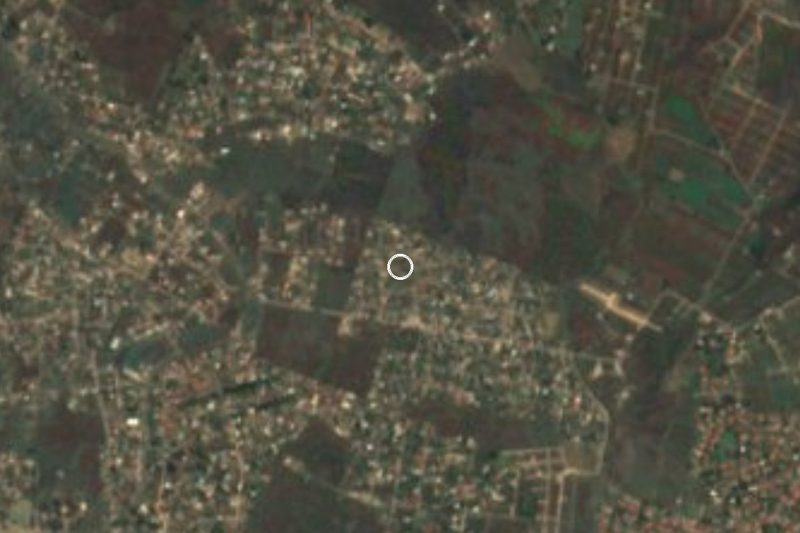
Near Zona Arqueológica El Tlatoani
-
San Andrés Cuauhtempan · Village · Morelos
1 h 40 min: 1 h 30 min on foot back to Tlayacapan, then drive -
Exconvento de Santo Domingo de Guzmán · Landmark · Morelos
1 h 40 min: 1 h 30 min on foot back to Tlayacapan, then drive -
Estadio Olímpico de Oaxtepec · Landmark · Morelos
1 h 40 min: 1 h 30 min on foot back to Tlayacapan, then drive -
San Juan Texcalpan · Village · Morelos
1 h 40 min: 1 h 30 min on foot back to Tlayacapan, then drive -
Balneario Ejidal El Bosque · Hot springs · Morelos
1 h 45 min: 1 h 30 min on foot back to Tlayacapan, then drive -
Templo y exconvento de San Guillermo · Landmark · Morelos
1 h 45 min: 1 h 30 min on foot back to Tlayacapan, then drive






Drive times by road from OpenStreetMap, without traffic. Times marked ~ are estimated from the straight-line distance.
Lists with Zona Arqueológica El Tlatoani
Ruins in Morelos · 9 Ruins near Tlayacapan · 17 Ruins near Tepoztlán · 19 Ruins near Cuautla · 12 Ruins near Cuernavaca · 17 Ruins near Xochitepec · 12 Ruins near Malinalco · 11 Ruins near Mexico City · 17Location from OpenStreetMap. Written by Puebloteca.