
Village Soltepec, Puebla
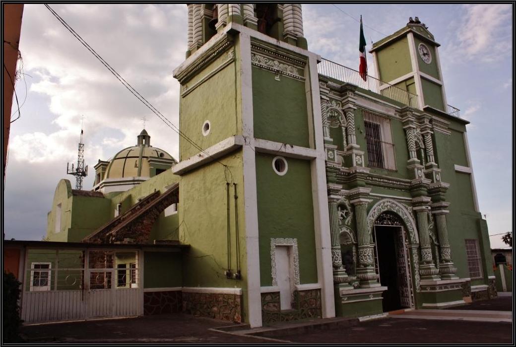
The "hill of quails", once "of palms": a town between the Llanos de San Juan and La Malinche, with a 17th-century church of San Hipólito.
From Huamantla: 35 min by car (40 km by road) How to get there ↓
Near here
See everything nearby ↓


Plan your visit to Soltepec
Where to stay near Soltepec
Compare hotels, posadas and guest houses in Soltepec.
Tours to Soltepec
Day trips and guided outings from Ixtenco often include Soltepec; with a local guide you can get there without a car.
How to get to Soltepec
- From Huamantla: about 35 min by road (~40 km)
- Nearest airport: Puebla (PBC), 1 h 16 min by car to Ixtenco
Links open a partner site. We may earn a commission if you book, at no cost to you.
About Soltepec
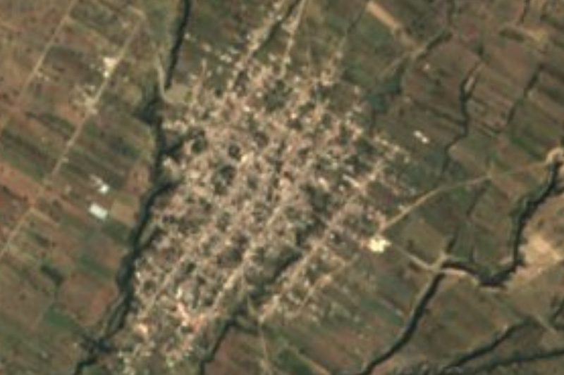
This town changed its name when its landscape changed. It was first called Zoyaltepec, from zoyatl, palm, and tepetl, hill: "on the hill of palms". Over the years the palm disappeared and people renamed the place Soltepec, from zollin, quail, "on the hill of quails"; the bird still appears among the municipality's wildlife, along with rabbits, hares, coyotes, opossums, hawks, owls and bobcats. The town had 6,533 inhabitants in 2020 and sits at 2,427 metres, about 52 km in a straight line from Puebla. From its square, on clear days, you can see the Citlaltépetl.
The municipality, 139.05 km², mixes two worlds. The northeast is flat, part of the Llanos de San Juan, an old closed lake basin whose lowest point holds the Totolcingo lagoon, with salty tequesquite outcrops; a network of irrigation canals connects with it. To the southeast runs a range rising some 500 metres above the valley, with steep slopes and the hills of Guiloa, Chiconguatze, La Magueyera, La Mesa and La Palizada; to the southwest begin the lower slopes of La Malinche. Elevation runs from 2,360 to 2,920 metres, averages are a mere 12 to 14 °C and 500 to 900 mm of rain falls. The north face of the range has pine and oak forest; the south face, desert scrub. The Tarasco, Salto de Gave and Xaxalapa ravines drop toward the Tepeaca valley, and in the community of San Mateo, 8 km from the seat, there is a marble mine. It borders Rafael Lara Grajales, Acatzingo, Mazapiltepec de Juárez and Nopalucan.
In the main square sits a prehistoric stone shaped like a cooking pot, and facing it the 17th-century parish church of San Hipólito. The cooking tastes of the cold highlands: mutton barbacoa, carnitas, grilled rabbit, mushroom mole, maguey worms, tlacoyos, broad beans with nopal and wheat tortillas, plus mole poblano, pipián, tamales and chileatole. People drink pulque, aguamiel and tepache, and sweets are made from pumpkin, chilacayote, peach, apple, perón and tejocote.
How to get to Soltepec
Drive from Huamantla: 35 min, 40 km
Soltepec borders Acatzingo to the south and Rafael Lara Grajales to the north. Acatzingo is about 48 km by road from Puebla, roughly 35 minutes' drive to the CAPU; buses run from Puebla to Acatzingo and to Tepeaca, with very frequent departures to Tepeaca. From Acatzingo, continue by local road or taxi. We found no published timetable for direct Puebla–Soltepec transport.
Directions to Soltepec on Google Maps
Distances are in a straight line; the road is usually longer.
Links open a partner site. We may earn a commission if you book, at no cost to you.
From the nearest cities to Soltepec
- Huamantla · 40 km by road, 35 min
- Puebla · 73 km by road, 1 h 5 min
- Chiautempan · 80 km by road, 1 h 10 min
Drive times by road from OpenStreetMap, without traffic or stops. Times marked ~ are estimated from the straight-line distance.
Visiting Soltepec: what to see and do
The 17th-century parish church of San Hipólito.
The prehistoric pot-shaped stone in the square and the view of the Citlaltépetl from the plaza.
The range with the Guiloa and Chiconguatze hills, and the plains toward the Totolcingo lagoon.
Mutton barbacoa, mushroom mole and pulque.
Plan your trip
Places to stay in Soltepec
Compare hotels, posadas, and rentals in and around Soltepec.
Tours & activities
Day trips and guided outings from Ixtenco often include Soltepec; with a local guide you can get there without a car.
Rental cars
Pick up a car at PBC (Puebla): about 1 h 16 min by road to Ixtenco, then 28 km more to Soltepec, on your own schedule.
Flights
The nearest airport with scheduled flights is Puebla (PBC), about 1 h 16 min by road from Ixtenco, the base for Soltepec.
Mobile data
Signal can drop away from Ixtenco: download a map of the way to Soltepec before you set out, or carry an eSIM with data.
Links open a partner site. We may earn a commission if you book, at no cost to you.
When to go to Soltepec cool
Soltepec shares the climate of Ixtenco, 28 km away. The best months to visit are February, March, November, and December.
See the month-by-month climate of Ixtenco
Weather in Soltepec now and the next 7 days
Live forecast from Open-Meteo. Chance of rain is the day's highest.
The closest Pueblo Mágico: Ixtenco

Ixtenco is the Pueblo Mágico closest to Soltepec, with places to stay, food, and more to see.
Also close to
- Huamantla · Tlaxcala · 31 km away
- Cholula · Puebla · 64 km away
- Tlaxco · Tlaxcala · 70 km away
- Orizaba · Veracruz · 70 km away
- Coscomatepec · Veracruz · 70 km away
Closest to Soltepec
-
Mazapiltepec de Juárez · Village · 1 km away
-
Rinconada · Village · 4 km away
-
San Salvador el Seco · Town · 7 km away
-
San Sebastián Villanueva · Village · 7 km away
-
Aljibes · Village · 9 km away
-
Santa María Coatepec · Village · 12 km away
-
Santa Úrsula Chiconquiac · Village · 12 km away
-
Santa María Ixtiyucan · Village · 13 km away
Near Soltepec





Drive times by road from OpenStreetMap, without traffic. Times marked ~ are estimated from the straight-line distance.
Location from OpenStreetMap. Written by Puebloteca.