
Town Emiliano Zapata, Tlaxcala
Mountain town in northern Tlaxcala at 2,884 m, born as the Ojo de Agua hamlet beside Hacienda Tenexac; Cristo Rey fiesta in November.
From Huamantla: 45 min by car (42 km by road) How to get there ↓
Near here
See everything nearby ↓



Plan your visit to Emiliano Zapata
Where to stay near Emiliano Zapata
Compare hotels, posadas and guest houses in Emiliano Zapata.
Tours to Emiliano Zapata
Day trips around Tlaxco sometimes stop in Emiliano Zapata; a tour is the easy way to see it without a car.
 Tours from Puebla City
Africam Safari Zoo Admission with Transportation
★ 4.8 (87) · From US$35
How to get to Emiliano Zapata
- From Huamantla: about 45 min by road (~42 km)
- Nearest airport: Puebla (PBC), 1 h 6 min by car to Tlaxco
Links open a partner site. We may earn a commission if you book, at no cost to you.
Tours from Puebla City, near Emiliano Zapata


Tours, prices and ratings from Viator, checked weekly. We may earn a commission if you book.
About Emiliano Zapata
Emiliano Zapata is the seat of the municipality of the same name in the hills of northern Tlaxcala, right on the border with Puebla. Its official elevation is 2,884 metres, the highest of any municipal seat in Mexico. It had 3,364 people at the 2020 census. The landscape is pine-covered hills, and people live from growing maize and potatoes, from clothing assembly workshops and from quarrying and cutting stone slabs (lajas).
The town is young. For centuries its land belonged to the Tenexac hacienda, which raised livestock and made pulque, and landless peasants lived in a hamlet called Ojo de Agua that supplied seasonal labour. In 1926 its residents began meeting to request ejido land from the hacienda, owned by Justo Bretón, and on 14 July that year the settlement was founded as part of Terrenate municipality. The state governor rejected the request in 1929, but the President of Mexico overturned that ruling on 30 October 1930, and on 5 September 1931 an engineer from the National Agrarian Commission handed Ojo de Agua 1,864 hectares taken from Tenexac. On 6 July 1932 the village took the name of the agrarian revolutionary Emiliano Zapata, and on 27 September 1995 it became the seat of its own municipality, split from Terrenate.
On some rock outcrops near town there are petroglyphs and rock paintings that have never been dated. Local oral tradition says Hernán Cortés's army came through here in August 1519, placing the first clash with the Otomí at a spot called El Convento, between the Lomas de Vacas and La Mancera ranches, and a first mass by the rock of La Santa Mitua, before the Gustavo Díaz Ordaz neighbourhood.
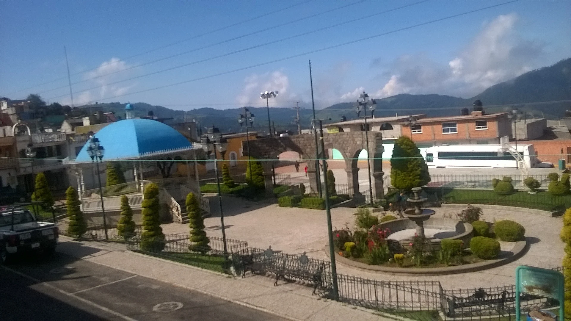
On the main square, with its blue-domed kiosk, fountain and stone arches, stands the church of Cristo Rey, with a white façade, stone columns and niches and a single tower; inside, a wall of stone from the municipality's own quarry depicts the apparition of the Virgin of Guadalupe. The Cristo Rey fiesta is usually held on the third Sunday of November, with masses, fireworks, fairground rides, a parade of the fiesta queen, bullfights and a greasy pole. At carnival "La Pandilla" goes out, a troupe of 12 to 40 huehue dancers, all men, who dance for three days at the houses that invite them and perform "El Ahorcado". Local food includes mutton barbacoa in mixiote, chileatole and pulque.
How to get to Emiliano Zapata
Drive from Huamantla: 45 min, 42 km
Emiliano Zapata is 13 km north of Terrenate on the Huamantla-Terrenate-Emiliano Zapata state road. From Tlaxcala city take federal highway 117 to Apizaco, then highway 136 towards Huamantla and the turn-off to Terrenate; the last stretch climbs into the hills to about 2,880 m. Tlaxco, the nearest Pueblo Mágico, is about 22 km to the west. By public transport, ATAH and Supra run hourly buses from Mexico City's TAPO terminal to Huamantla, and ATAH also serves Apizaco from the TAPO and Puebla's CAPU; there are no published schedules for transport to Emiliano Zapata itself, so ask in Huamantla or Apizaco about local colectivos.
Directions to Emiliano Zapata on Google Maps
Distances are in a straight line; the road is usually longer.
Links open a partner site. We may earn a commission if you book, at no cost to you.
From the nearest cities to Emiliano Zapata
- Huamantla · 42 km by road, 45 min
- Chiautempan · 55 km by road, 55 min
- San Martín Texmelucan · 79 km by road, 1 h 10 min
Drive times by road from OpenStreetMap, without traffic or stops. Times marked ~ are estimated from the straight-line distance.
Before you go to Emiliano Zapata: hours, prices and tips
- Best season
- Cristo Rey patronal fiesta, usually the third Sunday of November; carnival on the Sunday, Monday and Tuesday before Ash Wednesday. INAFED, Enciclopedia de los Municipios (Wayback Machine) · checked Oct 2026
Hours and prices change, especially around holidays. Each fact links to where we checked it.
Visiting Emiliano Zapata: what to see and do
The main square with its blue-domed kiosk, fountain and stone arches.
The church of Cristo Rey and its wall of local stone showing the apparition of the Virgin of Guadalupe.
The Cristo Rey fiesta on the third Sunday of November, with bullfights and a greasy pole.
The carnival of the huehue dancers of "La Pandilla".
About 100 hectares of pine forest in the hills, for mountain sports.
Plan your trip
Places to stay in Emiliano Zapata
Compare hotels, posadas, and rentals in and around Emiliano Zapata.
Tours & activities
Day trips around Tlaxco sometimes stop in Emiliano Zapata; a tour is the easy way to see it without a car.
Rental cars
Pick up a car at PBC (Puebla): about 1 h 6 min by road to Tlaxco, then 22 km more to Emiliano Zapata, on your own schedule.
Flights
The nearest airport with scheduled flights is Puebla (PBC), about 1 h 6 min by road from Tlaxco, the base for Emiliano Zapata.
Mobile data
Signal can drop away from Tlaxco: download a map of the way to Emiliano Zapata before you set out, or carry an eSIM with data.
Links open a partner site. We may earn a commission if you book, at no cost to you.
When to go to Emiliano Zapata cool
Emiliano Zapata shares the climate of Tlaxco, 22 km away. The best months to visit are January, February, November, and December.
See the month-by-month climate of Tlaxco
Weather in Emiliano Zapata now and the next 7 days
Live forecast from Open-Meteo. Chance of rain is the day's highest.
The closest Pueblo Mágico: Tlaxco

Tlaxco is the Pueblo Mágico closest to Emiliano Zapata, with places to stay, food, and more to see.
Also close to
- Huamantla · Tlaxcala · 27 km away
- Tetela de Ocampo · Puebla · 31 km away
- Chignahuapan · Puebla · 33 km away
- Ixtenco · Tlaxcala · 34 km away
- Zacatlán · Puebla · 42 km away
Closest to Emiliano Zapata
-
San José Villarreal · Village · 4 km away
-
Terrenate · Town · 8 km away
-
San José de la Laguna · Village · 9 km away
-
Chipilo (Ixtacamaxtitlán) · Village · 10 km away
-
Capulac · Village · 13 km away
-
Ixtacamaxtitlán · Village · 13 km away
-
La Peñuela · Mountain · 13 km away
-
Tecomalucan · Village · 16 km away

Near Emiliano Zapata




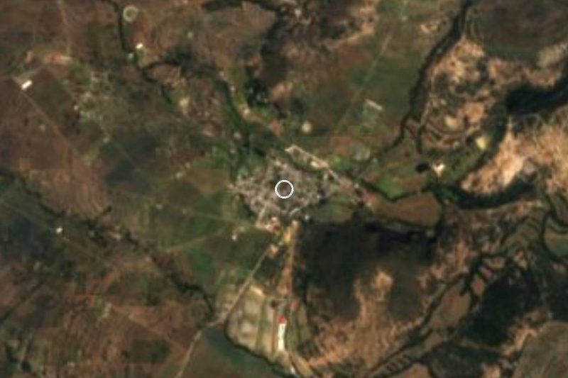


Drive times by road from OpenStreetMap, without traffic. Times marked ~ are estimated from the straight-line distance.
Location from OpenStreetMap. Written by Puebloteca.