
Village Tetlatlahuca, Tlaxcala Municipality of Tetlatlahuca Volcano Route Monasteries on the slopes of Popocatépetl Puebla Valley
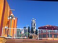
Village in Tetlatlahuca with a 19th-century church of San Bartolomé, its tower topped by a tiled dome; fiesta on 24 August.
From Chiautempan: 20 min by car (16 km by road) How to get there ↓
Near here
See everything nearby ↓


Plan your visit to San Bartolomé Tenango
Where to stay near San Bartolomé Tenango
Compare hotels, posadas and guest houses in San Bartolomé Tenango.
Tours to San Bartolomé Tenango
Day trips and guided outings from Huejotzingo often include San Bartolomé Tenango; with a local guide you can get there without a car.
 Tours from Puebla City
Africam Safari Zoo Admission with Transportation
★ 4.8 (87) · From US$35
How to get to San Bartolomé Tenango
- From Chiautempan: about 20 min by road (~16 km)
- Nearest airport: Puebla (PBC), 7 min by car to Huejotzingo
Links open a partner site. We may earn a commission if you book, at no cost to you.
Tours from Puebla City, near San Bartolomé Tenango


Tours, prices and ratings from Viator, checked weekly. We may earn a commission if you book.
About San Bartolomé Tenango
San Bartolomé Tenango is a village in the municipality of Tetlatlahuca, in southern Tlaxcala, at 2,285 metres above sea level. It is the municipality's third-largest locality after the seat and Santa Cruz Aquiahuac: the 2020 census counted 2,123 people, up from 1,807 in 2010. Its patron is the apostle St Bartholomew.
Tenango comes from Nahuatl tenamitl (wall) and the locative -co, and is usually read as "walled place" or "in the wall". In colonial times the village belonged to the doctrina of Tepeyanco until 1640 and afterwards to that of Santa Inés Zacatelco; by the end of the period it was part of the curato of Santa Isabel Tetlatlahuca, together with San Andrés Cuamilpa, San Jerónimo Zacualpan and San Damián Texoloc. In the 19th century, when Tlaxcala was split into municipalidades, Tenango was one of the villages that made up Tetlatlahuca's, and today its auxiliary municipal president is chosen by vote.
The main building is the church of San Bartolomé, built in the 19th century with a single nave. Its façade is beige and blue and the walls are about 80 cm thick. The tower has three stages: the first two with round arches and bells, the third a capulín-style cap covered in yellow tile, with battlements at the corners. It keeps its atrial wall topped with pinnacles and a wrought-iron entrance gate. The village fiesta is on 24 August. In the municipality, people weave petates, fans, mats and hats from tule and make paper flowers, and brass band music is the traditional sound.
How to get to San Bartolomé Tenango
Drive from Chiautempan: 20 min, 16 km
Tenango is in southern Tlaxcala, in the valley between Tlaxcala and Puebla. From the seat, Santa Isabel Tetlatlahuca, it is a few kilometres along local roads; Tetlatlahuca lies near the Zahuapan river, which crosses the municipality north to south. From the city of Puebla it is about 25 km, around 30 minutes by car, and Huejotzingo (a Pueblo Mágico of Puebla) is about 16 km away, roughly 20 minutes. Tetlatlahuca lies in the south of the state, next to municipalities such as Zacatelco and Tepeyanco. There are no published schedules for local transport; without a car the practical option is to go to Tlaxcala's bus terminal or Puebla's CAPU and finish the trip on local transport toward Tetlatlahuca.
Directions to San Bartolomé Tenango on Google Maps
Distances are in a straight line; the road is usually longer.
Links open a partner site. We may earn a commission if you book, at no cost to you.
From the nearest cities to San Bartolomé Tenango
- Chiautempan · 16 km by road, 20 min
- San Martín Texmelucan · 22 km by road, 20 min
- Puebla · 31 km by road, 35 min
Drive times by road from OpenStreetMap, without traffic or stops. Times marked ~ are estimated from the straight-line distance.
Before you go to San Bartolomé Tenango: hours, prices and tips
- Best season
- Fiesta of San Bartolomé on 24 August. Secretaría de Turismo de Tlaxcala, Calendario de ferias y fiestas · checked Oct 2026
Hours and prices change, especially around holidays. Each fact links to where we checked it.
Visiting San Bartolomé Tenango: what to see and do
The church of San Bartolomé, 19th century, with a three-stage tower and yellow tile cap.
The atrial wall with pinnacles and the ironwork gate.
The patron fiesta on 24 August, with brass band music.
Tetlatlahuca, the seat, with its church of Santa Isabel and its 19 November fiesta.
Tule petates and hats and paper flowers, the municipality's crafts.
Plan your trip
Places to stay in San Bartolomé Tenango
Compare hotels, posadas, and rentals in and around San Bartolomé Tenango.
Tours & activities
Day trips and guided outings from Huejotzingo often include San Bartolomé Tenango; with a local guide you can get there without a car.
Rental cars
Pick up a car at PBC (Puebla): about 7 min by road to Huejotzingo, then 16 km more to San Bartolomé Tenango, on your own schedule.
Flights
The nearest airport with scheduled flights is Puebla (PBC), about 7 min by road from Huejotzingo, the base for San Bartolomé Tenango.
Mobile data
Signal can drop away from Huejotzingo: download a map of the way to San Bartolomé Tenango before you set out, or carry an eSIM with data.
Links open a partner site. We may earn a commission if you book, at no cost to you.
When to go to San Bartolomé Tenango mild
San Bartolomé Tenango shares the climate of Huejotzingo, 16 km away. The best months to visit are January, February, March, and November.
See the month-by-month climate of Huejotzingo
Weather in San Bartolomé Tenango now and the next 7 days
Live forecast from Open-Meteo. Chance of rain is the day's highest.
The closest Pueblo Mágico: Huejotzingo

Huejotzingo is the Pueblo Mágico closest to San Bartolomé Tenango, with places to stay, food, and more to see.
Also close to
Closest to San Bartolomé Tenango
-
San Andrés Cuamilpa · Village · 2 km away
-
Santa Apolonia Teacalco · Town · 2 km away
-
Tetlatlahuca · Town · 2 km away
-
Jesús Tepactepec · Village · 3 km away
-
Natívitas · Village · 3 km away
-
San Damián Texóloc · Town · 3 km away
-
San Jerónimo Zacualpan · Town · 3 km away
-
San Vicente Xiloxochitla · Town · 4 km away


Near San Bartolomé Tenango


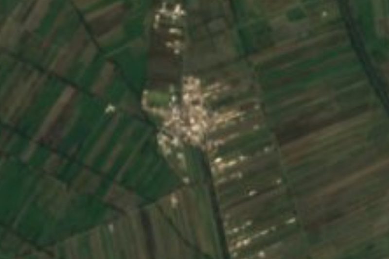


Drive times by road from OpenStreetMap, without traffic. Times marked ~ are estimated from the straight-line distance.
Location from OpenStreetMap. Written by Puebloteca.