
Town Santa Apolonia Teacalco, Tlaxcala Volcano Route Monasteries on the slopes of Popocatépetl Puebla Valley
Basket-making municipality in the Natívitas valley: huejote and pirul baskets, the church of Santa Apolonia and a fiesta on 9 February.
From San Martín Texmelucan: 20 min by car (18 km by road) How to get there ↓
Near here


Plan your visit to Santa Apolonia Teacalco
Where to stay near Santa Apolonia Teacalco
Compare hotels, posadas and guest houses in Santa Apolonia Teacalco.
Tours to Santa Apolonia Teacalco
Day trips around Huejotzingo sometimes stop in Santa Apolonia Teacalco; a tour is the easy way to see it without a car.
 Tours from Puebla City
Africam Safari Zoo Admission with Transportation
★ 4.8 (87) · From US$35
How to get to Santa Apolonia Teacalco
- From San Martín Texmelucan: about 20 min by road (~18 km)
- Nearest airport: Puebla (PBC), 7 min by car to Huejotzingo
Links open a partner site. We may earn a commission if you book, at no cost to you.
Tours from Puebla City, near Santa Apolonia Teacalco


Tours, prices and ratings from Viator, checked weekly. We may earn a commission if you book.
About Santa Apolonia Teacalco
Santa Apolonia Teacalco is the seat of the municipality of the same name, one of the smallest in Tlaxcala, covering just 8.06 km² in the Natívitas valley at about 2,200 metres above sea level. The 2020 census counted 4,624 people in the seat, which belongs to the Puebla–Tlaxcala metropolitan area. The municipality was created in August 1995 by splitting from Natívitas; besides the seat it includes the barrios of El Carril, El Centro and El Ranchito and the localities of San Antonio Teacalco and Santa Elena Teacalco, names inherited from three former haciendas: Santa Apolonia, Santa Elena and San Antonio.
The Enciclopedia de los Municipios says the barrio began as an Olmec-Xicalanca foundation tied to Natívitas, on a site a little north of today's village called Yehcaquiscatitlán, where cotton was planted. In the 16th century it paid tribute to Panotla and Quiahuixtlán; later the haciendas of Santa Elena and San Antonio employed its residents. Its notable people include Natalia Teniza Portillo, a peasant, midwife and local deputy who pushed for the distribution of land from the haciendas of Mazaquiahuac, San Blas, Santa Elena and San Antonio.
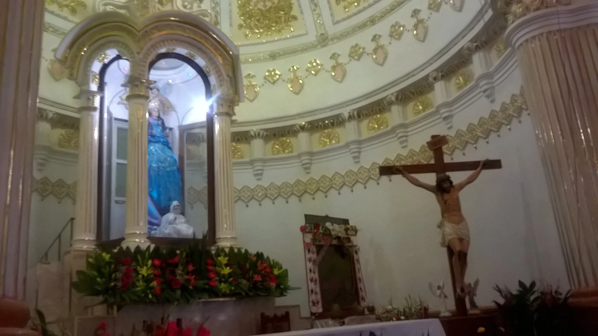
The local trade is basketry: from huejote and pirul rods people weave baskets, cradles and other objects sold in Tlaxcala and Puebla. The church of Santa Apolonia is of stone, with 1.20 m walls, a vaulted roof, an older right-hand tower and gilded interior decoration from 1985. At carnival, on Monday and Tuesday, dancers tour the village to brass-band music and the xochipitzhuak, a wedding dance. The patron saint is celebrated on 9 February with a procession.
How to get to Santa Apolonia Teacalco
Drive from San Martín Texmelucan: 20 min, 18 km
Santa Apolonia Teacalco is in southern Tlaxcala, about 15 km from Tlaxcala city (about 20 minutes by car) on highway 119, which runs down through Texóloc and Tetlatlahuca into the Natívitas valley; the last stretch is on village streets such as Avenida Benito Juárez. From Puebla it is about 29 km (about 30 minutes) via the Mexico–Puebla toll road and local roads through Santa Águeda and Santa Ana Portales. From Mexico City, go first to the CAPU in Puebla or the bus terminal in Tlaxcala and continue by local transport or taxi; no direct lines or schedules are published. Huejotzingo, the nearest Pueblo Mágico, is about 16 km by road (about 25 minutes). In the early 20th century the Ferrocarril Agrícola del Valle de Nativitas ran through San Antonio, within the municipality.
Directions to Santa Apolonia Teacalco on Google Maps
Distances are in a straight line; the road is usually longer.
Links open a partner site. We may earn a commission if you book, at no cost to you.
From the nearest cities to Santa Apolonia Teacalco
- San Martín Texmelucan · 18 km by road, 20 min
- Chiautempan · 20 km by road, 20 min
- Puebla · 30 km by road, 35 min
Drive times by road from OpenStreetMap, without traffic or stops. Times marked ~ are estimated from the straight-line distance.
What to see in Santa Apolonia Teacalco 3
Sights with their own page, closest to the centre first.
Archaeological sites
-
Cacaxtla-Xochitécatl · Archaeological site · 3 km from the centre
Twin hilltop sites across the Tlaxcala line, famous for vivid Maya-style murals of a battle, preserved under a huge roof. -
Xochitécatl · Archaeological site · 4 km from the centre
A ceremonial centre begun about 800 BC on an extinct volcano's summit, with the Pyramid of the Flowers and the round Spiral Building, facing Cacaxtla.


Landmarks and museums
-
Santuario de San Miguel del Milagro · Landmark · 2 km from the centre
National Shrine of St Michael, built where tradition places the 1631 apparition to Diego Lázaro, beside Cacaxtla; pilgrims come for the water of its well.
Map of Santa Apolonia Teacalco
Neighbourhoods and villages of Santa Apolonia Teacalco
Part of Santa Apolonia Teacalco or just outside it, closest first.
-
Natívitas · Village · in the centre
Southern Tlaxcala seat once called "España Chiquita": a baroque parish, ruined Franciscan convent walls, and Cacaxtla just 3 km away. -
Jesús Tepactepec · Village · 1 km from the centre
Village in Natívitas municipality, almost joined to the seat, with the sanctuary of Padre Jesús de los Tres Caminos and its March festival. -
Santo Tomás la Concordia · Town · 1 km from the centre
Natívitas town founded after a flood, with Saint Thomas and Saint Sebastian as patrons and a moros y cristianos dance. -
San Bartolomé Tenango · Village · 2 km from the centre
Village in Tetlatlahuca with a 19th-century church of San Bartolomé, its tower topped by a tiled dome; fiesta on 24 August. -
Tetlatlahuca · Town · 2 km from the centre
A municipal seat with the parish of Santa Isabel (fiesta 19 November), tule crafts and an ancient settlement on the Cerro de La Cruz. -
San Bernabé Capula · Village · 3 km from the centre
Natívitas village, "place where capulines abound", with a chapel of San Bernabé and an auxiliary president chosen by custom. -
Santa Ana Portales · Village · 4 km from the centre
A locality of 968 people in Tetlatlahuca at 2,188 m, with the chapel of Santa Ana and San Joaquín, about 20 km from Huejotzingo. -
Santiago Michac · Town · 4 km from the centre
The most populous locality in Natívitas: church of Santiago Apóstol, a fiesta on 23-26 July and a short hop from Cacaxtla.


Day trips and tours from Santa Apolonia Teacalco
The closest Pueblos Mágicos and places to visit, with the drive from Santa Apolonia Teacalco and tours that leave from it.


Times marked ~ are estimated from the distance. Links open a partner site. We may earn a commission if you book, at no cost to you.
Before you go: getting to and around Santa Apolonia Teacalco
- The nearest airport is Puebla (PBC).
- The best months to go are January, February, March, and November.
- 3 of the places on this page are more than 3 km from the centre: take a taxi, a ride-hailing app or a local bus.
- For day trips a rental car gives the most freedom; the tours above leave from Santa Apolonia Teacalco.
Before you go to Santa Apolonia Teacalco: hours, prices and tips
- Best season
- Fiesta of Santa Apolonia on 9 February, with a procession through the main streets; carnival on Monday and Tuesday; Santa Elena fiesta on 18 August. INAFED y Calendario de ferias y fiestas de Tlaxcala 2023 · checked Oct 2026
Hours and prices change, especially around holidays. Each fact links to where we checked it.
Visiting Santa Apolonia Teacalco: what to see and do
The church of Santa Apolonia, built of stone, with an old tower and gilded decoration on the vault and altar.
The chapel of El Calvario, Latin-cross plan and salmon-coloured facade.
Basketry workshops: baskets and cradles of huejote and pirul.
The remains of the former hacienda San Juan Mixco, with granary, chapel and traces of the mill.
The Monday and Tuesday carnival with the xochipitzhuak dance.
Plan your trip
Places to stay in Santa Apolonia Teacalco
Compare hotels, posadas, and rentals in and around Santa Apolonia Teacalco.
Tours & activities
Day trips around Huejotzingo sometimes stop in Santa Apolonia Teacalco; a tour is the easy way to see it without a car.
Rental cars
Pick up a car at PBC (Puebla): about 7 min by road to Huejotzingo, then 13 km more to Santa Apolonia Teacalco, on your own schedule.
Flights
The nearest airport with scheduled flights is Puebla (PBC), about 7 min by road from Huejotzingo, the base for Santa Apolonia Teacalco.
Mobile data
Signal can drop away from Huejotzingo: download a map of the way to Santa Apolonia Teacalco before you set out, or carry an eSIM with data.
Links open a partner site. We may earn a commission if you book, at no cost to you.
When to go to Santa Apolonia Teacalco mild
Santa Apolonia Teacalco shares the climate of Huejotzingo, 13 km away. The best months to visit are January, February, March, and November.
See the month-by-month climate of Huejotzingo
Weather in Santa Apolonia Teacalco now and the next 7 days
Live forecast from Open-Meteo. Chance of rain is the day's highest.
The closest Pueblo Mágico: Huejotzingo

Huejotzingo is the Pueblo Mágico closest to Santa Apolonia Teacalco, with places to stay, food, and more to see.
Also close to
Near Santa Apolonia Teacalco


Drive times by road from OpenStreetMap, without traffic. Times marked ~ are estimated from the straight-line distance.
Location from OpenStreetMap. Written by Puebloteca.