
Village San Agustín Tlaxiaca, Hidalgo Municipality of San Agustín Tlaxiaca Hidalgo Mountain Corridor Comarca Minera Geopark
A San Agustín Tlaxiaca locality at 2,409 m, near the dam that regulates the Chicavasco (Actopan) river a few km from Pachuca.
From Pachuca: 15 min by car (14 km by road) How to get there ↓
Near here
See everything nearby ↓


Plan your visit to El Durazno
Where to stay near El Durazno
Compare hotels, posadas and guest houses in El Durazno.
Tours to El Durazno
Day trips and guided outings from Mineral del Chico often include El Durazno; with a local guide you can get there without a car.
 Tours from Zacatlan
Zacatlán Guided Tour walking through the Center
★ 5.0 (2) · From US$8
How to get to El Durazno
- From Pachuca: about 15 min by road (~14 km)
- Nearest airport: Mexico City (Felipe Ángeles) (NLU), 1 h 12 min by car to Mineral del Chico
Links open a partner site. We may earn a commission if you book, at no cost to you.
Tours from Zacatlan, near El Durazno
Tours, prices and ratings from Viator, checked weekly. We may earn a commission if you book.
About El Durazno
El Durazno lies at 2,409 metres, in the municipality of San Agustín Tlaxiaca, on hilly terrain with a semi-dry temperate climate. Wikipedia places it in the Mezquital Valley region and in Pachuca's metropolitan area. In 2020 it counted 767 inhabitants, 1.97% of the municipality: 388 men and 379 women.
INEGI's series shows that the growth is recent. In 1940 there were 284 people, and the 1960 census marked the low, 190. From there it rose to 498 in 1980, hovered around 430 to 490 through the nineties and the first half of the 2000s, then jumped: 668 in 2010 and 767 in 2020. In six decades it quadrupled.
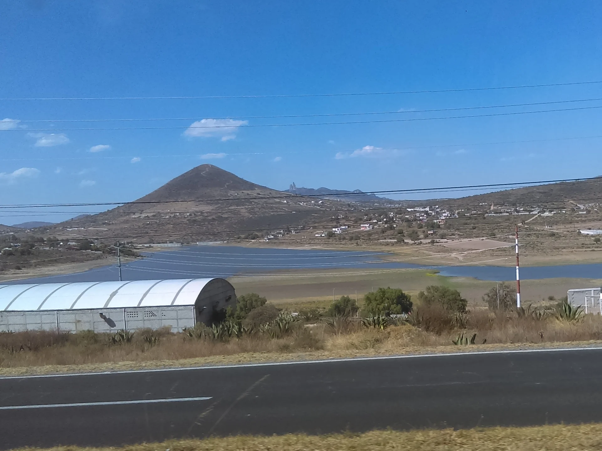
What gives the place character is water. Nearby is the El Durazno dam, which Wikipedia lists among the works that regulate the Chicavasco river, also called the Actopan: it rises at 2,950 metres in the Sierra de Pachuca, about 9 km north of the capital, and at 2,370 metres it passes this dam. Further down it cuts through the El Mexe range and the Actopan Valley, where it mixes with sewage and is used for irrigation, and finally joins the Tula River about 3 km from Ixmiquilpan. A photo of the dam taken about 1.6 km from the village is the one that illustrates this page.
In the municipality, whose Nahuatl name translates as "among the trees of the ball game", the main crops are barley (nearly 4,000 hectares in 2015) and pulque maguey (1,350), and pirul and mesquite trees are common.
How to get to El Durazno
Drive from Pachuca: 15 min, 14 km
From Pachuca, El Durazno is about 12 km as the crow flies (approx. 15 minutes by car); Mineral del Chico is about 14 km away. The natural starting point is the city: buses from the capital's Terminal Norte arrive at its Central de Autobuses. Actopan, with its own station one block north of Carretera Nacional 85, is 35 km from Pachuca (Wikivoyage). In Pachuca the combis, around 10 pesos, carry their destination on the front; ask there for the one to San Agustín Tlaxiaca and then, from the municipal seat, for the route toward El Durazno.
Directions to El Durazno on Google Maps
Distances are in a straight line; the road is usually longer.
Links open a partner site. We may earn a commission if you book, at no cost to you.
From the nearest cities to El Durazno
- Pachuca · 14 km by road, 15 min
- Tulancingo · 60 km by road, 1 h
- Mexico City · 96 km by road, 1 h 25 min
Drive times by road from OpenStreetMap, without traffic or stops. Times marked ~ are estimated from the straight-line distance.
Visiting El Durazno: what to see and do
The El Durazno dam, about 1.6 km from the village, on the Chicavasco riverbed.
The hills and the pirul and mesquite trees of San Agustín Tlaxiaca municipality.
The barley fields and pulque maguey of the area.
Pachuca, about 12 km away in a straight line.
Plan your trip
Places to stay in El Durazno
Compare hotels, posadas, and rentals in and around El Durazno.
Tours & activities
Day trips and guided outings from Mineral del Chico often include El Durazno; with a local guide you can get there without a car.
Rental cars
Pick up a car at NLU (Mexico City (Felipe Ángeles)): about 1 h 12 min by road to Mineral del Chico, then 14 km more to El Durazno, on your own schedule.
Flights
The nearest airport with scheduled flights is Mexico City (Felipe Ángeles) (NLU), about 1 h 12 min by road from Mineral del Chico, the base for El Durazno.
Mobile data
Signal can drop away from Mineral del Chico: download a map of the way to El Durazno before you set out, or carry an eSIM with data.
Links open a partner site. We may earn a commission if you book, at no cost to you.
When to go to El Durazno cool
El Durazno shares the climate of Mineral del Chico, 14 km away. The best months to visit are February, March, April, and May.
See the month-by-month climate of Mineral del Chico
Weather in El Durazno now and the next 7 days
Live forecast from Open-Meteo. Chance of rain is the day's highest.
The closest Pueblo Mágico: Mineral del Chico

Mineral del Chico is the Pueblo Mágico closest to El Durazno, with places to stay, food, and more to see.
Also close to
- Real del Monte · Hidalgo · 20 km away
- Huasca de Ocampo · Hidalgo · 29 km away
- Zempoala · Hidalgo · 31 km away
- Teotihuacán · Estado de México · 49 km away
- Otumba · Estado de México · 50 km away
Closest to El Durazno
-
San Agustín Tlaxiaca · Town · 4 km away
-
Santiago Tlapacoya · Village · 4 km away
-
San José Tepenene · Village · 8 km away
-
Parque Cultural Hidalguense · Nature reserve · 10 km away
-
El Arenal · Town · 11 km away
-
Presa San Jerónimo · Lake · 11 km away
-
San Jerónimo · Village · 11 km away
-
Acayuca · Town · 12 km away


Near El Durazno





Drive times by road from OpenStreetMap, without traffic. Times marked ~ are estimated from the straight-line distance.
Location from OpenStreetMap. Written by Puebloteca.